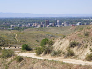
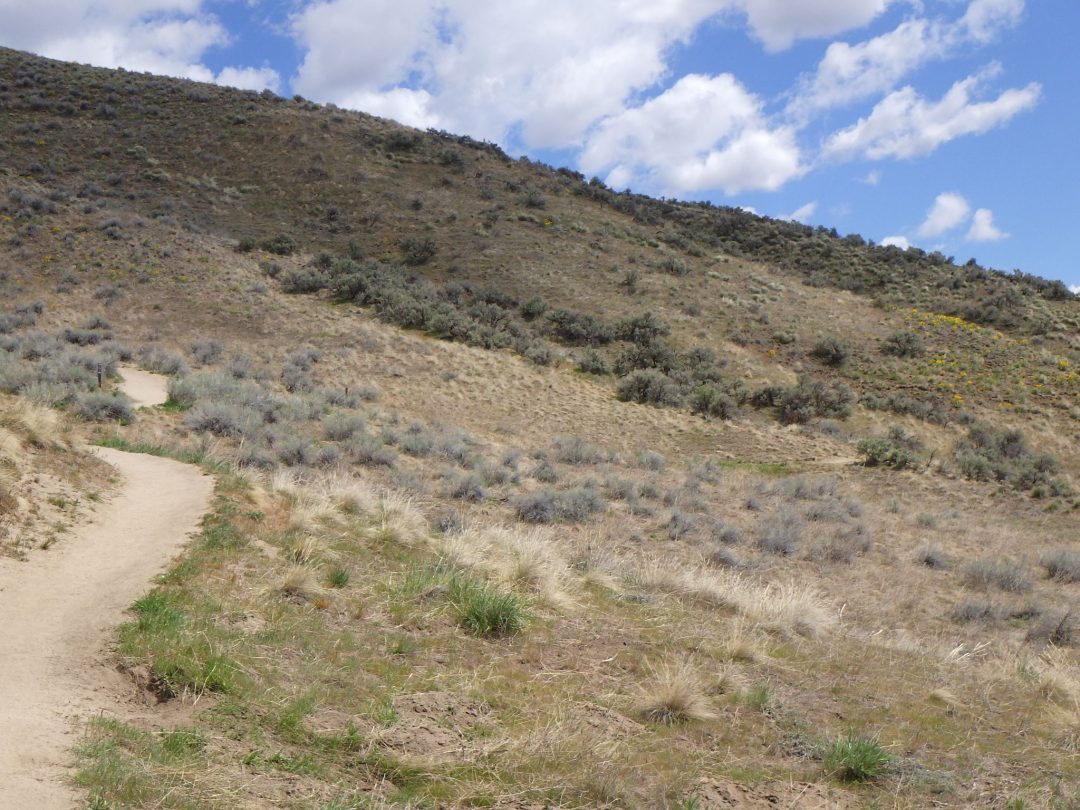
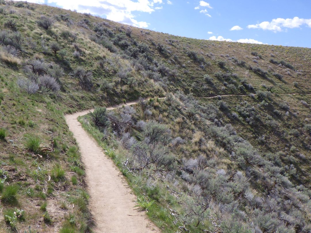
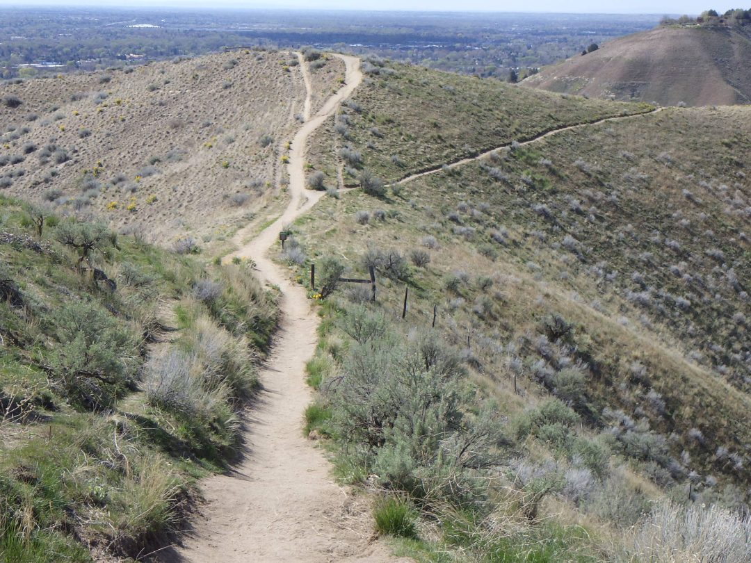
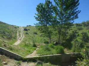
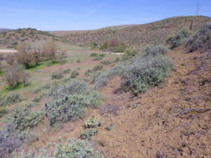
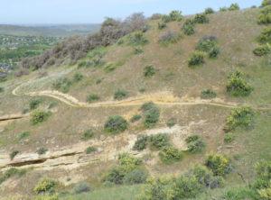
Description: This is one of the more challenging of the recommended wildflower walks, approximately 4 miles roundtrip (out and back) with 1000 foot elevation gain, on a (mostly) well-graded road. The goal is an uncommon “windswept ridge” habitat, with other interesting plants en route.
NOTE: Please enjoy the wildflowers and leave them for others to enjoy. Because our unique local flora is already under pressure from invasive weeds and habitat loss, harvesting of native plants is not encouraged on this website, especially along popular trails.
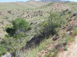
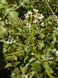
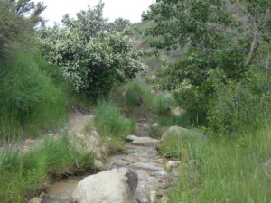
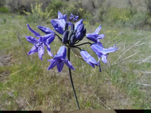
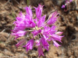
The walk begins at Highland Valley trailhead at the end of West Highland Valley Road off of east Warm Springs Road, in the East Valley development of Harris Ranch. Follow the West Highland Valley trail about 1/3 mile, taking note of shrubs and flowers along the roadside bank. Turn left on Cobb Trail, which immediately drops down to a small shrub-lined creek. There is a good diversity of wildflowers on the relatively intact north-facing slope above the creek, including the lovely longspur (“polychrome”) lupine (Lupinus arbutus).
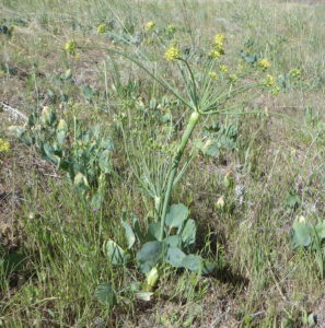
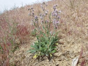
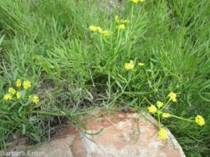
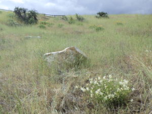
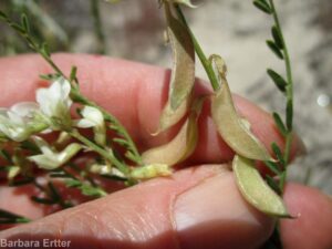
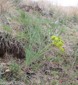
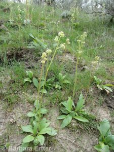
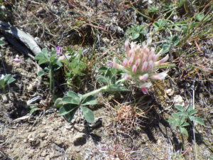
About another 1/3 mile from the creek crossing, the trail traverses a ridge where the recently described Andrus’s biscuitroot (Lomatium andrusianum) grows. This plant had previously been shoe-horned into nine-leaved biscuitroot (Lomatium triternatum), but recent molecular work by botanists at Boise State University and The College of Idaho showed that it was a distinct species. In an attempt to generate funds to continue their research on Lomatium, the “naming rights” for the new species were auctioned off, with the winning bid choosing to honor former Idaho governor Cecil D. Andrus.
Andrus’s biscuitroot (Lomatium andrusianum)
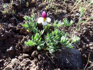
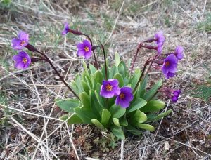
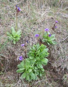
Beckwith’s violet, sagebrush pansy
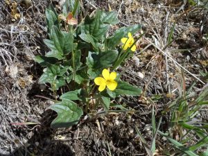
goosefoot or purplish violet (Viola purpurea ssp. venosa)
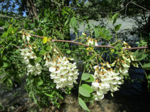
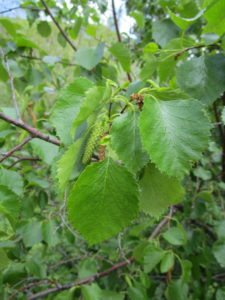
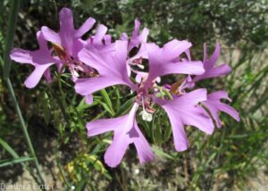
From the ridgeline, the trail traverses a west-facing slope where sharp eyes can sometimes spot the early-blooming Beckwith’s violet or sagebrush pansy (Viola beckwithii) and goosefoot violet (Viola purpurea ssp. venosa). An old homestead is encountered at about 1.5 miles from the trailhead, recognized by the naturalized grove of black locust (Robinia pseudoacacia, not in bloom until mid summer) and associated weeds growing around a spring.
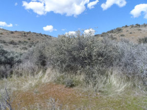
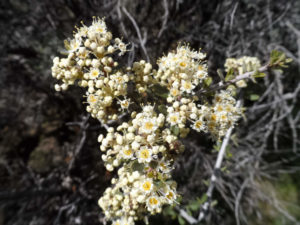
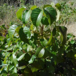
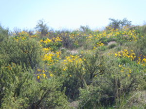
A couple of hundred feet north of the homestead area, mostly on the south side of the trail, look for rigidly branched white-flowered shrubs whose presence in the Boise foothills is a bit of a head-scratcher. This the Mojave ceanothus (Ceanothus vestitus), growing a long way from its Mojave Desert home. This is presumably one of the survivors of experimental plantings by the Rocky Mountain Research Station in the 1960’s and 1970’s when the goal was to improve deer winter range, with a focus on growth rates, protein content, winter leafiness, and palatability, but little regard for native range except the western US in general. There are also a couple of Apache plume (Fallugia paradoxa) from the same origin, but not doing as well as the ceanothus. Bitterbrush (Purshia tridentata) planted in rows on the hillside above are further evidence of experimental plantings.
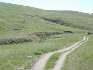
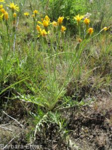
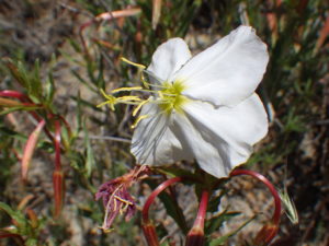
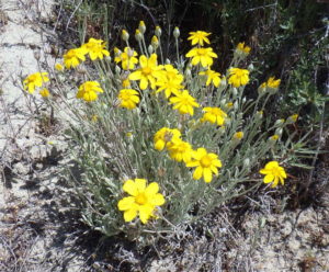
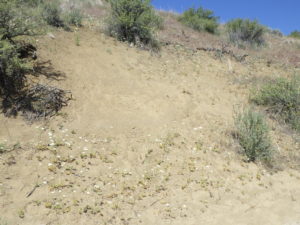
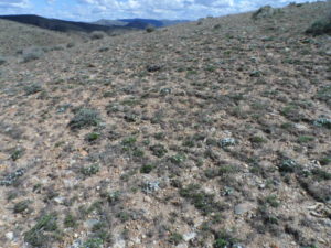
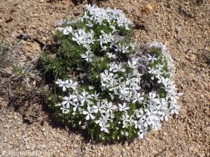
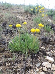
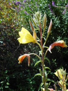
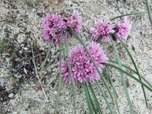
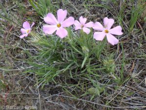
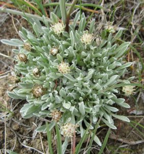
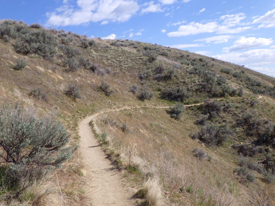
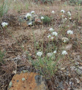
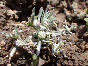
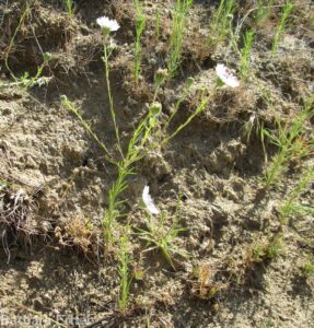
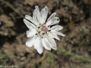
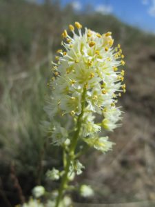
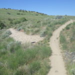
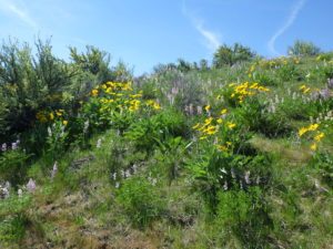
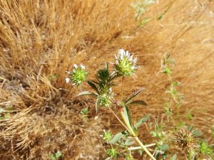
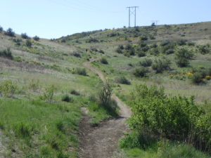
The final half mile ascent (ca 400 feet elevation gain) is relatively steep and rocky; hiking poles recommended if so inclined. The reward is both fine views and an entirely new suite of plants on the wind-swept knoll. Although the summit is tempting, please stay on the path, since this seemingly barren site is actually a delicate habitat. If your timing is right, you’ll be able to enjoy both tufted carpet phlox (Phlox caespitosa) and scabland fleabane (Erigeron bloomeri).
Wind-swept knoll on Cobb Trail
carpet or Hood”s phlox (Phlox caespitosa)
scabland or Bloomer’s fleabane (Erigeron bloomeri var. bloomeri)
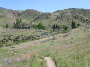
From this point, you can either retrace your steps, or else continue on a 5.7 mile loop via Lucky Peak and West Highland Valley trails (described in reverse in Scott Marchant’s The Hiker’s Guide: Greater Boise).
PLANT LIST [updating needed]
NOTE: Please enjoy the wildflowers and leave them for others to enjoy. Because our unique local flora is already under pressure from invasive weeds and habitat loss, harvesting of native plants is not encouraged on this website, especially along popular trails.
Plants listed in approximate order of occurrence within category; some might not yet be in bloom, or present during a particular year. * indicates native
*Rubber rabbitbrush (Ericameria [formerly Chrysothamnus] nauseosa) — var. hololeuca is the more common larger variety; the smaller, more spindly var. oreophila is mostly on plateaus
*Bluebunch wheatgrass (Pseudoroegneria spicata, alternatively in Agropyron or Elymus) – both native-to-site and planted races from other sites probably present
CAMEL’S BACK/HULLS GULCH RESERVE WILDFLOWER WALK mid to late May
Hulls Gulch Reserve from Camel’s Back
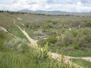
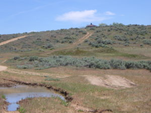
Description: This walk explores a diversity of habitats on Camel’s Back and Hull’s Gulch Reserve, showcasing late-spring wildflowers (including Mulford’s milkvetch) and riparian woodland consisting of native and non-native trees and shrubs. The walk begins at the trailhead at the end of 9th Street and is described in a counterclockwise direction. This makes the walk good for an after-dinner hike on a warm day, beginning along the shaded streamside corridor and then ascending the hilltop to catch the sunset. Much of the walk is on pedestrian-only, dog on-leash trails. Total distance is a 1½ mile loop; total elevation gain is about 350 feet.
Hulls Gulch Reserve was one of Boise’s first nature preserves, established in the early 1990s following grassroots efforts that we are now all benefiting from. Although most of the habitat is relatively altered, with an abundance of invasive and other non-native trees, shrubs, grasses, and forbs, enough native wildflowers persist to make this walk worthwhile for plant-lovers. The mixed native/non-native gallery forest is furthermore a significant habitat in its own right, supporting a great diversity of birds and other wildlife.
Soils are mostly fine or coarse sands, representing the sediments eroded from the Idaho Batholith and deposited in ancient Lake Idaho, which came and went between 12 and 2 million years ago. These soils favor rubber rabbitbrush (Ericameria nauseosa, previously in Chrysothamnus) and bitterbrush (Purshia tridentata) as the primary upland shrubs; sagebrush (Artemisia tridentata) is relatively uncommon.
Black locust (Robinia pseudoacacia)
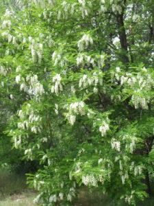
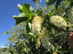
The only native large trees locally are black cottonwood (Populus trichocarpa) and the larger species of willow (Salix). All other large trees that have made themselves at home in Hulls Gulch, and in similar habitats elsewhere in Boise, were introduced by early settlers. As a result, we now walk in the shade of various species of maple (Acer), elm (Ulmus), oak (Quercus), and even catalpa (Catalpa) and mulberry (Morus), when we enjoy our otherwise natural areas. One of the most common is black locust (Robinia pseudoacacia), which forms a conspicuous grove on the hillside next to the 9th Street trailhead and is scattered elsewhere along the walk. Its pinnate leaves and clusters of pealike white flowers tend to appear relatively late, so might not be present at the recommended time for this walk.
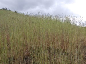
Solid stand of feral or cereal rye (Secale cereale) on Camel’s Back.
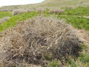
One of the first dominant plants encountered, at the trailhead and throughout the area, is feral or cereal rye (Secale cereale). Locally this highly flammable (when dry) invasive grass is worse than the notorious cheatgrass (Bromus tectorum), which it overtops and crowds out. Feral rye is actively spreading, and given a chance can eventually displace any remaining native species, especially when helped by soil disturbance. Control is difficult, with the best likelihood of success being to quickly remove any pioneering occurrences and to mow established patches after heads develop but before seeds mature. Removing thatch after the seeds have already dropped may reduce the immediate fire hazard for the year, but does nothing to eliminate the infestation.
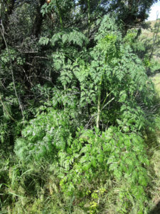
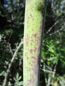
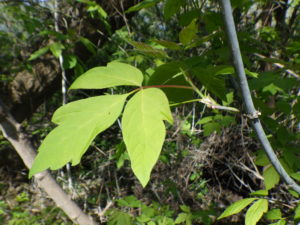
Begin by walking north on Red Fox Trail #36, taking note of the small dams and resultant ponds that were installed for flood control purposes. If the colony has not been recently sprayed, this is a good opportunity to learn how to recognize the extremely toxic (and notorious) non-native poison-hemlock (Conium maculatum). Even if not in bloom, the fern-like leaves and purple-spotted stem help identify this tall biennial; some people may even notice a characteristic scent given off by the foliage, especially when wet. All parts of the plant, but especially the parsnip-like root, can be deadly to eat; this is the plant that was used to put Socrates to death. Along with willows and wild roses, you may also notice some eastern box-elder (Acer negundo var. violaceum), an unusual maple tree with the leaves divided into three’s. Although there is a native variety of box-elder in southeastern Idaho that has densely and finely hairy branches, all the ones in the Boise area have smooth glaucous (waxy) branches, indicating they were introduced from the eastern US, probably by early settlers.
poison-hemlock (Conium maculatum)
poison-hemlock (Conium maculatum)
eastern box-elder (Acer negundo var. violaceum)
Boise sand-verbena (Abronia mellifera var. pahoveorum) at Camel’s Back.
Behind the fence on your left is the restored construction road that allowed heavy equipment to get to the top of Camel’s Back in 2016-2017, for the purpose of preventing erosion that would otherwise have made the popular viewpoint unsafe. A mix of grasses and other plants native to the Boise Foothills were seeded here as rehabilitation, but these were upstaged by the surprise appearance of a few plants of Boise sand-verbena (Abronia mellifera var. pahoveorum), presumably from dormant seeds that had lain buried for an unknown number of years. The Boise sand-verbena, which was described as a distinct variety in 2016, is only found in scattered remnant populations from Lucky Peak Dam to about New Plymouth, and may be sliding to extinction. Evidently it used to be quite common on sandy slopes in the Boise foothills, but the loose open sandy sites it prefers have largely been taken over by non-native annual grasses, or else bulldozed for development. It appears to be a relatively short-lived perennial, with the thick root easily rotting in heavy, wet soils, especially during the winter months. The Camel’s Back reappearance shows the potential longevity of the seeds and adaptations of the plant to freshly disturbed sandy soils. Please do not explore this area except as part of an authorized activity.
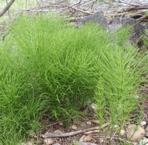
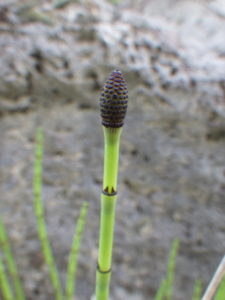
Turn right on Hulls Pond Loop (#34), which angles down and then curves back to a bridge crossing the creek. Red-winged blackbirds are conspicuous in the adjacent cattail-filled pond, and can be aggressive during nesting season. Siberian elm (Ulmus pumila) is a common tree along this trail and throughout the area, possibly hybridizing with the less common English elm (Ulmus procera), which has larger, double-toothed leaves. There are also several large black cottonwood (Populus trichocarpa); take note of the wide diversity of leaf shape, even on the same tree. Along the creek before the bridge, there are individuals of two native large shrubs/small trees that are characteristic of local streamsides: the multi-stemmed river birch (Betula occidentalis) on the left, and a mountain or thin-leaf alder (Alnus incana ssp. tenuifolia) on the right. At the bridge itself (and elsewhere on the walk) you can see some common horsetail (Equisetum arvense), a relative of ferns that produces spores in small ephemeral fertile stems before the showier sterile stems expand.
River birch (Betula occidentalis)
Common horsetail (Equisetum arvense)
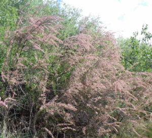
Small-flowered tamarisk (Tamarix parviflora)
Cross the creek and turn left on Red-Winged Blackbird Trail (#35A). This pedestrian-only trail is a delightful ramble through a diversity of native and non-native shrubs, pleasant even on hot days. One of the first encountered, on the left side of the trail, is a localized patch of small-flowered tamarisk or salt-cedar (Tamarix parviflora). Tamarisk is a major invasive shrub in wetlands of the American West, but is only sporadic in the Boise Front; this patch has nevertheless survived several eradication efforts already. Common native shrubs along the trail include various hard-to-identify willows (Salix), red-osier dogwood (Cornus stolonifera), and interior rose (Rosa woodsii ssp. ultramontana). Among the non-native shrubs are Tatarian honeysuckle (Lonicera tatarica), various plum and cherry relatives (Prunus), European privet (Ligustrum vulgare), Russian-olive (Eleagnus angustifolia), and European cranberry-bush (Viburnum opulus var. opulus). English ivy (Hedera helix) is a potentially invasive ground-cover that has a foothold in a couple of spots along the trail, and Virginia creeper (Parthenocissus vitacea) twines freely with its distinctive palmately divided leaves.
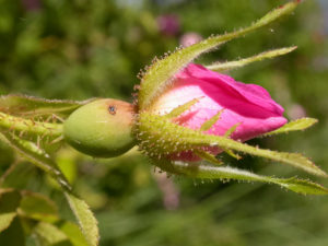
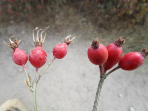
Several non-native roses are prominent in the last stretch of wooded pathway. In contrast to our native interior rose (Rosa woodsii var. ultramontana), which has slender prickles and forms open thickets, most of the non-native roses have thick curved prickles and arching stems in a single large clump; they also have side-flanges on the outer sepals, lacking in our native species. The sepals of the non-native species also tend to fall off in fruit, while those of interior rose remain attached. Petals of interior rose are always pink, while those of most non-native roses are pink or white. The three most common non-native roses locally can be told apart primarily by their leaves: dog rose (Rosa canina) has glabrous leaves, round-leaved rose (Rosa obtusifolia) has hairy leaves, and eglantine rose (Rosa rubiginosa) has glandular leaves with a green-apple smell.
interior or Wood’s rose (Rosa woodsii ssp. ultramontana)
Curved prickle of non-native rose
eglantine, sweetbrier rose (Rosa rubiginosa)
Fruit of Rosa woodsii (left) and non-native Rosa (right)
Restoration area in Hulls Gulch, with recently sprayed Scotch thistle.
To the left, after emerging from the woodland portion of the path, is a major restoration project initiated with the removal of a large number of invasive Russian-olive trees (Elaeagnus angustifolia) in 2019. One immediate aftermath was an explosion of weeds, perhaps invigorated by nutrients that had built up under the dense thicket and/or released from the dying roots. On-going efforts include extensive planting of native shrubs, including interior rose and golden currant (Ribes aureum), and spraying of whitetop (Lepidium draba, previously in Cardaria), Scotch thistle (Onopordum acanthium), and other invasive non-natives.
Keep following Red-winged Blackbird Trail to its north terminus and then turn left on Chickadee Ridge Trail (#35A), which crosses a grassy swale before intersecting with Red Fox Trail. The primary grass in the swale is crested wheatgrass (Agropyron cristatum), a Eurasian species widely planted in the West in the name of range improvement. More prominent at this time of year are dense patches of a rapidly spreading annual, bur chervil (Anthriscus caucalis), which was scarcely present in the Boise area twenty years ago and is now increasingly ubiquitous. The primary native of interest here is smooth scouring-rush (Equisetum laevigatum), very different from the previously encountered common horsetail in having similar sterile and fertile stems, neither one with branches.
bur chervil (Anthriscus caucalis)
bur chervil (Anthriscus caucalis)
Fertile stem of smooth scouring-rush (Equisetum laevigatum)
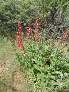
Firecracker penstemon (Penstemon eatonii)
Turn left on Red Fox Trail and then keep an eye out for firecracker penstemon (Penstemon eatonii) in patches of bitterbrush on the right side of the path. The native range of this beautiful plant, with its bright red flowers, is in the central and southern Great Basin, occurring naturally no farther north than central Nevada and Utah. So, regrettably, firecracker penstemon does not qualify as native to the Boise area, but was instead intentionally introduced at some point (which is why Hulls Gulch might be the only place to see it growing in the wild locally). Fortunately it show no evidence of being anything other than a fine addition to the local botanical highlights, and is undoubtedly popular with hummingbirds as well.
Continuing south on Red Fox Trail past the junctions with the trails to 15th Street and Hulls Pond, take note of the sandy flat on the right side of the trail. In addition to the aptly-named needle-and-thread grass (Hesperostipa comata), one of the loveliest of our native grass, this is a good place to look for one of our special endemic plants, Mulford’s milkvetch (Astragalus mulfordiae). Stay on the trail while looking; if you want a close-up view, there are usually additional plants elsewhere along the trail ahead. Mulford’s milkvetch is named after Isabel Mulford (1848-1943), the first Ph.D. student at Washington University in St. Louis. Her collections in 1892, some made in the company of Mary Hallock Foote, are among the earliest from the Boise area. Mulford’s milkvetch, which grows only in the sandy foothills of southwestern Idaho and adjacent Oregon, is considered a sensitive species that has been a candidate for federal protection. Mulford’s milkvetch in the Boise Foothills has decreased by 83% compared to 2008, indicating that the conservation status of this unique plant is in jeopardy, at least locally (Mancuso & Brabec 2019). If you want to help with monitoring this and other rare plants, contact the Foothills Restoration Specialist for the Boise Parks and Recreation Department.
Sandy flat on Red Fox Trail with Mulford’s milkvetch.
Mulford’s milkvetch (Astragalus mulfordiae)
Mulford’s milkvetch (Astragalus mulfordiae)
Looking south to Camel’s Back summit and Idaho state capitol building.
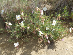
To continue with the self-guided tour, take a sharp right onto the Camel’s Back Trail network (#40), which will take you past a patch of pallid evening-primrose (Oenothera pallida). Then take the next sharp left, taking note of the green rabbitbrush (Chrysothamnus viscidiflora) with its twisted, bright-green leaves at the junction. Continue to the ridge, keeping an eye out for more Mulford’s milkvetch and neddle-and-thread grass in appropriate sites (unfortunately being increasingly overwhelmed by feral rye), as well as arrowleaf balsamroot (Balsamorhiza sagittata). Follow the ridge trail south to enjoy the view from the restored summit area, possibly timed to admire the sunset.
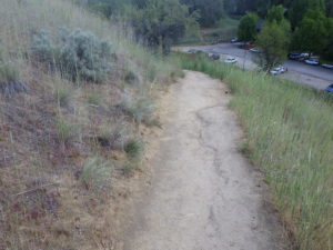
In early spring, there is a small colony of the rare Aase’s onion (Allium aaseae) tucked between the shrubs at the top of stairs on the south side of the the summit, but flowers and leaves are generally shriveled by mid-May; please avoid trampling off the path in this area. Instead, enjoy more pallid evening-primrose and the lavender-flowered silver phacelia (Phacelia hastata var. hastata) as you descend the stairs, along with some Indian ricegrass (Achnatherum hymenoides, previously in Oryzopsis). Turn left at the bottom of the stairs to return to the 9th Street Trailhead via Florence’s Trail. For one final ecological puzzle, speculate on possible reasons for the difference in vegetation between the uphill and downhill sides of the path, with the former still harboring native perennials while the latter is almost completely dominated by feral rye.
Pallid evening-primrose on Camel’s Back.
Different vegetation on uphill and downhill side of path.
PLANT LIST [updating needed]
NOTE: Please enjoy the wildflowers and leave them for others to enjoy. Because our unique local flora is already under pressure from invasive weeds and habitat loss, harvesting of native plants is not encouraged on this website, especially along popular trails.
Plants likely to be in flower, weedy, or otherwise noteworthy are listed below, arranged alphabetically by current scientific name. NATIVE species in ALL CAPS.
Box-elder (Acer negundo var. violaceum) – non-native tree; var. with finely hairy twigs is native in eastern Idaho but not locally
RUBBER RABBITBRUSH (Ericameria [formerly Chrysothamnus] nauseosa) – larger var. hololeuca common on slopes, transitioning to smaller var. oreophila on plateau
Catnip (Nepeta cataria) – non-native, probably not yet in bloom
Velvetweed or small-flowered gaura (Oenothera curtiflora, previously Gaura parviflora or G. mollis) – not native to Boise foothills, possibly in post-fire seeding; not in bloom
Cherry plum(Prunus cerasifera) – non-native tree; several other non-native Prunus also semi-established
BLUEBUNCH WHEATGRASS (Pseudoroegneria spicata, alternatively in Agropyron or Elymus) – both native-to-site and planted races from other sites probably present
Want to see wildflowers? Spot them on these Boise-area hikes in May
By Nicole Blanchard
Idaho Statesman (on-line blog only), April 25, 2019 12:35 AM, Updated April 25, 2019 12:35 AM
Thanks to the abundance of April showers the Treasure Valley has had this spring, you’re likely to find plenty of May flowers on Boise-area hiking trips.
If you’d prefer to scout out blooms under the helpful eye of an experienced botanist, consider tagging along on one of Barbara Ertter’s Treasures of the Boise Front wildflower walks. Ertter, a Boise native, is partnering with the Foothills Learning Center for the second year in a row to lead a series of hikes in the Foothills that focus on diverse and noteworthy displays of wildflowers.
According to Ertter, elevation is key when it comes to finding Idaho flowers in bloom.
“Start low and move higher (as the season progresses),” she said. “By the time you reach the highest elevations, you can start to move low again for fall blooms.”
Here are the best spots for the spring wildflower “wow factor,” according to Ertter and fellow botanist Martha Brabec, who works for Boise Parks and Recreation as a Foothills restoration specialist.
Boise-area wildflower hikes
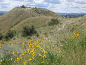
Military Reserve: Easy-to-recognize arrowleaf balsamroot are already in bloom at the Military Reserve in Boise’s North End. The flowers grow in large bunches of multiple, bright-yellow flowers.
Brabec recommends the Central Ridge trail to see small burnet, while Ridge to Rivers’ spring wildflower suggestions point hikers to Cottonwood Creek Trail, a shady route that follows a small stream.
Polecat Reserve: Ertter led a wildflower walk on the Polecat Loop Trail in mid-April. She said the reserve is one of the more diverse wildflower habitats in the Foothills, featuring species unique to our area, including Idahoa (a small green plant also known as pepperpod) and Aase’s onion, which grows light purple flowers close to the ground.
You also can find a variety of biscuitroots, Brabec said, including the recently discovered species of biscuitroot named for former Idaho Gov. Cecil Andrus.
Expect to look carefully for wildflowers here. Ertter calls these plants “belly flowers” — ones you have to lay on your belly to see. You’ll find showier flowers elsewhere.
Hillside to Hollow Reserve: Just off of Hill Road, you’ll find even more arrowleaf balsamroot in the spring, plus less-common plants including the purple Aase’s onion and Cusick’s primrose, a deep purple flower with a yellow center.
Ertter recommends hiking the Buena Vista trail, where she held a wildflower walk in early April.
Oregon Trail Reserve: Ertter led a walk to see wildflowers on the Columbia basalt flows on April 22. Expect “beautiful sagebrush” and blue flax.
Watchman Trail: Watchman is a must-see for wildflower lovers. Clusters of arrowleaf balsamroot create a sea of yellow for several miles through the Foothills. One Idaho trail runner told the Statesman “it’s like you’re in ‘The Sound of Music.’ ”
You also can see purple and white lupines here and on nearby 3 Bears and Orchard Gulch trails, according to Brabec.
Lucky Peak: Though Lucky Peak is a gateway to higher elevation (and later-blooming flowers), there are still spring wildflowers popping up.
Ertter will lead a hike on Cobb Trail, accessible from Lucky Peak Trail or West Highland Valley Trail, on April 30. The route will take you into the Foothills outside Southeast Boise, where you’ll find Hood’s phlox, wild violets and yellow and orange scabland fleabane, along with Andrus’ biscuitroot.
The following week, Ertter plans to return to the Lucky Peak area, viewing hare’s-foot milkvetch, bright purple Beckwith’s violet and clusters of small, white Bolander’s yampah in Lydle Gulch.
Corrals Trail: Toward the end of May, accompany Ertter on the Miller Gulch and Corrals trails in the Foothills southeast of Bogus Basin, where you’ll likely find lupines in full bloom. The tall plants feature tapering columns of purple, pink and white.
Ertter tentatively plans to look for the lupines on May 21, but check the Foothills Learning Center’s event page on Facebook closer to the date to confirm and RSVP. All wildflower walk dates are subject to change based on weather and flower displays, Ertter said.
Camas Prairie: Alright, so this one isn’t exactly in the Boise area, but the purple camas lily bloom in late May is a sight to behold. From Boise it’s about 2 hours to drive to the Camas Prairie Centennial Marsh Wildlife Management Area.
Where to find more wildflowers — and ensure they’ll bloom in the future
If you’re not a fan of hiking but still hope to see some flowers, catch the Idaho Native Plant Society’s native wildflower show at the Foothills Learning Center on Sunday, May 12, from 11 a.m. to 4 p.m. The event is free and features a variety of blooms indigenous to Idaho.
You also can plan to see flowers later in the summer at higher elevations in places like McCall, Stanley and Sun Valley. Ertter will continue to lead wildflower walks in the Boise area through June and July, and the Statesman will publish additional articles on wildflower hotspots this summer.
While you’re looking for blooms, be sure not to disturb the plants. Some tourists trampled flowers during California’s recent super bloom but Ertter said it’s simple to be a good steward and still enjoy the flora.
Ertter says the No. 1 rule is not to pick the plants (unless they’re invasive species, such as bachelor’s button). Stay on trails as much as possible, and watch your step if you have to leave the trail at all. Finally, remember that you’re one of hundreds or possibly thousands of people who will view the wildflowers — and the impact of each person really adds up.
“We like to think our individual choices don’t have that much of an impact (on the environment),” Ertter said. “But they do.”
BUENA VISTA TRAIL WILDFLOWER WALK mid March to early April
Aase’s onion (Allium aaseae)
Cusick’s or Wilcox’s primrose (Primula cusickiana)
For a good selection of early blooming spring flowers, including a couple of our rarest species, the Buena Vista loop in Hillside to Hollow Reserve is hard to beat! The route described here circumnavigates the upper slopes of the western ridge, traversing some of the best remaining good-quality habitat on both south- and north-facing slopes in the lower Foothills. Special plants for this trail include a large population of Aase’s onion (Allium aaseae) on the upper south-facing slopes. This is also the best trail for our only native true primrose, Cusick’s primrose (Primula cusickiana), which is one of the earliest flowers to bloom locally. A few small patches can be spotted in late winter/early spring on upper north-facing slopes.
NOTE: Please enjoy the wildflowers and leave them for others to enjoy. Because our unique local flora is already under pressure from invasive weeds and habitat loss, this website does not encourage the harvesting of native plants, especially along popular trails, and rare plants in particular should be given the best chance possible to continue existing in the wild, where everyone can enjoy them.
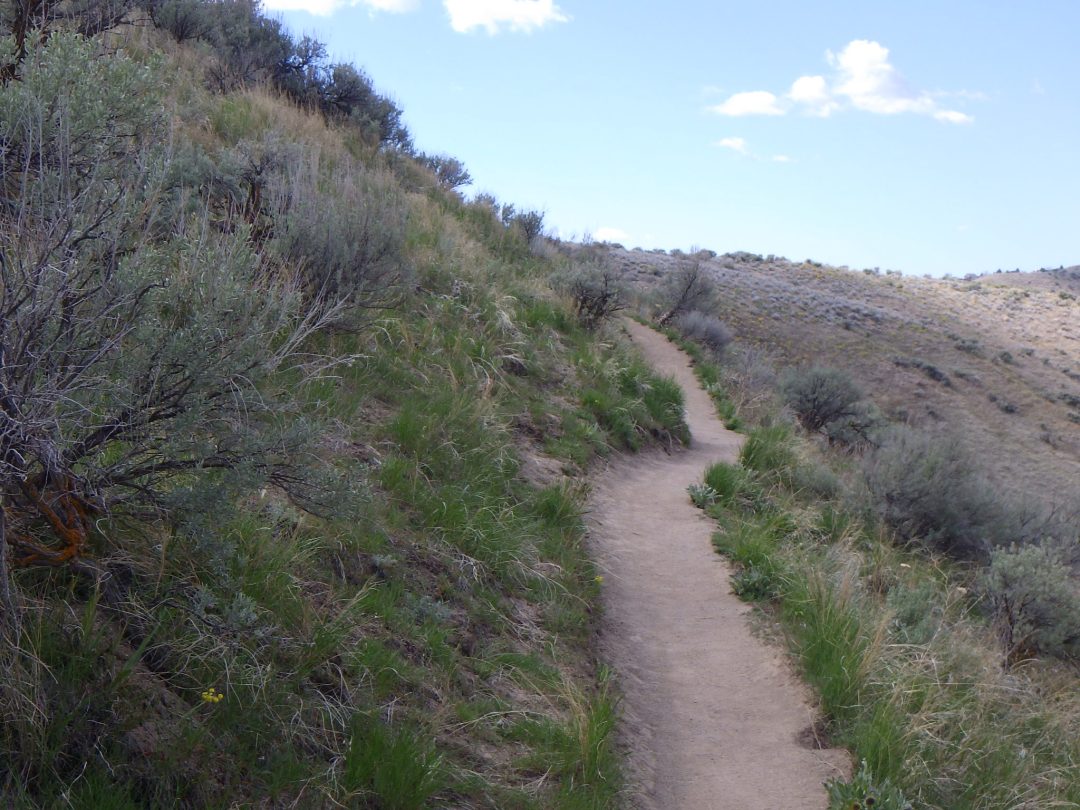
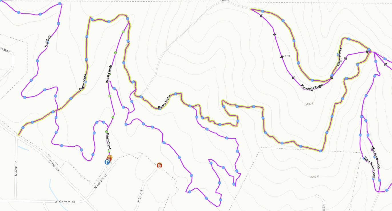
Description: Counter-clockwise on Buena Vista Trail from West Climb Trail in Hillside to Hollow Reserve (Ussery or Hillside trailheads). Full loop requires trail-only access through private land. Difficulty: 2-3 miles roundtrip, 130 feet elevation gain. Avoid when muddy!
The loop for this walk can be accessed at various points from multiple trailheads in the Hillside to Hollow Reserve, but to get to the “good stuff” as quickly as possible the route described here starts from the small trailhead at the end of Ussery Street on the north side of Hill Road. It also goes counter-clockwise for the same reason, but the reverse direction is recommended if crossing the muddiest sections while they are still frozen in the early morning is a priority.
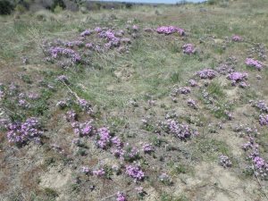
Buena Vista Trail on south-facing slope in early spring.
From the Ussery trailhead, head north on West Climb Trail (#55), which is an old road lined with feral rye (Secale cereale) and other invasive non-natives. Either turn right on Robert Smylie Trail (#54), then left on the short connector to Buena Vista Trail (#53), or stay on West Climb Trail until reaching the Buena Vista Trail; the latter option is more likely to be muddy. Go east on the Buena Vista Trail as it traverses the sandy south side of the ridge, with occasional switchbacks going higher up. As you go up in elevation, note how the solid stands of weedy grasses and other non-natives give way to an open matrix of sandy “bare” ground (actually a complex micro-ecosystem) that provides habitat for a diversity of bunchgrasses, perennial forbs, and tiny annual wildflowers (mostly non-native, but still cute!) Native wildflowers that are most likely to be in bloom in early spring include woollypod milkvetch (Astragalus purshii var. glareosus), narrow-leaf biscuitroot (Lomatium simplex), and prickly phlox (Phlox aculeata), soon to be joined by arrowleaf balsamroot (Balsamorhiza sagitatta).
woolly-pod milkvetch (Astragalus purshii var. glareosus)
narrowleaf or Great Basin biscuitroot (Lomatium simplex)
pricklyleaf phlox (Phlox aculeata)
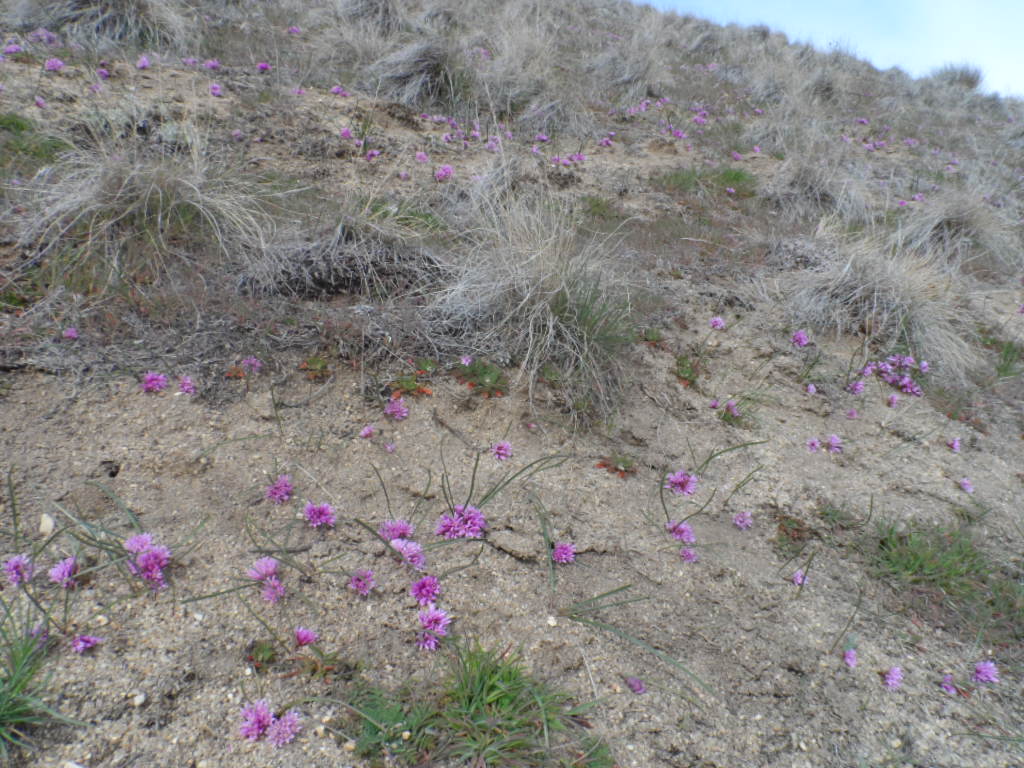
Aase’s onion (Allium aaseae)
Once you start encountering areas with lots of “bare” sandy habitat, start keeping an eye out for clusters of pink flowers scattered on the ground, with a couple of sprawling grasslike leaves per cluster. These are the lovely Aase’s onion (Alliumaaseae), among the rarest of all plants most of you will ever see growing in the wild. Although relatively common at this particular locality, the species’ worldwide distribution is limited to sandy areas in the foothills from Boise to Weiser, so be sure to stay on the trail and avoid disturbing this special plant. If your timing is right, the few you spot at first will become increasingly abundant, with the main population where the trail wraps around to the east side of the ridge.
Unmarked lower western trail from saddle.
After traversing the steep east-facing slope, the Buena Vista trail intersects a six-way junction at the saddle between the east and west peaks of the ridge. Take the lower of the options heading west, so as to traverse as much of the north-facing side of the ridge as possible. With luck, you might spot some sagebrush buttercup (Ranunculus glaberrimus), most likely on the slope well below the trail, tiny flowers nestled among mats of dwarf pussytoes (Antennariadimorpha), and even some more Aase’s onion. This segment of trail soon doubles back and briefly reconnects with Kemper’s Ridge Trail (#52) that climbs straight up the ridge; stay on the Buena Vista Trail when it immediately branches to the right.
Buena Vista trail on north side of ridge.
You are now traversing some of the highest quality north-facing habitat in the central Foothills, where many previously comparable ridges have been scalped and converted into coveted view lots. Note the differences from the previously traversed south-facing slope: fine loamy soil (muddy when wet!), an abundance of mosses and lichens covering the “bare” matrix, and a corresponding different suite of flowers (with some overlap).
dwarf, cushion, or low pussytoes (Antennaria dimorpha)
foothill, peak, or swamp saxifrage (Micranthes nidifica)
Cusick’s or Wilcox’s primrose (Primula cusickiana)
With good timing and luck, you will be able to spot some Cusick’s primrose (Primula cusickiana) in bloom in one of the small populations scattered along the trail. This is our only locally native true primrose, not to be confused with unrelated evening-primroses (Oenothera). Although not considered as globally rare as Aase’s onion, with a range extending from the Blue Mountains of Oregon to central Idaho, Cusick’s primrose is much harder to find in the Boise Front, and is often finished blooming before Aase’s onion even gets started. This stretch of trail is in fact one of the only trails, and certainly the easiest, to see this charming little plant in the Ridge to Rivers trail network. Unfortunately, it is also EXTREMELY vulnerable, especially when the steep slopes are so saturated that even a dog running happily off path can cause serious damage. Be sure to stay on the path on this section of the trail, or turn back if muddy, no matter how tempted you might be to do otherwise.
Saddle dividing public and private lands.
The official Buena Vista Trail ends at the next saddle, but a selection of trails continues into the private land at the west end of the ridge. Behave respectfully, and hopefully public access will continue to be allowed, preserving the intactness of the ridge and making the full loop possible. If possible, stay to the right, traversing the final stretch of north-facing slope that harbors a few more Cusick’s primrose, which sometimes bloom a bit earlier here than elsewhere.
Trail traversing east-facing slope through private lands.
Once the side trail reconnects with the main trail, the recommended route is to continue following the ridge down past a neighborhood connecting trail to the right and then past a well-used but steep short-cut to the left. Turn left instead on the next trail that doubles back to traverse an east-facing slope with abundant sagebrush overlooking the Quail Hollow golf course. Although not as rich in spring flowers as other parts of the loop, this is a good stretch to enjoy other species as the season progresses, in reasonably intact habitat.
After this stretch ends by rejoining the steep short-cut from the ridge, take whichever route catches your fancy to return to the Ussery trailhead. The shortest route is the steep drop back into the draw, or you can stay on the ridge a bit longer to re-enter public lands and a choice of more gradual descents. Either the short route or left on Buena Vista trail take you into the draw near an old homestead site with non-native black locust trees (Robinia pseudo-acacia) harboring bulky magpie nests; take time to also admire the lichens that grace the former stonework strewn around. Alternatively, you can prolong your hike by continuing straight on Buena Vista trail before returning to Ussery by turning left on Full Sail Trail (#56). Whatever route you choose, be sure to enjoy your hike, and whatever wildflowers you see!
*Rubber rabbitbrush (Ericameria [formerly Chrysothamnus] nauseosa) — var. hololeuca is the more common larger variety; the smaller, more spindly var. oreophila is mostly on plateaus
SIGNIFICANT NOXIOUS WEEDS (not in bloom, but evident)
BONNEVILLE POINT WILDFLOWER WALK mid May to mid June
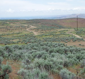
Oregon Trail from Bonneville Point
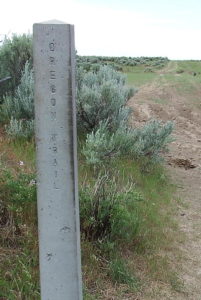
Description: This walk provides a very different experience from that of most trails in the Boise Front, exploring a section of the Oregon Trail on the edge of the Mountain Home desert to enjoy serene views, mid-season wildflowers, history, and maybe even a few pronghorn. The self-guided tour and plant list covers 2-3 miles roundtrip from Bonneville Point, with modest elevation loss and gain. The walk is on exposed tableland, so it is best to avoid extremes of either hot temperatures or the threat of thunderstorms.
To get to Bonneville Point, take the Blacks Creek exit (#64) on I-84 southeast of Boise [may require detour during construction in summer 2020]; follow Blacks Creek Road east for about 2½ miles, then turn left on a well-signed road for another 1+ miles. There are often a few pronghorn visible along the route; always a treat to see! The road ends at a scenic viewpoint and interpretative area on the Oregon Trail, with expansive views across the Boise Valley and western Snake River Plains to the Owyhee Mountains on the southwestern horizon. The interpretive kiosk is in a fenced area with several sickly and dead honey locust (Gleditsia triacanthos), along with a few healthier black locust (Robinia pseudoacacia) with their clusters of fragrant white flowers.
If you have not previously done so, be sure to take advantage of the interpretative signage, for what is essentially the starting point for the current city of Boise, which was, and remains, the largest city on the Oregon Trail between its beginning and ending points.. This is the approximate location where Captain Benjamin Bonneville’s expedition (romanticized by Washington Irving) had their first glimpse of the tree-lined river in the valley below in May 1933, after days of crossing the arid sagebrush plains from the east. Those of us who took Idaho history in 4th grade were taught how the French members of the expedition exclaimed “Les bois, les bois – voyes les bois (The woods, the woods – see the woods)!”. Although this episode is regrettably not mentioned by Irving, it nevertheless provides the apocryphal origin of the name Boise being applied to the river, and ultimately the “City of Trees” that grew on its banks. The interpretative signage provides additional history, from the indigenous inhabitats of the area (Shoshone, Bannock, Northern Paiute), to the fur trade, to Oregon-bound emigrant wagons following the same route as Bonneville’s expedition, which presumably took advantage of existing Indian trails.
The wildflower walk described here does not follow a designated route, but rather addresses the most noteworthy habitats and plants that are likely to be encountered on whatever combination of the several intertwining roads one wishes to follow, heading gently downhill to the west and dropping stepwise onto successive terraces. The plant list goes for about 1 mile, where several roads intersect.
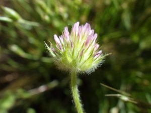
The geology on the south side of the Boise River is, with some exceptions, very different from that on the north side of the river. As a sweeping generality, the Boise Front is dominated by granite-derived soils and sediments of the Idaho Batholith, interspersed with some basalt volcanic features such as Chukar Butte. In contrast, recurrent. relatively young (less than 1½ million years old) basalt flows created the upland plateau that stretches from Boise to Mountain Home, now overlain by wind-blown loess soils and minor sediments in creek beds, including cobbles and sand from the granite batholith. Polished granitic cobbles are a dominant feature at Bonneville Point; it is possible that the Oregon Trail preferentially followed this natural “pavement”. And since plants are excellent geologists, you can find plants growing here that aren’t known from the Boise Front proper, notably hairy or Hooker’s balsamroot (Balsamorhiza hispidula) and bighead clover (Trifolium macrocephalum). Many of these are common to the south, including in the distant Owyhee Mountains, and in fact the Boise River is an approximate dividing line between major floristic regions: the Pacific Northwest/Rocky Mountain floras to the north, and the Great Basin/Intermountain Region flora to the south.
Low-sagebrush scabland at Bonneville Point.
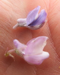
One of the most interesting habitats occurs near the beginning of the walk, north of the interpretive area. This is a cobbly scabland with well-spaced low-sagebrush (Artemisia arbuscula ssp. longiloba), which is not found elsewhere in the area covered by this website. Characteristic wildflowers of this habitat include several that would be suitable for rock-gardens, notably scabland fleabane (Erigeron bloomeri var. bloomeri) and ballhead sandworth (Eremogone congesta var. cephaloidea). Gumbo biscuitroot (Lomatium bicolor var. leptocarpum) is also locally common, but probably already in fruit at the recommended time for this walk. This is furthermore a good place to compare our two most common species of lupine, when their blooming times overlap. The flowers of the earlier blooming longspur lupine (Lupinus arbustus) come in many colors and have a pronounced spur, while the later-blooming silver lupine (Lupinus argenteus) has more uniformly blue-violet flowers that have only a slight bump; leaves of the silver lupine are generally also more silver-hairy.
scabland or Bloomer’s fleabane (Erigeron bloomeri var. bloomeri)
Ballhead sandwort (Eremogone congesta var. cephaloidea)
Silver lupine (top) and longspur lupine (bottom)
Dark green patch of Baltic rush (center of photo) and roadbed pool on Oregon Trail
Additional wetland diversity exists around the pools that form in depressions on the roadbeds, indicating the prescence of an underlying hardpan that inhibits water percolation. Despite ubiquitous damage by motorized recreation, mudflats around the pools are an excellent place to look for several noteworthy native annuals, including two species of woolly-marbles (Psilocarphus), Great Basin pincushion plant (Navarretia propinqua), two species of popcorn-flower (Plagiobothrys), and lowland cudweed (Gnaphalium palustre). Smooth spike-primrose (Epilobium campestre) is often common, but the tiny pink flowers generally bloom later in the season.
A very different habitat occurs on the slope southwest of the interpretive area, where a dark green swath of wiry-stemmed Baltic rush (Juncus balticus) marks a seasonal seepage area. In a good year (which 2020 is not), it can be worthwhile to spend some time looking for a variety of native annuals, including hairy own-clover (Castilleja tenuis), smallhead clover (Trifolium microcephalum), and even the intriguing pearlflower (Heterocodon rariflorum), which only rarely produces obvious (chasmogamous) bell-like flowers, relying otherwise on obsure cleistogamous flowers. In a good year, be careful to stick to the drier margins, so as not to trample tiny natives in their sensitive wetland habitat (unless cattle have beaten you to it).
Mudflat annuals on Oregon Trail.
Oregon woolly-marbles (Psilocarphus oreganus)
Alkali popcorn-flower (Plagiobothrys leptocladus)
Mound-intermound topography along Oregon Trail, with native grasses.
One intriguing landscape feature to note is the discernible mound-intermound topography, also referred to as Mima mounds. Although not as distinct as in some areas, where the regularly spaced mounds form patterns easily seen from airplanes, the contrast between sagebrush-covered mounds of relatively deep soil and the rocky flats in between is clearly evident. Several theories exist for the origin of this topography, but none have been confirmed. Among the plants to look for in the intermound habit is one of the most lovely, though rarely caught in bloom locally: bighead clover (Trifolium macrocephalum), which differs from most clovers in having more than three leaflets. This species is relatively common in the Owyhee Desert but not known from the Boise Front proper; the plants growing have paler flowers than is typical. Intermound flats are also good places to look for several annual genera in Asteraceae, including the relatively common eyelashweed (Blepharipappus scaber), the softly pubescent hareleaf (Lagophylla ramosissima), and the much harder-to-spot wireweed (Rigiopappus leptocladus). In addition, take note of the well-developed soil crusts comprised of mosses and lichens, some also growing on the abundant cobbles.
bighead clover (Trifolium macrocephalum)
eyelashweed or blepharipappus (Blepharipappus scaber)
eyelashweed or blepharipappus (Blepharipappus scaber)
Mosses and lichens forming soil crust.
It is unfortunate that the seemingly bare flats of the intermound appear so inviting to ATV’s, since they not only host a nice selection of interesting wildflowers but also provide important ecological functions, including nutrient recycling and natural firebreaks. Intact soil crust is resistant to seed germination of invasive cheatgreass (Bromus tectorum), but repeated disturbance can result in the natural firebreak being replaced by solid stands of tinder-dry annual grass. Unregulated mechanized recreation has a long history of use in this area, but whether or not this remains the best possible use is a legitimate question, especially for a prime recreation site so accessible to a rapidly growing population.
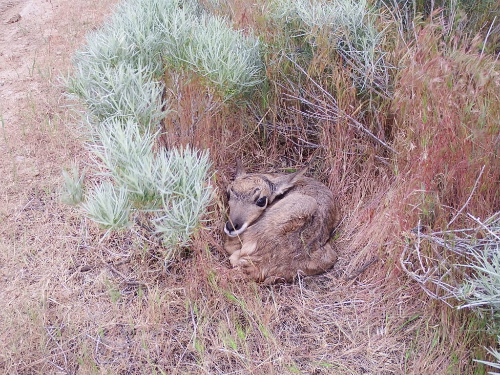
The open sagebrush-covered slopes and flats around Bonneville Point are also the most reliable place locally to look for pronghorn, the fastest land animal in North America. Although commonly called antelope, pronghorns are evidently more closely related to giraffes and okapis. These beautiful buff-and-white animals will see you long before you see them, depending on speed more than cover for safety (except for the fawns, which hide tucked among the brush).
Pronghorn fawn near Bonnevile Point.
PLANT LIST [updating needed]
NOTE: Please enjoy the wildflowers and leave them for others to enjoy. Because our unique local flora is already under pressure from invasive weeds and habitat loss, harvesting of native plants is not encouraged on this website, especially along popular trails.
Plants listed in alphabetical order of scientific name within category; * designates native plants
The lower half-mile of Bob’s Trail (#30), along East Crane Creek, is a delightful walk at most times of the year, harboring a surprising diversity of native wildflowers along its relatively short length. Separate walks are described for June, when the syringa and checkermallow are most likely to be in bloom, and early fall, when an entirely different suite of streamside plants are in bloom. The popular single-track trail is narrow and rocky in places, with three stream crossings that can be challenging at high water. Total distance covered by the plant list is a bit less than a mile (out and back); total elevation gain is 150-200 feet. Longer return loop options exist for those feeling more ambitious.
Syringa (Philadephus lewisii)
Description: The walk begins at trailhead at the north end of Hearthstone Drive (access via Curling Drive in the Highlands); be respectful of the neighborhood and obey posted speed limits. Follow the trail up East Crane Creek; guided wildflower walk and plant list cover about half a mile, to the junction with Urban Connector Trail (#9). The flowing creek (at least through spring), at the base of a steep north-facing slop, is largely free of a solid shrub cover and creates special conditions that foster the diversity of plants that makes this walk special. This is one of the easiest places to see an abundance of syringa or mock-orange (Philadelphus lewisii), Idaho’s state flower, and to enjoy its fragrant flowers. The site also provides a low-elevation refuge for some plants that normally occur at higher elevations, notably the wingfruit mariposa or sego-lily (Calochortus eurycarpus); if you are lucky, you might see a few of the purple-spotted white flowers scattered on the north-facing slopes. Although not visible from the trail, there is also a single outlying occurrence of starry sulphur-flowered buckwheat (Eriogonum umbellatum var. ellipticum), tucked under the lone cottonwood on the opposite side of the creek near the beginning of the trail.
Salad burnet (Poterium sanguisorba)
As is obvious right from the beginning of the walk, the native diversity is matched by non-native diversity, and whether the latter will ultimately displace the former remains to be seen. In addition to the usual non-natives common at low elevations, several plants in particular are likely to trigger some curiosity, including a few red-orange flowers of long-headed poppy or blindeyes (Papaver dubium), probably originating from a “wildflower” seed mix, that can sometimes be seen near the trailhead. The distinctive purplish-leaved shrub right next to the trail is a form of cherry plum (Prunus cerasifera). Occasional plants of garden burnet (Poterium sanguisorba, previously Sanguisorba minor) provide an additional curiosity, as a very atypical member of the rose family with short spikes of highly reduced flowers; the edible leaves taste like cucumber.
Young black cottonwood (Populus trichocarpa) are scattered along the creek, as are syringa, several species of willow (Salix), and a couple of species of non-native rose (Rosa canina and R. obtusifolia). Upland shrubs include not only the common foothill shrubs (sagebrush, antelope brush, rubber rabbitbrush), but also green rabbitbrush (Chrysothamnus viscidiflorus) with its corkscrew-twisted leaves, our native interior or Wood’s rose (Rosa woodsii ssp. ultramontana), golden currant (Ribes aureum), and several thickets of chokecherry (Prunus virginiana var. melanocarpa). The white spikes of chokecherry bloom earlier in the year, while the yellow heads of rabbitbrush won’t appear until fall. The young juniper (Juniperus) is presumably an escapee from cultivation, probably with the help of a bird, since native junipers are not known to occur naturally in the Boise Front (although common south of the Snake River Plains.) There are also a few large clumps of Great Basin wildrye (Leymus cinereus) on the north-facing slope, along with wildflowers such as longspur lupine (Lupinus arbustus; mostly past bloom), wild-hyacinth (Triteleia grandiflora), largeflower collomia (Collomia grandiflora) with its distinctive salmon-colored flowers, and many others, depending on the season. Perennial flax (Linum perenne), with its sky-blue flowers, is often conspicuous at the first creek-crossing. This widespread species is often included in wildflower seeding mixtures as the closely related Lewis’s flax (Linumlewisii), but it is actually a Eurasian species that differs in having heterostylous flowers (i.e., some plants with styles longer than the anthers, others with styles shorter than the flowers).
western chokecherry (Prunus virginiana var. melanocarpa)
Wild hyacinth
grand or largeflower collomia (Collomia grandiflora)
Lewis’s flax (Linum lewisii)
Take time to admire the plant diversity along the sandy, sunny, streambank, though several of the most interesting plants won’t be blooming until later in the season. Two small-flowered native annuals that might be starting to bloom are bird’s-foot trefoil (Acmispon americanus, previously Lotus purshianus) and smallhead clover (Trifolium microcephalum), both in the pea family. Several native grasslike perennials are also relatively easy to spot: straightleaf rush (Juncus orthophyllus), Douglas’s sedge (Carex douglasii), and common spike-rush (Eleocharis palustris). Conspicuous non-native perennials include curly dock (Rumex crispus), Bouncing bet or soapwort (Saponaria officinalis, probably not yet in bloom), and sulphur cinquefoil (Potentilla recta), which is a troublesome invasive species.
Bird’s-foot trefoil (Acmispon americanus)
smallhead or maiden clover (Trifolium microcephalum)
Douglas’s sedge (Carex douglasii)
sulphur cinquefoil (Potentilla recta)
Previous year’s leaf gall and fruit of netleaf hackberry (Celtis reticulata)
Coming up next is a grove of light green shrubs or small trees with a gnarled, contorted appearance; these are our native netleaf hackberry (Celtis reticulata). Their odd appearance is exacerbated by the presence of numerous leaf galls, which result when an insect not only lays its eggs on a plant, but then manages to co-opt the plant’s growth hormones to force it to grow a tailor-made nursery for the developing larvae. There are many different kinds of galls on different plants, each created by a specific insect, most often a wasp or fly.
Western poison-ivy (Toxicodendron rydbergii)
A small sandy beach is on the other side of the second creek crossing, bring the path back to the base of the north-facing slope. If you are not already familiar with western poison-ivy (Toxicodendron rydbergii, previously included in Rhus radicans), take note of the colony at the edge of the beach. Unlike other kinds of poison-ivy and poison-oak, western poison-ivy is not a vine or large shrub. Instead, it forms an open patch of erect grayish stems, mostly less than three feet tall. In addition to the “leaflets three, let it be” identification refrain, even the leafless winter stems can often be recognized by clusters of dried white berries.
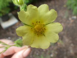
As the trail continues, keep an eye out for several additional perennial wildflowers along the edge of the creek and adjacent slope. If you’re lucky, you might catch foothill death-camas (Toxicoscordion paniculatum, previously in Zigadenus), wingfruit mariposa or sego-lily (Calochortus eurycarpus), Oregon checkermallow (Sidalcea oregana), and Nuttall’s cinquefoil (Potentilla gracilis var. fastigiata) in bloom. The Boise Foothills form of Oregon checkermallow differs from forms growing elswhere in having dense stellate (starlike) hairs on the stems and leaves; whether this has any taxonomic significance remains to be determined. A clump of Nuttall’s cinquefoil grows on the right side of the path opposite a small black cottonwood on the other side of the creek, shortly before the third (and final) creek crossing. This native cinquefoil, relatively uncommon in the Boise Front, has bright yellow petals and retains its cluster of dark green basal leaves. In contrast, the invasive sulphur cinquefoil has pale yellow petals, and the basal leaves generally shrivel by the time flowering begins.
foothill or panicled death-camas (Toxicoscordion paniculatum)
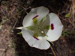
wing-fruited or white mariposa lily (Calochortus eurycarpus)
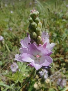
Oregon checkermallow (Sidalcea oregana)
Check-dam on East Crane Creek
About 1/3 mile from the trailhead is a check dam, built in the mid 1990’s as a flood control measure after disastrous mudflows following major fires in the Boise Front (see Interpretative Loop wildflower walk, and “When the Pot Boiled Over”). Take time to appreciate the various construction features of this earth-fill dam, which was not designed to store water but rather to protect neighborhoods downstream by limiting maximum water flow and holding back mud and debris in case of future flood events. In this photo, the dam is the hill spanning the gulch in the background; the concrete structure in the foreground is a flow spreader/erosion catch, intended to keep floodwater from cutting the stream channel deeper and potentially undercutting the dam. Annual maintenance by the Department of Public Works is presumably the reason for the recent removal of some shrubs and small trees from this area. Fortunately the remaining trees continue to provide a pleasantly shaded resting area, and at least as of spring 2020 they still shelter a particularly fine specimen of Oregon checkermallow.
Upstream side of check-dam on East Crane Creek.
The trail ascends the north side of the check-dam, with a bench at the top providing good views of the sunset and surrounding area. Note the additional drainage features on the upstream side of the dam, and see if you can recognize the access roads and areas where soil was excavated for dam construction. Both the dam itself and adjacent construction areas are nearly devoid of native species, having been seeded instead with a variety of non-native perennial grasses, which have been joined by invasive species such as field bindweed or wild morning-glory (Convolvus arvensis) and whitetop (Lepidium draba, previously in Cardaria). On the flip side, is quite possible that the dam has benefited the native diversity downstream, if backed-up floodwaters supplement the groundwater that allows the stream to flow longer into the summer season than would otherwise have happened.
Western or intermediate dogbane (Apocynum floribundum)
The plant list for this walk continues a little bit farther along Bob’s Trail to the junction with Urban Connector (#9). The sandy south-facing slope adds a bit of diversity but is mostly dominated by invasive non-natives; the actual goal of the extra distance is a colony of western or intermediate dogbane (Apocynum floribundum) lining the streamlet below, and where crossed by Bob’s Trail. Western dogbane is considered to be the sporadic hybrid between hemp dogbane (Apocynum cannabinum), which forms tall patches along the Greenbelt, and spreading dogbane (Apocynum androsaemifolium), which occurs at higher elevations. At least locally, however, western dogbane is now behaving as a species in its own right, forming extensive patches as the most abundant dogbane in the Boise Front. We may even be witnessing an emerging species that is pre-adapted to the increasingly common novel habitat dominated by non-native grasses, where the western dogbane seems to thrive.
For those wishing to do more than simply retrace their steps from this point, there are two loop options. The shorter option is to cross the dam, follow the road up the hill, and turn right on an unofficial trail along the ridge south of the creek, which drops down to Hearthstone a short distance south of the trailhead. This is a nice option for sunset views, with a few additional species including Thurber’s needlegrass (Achnatherum thurberianum) and pestle parsnip (Lomatium nudicaule). The longer loop (nearly 2½ miles on official trails, with an additional 360 foot elevation gain) is to follow Urban Connector to the ridge north of the creek, returning via Highlands Trail (#1). Most of this loop is through low-diversity mid-elevation pastureland dominated by non-native grasses, but note also the flourishing population of western dogbane. A scattering of additional native species can also be found on the sandy slopes above the trailhead.
Myrtle spurge (Euphorbia myrsinites)
The section of Bob’s Trail covered by this wildflower walk description would provide an excellent community-based site-stewardship project, especially for nature-lovers living in nearby neighborhoods. Regular attention to the special native wildflowers that grow here, perhaps in combination with judicious weeding of non-native grasses that threaten to crowd them out, could make the difference in ensuring their continued survival here. A targeted effort to remove the most worrisome invasives, while their populations are still limited enough to make this feasible, would also be extremely beneficial. Prime candidates include the sulphur cinquefoil along the creek (as long as care is taken to leave Nuttall’s cinquefoil undisturbed) and whitetop at the edge of the dam. There is also a small but expanding population of myrtle spurge (Euphorbia myrsinites) at the base of the unofficial trail; the sooner this is removed, the better!
PLANT LIST [updating needed]
NOTE: Please enjoy the wildflowers and leave them for others to enjoy. Because our unique local flora is already under pressure from invasive weeds and habitat loss, harvesting of native plants is not encouraged on this website, especially along popular trails.
Plants listed alphabetically by genus within category. * indicates native species
Small or garden burnet (Poterium sanguisorba var. polygamum, alternatively Sanguisorba minor) – non-native, frequently included in post-fire seeding mixes for livestock and wildlife forage
Bouncingbet, soapwort (Saponaria officinalis) – non-native, probably not yet in bloom
(out and back, or return via Chukar Butte and Cartwright Road)
Recommended for May
This short but scenic walk covers the first mile or so of a trail that users might want to explore further on their own. Most of the trail has a relatively high clay content, so best used when fully dry; 420 foot elevation gain.
Hillside on Currant Creek Trail east of Cartwright Road.
The most unusual plants occur on a south-facing slope after the ascending trail wraps around a ridge, consisting of dark clay soil of volcanic origin. Just below the trail at one point is a very small, highly localized population of pallid milkweed (Asclepias cryptoceras), a particularly stunning member of the genus that unfortunately does not do well in cultivation. This is one of very few places that pallid milkweed grows in the Boise Front, but please admire the plant from the trail, since the habitat is extremely fragile. Hotrock penstemon (Penstemon deustus) is present on the same slope, blooming somewhat later than most other flowers mentioned here.
Clay slope with pallid milkweed (Asclepias cryptoceras) on Currant Creek Trail.
Pallid milkweed (Asclepias cryptoceras_
Hotrock penstemon
The trail passes near a small brush-lined creek at one point, with patches of yellow-flowered upland violet (Viola nuttallii var. praemorsa) and starry false solomon’s-seal (Maianthemum stellatum, previously in Smilacina) visible. Although tempting to admire close-up, beware of abundant poison-ivy (Toxicodendron rydbergii, previously in Rhus radicans)! The trail then follows a ridge-top road with good views, abundant pestle-parsnip (Lomatium nudicaule), and scattered globemallow (Sphaeralcea munroana). Dramatic sandstone cliffs form the southern escarpment of the ridge, providing additional geological interest as well as habitat for netleaf hackberry (Celtis reticulata).
The trail drops down at a gap in the escarpment to its junction with Chukar Butte Trail (#74). If you want to make a loop hike, although without very many additional species, go right on Chukar Butte Trail and then walk alongside Cartwright Road about half a mile back to your starting point. You can also extend your hike by turning left on Chukar Butte Trail as an out-and-back option, again with limited additional species at least while traversing the mid-elevation pastureland.
[plant list not yet generated]
NOTE: Please enjoy the wildflowers and leave them for others to enjoy. Because our unique local flora is already under pressure from invasive weeds and habitat loss, harvesting of native plants is not encouraged on this website, especially along popular trails.
Recommended for June, when syringa (Philadelphus lewisii) is in bloom; the granite outcrops are spectacular at any time. Hiking poles might be useful for balance when negotiating portions of path through rock outcrops. Sections of the trail can be muddy; avoid when wet. Total distance: 1½ to 2½ miles, with about 300 feet elevation loss.
Start at the trailhead on Bogus Basin Road (same trailhead as upper access to Dry Creek trail). The first third mile crosses heavily modified pastureland now dominated by medusahead (Taeniatherum caput-medusae), an invasive annual grass, and rush skeletonweed (Chondrilla juncea; fall-blooming). Beautiful silver lupines (Lupinus argenteus) ameliorate this part of the walk, and, if one can ignore the perniciousness of the medusahead, the wind making waves across the bright green hillsides can be lovely.
Seepage on rock outcrops along Sweet Connie Trail
Flowering diversity picks up when the trail turns onto a short stretch of north-facing slope, where there might be a few lingering longspur or polychrome lupine (Lupinus argenteus) or precocious sagebrush sego-lilies (Calochortus macrocarpus). The trail then starts following a small spring-fed streamlet, which (especially where mossy springs drip over outcrops) provides habitat for some interesting annual wildflowers only occasionally encountered in the foothills: American bird’s-foot trefoil (Acmispon americanus, previously Lotus purshianus), field monkeyflower (Erythranthe arvensis, previously in Mimulus guttatus), smallhead clover (Trifolium microcephalum), whitetip clover (Trifolium variegatum), dense spike-primrose (Epilobium densiflorum), and possibly even western pearlwort (Heterocodon rariflorum). Flowers of interior or Wood’s rose (Rosa woodsii ssp. ultramontana) tend to be a particularly deep pink along this stretch, and an Oregon checkermallow (Sidalcea oregana) or two can be seen on the opposite side of the draw. Also keep an eye out for occasional patches of narrowleaf milkweed (Asclepias fascicularis), at least later in the season.
smallhead or maiden clover (Trifolium microcephalum)
white-tip clover (Trifolium variegatum)
Oregon checkermallow (Sidalcea oregana)
narrowleaf or Mexican milkweed (Asclepias fascicularis)
Oregon cliff fern (Woodsia oregana)
Granite outcrops start adding to the scenery at about half a mile from the trailhead, and become increasingly prominent along the lower part of the trail. Patches of syringa (Philadelphus lewisii) scent the air if your timing is right, gnarled netleaf hackberries (Celtis reticulata) add their own bizarre beauty, and small clumps of Oregon cliff fern (Woodsia oregana) peek out from under boulders.
At the forks of Daniel Creek just before the junction with Peggy’s Trail (0.8 miles from the trailhead), an inviting shady spot beneath a large hackberry provides an inviting rest stop and good turn-around site (be sure to check for rattlesnakes first!) A clump of camas (Camassia quamash) perches midstream below the trail, already past bloom when the syringa are at their peak. The volcanic outcrop of Chukar Butte defines the skyline to the west.
For an optional extension of this wildflower walk, follow Peggy’s Trail downstream for half a mile or so. This stretch of trail is on a north-facing slope of heavy clay, well above the brush- and tree-lined Daniel Creek below. Depending on timing, rainfall, and severity of cattle activity, you may be rewarded with tapertip onion (Allium acuminatum), largeflower collomia (Collomia grandiflora), and ragged robin (Clarkia pulchella)
tapertip onion (Allium acuminatum)
grand or largeflower collomia (Collomia grandiflora)
NOTE: Please enjoy the wildflowers and leave them for others to enjoy. Because our unique local flora is already under pressure from invasive weeds and habitat loss, harvesting of native plants is not encouraged on this website, especially along popular trails.
Although largely through relatively low-diversity altered pastureland, patches of interesting wildflowers, habitat diversity, and wide views makes this walk a good intermediate-distance loop in one of the less-used parts of Military Reserve. The elongate loop traverses in and out around tributaries of Freestone Creek, well above the stream except where it crosses at the far end. The full loop is nearly 4 miles, with 420 foot elevation gain. Most trails have a relatively high clay content, so best used when fully dry. The trails are popular with mountain bikers, so be prepared to share.
Plants of special interest: Hotrock penstemon; Bolander’s yampah, abundant pestle-parsnip, at least 3 different hawksbeard. Other seasonally showy flowers: arrowleaf balsamroot, polychrome lupine, bitterbrush, sagebrush sego-lily
Stage 1: Starting from Three Bears Trailhead at the end of the public section of Mountain Cove Road, take Ridge Crest Trail (#30) up a north-facing slope to the ridge line; keep left to Bucktail trail (0.4 mi). The lovely knoll between the trailhead and the archery range has a nice display of arrowleaf balsamroot (Balsamorhiza sagittata), longspur lupine (Lupinus arbustus), and other wildflowers; enjoy from the trail, since the heavy clay soils are easily compacted. A localized population of Hotrock penstemon (Penstemon deustus), occurring near a bend in the trail, is one of the special plants on this trail; the plant is more commonly found on rocky outcrops, not open clay slopes.
Ridge Crest Trail.
Bitterbrush, arrowleaf balsamroot and longspur lupines on knolll near base of Ridge Crest Trail.
Hotrock penstemon
Bitterbrush (Purshia tridentata) is the most common shrub on the entire loop, coloring the hillsides yellow and scenting the air at peak bloom. A conspicuous grayish shrub, near the trailhead and elsewhere in Military Reserve, is the fourwing saltbush (Atriplex canescens). Although a common native shrub in much of the western US, including southwestern Idaho, this shrub was not present in Military Reserve when I was growing up; instead, it became established here after being included in post-fire seeding efforts several decades ago.
four-wing shadscale or saltbush (Atriplex canescens var. canescens)
four-wing shadscale or saltbush (Atriplex canescens var. canescens)
four-wing shadscale or saltbush (Atriplex canescens var. canescens)
As the trail cuts across the north-facing slope just before reaching the ridge, keep an eye out for wildflowers in this habitat. In particular, here and in similar settings elsewhere in the Boise Front, take a look to see what grows in the shelter of shrubs; if not displaced by invasive annual grasses and other weeds, there is often a nice diversity of small annuals (“belly flowers”), including miner’s-lettuce (Claytonia perfoliata) and “wedding-cake plant” (Plectritis macrocera). Unfortunately, the invasive bur-chervil (Anthriscus caucalis), which is rapidly spreading in the Boise Front thanks to its velcro-covered fruits, has gained a foothold at this site as well. In the accompanying photo, the bur-chervil has the fern-like leaves; it is probably only a matter of time before it displaces the round-leaved miner’s-lettuce and any other belly-flowers.
Low-diversity pastureland along Bucktrail Trail.
BUCKTAIL TRAIL IS CURRENTLY FOR CYCLISTS ONLY, AS PART OF A PILOT PROGRAM THROUGH AT LEAST NOVEMBER 2021. A new pedestrian-only trail, Two Point Trail, has been constructed parallel to Bucktrail Trail. It has not yet been surveyed for this wildflower walk, but will probably have less to see since it will not be skirting the edge of the steep slope.
Stage 2: Left on Bucktrail trail (1.3 mi). This segment of the loop mostly winds through altered habitat managed as pastureland, dominated by non-native intermediate wheatgrass. Native wildflower diversity is relatively low as a result, with the primary exception of some grazing-tolerant species such as pestle-parsnip (Lomatium nudicaule) and gray-green thistle (Cirsium cymosum var. canovirens). Several species of hawksbeard (Crepis), shaggy fleabane (Erigeron pumilus var. intermedius), sagebrush sego-lily (Calochortus macrocarpus), and tapertip onion (Allium acuminatum) are also present, but generally bloom later than most other plants mentioned here. One curiosity is the occasional young silver sagebrush (Artemisia cana) along the trail, differing from big sagebrush (Artemisia tridentata) in that the leaves are pointed instead of 3-toothed. Although native to the West in general, silver sagebrush does not occur naturally in the foothills; these young plants were presumably planted as generic “sagebrush” in an early restoration attempt.
gray-green thistle (Cirsium cymosum var. canovirens)
Young silver sage (Artemisia cana) planted along Bucktail Trail.
Additional diversity shows up where the trail approaches the edge of a steep slope, including Modoc hawksbeard (Crepis modocensis) and large-flower goldenweed (Pyrrocoma carthamoides), which is late-blooming species.
Bucktail Trail skirting top of north-facing slope.
Modoc hawksbeard (Crepis modocensis)
Forage kochia (Bassia prostrata)
Stage 3: Left on Shane’s Trail at a fourway junction. This section of the loop traverses a the somewhat less modified habitat of a north-facing slope before continuing the gentle ascent to the junction with Three Bear Trail (which is the highest point on the loop). A short distance before this junction, there is a small colony of a controversial plant that you will probably soon be seeing lots more of: forage kochia (Bassia prostrata, alternatively in Kochia). This Eurasian subshrub is currently one of the favored plants being intentionally seeded in massive fuel breaks throughout the arid West, in an effort to stop the spread of habitat-converting wildfires. Whether this strategy is successful, or if the cure is worse than the disease, remains to be seen.
Homestead on Three Bears Trail in Curlew Gulch.
Stage 4: Left on Three Bears Trail to Curlew Gulch creek crossing. The trail descends along a ridge and north-facing slope, mostly with the same plants already seen until just above the creek. In addition to several native willows (Salix sp.) and black cottonwood (Populus trichocarpa), shrubs include some non-native wild plums (Prunus domestica) and two different non-native wild roses: eglantine rose (Rosa rubiginosa) with sticky leaves smelling of green apples, and non-sticky-leaved dog rose (Rosa canina). A few plants of common wood-beauty (Drymocallis glandulosa) and ballhead waterleaf (Hydrophyllum capitatum) might also be in bloom. A few open places near the creek crossing can serve as pleasant rest areas, with checkermallow (Sidalcea oregana) in bloom later in the season. An old homestead ranch behind the creek crossing adds historical interest to the scenery.
Roadcuts along Three Bears Trail.
Stage 5: Above the creek, Three Bears Trail follows the ranch road back to trailhead (do NOT go right on Freestone Ridge trail). This segment of the loop features sandy south-facing roadcuts that have a new selection of flowers to enjoy, including silverleaf phacelia (Phacelia hastata), Oregon sunshine (Eriophyllum lanatum), pallid evening-primrose (Oenothera pallida), and wild-hyacinth (Triteleia grandiflora); early in spring you might even spot some Aase’s onion (Allium aaseae). This fragile habitat is damaged in some places by cyclists creating banked turns above the established road.
Pallid evening primrose (Oenothera pallida)
Oregon sunshine (Eriophyllum lanatum)
Silverleaf phacelia (Phacelia hastata)
At the lowermost stretch of Three Bears Trail, soils abruptly change from the characteristic sand of the Boise foothills to a distinctive heavy clay, derived from volcanic outcrops. This is one of the few places in the Boise Front to see Bolander’s yampah (Perideridia bolanderi), locally abundant on the roadcuts and slopes.
Population of Bolander’s yampah on Three Bears Trail
NOTE: Please enjoy the wildflowers and leave them for others to enjoy. Because our unique local flora is already under pressure from invasive weeds and habitat loss, harvesting of native plants is not encouraged on this website, especially along popular trails.

 If you have not previously done so, be sure to take advantage of the interpretative signage, for what is essentially the starting point for the current city of Boise, which was, and remains, the largest city on the Oregon Trail between its beginning and ending points.. This is the approximate location where Captain Benjamin Bonneville’s expedition (romanticized by Washington Irving) had their first glimpse of the tree-lined river in the valley below in May 1933, after days of crossing the arid sagebrush plains from the east. Those of us who took Idaho history in 4th grade were taught how the French members of the expedition exclaimed “Les bois, les bois – voyes les bois (The woods, the woods – see the woods)!”. Although this episode is regrettably not mentioned by Irving, it nevertheless provides the apocryphal origin of the name Boise being applied to the river, and ultimately the “City of Trees” that grew on its banks. The interpretative signage provides additional history, from the indigenous inhabitats of the area (Shoshone, Bannock, Northern Paiute), to the fur trade, to Oregon-bound emigrant wagons following the same route as Bonneville’s expedition, which presumably took advantage of existing Indian trails.
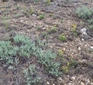

 The trail passes near a small brush-lined creek at one point, with patches of yellow-flowered upland violet (
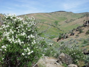
 As the trail cuts across the north-facing slope just before reaching the ridge, keep an eye out for wildflowers in this habitat. In particular, here and in similar settings elsewhere in the Boise Front, take a look to see what grows in the shelter of shrubs; if not displaced by invasive annual grasses and other weeds, there is often a nice diversity of small annuals (“belly flowers”), including miner’s-lettuce (