SWEET CONNIE TRAIL
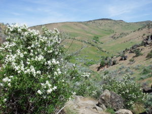
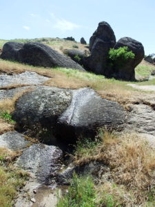
Recommended for June, when syringa (Philadelphus lewisii) is in bloom; the granite outcrops are spectacular at any time. Hiking poles might be useful for balance when negotiating portions of path through rock outcrops. Sections of the trail can be muddy; avoid when wet. Total distance: 1½ to 2½ miles, with about 300 feet elevation loss.
Start at the trailhead on Bogus Basin Road (same trailhead as upper access to Dry Creek trail). The first third mile crosses heavily modified pastureland now dominated by medusahead (Taeniatherum caput-medusae), an invasive annual grass, and rush skeletonweed (Chondrilla juncea; fall-blooming). Beautiful silver lupines (Lupinus argenteus) ameliorate this part of the walk, and, if one can ignore the perniciousness of the medusahead, the wind making waves across the bright green hillsides can be lovely.
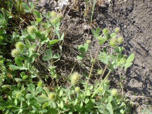
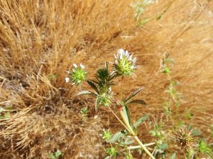
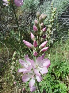
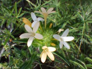
Flowering diversity picks up when the trail turns onto a short stretch of north-facing slope, where there might be a few lingering longspur or polychrome lupine (Lupinus argenteus) or precocious sagebrush sego-lilies (Calochortus macrocarpus). The trail then starts following a small spring-fed streamlet, which (especially where mossy springs drip over outcrops) provides habitat for some interesting annual wildflowers only occasionally encountered in the foothills: American bird’s-foot trefoil (Acmispon americanus, previously Lotus purshianus), field monkeyflower (Erythranthe arvensis, previously in Mimulus guttatus), smallhead clover (Trifolium microcephalum), whitetip clover (Trifolium variegatum), dense spike-primrose (Epilobium densiflorum), and possibly even western pearlwort (Heterocodon rariflorum). Flowers of interior or Wood’s rose (Rosa woodsii ssp. ultramontana) tend to be a particularly deep pink along this stretch, and an Oregon checkermallow (Sidalcea oregana) or two can be seen on the opposite side of the draw. Also keep an eye out for occasional patches of narrowleaf milkweed (Asclepias fascicularis), at least later in the season.
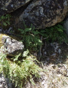
Granite outcrops start adding to the scenery at about half a mile from the trailhead, and become increasingly prominent along the lower part of the trail. Patches of syringa (Philadelphus lewisii) scent the air if your timing is right, gnarled netleaf hackberries (Celtis reticulata) add their own bizarre beauty, and small clumps of Oregon cliff fern (Woodsia oregana) peek out from under boulders.
At the forks of Daniel Creek just before the junction with Peggy’s Trail (0.8 miles from the trailhead), an inviting shady spot beneath a large hackberry provides an inviting rest stop and good turn-around site (be sure to check for rattlesnakes first!) A clump of camas (Camassia quamash) perches midstream below the trail, already past bloom when the syringa are at their peak. The volcanic outcrop of Chukar Butte defines the skyline to the west.
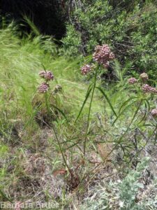
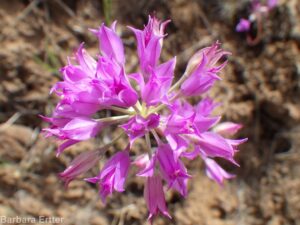
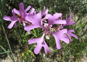
For an optional extension of this wildflower walk, follow Peggy’s Trail downstream for half a mile or so. This stretch of trail is on a north-facing slope of heavy clay, well above the brush- and tree-lined Daniel Creek below. Depending on timing, rainfall, and severity of cattle activity, you may be rewarded with tapertip onion (Allium acuminatum), largeflower collomia (Collomia grandiflora), and ragged robin (Clarkia pulchella)
NOTE: Please enjoy the wildflowers and leave them for others to enjoy. Because our unique local flora is already under pressure from invasive weeds and habitat loss, harvesting of native plants is not encouraged on this website, especially along popular trails.