What is a weed? As commonly used, “weed” is not really a botanical term, but instead usually means a plant growing where it is not wanted (in other words, a subjective judgement). “Weed” is also often part of the name of a plant (e.g., chickweed, tarweed, gumweed) that is particularly common, independent of any other attributes of that plant. Other terms are therefore usually used in reference to wild plants; i.e., native, non-native, established/naturalized, and invasive.
bachelor buttons, cornflower (Centaurea cyanus)
What makes a plant native vs. non-native? At least in North America, native plants are those that were already present in an area prior to the post-Columbian Interchange that began in the late 15th Century (as well described in Mann’s book “1493″). Non-native plants are those whose current distribution results from the activities of explorers, merchants, settlers, and others from the Eastern Hemisphere. For the most part this involves plants from Eurasia, but it also applies to plants from one part of North America that have been relocated with human assistance to other parts of North America where they did not previously occur. A non-native plant that has developed self-sustaining populations outside of cultivation in areas beyond its pre-Columbian native range is referred to as established or naturalized.
Why does this matter? For a start, the unique suite of native plants growing in a particular place (e.g., the Boise Front) are what makes that area special, often including endemic species that grow no where else, or at least unique genotypes. In contrast, non-natives are generally widespread “lowest common denominators”; i.e., plants that are found in similar areas throughout the world. As a result, the well-being of native plants can be critical to global biodiversity, while non-natives are of minimal significance in this regard (though admittedly better than lawn!)
In addition, and as well summarized by Douglas Tallamy (e.g., Nature’s Best Hope, 2019), plant and animal species usually co-evolve over thousands of years, resulting in relatively harmonious and stable ecological communities consisting of numerous species engaged in a highly complex network of biological interactions. New species that are suddenly added to the mix rarely add much in the way of benefit to the community, at least compared to the co-evolved natives, and can often be extremely detrimental.
whitetop, hoary cress (Lepidium draba)
What are invasive species? Although the majority of non-native species have limited ecological impact, and in rare cases can even provide some benefits, there are some that are so aggressive in their new home that they essentially crowd out most other plants and even destroy the habitat needed by the natives. These hyper-competitors are often called invasive species, and when they take over they can reduce both local and global biodiversity by threatening not only most native plant species, but all the insect and other animal species that are dependent on that plant in a complex web of ecological interactions. Cheatgrass and white-top are well-known examples, but there are unfortunately many others.
As a result, although the initial appearance of non-natives can appear to be a desirable increase in local biodiversity, especially if the non-natives have showy flowers (like bachelor’s-buttons, Centaurea cyanus), the long-term result is usually a net LOSS in local biodiversity, primarily of the unique native species that made the local area special. As these locally unique species decline and are replaced with widespread non-native species that are common elsewhere, global biodiversity also declines.
The shrub-steppe ecosystem that was a dominant component of the interior West is highly vulnerable to transformation by invasive species, resulting in a degraded ecosystem that supports drastically fewer native plants species and the animals that co-evolved with them, and that also provides fewer of the ecosystem services that human societies depend on. Reversal of a degraded ecosystem that has been transformed by invasive species can be extremely difficult, if not impossible.
Legal Definitions: For official purposes, especially where land management is involved, various government levels and agencies have specific lists and/or definitions. For example:
Bureau of Land Management (from Noxious Weed and Invasive Plant Management environmental assessment ): “An invasive species is defined as a species that is 1) non-native (or alien) to the ecosystem under consideration, and 2) whose introduction causes or is likely to cause economic or environmental harm or harm to human health (Executive Order 13112). Noxious weeds are invasive species that have been designated “noxious” by state law (Idaho Statute 22).”
One intriguing historical aspect of the Boise Front is the predominance of women who were among the earliest significant botanical collectors, or who otherwise contributed to our knowledge of the original flora of the area. A brief synopsis of four of these women who were active before 1950 is provided here: A. Isabel Mulford, Mary Hallock Foote, June A. Clark, and Bernice Bjornson; Annetta McBride is also briefly mentioned. Biographical information on Mulford is mostly derived from the efforts of my colleague Carol Prentice; since the full version is already posted elsewhere on this site (“Isabel Mulford and her Milkvetch“), only a very abbreviated account is presented here. The literary contributions of Foote have resulted in her being the focus of multiple studies, though her natural history contributions are less well known. My intent is to do a future article on these contributions, with the synopsis presented below only a few highlights.
In contrast, June Clark and Bernice Bjornson have been largely unknown, except as names of collectors on herbarium specimens. The accounts below are my first efforts to summarize what I have been able to learn about these two enigmatic women, greatly helped by sleuthing provided by Molly Ackley Brown and Tom Thomason, classmates of mine at Boise High School. I also acknowledge the assistance of Burrell E. “Ernie” Nelson and Ben Legler at the Rocky Mountain Herbarium, University of Wyoming. The Consortium of Pacific Northwest Herbaria has also been an invaluable resource, and the source of specimen images incorporated here.
These accounts undoubtedly only scratch the surface of what can still be found learned about these women, including the times they lived in, their motivations, and the troubles they faced. Full coverage would also include whatever records could be located about the Shoshone, Bannock, and Northern Paiute women who have called this area home since time immemorial.
A. ISABEL MULFORD
A. Isabel Mulford
The most noteworthy early woman botanical collector in southern Idaho is A. Isabel Mulford, who is only briefly mentioned here since she already has her own post on this website. Mulford’s milkvetch (Astragalus mulfordiae), named in her honor, is the best-known of the plants collected by Mulford during her time in southern Idaho in 1894. The milkvetch is is endemic to the western Snake River Plain in southwestern Idaho and adjacent Oregon, restricted to loose, sandy substrates of former Lake Idaho sediments.
Another plant that Mulford not only collected but also named as a new species is white frasera (Fraseramontana). This lovely white-flowered plant (which deserves to be in cultivation!) is endemic to the central Idaho mountains, barely entering the Boise Front area at the northern margins of the Conifer Zone (see Clear Creek, below). Three other plants described by Mulford from Idaho have, alas, been absorbed by previously named species: Oenothera idahoensis into O. caespitosa ssp. marginata, Frasera caerulea into F. albicaulis var. cusickii, and Gilia grandiflora var. diffusa into an undifferentiated Collomia grandiflora.
MARY HALLOCK FOOTE
Mary Hallock Foote
Mulford’s publications indicate that she spent at least one day in the field with locally renowned Mary Hallock Foote, and presumably had other interactions with her as well. Foote’s memoirs, posthumously published as A Victorian Gentlewoman in the Far West, describe the travails experienced by the family as her husband, Arthur Foote, pursued various engineering schemes (including what would eventually become the New York Canal) in the western United States and Mexico. During the financial lean times, including most of her Idaho years (1880’s and 1890’s), she helped support their growing family with her professionally trained illustrations and abundant writings, which found an eager market on the East Coast thanks to her personal connections.
Although not a botanist herself, Foote’s written opus, both fictional and non-fiction, is replete with detailed observations of local natural history that deserve more attention (and is the intended topic for a future article). My favorite example is from the short story “The Lamb That Couldn’t Keep Up”, published in The Little Fig-Tree Stories (1899). Even though fictionalized, it is based on an actual occurrence, when a band of 8,000(!) sheep spent the night upstream from their Canyon Home near present-day Lucky Peak Dam:
Beckwith’s violet, sagebrush pansy
“Those eastern hills in spring had been covered with wildflowers,—the moss pink, lupines both white and blue, wild phlox, the small yellow crocus [Fritillaria pudica], beds of tiny sweet-scented wild pansies [Viola beckwithii?], the camas flower [Camassia quamash], and a tall-stemmed, pale lilac lily [Calochortus macrocarpus],—the queen of the hill garden. But when spring came again, the old pathways were like an ash heap. The beautiful hill garden was a desert.”
Some of the plants mentioned in this passage are still present at this locality (Lydle Gulch), but nowhere close to the initial abundance described by Foote. Others have disappeared completely from the area (e.g., camas); the identity of her “moss pink” remains a mystery.
dwarf or Foote’s skullcap (Scutellaria nana)
Foote’s interaction with Mulford is addressed in the article in which Mulford describes the plants she collected in Idaho (Mulford 1894). One of these was a diminutive skullcap named in Foote’s honor: “This was found at about 3,500 ft near Black Cañon [presumably Black Cliffs], Boise River, June 18th. I have named the plant in honor of Mrs. Mary Hallock Foote, who planned, and accompanied me upon the pleasant expedition which led to its discovery.” Alas, Foote’s botanical claim to fame was short-lived, with Scutellaria footeana soon disappearing into the synonymy of the relatively widespread dwarf skullcap, S. nana.This species can still be found in Lydle Gulch, but not in abundance.
JUNE A. CLARK
June Clark Redecker, 1914
My initial awareness and curiosity about June Clark was triggered by a few sentences in one of Aven Nelson’s articles describing new plants from Idaho (Nelson 1912). Many of these plants were collected by his eventual protégé James Francis Macbride, but his 1912 article also includes “a few species based upon collections by Miss June A. Clark, of Boise, at present a student in the Idaho State University. During 1911 she made very creditable collections of the plants of the mountains adjacent to Boise, and in the mountains of Washington County of her state.”
Although Nelson placed Clark at Idaho State University, this is not the university in Pocatello that currently has that name. The precursor institution of the Academy of Idaho was created in 1901, but it did not become Idaho State University until 1963 (with multiple interim designations in between, including as the southern branch of the University of Idaho; see History of ISU). Clark would instead have been a student of at the original University of Idaho located in Moscow, where many of her collections can be found. She evidently became a student shortly after the University of Idaho herbarium (= research collection of dried plants) had been destroyed in the Administration Building fire of 1906. Louis F. Henderson, the botany professor at University of Idaho who had founded the herbarium, was so disheartened by its destruction that he retired in 1908 (Love 2001).
Syringa (Philadelphus lewisii) collection by June Clark, now at Boise State University (SRP)
Faced with the lack of comparative material and an experienced botanical advisor, it is no surprise that Clark sent her collections to Aven Nelson, a professor at University of Wyoming, who was the closest thing to a professional botanist existing in the northern Rocky Mountains at that time. In fact, the first set of the 346 collections Clark made in 1911 are housed not in the herbarium at the University of Idaho (ID), but in the Rocky Mountain Herbarium (RM) at the University of Wyoming, which is also where her field book ended up (B.E. Nelson 2004, pers. comm). Duplicate sets of her collections were subsequently distributed to other herbaria using labels from the Rocky Mountain Herbarium: 91 to Montana State University (MONT), 80 to Washington State University (WS), 65 to New York Botanical Garden (NY), and only 52 to University of Idaho (ID). A few also ended up at University of Washington (WTU), Oregon State University (OSC), and Boise State University (SRP) (Consortium of Pacific Northwest Herbaria, queried 14 Apr 2024).
The majority of these collections are from in or near Boise, primarily simply “Boise” (most likely Ada County) but also many from “Boise (Clear Creek)” in Boise County (more about Clear Creek below). Several are from “Squaw Butte” (recently renamed Sehewoki’l Newenee’an Katete), at that time in a more inclusive Boise County but in the portion subsequently split off to become part of Gem County. Quite a few are from around the community of Tamarack south of New Meadows in the central Idaho mountains. Although included in Washington County at the time Clark was making her collections, shortly thereafter the northern portion of the county (including Tamarack) was split off and is now Adams County (Boone 1988).
Early blue violet, western dog violet, hookspur violet (Viola adunca)
In his 1912 paper, Nelson based several new plants on Clark’s collections, most of which were subsequently absorbed into the synonymy of previously existing names. One of these was even named in her honor: Viola clark[i]ae. When describing this species, Nelson stated that “I have pleasure in dedicating this apparently strong species to Miss June Clark, of Boise, Idaho, who made an extensive collection of the plants, in duplicate, in her home neighborhood and in the mountains of Washington County, during the season of 1911. Her no. 84, from Clear Creek, in the Boise Mountains, July 4, 1911, is the type.” Morphologically comparable plants have been located in both Clear Creek and nearby Pine Creek (photo here), tributaries on the south side of Grimes Creek that are included in boundaries of the Boise Front. Although Nelson emphasized the distinctiveness of Clark’s collections, the name is currently placed in synonymy of a broadly defined early blue violet (Viola adunca), though Clark’s plants tend to have narrower and hairier leaves than the norm for this species.
Nelson’s other new plants based at least in part on Clark’s collections are a willow (Salix boiseana; currently in S. lasiolepis) and a rabbitbrush (Chrysothamnus oreophilus var. artus; currently in Ericameria nauseosa var. oreophila) from Boise, a sweetpea from Clear Creek (Lathyrus bradfieldianus; currently in L. pauciflorus), and a buckwheat (Eriogonum fasciculifolium; currently E. sphaerocephalum var. fasciculifolium) and a lupine (Lupinus tenuispicus; currently treated as L. leucophyllus, sometimes as var. tenuispicus, sometimes as subsp. erectus) from Tamarack. Although most of Clark’s specimens were of vascular plants, she also collected a few fungi, leading Ewan and Ewan (1981) to speculate about an otherwise unfounded relation to mycologist Ernest D. Clark.
Wedding picture of June Clark and Harry Redecker, 1914
Thanks to the help of Molly Ackley Brown, and her Ancestry.com account, I now how have some of June Clark’s basic biographical statistics. She was born 12 February 1891 in South Dakota, and was still living with her parents by the time they moved to Boise, according to the 1910 census. In 1914 she married Harry Redeker, who was subsequently hired as chemistry and physics teacher at Boise High School. Harry also started Idaho’s first radio station, KFAU (precursor to KIDO), in 1922 (Just 2021). By at least 1936, the Redecker’s had moved to San Mateo County, California, where June died in 1975, age 84.
J. Francis Macbride
This bare-bones biographic summary still leaves many unanswered questions surrounding the enigmatic Miss Clark, with one overarching puzzle grabbing my attention: why would a promising young woman from the Boise area, seemingly with no botanical training, suddenly devote a single year to collecting and preparing a large number of professional-caliber herbarium specimens, only to abruptly cease this activity in spite of encouraging feedback, and even having a species named in her honor? Although the evidence is completely circumstantial, my suspicion is that the answer somehow involves her contemporary J. Francis Macbride (changed from McBride in 1914), another student from Idaho who ended up under the tutelage of Aven Nelson, and another early Idaho botanist whose biographical sketch I’ve been working on. From an earlier paper by Nelson (1911), and from Roger William’s (1984) excellent biography of Nelson, we know that Macbride was “a boy just out of Boise High School” when he first sent plants to Nelson for identification in 1910. This initial contact led to Macbride collecting more plants for University of Wyoming and eventually becoming a student of Nelson’s. All of which makes it quite possible that Clark and Macbride were students together at Boise High School, jointly developing a mutual enthusiasm for botany. If so, then it only makes sense that Macbride would have shared the training and encouragement he received from Nelson, along with access to specimen preparation resources at the University of Wyoming. This would still beg the question, however, of why Clark ceased collecting plants after only a single year, whereas Macbride went on to an illustrious botanical career that included the Flora of Peru and photographing type specimens in Berlin. I can think of a multitude of possible factors, both personal and professional, but all are sheer speculation at this point.
Annetta and young Francis McBride, from interpretive signage in New Plymouth.
Macbride also provides a tangential connection to another enigmatic woman who had a plant from southwestern Idaho named after her, though from the Owyhees instead of the Boise Front. This is Annetta McBride, wife of Cornelius M. McBride and mother of J. Francis Macbride. Mother and son were unusually close, to the extent that she joined her son in the field at least in 1910, and then apparently accompanied him to Laramie and Harvard (Williams 1984). Nelson named one of their collections from the Owyhees Onagra macbrideae to honor Mrs. McBride, “who so industriously and discriminatingly assisted her son in the field work during most of the season of 1910” (Nelson 1911). Although Nelson considered it to be a different from a similar evening-primrose collected by Macbride from the Boise Front, described in the same publication as Onagra ornata, both names are now included within Oenothera elata ssp. hirsutissima.
BERNICE BJORNSON
Cover page for Bjornson’s flora
When I was a student at Boise High School (class of 1971), I was fortunate to have had Fred Baldridge as our biology teacher. Equally important to my budding botanical interest was the stack of mimeographed copies of “A Key to the Spring Flora of Southwestern Idaho” that were used in the class. Some years later, I looked up the then-current biology teacher to see if these books were still around. As I’d expected, they were no longer being used, but fortunately they hadn’t been discarded, either, so the teacher was willing to give me several copies to distribute among some of the botanical libraries I knew would be interested in having them (keeping one for myself as well, of course!)
With book in hand, and a burgeoning interest in botanical history, I became increasingly curious about the author herself, Bernice Bjornson. The Preface to her book provides the primary source of relevant information: that it was prepared as a thesis project at the University of Idaho, the boundary of the area covered, and people who helped her with field work, transportation, and general encouragement. Her reasons for producing a non-technical key to the spring flora of southwestern Idaho are several-fold:
There was no book currently written for the flora of this part of the state.
The existing books that partly cover this area had so many technical terms that use was difficult even with a glossary; as many of these terms as possible were therefore eliminated “as is consistent with clarity and accuracy”.
Spring is a good time for beginning botany students to become familiar with the classification process, when the most wildflowers are in bloom, and also when people get outdoors. In contrast, fall is when “most of the wild flowers still in bloom belong to the sunflower [Asteraceae] family and are too difficult for young students having little knowledge of plants.”
A general hope that the book will stimulate wider interest in the local flora.
Boise sand-verbena (Abronia mellifera var. pahoveorum) collected by Bernice Bjor[e]nson.As part of the project, Bjornson made over 100 plant collections that are now housed at the Stillinger Herbarium (ID) of the University of Idaho, with her name spelled “Bjorenson” for some unknown reason. Most collections were made in 1940, with the majority from the area in and around Boise. Others were from elsewhere in an area “bounded by Homedale, Marsing, and Weiser on the west; Glenns Ferry and Atlanta on the east; Bruneau to the south; and McCall and Warm Lake to the north.” In these collecting efforts, Bjornson acknowledged the aid of Harold M. Tucker, the botany professor at The College of Idaho, as well as several students from Boise High School (Ralph Joslyn, Alice Buck, Martin Fry). She also expressed her indebtedness to several other individuals “for transportation and encouragement in making the longer field trips”.
The continued value of Bjornson’s book is not as a taxonomic reference, since it is of course very much outdated as well as unabashedly non-comprehensive. And to my knowledge, none of her collections were used as the basis of new species, though at least one (pictured above) is among those recently described: i.e., the Boise sand-verbena, Abronia mellifera var. pahoveorum. Her book and collections are nevertheless invaluable for providing a snapshot of a slice in time, documenting both the former local abundance of now-uncommon plants and the early appearance and spread of several non-native species. The book is a also a gold mine of enlightening comments in delightful prose about the various plants addressed, in particular names and uses of plants known to Idahoans at that time, and earlier. The discussion of Cusick’s primrose, Primula cusickiana, is an excellent example:
Cusick’s or Wilcox’s primrose (Primula cusickiana)
“A few places in the West are fortunate in having the attractive little primrose known in southern Idaho as Wilcoxiana, Primula cusickiana. Its leaves are simple, entire, and basal. Its flowers borne on a leafless stalk vary in color from pale blue to dark purple with a yellow eye. They are fragrant. People who lived in southwestern Idaho in the early 1900’s tell us that in spring the foothills used to be a mass of color with these flowers. Surely this is a flower which needs protection; one has to hunt for it nowadays.”
Bjornson also makes liberal use of even earlier popular wildflower guides, such as Wild Flowers of the Pacific Coast (Haskin 1934) and Western Wildflowers and Their Stories (Saunders 1933). The entry for Eriophyllum is characteristic:
Oregon sunshine (Eriophyllum lanatum var. integrifolium)
“A search through the books on wild plants resulted in our finding the following reference to a common name for this plant that is so common on the foothills near Boise: ‘There is now an attempt to be made to popularize it under the name Oregon sunshine. This name seems to me especially appropriate, but it should be recognized as applying in a broad sense to all of the Oregon Country, a great territory now divided into three or more states.’ [Haskin 1934]. Indeed, a bit of sunshine it is with its many bright yellow flowers made brighter by the grayness of the leaves and stems.”
In turn, I have made liberal use of incorporating excerpts from Bjornson’s opus (and embedded quotes from earlier publications) in the species’ pages of this website. This has been greatly assisted by Anne Halford’s aid in acquiring funding from the Bureau of Land Management, which hired Christina Riddle to transcribe the majority of Bjornson’s floristic work. Although the book itself is still under Bjornson’s personal copyright, having access to an electronic copy has made it easy to extract relevant portions for use here, with proper citation of this nearly forgotten book now supplemented by the background presented here.
Bernice Bjornson: faculty photo in 1938 yearbook for Boise High School
As for Bernice Bjornson herself, I am indebted to Molly Ackley Brown, for locating a yearbook with Bjornson’s photo (and signature) and sharing information from her Ancestry.com accounty, and to Tom Thomason, for information from the 1940 census. As a result, we now know that Bernice Bjornson was born in North Dakota in 1901, so she was only 10 years younger than June Clark. The family, originally from Iceland, was farming in Mountain Home by 1910 and in Rupert by 1930. In 1940, which is the same year that Bernice was collecting plants in connection with her thesis at University of Idaho, she is listed in the census as living with her parents in Boise and teaching at Boise High School (with my father, who lived only a block away, as one of her possible students!) This means that Bjornson was already around 40 years old when she decided to pursue an advanced degree at University of Idaho, with pedagogy evidently more important than botany per se. She never married, and died in 1959, age 57, of heart disease.
WHERE IS CLEAR CREEK?
Although Bernice Bjornson’s collecting activities in the Boise Front were nearly three decades later than those of June Clark, there was only a ten year difference in the age of the two women. It is even possible that they might have overlapped at Boise High Schoool, if Bjornson joined the faculty before the Redekers moved to California, but it would be a narrow window for this to have occurred.
White frasera (Frasera montana)
It is nevertheless intriguing to wonder if Bernice’s botanical interest could have been at all influenced by June’s earlier efforts, especially since both women made collections from a place called Clear Creek in Boise. Never having heard of a local Clear Creek myself while growing up in Boise, my curiosity was picqued: where exactly was this particular Clear Creek, and why would both women have chosen it as a collecting destination? As further incentive to figure this out, several of the plants collected from Clear Creek were otherwise unknown, or nearly so, from other parts of the Boise Front; i.e., sugarbowl (Clematis hirsutissima), Virginia strawberry (Fragaria virginiana), white frasera (Frasera montana), black twinberry (Lonicera involucrata), northern suncup (Taraxia subacaulis), and early blue violet (Viola adunca), including the type of Viola clarkiae.
It took a couple of years, but I eventually figured out that the Clear Creek in question would have been the small community on the backside of Boise Ridge, along a road and tributary with this name south of Grimes Creek. Even though many of Clark’s and Bjor[e]nson’s collection have been databased as Ada County, due to the association with Boise, this location is actually in Boise County. Because of the community’s mining history, it is essentially all private land, making access difficult except along the main road. I was therefore delighted to learn that one of my botanical colleagues, Jessica Irwin, had recently purchased an undeveloped parcel of land here and was willing to take me botanizing with her. We had no trouble finding many of the plants that Clark and Bjornson had collected, including the Clematis, Frasera, and Viola, as well as another rare plant (Idaho penstemon, Penstemon laxus) not previously recorded from the Boise Front boundaries. We then found many of the same species on the next drainage to the north, Pine Creek, which traverses public land (Boise National Forest). As a result, I decided to refine the northeastern bounderies of the Boise Front flora area to include both Clear Creek and Pine Creek.
Clear Creek Lodge, 2023
What makes Clear Creek in particular so intriguing is that it appears to be a small remnant prairie, very unusual in this part of Idaho. If so, this could have been part of the appeal of the original community, as an attractive area to settle in the mountains without needing to clear out all the timber first. I would love to learn more about the history of this area, since my suspicion is that it might have also served as the convenient get-away resort from Boise’s summer heat in the early 1900’s, easily accessible (relatively speaking) along the old stagecoach route between Boise and Idaho City. There is even a Clear Creek Lodge, though whether this is historical as well as modern remains unknown. If it was a well-known resort at the time, that would explain why both Clark and Bjornson chose to collect here, and why they considered it an extension of Boise.
Clear Creek community
REFERENCES
Bjornson, Bernice. 1934. A Key to the Spring Flora of Southwestern Idaho. Copyright by the author, evidently self-printed.
Boone, Lalia. 1988. Idaho Place Names: A Geographical Dictionary. The University of Idaho Press, Moscow.
Ewan, J., and N. D. Ewan. 1981. Biographical Dictionary of Rocky Mountain Naturalists. Regnum Vegetabile vol. 107.
Haskin, L. L. 1934. Wildflowers of the Pacific Coast. Metropolitan Press, Portland, OR.
Just, Rick. 2021. Idaho’s First Radio Station. https://www.rickjust.com/blog/idahos-first-radio-station9065497
Love, Rhoda M. 2002. Louis F. Henderson (1853-1942): The Grand Old Man of Northwest Botany. Native Plant Society of Oregon Occasional Paper 2: 1–58. (adapted for Flora of Oregon 1: 12–13. 2015).
Mulford, A. Isabel. 1894. Notes upon the northwestern and Rocky Mountain flora. Botanical Gazette 19: 117-120.
Nelson, A. 1911. Contributions for the Rocky Mountain Herbarium. IX. New Plants from Idaho. Bot. Gaz. 52: 261–274.
Nelson, A. 1912. Contributions for the Rocky Mountain Herbarium. XII. New Plants from Idaho. Bot. Gaz. 54: 404–418.
Saunders, Charles Francis. 1933. Western Wildflowers and Their Stories. Doubleday, Doran & Company, Inc. Garden City, NY.
Williams, Roger L. 1984. Aven Nelson of Wyoming. Colorado Associated Univ. Press, Boulder, CO.
Frosted mosses in Lower Hulls Gulch, 2 January 2023.
While most sensible plants hunker down during the cold winter season, awaiting the return of warmth and sunshine, there are some that flourish at this time of year. This is particularly likely in parts of the world where most of the yearly precipitation falls during the period when temperatures vacillate between freezing and thawing, with intermittent blanketing by several inches of snow; in other words, very much like lower elevations in the Boise Front. Plants that grow here have to choose: grow when there is plenty of sun and warmth, but very limited and uncertain water, or grow when there is more reliable water, even if it means spending a lot of time being frozen and snowed under? Very few animals can survive being frozen, but for many cold-adapted plants it’s no big deal, even to the extent of daily cycles of freezing and thawing. Surviving the hot, dry summer can be the greater challenge, with a variety of dormancy options to choose among.
Mosses growing on granite outcrop in Lower Hulls Gulch; plant on right with developing sporocarps. (2 January 2023)
At the head of the pack of winter-loving plants are true mosses, members of an ancient group of plants called bryophytes that were among the first lineages to colonize the earth’s surface. Lacking true roots and vascular tissue, mosses have no recourse except dormancy (or death) in the absence of abundant water. Mosses that thrive locally are those that have perfected not only the capacity to survive both freezing during the depths of winter and desiccation during the searing summer, but also the amazing ability to rapidly pick up where they left off during the intermittent periods of favorable growing conditions.
Mosses in summer-dormant phase.
As a result, winter is actually the primary growing period for mosses in the Boise Front, including during the cool moist conditions when temperatures hover above freezing during the daytime. Not only does most vegetative growth occur at these times, when plants are bright green, but this is also when sexual reproduction takes places (by spores, not flowers and seeds). In summer, the exact same plants are dried and brown, appearing dead but actually in a state of dormancy that can be quickly broken when wet conditions return. Counterintuitively, mosses are extremely vulnerable at this stage; if artificially rehydrated in the heat of the full summer sun, plants that easily withstood both freezing and desiccation can bake to death if too hot when wet.
Sagebrush buttercup (Ranunculus glaberrimus) leaves, 2 January 2023.
Some flowering plants also rely heavily on the intermittent favorable growing conditions during the winter months, primarily in preparation for flowering as early as possible once spring conditions arrive. Sagebrush buttercup (Ranunculus glaberrimus) is one of the champions in this regard. Plants evade the summer’s heat and drought by retreating underground as drought-tolerant swollen roots. As soon as the late fall/early winter rains saturate the soil, however, new leaves emerge and continue to grow during intermittent periods of favorable weather throughout the winter. Flower buds also develop, often opening as early as mid-February locally, coinciding with the emergence of the earliest pollinators (mostly flies).
This strategy comes with risks, however; if the rains do not begin before the ground freezes solid, and if the ground then stays frozen solid, the buttercups lose out on their prime vegetative growing season. Even worse is if prolonged freezing is coupled with an absence of protective snow cover; in such conditions, tender new leaves can easily dry out, causing the plant to skip a growing season, or even die. This happened at lower elevations in the Boise Front in the winter of 2022/23, when an unusually mild fall shifted abruptly to a hard freeze that lasted much of the winter; as a result, sagebrush buttercup flowers were less abundant than they were in more favorable years.
Another common strategy for local flowering plants is that of the fall-germinating annual. After a brief few months of luxuriant growth during the brief spring period when water and warmth coincide, mature plants simply throw in the towel and die rather than trying to survive the searing summer heat. Instead, they rely on resistant seeds to make it through to the next favorable growing season, which might be several years down the road. Numerous seeds develop during favorable years, fewer when conditions are less favorable, all potentially accumulating and hanging out in the subsurface seedbank until the right combination of temperature, moisture, and day length trigger germination.
Leaf rosettes of fiddleneck (Amsinckia) in Lower Hulls Gulch (2 January 2023).
If all works as planned, the reward for those enterprising annuals that germinate in fall and then tough it out over the winter months is getting a good jump on slug-a-bed species that wait until the warm days of spring before germinating. Unfortunately, some of our most invasive non-natives like cheatgrass (Bromus tectorum) and bachelor buttons (Centaurea cyanus) use this is the same strategy. Worse, they often do this even more successfully than our natives do, which get crowded out when invasive non-natives beat them out for favorable growing sites and resources. On the other hand, fall-germinating annuals, both native and non-native, are gambling that fall rains that trigger germination are not followed by a dry spell prolonged enough to cause vulnerable seedlings to shrivel and dry. While this can significantly reduce the invasive non-natives that survive until spring, it can be equally devastating to our diminishing, diminutive natives.
Take time on your winter walks to look for these plants that also love winter, while also taking care not to trample vulnerable rosettes and tender mosses. Take delight in experiencing what each season has to offer, with these early signs reminding us that the wildflowers are already getting ready for a new year!
sagebrush buttercup (Ranunculus glaberrimus var. glaberrimus)
cross-seed or slender popcorn-flower (Plagiobothrys tenellus)
cross-seed or slender popcorn-flower (Plagiobothrys tenellus)
rigid or harvest fiddleneck (Amsinckia retrorsa)
For more information on some of our local mosses, see “Common Mosses and Ground Lichens of the Boise Foothills“. To learn more about the wonders of mosses in general, I highly recommend Gathering Moss: A Natural and Cultural History of Mosses (2003) by Robin Wall Kimmerer. This is the first book written by RWK, introducing many of the concepts and themes further developed in her inspirational book Braiding Sweetgrass (which I also highly recommend!)
Even for those of us inured to the inevitability of name changes, and fully versed on the perfectly good reasons behind them, the nearly complete turnover in the nomenclature of our local biscuitroots (genus Lomatium) can be mind-boggling. For those of you who haven’t been keeping track, here’s a current synopsis, with the what’s and why’s, including a behind-the-scenes glimpse at what all those pesky plant taxonomists are up to.
narrowleaf or Great Basin biscuitroot (Lomatium simplex)
First, it is important to note that this group of plants is extremely important, both for food and medicine, to most of the Native American tribes within whose traditional territories the many different species of biscuitroot occur (note: although the English common name of “biscuitroot” is sometimes restricted to only those species with enlarged edible roots, which were, and still are, a significant food source for many tribes, I am using this as the common name for the genus Lomatium in general; desert parsley is an alternate common name). Each tribal language group has its own name, or names, for subunits of Lomatium, with the subunits often based more on specific use than necessarily coinciding with current scientific nomenclature. One of these names, “cous” (rhymes with “house”), is one of the few examples where a Native American name was incorporated into the scientific name: Lomatium cous, which does not occur in the Boise Front. The names given by the Shoshone, Bannock, Paiute, and other tribes to those species that do occur in the Boise Front, and the uses of these plants, should be respected as their traditional intellectual property.
As currently defined by science, Lomatium is a large genus that has undergone rapid evolutionary radiation in western and central North America. Over the last century, taxonomic treatments of the genus have gone through several cycles of expansion and contraction, with major chunks sometimes treated as separate genera (e.g., Cogswellia, Leptotaenia, Peucedanum). The number of species within the currently inclusive Lomatium is a moving target, with new species being described (or “resurrected” from synonymy) on a regular basis. In 1997, Intermountain Flora provided a conservative estimate of “about 70”, but over 100 are currently in the draft treatment for Flora of North America (B. Wilson, pers. comm. 2023).
A major reason for all this nomenclatural activity is because several independent teams have recently homed in on Lomatium as a worthy research topic, rich in previously under-appreciated diversity that is amenable to analysis with the burgeoning new tools in the taxonomic toolkit. One of these teams is centered here in the Treasure Valley, spearheaded by Dr. James F. Smith at Boise State University and Dr. Don Mansfield at The College of Idaho. Their students and other collaborators have integral roles in the research, currently aided by a major NSF grant.
The genus itself is replete with narrow endemics (i.e., species that occur in a very restricted geographic area, often confined to a specific geologic substrate or soil type), many of conservation concern. However, many of these species look very similar superficially, with clusters of small yellow flowers and leaves divided into narrow lobes; their morphological distinctiveness only becomes apparent when other features are carefully examined. Molecular phylogenetic analysis has accordingly been invaluable, especially when combined with morphometric evaluation, extensive field studies, soil analyses, and other techniques. None of these are “magic bullets” by themselves, but when combined with one another, and with traditional taxonomic approaches, they can bring biodiversity patterns to light that had not previously been evident, including new species.
With this background in hand, what exactly has been going on with biscuitroots in the Boise Front? Here’s the run-down:
What’s the story with Nineleaf Biscuitroot?
narrowleaf or Great Basin biscuitroot (Lomatium simplex)
Most wildflower guides and apps will lead you to believe that the most common biscuitroot in the Boise Front is the nine-leaf biscuitroot, Lomatium triternatum. Until recently, the primary technical floras (e.g., Vascular Plants of the Pacific Northwest, IntermountainFlora) also placed most of these plants in Lomatium triternatum, but specifically in the subspecies platycarpum. This is the most commonly encountered biscuitroot in relatively sandy and loamy soils, easily recognized by its blue-green leaves that are commonly divided into nine narrow segments.
As happens, initial molecular phylogenetic analysis showed that ssp. platycarpum was not all that closely related to ssp. triternatum, and the two should therefore be treated as separate species — which is what some even earlier floras (e.g., Illustrated Flora of the Pacific States) had actually done. Because of the rules of botanical nomenclature, the correct name for these plants at the species rank is Lomatium simplex, not platycarpum, and so this is now the correct name for most of what we had been accustomed to calling L. triternatum, at least in the Boise Front. For the record, yes, we really do use the term “resurrecting” when an existing name that had been relegated to synonymy under an older inclusive name is deemed to be distinct after all.
Ok, that takes care of ssp. platycarpum, but what about the rest of Lomatium triternatum? Well, now the story really gets tricky, in that there turns out to be a lot of subtle variation within what had been ssp. triternatum, which had actually been divided into two varieties: triternatum and anomalum. Oh, and let’s not forget the closely related Lomatium ambiguum from central Idaho and the recently described L. packardiae from nearby Oregon. As a further complication, it took a significant amount of sleuthing and fieldwork to nail down exactly which of the multiple possibilities was the REAL L. triternatum, all based on a scrappy specimen collected by the Lewis & Clark Expedition somewhere on the “Kooskooske” (Clearwater) River. (See Smith et al. 2018 and “Lewis’s Lost Lomatium Found” by Michael Ottenlips).
Andrus’s biscuitroot (Lomatium andrusianum)
On top of which, it’s been a toss-up as to whether one of our other common biscuitroots in the lower Foothills, which often forms dense stands on heavy clay soils (e.g., Chief Eagle Eye Reserve, Foothills East Reserve), is best treated as L. triternatum var. anomalum or L. ambiguum (with the names themselves giving a clue to the challenges of biscuitroot identification!) Well, guess what? It turns out to be neither one, but instead a previously overlooked species! Given the prominence of the new species in the hills overlooking the state’s largest city, and the bottleneck of available funding to continue research on the genus, the team decided to try an innovative fund-raising option that had been used successfully elsewhere: they auctioned off the naming rights for the new species. The winning bid chose to use the opportunity to honor Cecil D. Andrus, so this element of the baffling Lomatium triternatum complex is now officially known as Lomatium andrusianum, or Andrus’s biscuitroot (Stevens et al. 2018).
Next Up: Butterflies as Botanists
butterfly biscuitroot (Lomatium papilioniferum)
Another conspicuous biscuitroot in the Boise Front, especially along Currant Creek north of Hidden Springs, is easily recognized by its finely divided bluish green leaves with a strong cilantro-scent. Wildflower guides and apps will probably tell you this is Gray’s biscuitroot (Lomatium grayi), and this was in fact correct . . . until 2018. That’s how long it took for a different team working on Lomatium to realize that at least three distinct species were shoehorned together under the same name (Alexander et al. 2018).
Well, at least that’s how long it took humans to figure it out; swallowtail butterflies had already known there were several species involved, and they used some but not others as host plants for their caterpillars. It was actually an entomologist who first homed in on this lepidopteran behavior and cued the botanists in. The name chosen for the most widespread component of chopped-up Lomatium grayi, which is the one occurring in the Boise Front, is Lomatium papilioniferum, with the epithet translating as “butterfly-bearing” (Papilio being the genus name for swallowtail butterflies). Although iNaturalist uses “pungent desert parsley” as a common name, “butterfly biscuitroot” is both more euphonious and a tie to the delightful backstory.
True Lomatium grayi, from SE Idaho.
As for Lomatium grayi itself, it’s still a perfectly good species, just not the one occurring in the Boise Front. In fact, it only barely enters southeastern Idaho, with most populations occurring further south and/or east. As you can see from this photos, leaves are greener, shorter, and less “fluffy” than in L. papilioniferum, at least in this population north of Preston. How fun that it took butterflies to make us take a more careful look!
Mostly the Same . . . For Now
The other biscuitroots occurring in the Boise Front still retain their previous names, with some reshuffling between varietal and species names. This, however, could easily change, depending on all the new results flooding in from the various Lomatium teams; all I can say at this time is, hold on to your hats! For now, here’s the most up-to-date synopsis I’m aware of:
Barestem biscuitroot (Lomatium nudicaule): This is a another relatively common species throughout the Foothills, and the easiest to identify with its distinctive round blue-green leaflets. A delightful alternate common name is pestle-parsnip, probably due to the swollen apex of the stem. If any nomenclatural surprises are in the works, I’m not aware of them.
Fernleaf biscuitroot: Previously known as Lomatium dissectum var. multifidum, now just plain L. multifidum. This is the largest of our locally occurring biscuitroots, with reddish brown flowers that fade with age. It is mostly missing from the Foothills proper but still fairly common at higher elevations, and particularly abundant in the basalt talus along Highway 21/Mores Creek. Although fernleaf biscuit is currently in vogue for both culinary and medicinal purposes, please keep in mind that any thoughts of harvesting should be balanced against the continued existence of our local populations already in decline from other threats, any legal restrictions on collecting, and the priority of indigenous rights to a culturally significant plant.
Gumbo or Wasatch biscuitroot: The jury is still out as to whether this is best treated as Lomatium bicolor var. leptocarpum (which is what is what I’m using for now) and plain Lomatium leptocarpum (as used in Intermountain Flora). Locally it is only known from south of the Boise River, especially along the Oregon Trail below Bonneville Point. It differs from the more widespread Lomatium simplex in having more irregularly divided leaves with shorter, greener segments, and also in its more spreading habit.
Bigseed biscuitroot (Lomatium macrocarpum): This is another species known locally only from south of the Boise River, most readily found in the Oregon Trail Recreation Area. It is easily recognized, at least when in bloom, by the large white inflorescences and lacy blue-green leaves. Nomenclaturally stable, at least for now.
And One to Add!
The diminutive turkey-pea is one of the contenders for the earliest wildflowers to bloom in later winter, with sagebrush buttercup (Ranunculus glaberrimus) as the primary competition. The inconspicuous low-lying clusters of white flowers and leaves divided into a few narrow leaflets are within the range of morphological variation of Lomatium, but the globular fruit of turkey-pea differ from the diagnostic flattened fruit of typical Lomatium, with the result that turkey-pea had traditionally been placed in a separate genus as Orogenia linearifolia. However, one of the side results of the molecular phylogenetic revolution has been an essentially philosophical shift as well, emphasizing cladistic relationships as paramount in classification independent of unique evolutionary adaptions in an embedded lineage, or how disruptive its inclusion might be to an otherwise morphologically coherent genus (sorry, no way to explain this in simpler terms without an entire separate essay!) Unsurprisingly, the evidence now unequivocally shows that Orogenia linearifolia is nested within (or originated from) the Lomatium clade, and by the currently ascendant philosophy is therefore a Lomatium. As a result, we can add Lomatium linearifolium to the list of biscuitroots present in the Boise Front, though I will continue using “orogenia” as a common names, along with turkey-pea.
Anyway, that’s what I can tell you about biscuitroots in the Boise Front, at least for now, which I hope has also served as a window into why names keep changing. In essence, as much as we crave to have nature presented to us as tidy, definitely named chunks, the reality is that a) nature doesn’t really care what we want, and b) our scientific knowledge of exactly what is “out there”, and how best to package it for general consumption, is constantly being refined. Although not generally appreciated as such, species are fundamentally hypotheses, which are often initially proposed on scanty evidence (e.g., “Lewis’s Lost Lomatium”) and then subsequently supported, undermined, and/or modified as new information comes to light, ranging from basic observational data in the field to sophisticated technological analysis in the laboratory. The result being that you, the user community, has the joy, and frustration, of a seemingly never-ending bounty of new species and names to try to keep on top of; stay tuned, and go with the flow!
Alexander, J. A., W. Whaley, & N. Blain. 2018. The Lomatium grayi complex (Apiaceae) of the western United States: a taxonomic revision based on morphometric oil composition and larva-host coevolution studies. Journal of the Botanical Research Institute of Texas 12(2): 387-444.
Ottenlips, M. 2019. Lewis’s Lost Lomatium Found. Sage Notes 41(1): 1, 7. https://idahonativeplants.org/wp-content/uploads/2019/03/SageNotesMarch2019.pdf
Smith, J., D.H. Mansfield, M. Stevens, E. Sosa, M.A.E. Feist, S.R. Downie, G. Plunkett, & M. Darrach. 2018. Try, tri again? Resolving species boundaries within Lomatium triternatum (Apiaceae) complex using molecular phylogenetic tools. J. Syst. Evol. 58(3):218–230.
Stevens, M., D.H. Mansfield, J.F. Smith, and M.E. Feist. 2018. Resolving the anomaly of Lomatium anomalum: Discovery of a new species in southwestern Idaho (U.S.A.), Lomatium andrusianum (Apiaceae). J. Bot. Res. Inst. Texas 12(1): 1 – 15.
Mulford’s Milkvetch (Astragalusmulfordiae), one of Idaho’s rarest plants that is currently in peak bloom in the Boise Front, comes with a wonderful back-story involving a woman who was both one of the earliest plant collectors in the young state of Idaho and also the first student to obtain a Ph.D. from the joint doctoral program between Washington University and Missouri Botanical Garden in St. Louis. This was Dr. Anna Isabel Mulford, with the following biography based on a combination of decades-long sleuthing by my colleague Carol Prentice and a recent on-line biography by Cassidy Moody.
Carol’s interest was piqued in 1979, when Dr. Patricia Packard mentioned that no one in Idaho knew who Astragalus mulfordiae was named for. The “-iae” ending was a clue that the species was named for a woman (the ending would have been “-ii” if named for a man), but Carol didn’t know this at the time. It therefore came as a surprise to learn that Marcus E. Jones, who formally described the species in 1898, named it honor of a woman who had first collected it in Idaho. This led Carol to track down a separate publication by Mulford herself, describing her travels to the wild West in 1892, and several of the plants she found during her visit. This was all before the internet, adding to Carol’s challenge of tracking down the relevant publications and other sources.
Mulford’s article, published in 1894 in the Botanical Gazette, begins with “In the summer of 1892 I made a very interesting trip in the northwest. The months of June, July and August were spent in Idaho. My work in the state was done in the sage brush of the southern part, in the Owyhee mountains to the southwest, and in the highlands, foothills and mountains of the eastern portions. I traveled by railroad to the principal points, and by stage, carriage, or horseback to more distant ones. Of course I walked a good deal. I was well provided with letters of introduction, and there was seldom any difficulty in procuring company whenever desirable, which was necessarily a great part of the time.”
Among the letters of introduction was evidently one that led to Mary Hallock Foote, well-known locally for her writings and illustrations that capture an early era of Boise’s history. Foote’s memoirs, posthumously published as A Victorian Gentlewoman in the Far West, describe the travails experienced by the family as her husband, Arthur Foote, pursued various engineering schemes (including what would eventually become the New York Canal) in the western United States and Mexico. The memoirs also provided inspiration, and fodder, for Wallace Stegner’s controversial Angle of Repose.
Mulford’s interaction with Foote is documented by one of the several species that Mulford described from her time in Idaho, Scutellaria footeana. “This was found at about 3,500 ft near Black Cañon, Boise River, June 18th. I have named the plant in honor of Mrs. Mary Hallock Foote, who planned, and accompanied me upon the pleasant expedition which led to its discovery.” The specific reference to the Boise River makes the basalt-rimmed stretch of the river east of Boise the probable site of Mulford’s “Black Cañon,” and it would have made perfect sense for Foote to take her visitor botanizing in the area where the Foote family had lived for several years.
Alas, Foote’s botanical claim to fame was short-lived, with Scutellaria footeana soon disappearing into the synonymy of the relatively widespread Scutellaria nana. Three other plants described by Mulford in the same publication have likewise been absorbed by previously named species: Oenothera idahoensis into O. caespitosa ssp. marginata, Frasera caerulea into F. albicaulis var. cusickii, and Gilia grandiflora var. diffusa into an undifferentiated Collomia grandiflora. The only species Mulford described from Idaho that has stood the test of time is Frasera montana, whose lovely white blooms grace the mountains of central Idaho.
Somewhat surprisingly, Mulford was already 44 years old at the time of her Idaho excursion, six years after taking a post-graduate course at Vassar College that qualified her to be a professor of botany. She eventually went on to obtain a Ph.D. at Washington University in 1895, age 47. Her doctoral dissertation was on the genus Agave, working with Garden director William Trelease. Although this choice of topic leaves unanswered the impetus for her collecting trip to Idaho, it did create an opportunity for her to interact with another early Idaho collector, Timothy E. Wilcox, who had been Assistant Surgeon at Fort Boise from 1879 to 1882. At the time of Mulford’s doctoral research, Wilcox was posted at Fort Huachuca in southern Arizona, where Agave was abundant. Mulford credits Wilcox with assistance and for photos, specifically noting the value of his “habit photos,” and also quotes Wilcox describing which species of agave that cows will eat in Arizona.
Little is known of Mulford’s early years, other than growing up in East Orange, New Jersey, and attending Trenton Normal School (now The College of New Jersey). Obituaries indicate that her father, Timothy Mulford, was a wheelwright who “manufactured wheels used by Union forces in the Civil War.” After obtaining her Ph.D., Mulford had a long teaching career, including high schools in St. Louis (and possibly Wake Forest University in North Carolina). Census records show that she had moved back home to East Orange by 1930. She evidently never married, retaining her maiden name at the time of her death in 1943, age 95.
Astragalus mulfordiae is one of three species named after Isabel Mulford, and the only one still in active use. The other two are Agave mulfordiana Trelease (now a synonym of A. schottii) and Viola mulfordiae Pollard (now used for the hybrid of V. brittoniana × V. sagittata).
Mulford’s milkvetch is endemic to the western Snake River Plain in southwestern Idaho and adjacent Oregon, restricted to loose, sandy substrates of former Lake Idaho sediments. It has an S2/Imperiled conservation status in Idaho, due to the ongoing loss and habitat degradation of its scattered populations from development, invasion by cheatgrass and other non-natives, and careless recreation. Federal protection would easily be warranted if this species were a mammal or bird, but the abundance of plants with equivalent status would overwhelm an already overloaded system out of favor with competing agendas. If the decline of this delicate species is not reversed, we will lose not only one of the special plants that still grace the Boise Front, but also a tangible tie to an intrepid woman who is also nearly forgotten.
Mulford’s milkvetch (Astragalus mulfordiae)
Mulford’s milkvetch (Astragalus mulfordiae)
Mulford’s milkvetch (Astragalus mulfordiae)
Mulford, A. Isabel. 1894. Notes upon the northwestern and Rocky Mountain flora. Botanical Gazette 19: 117-120.
Mulford, A. I. 1895. A Study of the Agaves of the United States. Missouri Botanical Garden Annual Report 7: 47-100.
With “zombie fungus” currently in the public eye, thanks to the popularity of “The Last of Us”, let me introduce you to a botanical counterpart that’s easily observed in the Boise Front in spring. As is so often the case, what nature comes up with can be more bizarre than what human minds could conceive of on their own, which is why we often turn to the natural world for inspiration in our fiction, and even our technology.
The two plants in this photo are in all likelihood different shoots of the same plant, connected by underground branches. The one on the right is a normal early-season shoot of phlox, either prickly-leaf phlox (Phlox aculeata) or long-leaf phlox (Phlox longifolia). The two closely related species are relatively distinct and easy to tell apart in the portions of their respective ranges that don’t overlap on one another, but a full gamut of morphological intermediates occurs in the Boise Front, and young shoots with leaves just developing are particularly problematic.
In contrast, the shoot on the left is so different that it appears to be an unrelated species, with much wider, yellowish leaves. These differences are caused by a rust fungus that has infected this shoot, hijacked its metabolic controls, and forced the plant to grow into a form that benefits this fungus, not the plant. I’m guessing the rust fungus in question is a species of Puccinia, though if there are any existing studies on this particular rust/flower combination, I’m not aware of them.
What intrigues me most is the similarity of the resultant morphology to a well-studied counterpart in some other genera, notably rockcresses (Boechera and Arabis). Rust–infected shoots in these genera terminate in conspicuous yellow clusters of modified leaves that not only look enough like flowers to attract flies and other pollinators, but can even produce fragrances and sugary nectars (see “Fungus Is a Flowerlike Con Artist“). It is probably no coincidence that these “pseudoflowers” can most often be found in early spring, when actual flowers are still in short supply, and when buttercups (Ranunculus) and other bright yellow flowers are particularly noticeable.
Fungus-infected phlox with spores ready for disperal. Pink flowers in background are on uninfected shoots.
The set-up works great for the fungus, which takes advantage of the existing flower-pollinator collaborative system for dispersing its own spores. These spores, and usually(?) a sweet nectar, are produced in abundance in tiny cups on the undersides of the modified leaves. Flies, which are often the most abundant early spring pollinators, seem perfectly satisfied with the pseudoflower nectar, and may even prefer it over whatever the real flowers that are in bloom have to offer.
The loser, alas, is the poor infected plant itself. Not only is the modified shoot prevented from blooming, but even normal-looking adjacent shoots appear to be less likely to develop flowers, at least in the phlox I’ve been observing in the Boise Front. My guess is that energy and nutrients are diverted to the greedy zombie shoots via underground stems, depleting what would otherwise be available to the rest of the plant. It’s even possible that other spring-blooming species lose out, if pollinators are in short supply and preferentially visit the scamming pseudoflowers.
Of course, a major difference between zombies in pop culture, and zombie-esque fungi in real life, is that the latter don’t end up threatening the continued existence of the host species, either by directly killing them off or by simply disrupting their reproductive capacity. Any fungus or other parasite that wiped out its host species would end up wiping out itself, and while we can’t be certain this never happens, it does mean that any fungus so poorly adapted would quickly disappear after a very brief existence. In the case of phlox, although a few shoots in a population might be infected, and some individual plants weakened beyond recovery, the population itself generally continues just fine, blooming merrily away as the season progresses. And by peak bloom, the zombie shoots have often finished their fungal reproduction and disappeared, waiting to reappear in the sequel year.
Sagebrush buttercup struggling through intermediate wheatgrass thatch.
Given that this website is based on blogging software, I thought I’d try an actual blog post, inspired by this poor struggling sagebrush buttercup (Ranunculus glaberrimus) that I photographed on this morning’s walk. It was one of the few lonely survivors in a small isolated population along the Corrals Trail, not far north of the east end of Bob’s Trail. This is a surprisingly popular trail for hikers as well as cyclists, given that it is nearly 10 miles to do as a loop (rather than the wimpy out-and-back from the 8th Street Road that I opted for), or so I was told by one set of hikers.
It was a fine day to be out in the central Foothills, especially after a agonizingly protracted winter. However, while I was certainly sharing the general enjoyment of the expansive views and just being in nature that my fellow trail users were presumably relishing, I was also suffering the curse of being a botanist, incapable of closing my eyes to the biological poverty and degradation of too much of the area I was walking through. I refer to this portion of the Foothills as “Low-Diversity Mid-Elevation Pastureland”, characterized by a dominance of non-native perennial grasses and only a smattering of the most common native wildflowers.
The reasons for this biological impoverishment began with the intense unregulated grazing by cattle and sheep in the early days of Euroamerican settlement, which both reduced the more vulnerable wildflowers and created prime conditions for the spread of non-native annual grasses such as cheatgrass (Bromus tectorum). Although grazing became moderated as the Foothills became carved up among privately owned ranches and leased areas of public lands, management of these lands was specifically as pastureland for livestock and big game animals (aka “range improvement”). Erosion control has also been a major concern, especially in the aftermath of devastating fires that repeatedly swept across the Foothills in late summer, driven by hot dry winds (and increasingly sparked by human carelessness). The default management tool for both grazing purposes and erosion control/post-fire rehabilitation has been seeding with a selection of perennial grasses that thrive in the Boise Front. Selection of species and cultivars has been based on performance and availability; only recently have native species been promoted as the desirable option, and even then local gene pool is rarely an option (WAY too costly!)
In the Boise Foothills, one of the most commonly and widely planted grasses for range improvement and post-fire rehabilitation is intermediate wheatgrass (Thinopyrum intermedium, alternatively treated as Agropyron or Elytrigia). Although sometimes mistakenly assumed to be native, intermediate wheatgrass was introduced from Eurasia in the early 1900s and is now one of the most esteemed grasses in land management arsenals.
Unfortunately, the features that make intermediate wheatgrass superb for the intended uses can also come at the expense of native diversity, not only wildflowers but also moss, lichens, many insects, and even some smaller mammals and birds. This is because this Eurasian species does so well that it displaces, replaces, the shrub-steppe habitat that our unique native plant, animal, fungal, and microbial diversity evolved in and is adapted to. The characteristic feature of the shrub-steppe habitat is an open scattering of shrubs, tufted bunch-grasses, and tufted forbs (i.e., wildflowers) in a matrix that we tend to dismiss as “bare ground”, but which is actually a complex micro-ecosystem of mosses, lichens, and microbes called biotic crust. This crust provides an essential germination site and nursery for both annual and perennial wildflowers, which in turn provide critical food and other requirements for many animal species. The biotic crust most likely plays an integral role in nutrient cycling and water retention as well, though this is still under investigation.
Enter intermediate wheatgrass, which differs from our native bunch-grasses in being an aggressively rhizomatous perennial, capable of forming a solid turf that fills in the “bare ground” and eliminates the previous matrix habitat. Some of the more hardy native perennials, such as the buttercup in the above photo, may persist for a number of years, but the population will eventually wink out if suitable conditions for seedling germination and development no longer exist. And the previously established mature plants might also face a shortened life span, in the face of competition for light and nutrients from such a successful invader. The story is different for species that co-evolved with turf grasses, especially in areas with summer rainfall such as the Great Plains and African savannas, but this is not that habitat, or our story.
To add insult to injury, the dried thatch of non-native grasses evidently accumulates more than that produced by native grasses, creating the conditions in the above photo. If there is any research on why this happens, it’s not something I’m not familiar with; I can’t help but suspect, however, that our native decomposers are not well-equipped to deal with Eurasian grasses, for whatever reason. This could possibly change over time, given how evolution operates, but what we have is the current situation.
Whether there is any hope for restoring native diversity in areas already dominated by intermediate wheatgrass and other non-native grasses is a problematic question. Unsurprisingly, the standard range-management solution to thatch build-up is . . . more grazing! While intensive grazing will indeed reduce thatch, it comes with costs that are seldom mentioned. For a start, while there are indeed some less palatable native species that thrive under moderate grazing pressure, others (like our only native peony, Paeonia brownii) are preferentially eaten as “cattle candy” and will quickly disappear from even moderately grazed sites. Browsers like goats can be even worse, tending to eat dried grass only after more desirable plants, including bitterbrush (Purshia tridentata) have been decimated. Furthermore, the trampling can be devastating to the critical biotic crust, especially on steep hillsides. The benefits ascribed to herds of large herbivores in summer-rain grassland habitats do not automatically carry over to semi-arid shrub-steppe habitats, which evolved with smaller and sparser herbivores (and without having to compete with aggressive non-natives).
So, what, if anything, can be done? Paradoxically, my primary response is to say: do nothing. This comment is primarily intended to counter our deep-rooted tendency to do SOMETHING: to continue modifying declining habitat to suit our insatiable needs, to implement drastic remediation measures that often cause more harm than simply allowing burned or otherwise impacted habitat to recover on its own, even when there is no significant threat to human lives or property. Stop planting more intermediate wheatgrass and other non-native species, at least as the one-size-fits-all solution to just about everything. Beyond that, follow a Hippocratic oath for ecological practitioners, beginning with “Do no harm”. Proceed cautiously and tailor treatment to individual situations, taking note of what works and what doesn’t. Above all, pay attention to the entire “patient” (i.e., the full diversity of a unique biological community), not just the “disease”; outcomes where “the operation was a success, but the patient died” are not success stories. Cherish the buttercups that still remain in the Foothills, and give them and the rest of our bountiful native diversity the best chance possible to continue sharing this wonderful area we all call home.
“GET THE JUMP ON SPRING” WILDFLOWER WALK
Mid-February to late March
Sagebrush buttercup (Ranunculus glaberrimus) and orogenia (Lomatium linearifolium)
As days start to lengthen, triggering once again the urge to seek out the floristic treasures that the Boise Front has to offer, this walk offers an excellent chance to “get the jump on spring”. With luck, you will be rewarded with at least two of the earliest blooming wildflowers and the spring serenade of meadowlarks, supplemented with a diversity of natural history and cultural tidbits that can be enjoyed throughout the winter months. The loop described here is about 5 miles long, with about 600 feet elevation gain. The full loop is now accessible to hikers only on even-numbered days, with the last leg (Lower Hulls Gulch #29) restricted to downhill cyclists on odd-numbered days (see Ridge to Rivers’ Special Trail Management Strategies). Furthermore, some trail sections tend to be too muddy to use in winter except when frozen; the walk is therefore described in a counterclockwise direction so that the worst trail sections are more likely to still be frozen with an early morning start (e.g., by 9 am on an average winter day). Lower Hulls Gulch is sandy enough to qualify as all-weather, though footwear traction devices (e.g., Yaktrax) are recommended if icy trails are a possibility. Hiking poles can also be helpful, for negotiating both icy and rocky sections of trail.
Lower Hulls Gulch trailhead from Sunset Peak Road
The closest parking is at a wide spot on Sunset Peak Road (8th Street Extension) about 1/4 mile past the Foothills Learning Center (FLC); you can also park at the Hulls Gulch trailhead adjacent to the FLC (parking often limited, but with a restroom), and walk 0.3 miles north on Lower Hulls Gulch trail (#29) to the junction with Red Cliffs trail (#39).
If taking the trail from Sunset Peak Road, take note of the large patch of interior rose (Rosa woodsii ssp. ultramontana), our common native rose, on the right side of the path. In contrast to the several species of non-native rose, which will be encountered later on the hike, interior rose has slender straight prickles and grows as an open thicket. Note also the tall dried stalks of the highly toxic poison-hemlock (Conium maculatum), a concoction of which was used to poison Socrates. You might also spot some leaves of the poison-hemlock, which look somewhat like those of carrots (which are in the same plant family, Apiaceae).
Thicket of interior rose (Rosa woodsii ssp. ultramontana) and stalks of poison-hemlock (Conium maculatum).
Winter hips of interior rose (Rosa woodsii ssp. ultramontana)
Overwintering leaves of poison-hemlock (Conium maculatum)
Poison-hemlock (Conium maculatum) dried fruit
Bridge, shrubs, and multi-colored cliff at base of Red Cliffs Trail.
Turn right at the junction with the other branch of Lower Hulls Gulch trail (#29) and cross the bridge over the small creek, which is lined with the numerous slender stems of sandbar willow (Salix exigua var. exigua). Go left up Red Cliffs trail (#39), first taking a moment to admire the colorful cliffs for which the trail is named. Note the lovely red, yellow, black, brown, and white bands of soft sandstone, all representing different chemical and depositional strata in Lake Idaho sediments.
This is also a good starting place to hone your recognition skills for the three primary upland shrubs that are common in the Boise Front: bitterbrush (Purshia tridentata), rubber rabbitbrush (Ericameria nauseosa, previously Chrysothamnus nauseosus), and big sagebrush (Artemisia tridentata). Bitterbrush is a relatively large shrub covered with short stubs, which are nearly leafless in winter or with reduced winter leaves; these same stubs will be covered with fragrant yellow flowers in mid spring. Stems are sometimes heavily browsed, since bitterbrush is one of the most important winter food sources for deer and elk. Rubber rabbitbrush is a smaller grayish shrub, often topped with round clusters of dried flowers; most of the linear leaves fall off in winter. In contrast, the fragrant, grayish, 3-toothed leaves of big sagebrush are present year-round, and the spikes of tiny dried flowers are also distinctive. As you continue your walk, take note of how each of these three shrubs prefer different habitats, in particular associated with soil type and slope aspect. Be sure to also admire the colorful lichens that occur on the stems of large bitterbrush and sagebrush, indicating that these qualify as old-growth shrubs.
Bitterbrush (Purshia tridentata) in winter
Winter stubs of bitterbrush with reduced leaves.
Big sagebrush (Artemisia tridentata) in winter
Leaves and dried inflorescence of big sagebrush.
Rubber rabbitbrush (Ericameria nauseosa) in winter
Lichens on old-growth bitterbrush.
Another fascinating item to keep an eye out for during your walk is the diversity of plant galls that can be found at this time of year, in particular on rabbitbrush, sagebrush, and willows. The most intriguing of these curious structures form when certain insects, most often tiny wasps and flies, lay their eggs on developing plant tissue; somehow, the developing larvae then chemically “hijack” the plant’s growth mechanisms to create a custom-built home specific to that insect, on a specific species of plant. The study of plant galls is still a wide-open field, with a large percentage of gall-forming species still undescribed, including some of the most common ones in the Boise Front. (Note: labels on photos are morphological descriptions rather than standardized common names).
Cotton-flower galls on rabbitbrush.
Bubble galls on rabbitbrush
Larva inside of bubble gall
Cotton-cone gall on rabbitbrush
Sponge gall and medusa gall on sagebrush
Stem gall on sagebrush
Flowing mud during freeze-thaw cycle.
Continuing beyond the cliffs, the trail traverses across a a slope with heavy clay content, which is likely to be exceptionally muddy if neither dry nor frozen. If at all muddy, turn around and come back another day; do not proceed!High-clay soils in the Boise Front are extremely fragile and can be badly damaged by irresponsible use when muddy, resulting in erosion, badly damaged trails, decline of native vegetation, and spread of invasive non-natives, at the expense of the very wildflowers that we are here to look for. The freeze-thaw cycle that is typical of late winter, when saturated ground freezes at night and then warms in the morning sun, creates particularly unfavorable conditions. Water released as the top layers thaw cannot soak into the still-frozen layers underneath, and instead forms a slippery slurry that can actually flow when thawing. Trampling on adjacent vegetation in an attempt to avoid the mud results in destroying this vegetation as well, expanding the damaged mud-prone section of trail wider and wider. Please don’t be misled into thinking that your individual choices have no impact; quite the opposite.
Sagebrush buttercup (Ranunculus glaberrimus var. glaberrimus)
As long as the trail is dry or frozen solid, continue onward, keeping an eye out for the first of our target wildflowers on the upper portion of the slope: sagebrush buttercup (Ranunculus glaberrimus). These charming yellow flowers, which can be found throughout the Boise Front, appear quickly after a spell of weather warm enough to thaw the ground, sometimes by early February, sometimes not until March. If no buttercups are in bloom at this site during your walk, don’t give up; there are other populations on the loop that might be further along. There are also numerous other trails with early displays of sagebrush buttercup, including Polecat Gulch, Peggy’s Trail, Cartwright Ridge, and trails from the Big Springs trailhead.
View NW showing discontinuous plateaus of former lake-bed terrace.
At the top of the slope, the trail levels out onto a flat-topped divide or narrow plateau between side gullies of Hulls Gulch. Particularly looking to the northwest, you can similar plateaus aligned in the same plane, representing the remnants of a former lake bed terrace that has been tilted by the uplift of the Boise Ridge and eroded by numerous drainages. Be forewarned: soils on these plateaus tend to be fine-grained and therefore muddy when wet. The lighter color of these remnant plateaus in winter, which makes them easy to see, results primarily from a dense thatch of dried grasses, mostly intermediate wheatgrass (Thinopyron intermedium) and other non-native perennials.
Buttercups struggling through non-native grass thatch.
These non-native perennial grasses, which have been routinely planted for forage and post-fire rehabilitation, can unfortunately crowd out native wildflower diversity. Most of our wildflowers are adapted to the open matrix between the shrubs and bunchgrasses that characterize our local shrub steppe. The background matrix may appear to be bare ground, but it is actually a complex microhabitat that is critical to the reproduction and flourishing of many, perhaps the majority, of our native species. Non-native grasses, both rhizomatous perennials like intermediate wheatgrass and invasive annuals like cheatgrass, eliminate this critical habitat by filling it with their own biomass, which tends to accumulate as dried thatch in the absence of decomposing organisms adapted to non-native species. Throughout your walk, both today and throughout the year elsewhere in the Boise Front, take note of the difference in species diversity between areas of shrub steppe that still have a good open matrix, vs. those that have been filled in by thatch.
Continuing on the topic of grasses, the majority of our native grasses are perennial bunchgrasses, meaning that they form more or less tight tufts instead of spreading turf or swards. Many of these can be seen on this walk and identified even in the winter; some of the more conspicuous are pictured below. Three-awn grass (Aristida purpurea var. longiseta) is particularly abundant on sandy south-facing slopes; it is easily recognized by the seeds tipped by three long awns, many remaining attached throughout the winter. The awned seeds of squirreltail grass (Elymus elymoides, previously Sitanion hystrix) form a distinctive dense cluster that easily breaks apart once mature, but usually with enough basal portions retained to confirm identification. Another conspicuous bunchgrass that can be common on sandy flats at several sites along this walk, sand dropseed (Sporobolus cryptandrus), has a more subtle combination of diagnostic characters: relatively wide, twisted leaves and narrow, curved inflorescences with tiny seeds. Bluebunch wheatgrass (Pseudoroegneria spicata, previously in Agropyron) is another common but even more challenging grass, in that both native and non-native forms are common in the Boise Front. The native, locally adapted genotype (= genetically unique form) forms rather messy clumps with straight, slender inflorescences, most often on north-facing slopes in reasonably intact shrub-steppe. In contrast, the non-native genotype(s), which are widely used for post-fire rehabilitation, are generally larger and more erect, and can also form more solid stands in a diversity of habitats. Bluebunch wheatgrass is one of the most widely used native grasses propagated for various purposes, with multiple cultivars developed from particularly vigorous sources.
Three-awn grass (Aristida purpurea var. longiseta)
Some dried wildflowers are also identifiable in winter condition, sometimes jokingly referred to as “forensic botany”. Pictured below are some to keep an eye out for on this walk, beginning with the natives:
Curly-cup gumweed (Grindelia squarrosa)
Yarrow (Achillea millefolium)
Sunflower (Helianthus annuus)
Sagebrush mariposa lily (Calochortus macrocarpus)
Add some of the more distinctive non-natives:
Yellow salsify (Tragopogon dubius)
St. Johnswort (Hypericum perforatum)
Woolly mullein (Verbascum thapsus)
Moth mullein (Verbascum blattaria)
View up Red Cliffs trail
Returning to the walk description itself, Red Cliffs trail continues winding up the small ridge for 1.3 mile, sometimes cutting across north-facing slopes to avoid some steep ascents on the ridgeline proper. The snow-covered Boise Ridge beckons to the northeast, promising a rewarding destination for summer wildflower walks (e.g., Hulls Gulch Interpretive Loop, Milepost 12/Upper Dry Creek, Shafer Butte Loop). On a clear day, the Owyhee Mountains stand out on the southern horizon, easily admired when the trail crests out after doubling back through a stand of bitterbrush. Among the trailside curiosities that might catch your attention are the tubular mesh “cages” (aka Vexar® Seedling Protection Tubes) that are placed to protect seedling sagebrush and other shrubs, which are often planted for restoration and to discourage further trail widening. Golden patches of ground-covering moss, tipped with slender young sporophytes, glow enchantingly when backlit by the low winter sun. A young Russian-olive (Elaeagnus angustifolia) is conspicuous at one spot along the Red Cliffs trail; other representatives of this highly invasive tree are scattered on the ridge above and elsewhere along the loop. Small slickspots, nearly devoid of vegetation, can be noted on some of the flatter stretches; these seemingly degraded sites, formed and maintained by an unknown combination of factors, are in fact one of our most sensitive habitats regionally. Larger expanses elsewhere support the last remaining populations of slickspot peppergrass (Lepidium papilliferum), currently listed as a threatened species under the Endangered Species Act. Perhaps this species can someday be reintroduced into appropriate habitats throughout the foothills, including sites like these along the Red Cliffs trail.
Tubular mesh “cage” protecting planted sagebrush.
Golden patch of backlit moss.
Young Russian-olive (Elaeagnus angustifolia) on Red Cliffs trail
Small slickspot on side of trail.
Planted rows of bitterbrush along Red Cliffs trail.
Another noteworthy feature consists of the straight bands of bitterbrush that can be seen from some vistas, in particular looking back from the final ascent of Red Cliffs trail. These are evidence of massive planting efforts in previous decades, probably planted as post-fire rehabilitation. Further along on this walk you can see evidence of earlier experimental plantings of a wide diversity of shrubs from throughout the western US, mostly by the Rocky Mountain Research Station in the 1960’s and 1970’s. The goal at this time was to improve deer winter range, with a focus on growth rates, protein content, winter leafiness, and palatability. Whether or not a species was already growing in the Boise Front was irrelevant; quite the contrary, trying out shrubs far outside of their natural range was part of the experiment. In addition to the current walk, the Cobb Trail wildflower walk also highlights some noteworthy survivors of this planting phase.
Aase’s onion (Allium aaseae) in early bloom.
Red Cliffs trail ends at the junction with Crestline trail (#28), which follows the ridge dividing the Hulls Gulch and Freestone/Cottonwood drainages. The full loop described here takes the lefthand fork, continuing uphill, with the righthand fork an alternate option for a shorter and/or odd-numbered day loop option via the Kestral trail. Even if doing the full loop, consider taking a short sidetrip (about 120 yards from the right junction) to see a small population of Aase’s onion (Allium aaseae) growing on the bank where the road cuts through a high spot on the ridge. Plants often begin blooming in early March, but can be recognized even earlier by the curving paired leaves with a reddish bud at the base. Be careful not to disturb these locally rare plants, whose worldwide distribution is limited to sandy areas in the foothills from Boise to Emmett.
High voltage transmission lines marching across foothills.
Returning to the junction with Red Cliffs trail, the main loop continues northeast (uphill) on the lefthand fork of the Crestline trail (#28). Note that this is marked as an easement through private property, as are other segments of the loop and many other trails in the Boise Front; be respectful and stay on the marked trail, to avoid jeopardizing future access. Several items are worth pondering about on this stretch of trail; for example, how did rounded cobblestones, indicative of a former riverbed, end up on a ridgeline? Or, where exactly is the electricity generated that is flowing through the high voltage power transmission lines high overhead, strung between conspicuous towers marching across the foothills? And where is it heading, as part of the grid that provides the power to our light-switches that we take for granted?
Black-locust (Robinia pseudoacacia), with seed-pods and magpie nest (lower right).
Another noteworthy feature, about 1/3 mile from the Red Cliff trail junction, is a prominent grove of black-locust trees (Robinia pseudoacacia) above a large erosion gully. Black-locust, native to the eastern United States, was one of several trees planted by early Euro-American settlers that thrived in the Boise Front. Trees are easily recognized, even in mid-winter, by the persisting flattened seed-pods, thorny branches, and deeply furrowed bark, which is often covered with colorful lichens. This and other groves are popular nesting sites for magpies, with the thorny branches providing added protection for the large masses of twigs that surround the nest proper.
Erosion gully below black-locust grove on Crestline trail.
Black-locust groves in the Boise foothills commonly mark the site of old homesteads, but the presence of this particular grove is a bit of puzzler. There is no adjacent flat site that would indicate a former homestead or abandoned field, nor a currently obvious source of water to have created the associated erosion gully. A plausible but unconfirmed explanation, provided by the realization that Crestline trail from this point makes a nearly level transect to Hulls Gulch creek, is that the trail follows an old abandoned ditch that once diverted water from Hulls Gulch to the Cottonwood/Freestone Creek drainage, perhaps to supplement the water available to Fort Boise and the earliest adjacent settlements. If so, did the ditch fail at this point, creating the current large erosion gully, or was the water was simply allowed to flow freely once across the dividing ridge?
Dogleg on Crestline trail, with cliff-rose marked on ridge.
Crestline trail follows the contour line from this point, though the roadside drainage barrow only hints at a former irrigation ditch. Around the bend (which is a good place to look for an odd ground lichen, Diploschistesmuscorum, sometimes called “bird-poop lichen”), and past the west junction with Sidewinder Trail (#24), the trail make a sharp dogleg around the head of a brush-lined drainage. The dominant shrub here is one of the non-native wild roses (Rosa) that are established to the point of being invasive in the Boise Front. The several different possible species are difficult to distinguish in winter, but all can be readily distinguished from the native interior rose (Rosa woodsii ssp. ultramontana, noted previously) by their dense growth form, arching branches, large hooked thorns, and conspicuous hips (= fruit) that have dropped their sepals. Conspicuous mossy galls are also much more common on non-native roses. Take note also of the large shrub on the ridgeline, marked by arrow in the accompanying photograph. This is the largest survivor in a small colony of cliff-rose (Purshiastansburiana, previously in Cowania), easily accessible from the Sidewinder Trail. The presence of this lovely shrub in the Boise Front, 200 miles north of its normal range in the Great Basin, suggests that cliff-rose is one of the shrubs persisting from the experimental plantings mentioned previously.
Prickles on non-native rose, with hips in background
Mossy gall on non-native rose
Curly dock (Rumex crispus)
Smooth sumac (Rhus glabra) on Crestline trail.
As the trail wraps around to the opposite side of the drainage, take note of the difference in snow persistence between the north- and south-facing slopes, and the associated differences in soil type, vegetation cover, and species composition. This dramatic difference between north- and south-facing slopes, a significant feature of the Boise Front in general, presumably results from different amounts of solar radiation, but exactly how this affects the development of different soil types and associated vegetation remains to be determined. You will also see a small colony of smooth sumac (Rhus glabra), another presumed survivor of earlier experimental plantings. Although the Boise Front is encompassed by the natural range of this wide-ranging species, the fact that it only occurs here as small localized populations, restricted to areas where other non-native shrubs have been intentionally planted or escaped, suggests that smooth sumac is only present locally as a result of experimental plantings. The colony, which consists mostly of dead stems, is barely hanging on, probably dependent on water captured by the ditch remnant. The attractive red stems of non-native curly dock (Rumex crispus) might also catch your attention, growing along the roadside drainage.
Colony of orogenia (Lomatium linearifolium); inflorescences marked with arrows.
After the trail doubles back again, now traversing the north-facing slope above Hulls Gulch, it is time to start keeping a close eye out for our second target species, known variously as orogenia, turkey-pea, and Indian-potato (Lomatium linearifolium, previously in Orogenia). This cute little plant sometimes blooms even earlier than sagebrush buttercups, but is less common and much less conspicuous. Even at peak bloom, the clusters of tiny salt-and-pepper flowers can be hard to spot, and if there are still patches of snow around the challenge of distinguishing flowers from snow flecks is even greater. Your best bet is to scan areas of bare soil on the road bank, with patches scattered from here to the creek crossing. This particular harbinger of spring is unfortunately in decline in the foothills, as the bare soil it requires is filled with competing non-natives and thatch. Please do not contribute to further decline by digging the bulbs; leave the flowers for others to enjoy!
This stretch of trail is also a good place to start looking for more buttercups, as well as paying attention to the shrubby willows (several species of Salix) that line the road in places. Even in winter, willows can be easily recognized (at least to genus!) by their buds, which are covered with a single bud-scale shaped like a curved, blunt cone. With luck, you will see newly emerging inflorescences, commonly called pussy-willows, breaking free of these buds, before expanding into mature male and female inflorescences. Keep an eye out for willow galls as well, with willow leaf galls being particularly conspicuous here. Take a look also at the distant opposite slope, specifically the curious eroded orange cliffs at the top of a drainage with exposed granite outcrops at the base. Our loop will take us to the granite outcrop and the special plants there, but whatever botanical curiosities might occur on the orange cliffs is currently unknown.
Cusick’s primrose (Primula cusickiana)
About 1/4 mile before the road reaches the creek, Crestline trail gives way to the 8th Street Motorcycle trail (#4) where the latter doubles back up the slope; be aware that motorcycles might be legally sharing this short stretch of the loop. Especially in mid- to late March, consider taking a short side trip up the right fork, which transects high quality shrub-steppe habitat on a steep north-facing slope. Note the wonderful diversity of wildflowers that flourish in the intact portions of this habitat, which used to be the dominant habitat on north-facing slopes throughout the foothills before being overrun and displaced by invasive annuals, planted grasses, and other non-natives. In particular, look carefully for the lovely Cusick’s primrose (Primula cusickiana), about 1/10 mile from the junction (while also remaining alert for bicycles and motorcycles on a narrow singletrack trail). This is our only native true primrose, faintly violet-scented, which has become increasingly difficult to find as its habitat declines. It also has a fun backstory, in that the first collection from the Boise Front was by made by Captain Timothy E. Wilcox when he was stationed at Fort Boise as Assistant Surgeon. The collection was sent to a botanist in New York, who thought it might be a new species to be named “wilcoxiana”. Although this name was never formally published, it has remained associated with the Boise populations of this lovely spring wildflower.
River birch (Betula occidentalis) in winter
Returning to the main loop, continue following the contour road (left-hand fork of the 8th Street Motorcycle Trail) to the multi-trail junction at the Hulls Gulch creek crossing. While still keeping an eye out for more buttercups and orogenia, start paying attention to the diversity of shrubs and small trees that line the stream, along with the beautiful birds that enrich this habitat. One of the largest is river birch (Betula occidentalis), whose multiple trunks are covered with smooth dark bark. Our state flower, syringa (Philadelphus lewisii), can be recognized in winter by the distinctive dried capsules; come back in early June to enjoy the fragrant flowers. Large shrubs or small trees with thorns and a few left-over fruit (“haws”) are black hawthorn (Crataegus douglasii), our local native hawthorn. Red-osier dogwood (Cornus sericea, alternately C. stolonifera) gets its common name from the willow-like red stems, which resemble those of interior rose (which has been scattered at multiple locations along our walk) but with opposite branching and no prickles. A variety of willows and roses, both native and non-native, provide additional winter color with their red and yellow stems. Perhaps the most important woody plant to learn how to recognize, however, is the inconspicuous low-growing one with dull gray stems bearing whitish berries. This is our local form of western poison-ivy (Toxicodendron rydbergii); emerging young leaves are particularly rich in dermatitis-causing urushiol, and broken winter stems should also be avoided. Many birds, however, relish the berries as an important winter food source.
Dried inflorescence of syringa (Philadelphus lewisii)
Winter branch of black hawthorn (Crataegus douglasii), showing thorns and dried fruit.
Western poison-ivy (Toxicodendron rydbergii)
Hips of dog rose (Rosa canina) at peak flavor.
Across the bridge on the north side of the creek, a wide spot with large rocks to sit on provides a convenient place to take a break and enjoy a snack. In addition to refreshing yourself with whatever you brought along, this is a particularly good spot to taste-test wild rose hips, specifically those of the non-native dog rose (Rosa canina) that flourishes at this site. The hips are best in late winter, after freezing has softened and sweetened the pulp. Taking care not to get snagged on the prickles, select an oblong fruit that is bright orange-red, slightly soft, and unmarred. Break it off at its base, and either carefully squeeze out some of the pulp, or else nibble a bit off the base of the hip. Be careful to avoid the seeds (pips) and the irritating hairs that surround them. If you succeed in selecting a prime hip, and extracting the edible pulp, you will be rewarded with a burst of intense flavor that is high in vitamin C. Please discard the uneaten portion in the middle of an existing population; otherwise you may be contributing to the spread of this invasive species.
Contrasting north- and south-facing slopes on Lower Hulls Gulch trail.
Provided it is an even-numbered calendar date, continue the loop by heading down Lower Hulls Gulch trail (#29). The trail is sandy enough to qualify as all-weather, but icy stretches in winter are best navigated with traction footwear. The first thing to take note of is the extreme contrast between the south-facing slope you are now on, and the north-facing slope on the other side of the creek. Here on the south-facing slope, where warmed by the sun even in winter, soils are sandier, vegetation cover is sparser, and a different suite of species predominate. Tiny spring-blooming annuals, collectively referred to as belly flowers, are common in favorable years, notably spring whitlow-grass (Draba verna) with its split white petals, yellow-flowered desert alyssum (Alyssum desertorum), the white flowers and blue-green foliage of jagged chickweed (Holosteum umbellatum), the delightful pink and white flowers of slender phlox(Microsteris gracilis), and the light green basal rosettes and white flower clusters of cross-seed popcornflower (Plagiobothrys tenellus); regrettably, only the last two are native. Cranes-bill (Erodium cicutarium) is abundant, with its pink flowers arising from rosettes of conspicuous winter-red leaves, and you might even catch the purple pea-flowers of woolly-pod milkvetch (Astragalus purshii var. glareosus) in bloom. Also take time to admire the mosses and colorful lichens on granite boulders along the trail; this time of year is actually their most active growing season.
Spring whitlow-grass (Draba verna)
Desert alyssum (Alyssum desertorum)
Slender phlox (Microsteris gracilis)
Cross-seed or slender popcorn-flower (Plagiobothrys tenellus)
Crane’s-bill (Erodium cicutarium)
Woolly-pod milkvetch (Astragalus purshii var. glareosus)
Dry rock moss (Grimmia pulvinata)
Lichens on granite boulder
Granite outcrops and netleaf hackberry in Lower Hulls Gulch
The most impressive features along this stretch of the loop, about half a mile downstream from the junction, are some trailside granite outcrops. (Note: the trail traverses one outcrop with tricky enough footing to make hiking poles appreciated.) These outcrops are the bones of the Idaho Batholith, exposed by the creek cutting away the overlying sediments of Pliocene Lake Idaho. The combination of exposed granite and cold air drainage down the deeply cut creek makes this spot a low-elevation refuge for common woodbeauty (Drymocallis glandulosa var. glandulosa, previously in Potentilla as sticky cinquefoil), and possibly other species more common at high elevations above the Lake Idaho sediments. Even at this time of year, woodbeauty can be recognized by its pinnate basal leaves and dried inflorescence; come back in early summer to look for the flowers with small cream-white petals. Less welcome are the bluish green clusters of myrtle spurge (Euphorbia myrsinites) that are abundant on the opposite site of the creek; although the rosettes of succulent leaves and early-blooming yellow flowers make this a seemingly desirable addition to fire-wise gardens, it is an extremely pernicious non-native whose milky sap can cause blisters, or even blindness. If hiking the loop when temperatures still drop below freezing, be sure to also admire the beautiful, and often bizarre, ice formations that develop along the creek, especially where flowing water cascades over rocks.
Dried inflorescence of common woodbeauty (Drymocallis glandulosa var. glandulosa)
Leaves of myrtle spurge (Euphorbia myrsinites)
Late-winter ice formations in Lower Hulls Gulch
Petiole gall and fruit on netleaf hackberry (Celtis reticulata)
The dense tangled groves of netleaf hackberry (Celtis reticulata), particularly noticeable near the outcrops, are common in rocky sites throughout the foothills. Although defying traditional aesthetics in American landscaping norms, this shrub to small tree deserves more horticultural consideration as a drought-tolerant native that supports a large number of insect species, which in turn are critical for songbirds. One of these insects is the cause of the conspicuous petiole gall on dried leaves that persist through the winter, contributing to the hackberry’s apparent “messiness”. The small reddish berries have only a thin layer of dried pulp over the large seed, but the intense sweetness of this layer in mid-winter merits a taste trial.
Black cottonwoods in Lower Hulls Gulch.
About 1/3 mile farther down the trail, approaching the high-voltage transmission lines passing high overhead, keep an eye out for cone galls on the sandbar willows (Salix exigua). These are most common just before a large stand of black cottonwood (Populus trichocarpa) that flourishes at the mouth of the same drainage that the dogleg on the Crestline trail wrapped around higher up. Black cottonwood, easily recognized by its smooth powdery white bark and large sharply pointed buds, is the largest of our native trees that occur along streams below the conifer zone. The old dangling nests of Bullock’s orioles can often be seen in the high branches. Growing with the cottonwoods is a large tangled thicket of small trees and shrubs, including various willows (Salix spp.), more river birch, Russian-olive, and red-osier dogwood. By late March, you might also see scattered cherry plums (Prunus cerasifera) in flower; this non-native small tree is our most common and early-blooming species of Prunus. Mahaleb cherry (Prunus mahaleb) is also well-established at this site, covered in white flowers in late April and early May. This shrub to small tree was probably originally brought to the Boise area as rootstock for other kinds of Prunus (e.g., cherries and plums), though a spice derived from the seeds has an ancient history. Like most other Prunus and several other genera, both species have smooth dark bark with horizontal streaks called lenticels, which allow the tree to “breathe”. The winter twigs of mahaleb cherry are finely hairy, while those of cherry plum are glabrous.
Cone gall on sandbar willow
Winter buds on black cottonwood (Populus trichocarpa).
Cherry plum (Prunus cerasifera)
Bark of mahaleb cherry (Prunus mahaleb)
Escaped juniper and staghorn sumac in Lower Hulls Gulch.
In another 1/3 mile, an unofficial trail to the right follows a deeply eroded gully to Sunset Drive/8th Street Extension, also providing access to East Highland View Drive. The main trail forks a bit later, only to rejoin after a short distance. The right-hand option provides a good opportunity to look for more early blooming annuals on the open south-facing slope, as well as comparing the similar red stems of red-osier dogwood (Cornus sericea; opposite branching) and interior rose (Rosa woodsii ssp. ultramontana; alternate branching) growing side by side. The left-hand option crosses two bridges over the creek, and also passes by a solitary Utah serviceberry (Amelanchier utahensis) on the left, which could be in bloom in late April/early May. Both options allow a good look at several noteworthy non-native trees and shrubs growing intermixed with the other streamside vegetation. The spindly shrub with brick red clusters of fuzzy fruit is staghorn sumac (Rhus typhina), which differs from the smooth sumac seen earlier on the walk in that the twigs are densely hairy (resembling the velvet on deer antlers, giving rise to the common name). The evergreen juniper (Juniperus sp.) is a puzzle; even though several native species of juniper are major ecosystem components south of the Snake River Plains, the distribution and age class of the ones scattered along streams in the Boise Front suggest that these are all sporadic introductions of cultivated junipers, perhaps cultivars of Chinese juniper (Juniperus chinensis), mostly likely spread by birds. If so, this in turn begs the question of why native junipers, which are abundant elsewhere in southern Idaho, are missing from the Boise Front. The third noteworthy non-native is a well-established colony of English elm (Ulmusprocera), which dominates the downstream end of the grove. It can be recognized by its dark lichen-spangled bark and twigs that are often corky winged; these features, along with its tendency to form rhizomatous colonies, help distinguish this species from other naturalized elms in the Boise Front.
Solitary Utah serviceberry (Amelanchier utahensis) in Lower Hulls Gulch
Hairy twig of staghorn sumac (Rhus typhina)
Corky-winged twig of English elm (Ulmus procera)
Freshly excavated gopher mound
Pine at mouth of Lower Hulls Gulch.
The final 1/3 mile to complete the loop has no shortage of additional curiosities to engage the attention of anyone willing to take note of their surroundings, such as the numerous gopher mounds, leaf rosettes of a variety of native and non-native plants, the dried red stems of broom buckwheat (Eriogonum vimineum), and occasional black beetles scuttling across the path. These, however, are now left to the individual observer to appreciate, and to ponder on. What is the origin, for example, of the lone pine tree on the left at the mouth of the gulch? And why is the large box-elder on the right more dead than alive? Keep your eyes open, and keep nourishing your sense of curiosity, as you continuing enjoying the Boise Front on future walks throughout the year.
Special thanks to Roger Rosentreter, Alma Hanson, and Samuel Degrey for helping with the identifications of lichens, mosses, and galls, and to all my hiking companions that tolerate my wandering rambles.
Cusick’s or Wilcox’s primrose (Primula cusickiana)
Cusick’s or Wilcox’s primrose (Primula cusickiana)
Capt. Timothy E. Wilcox
(in collaboration with Carol Prentice)
Our sole native true primrose is officially known as Cusick’s primrose (Primula cusickiana), but locally it is sometimes referred to as Wilcox’s primrose, or even wilcoxiana. The reason why is intertwined with the early history of Boise.
The story begins with Captain Timothy Erastus Wilcox (1840-1932), who was posted as Assistant Surgeon at Fort Boise from June 1879 to August 1882. With the Fort conveniently situated at the base of the Boise Foothills, near the mouth of Cottonwood Creek, Wilcox was able to indulge his naturalistic bent, and may in fact be the first Boise resident to have made plant collections that ended up in permanent herbaria. Among his claims to fame is a paper that he published in Nature calling attention to the absence of earthworms in Boise; evidently they did not occur here until introduced by settlers. He is also credited with introducing pheasant and bobwhite in Oregon and Idaho (Ewan & Ewan 1981). As part of his official duties, Wilcox was even delegated with providing daily weather observations, a task required by U.S. Army Post Surgeons during Wilcox’s tenure at Fort Boise (Smith 2017).*
The plants Wilcox collected in Boise were sent to botanists in New York, where they triggered this write-up in the July 1881 issue of Bulletin of the Torrey Botanical Club:
“Idaho Plants.—The acknowledgements of the Torry Club are due to Dr. T. E. Wilcox, U.S.A., of Boisee[sic] City, Idaho, for several packages of plants of that vicinity collected in April and May of this year. Many interesting species are represented; among them, Delphinium decorum var. Nevadense, Watson; Brodiaea laxa, Watson; Fritillaria pudica, Spreng.; Allium nevadense, Watson; Balsamorrhiza[sic] Hookeri, Nutt.; Antennaria dimorpha, T. & G.; Crepis occidentalis, Nutt.; Lupinus Chamissonis, Eschs.; Mertensia oblongifolia, DC.; Plectritis congesta, DC.; also a dwarf primrose of the same general size and habit as Primula angustifolia, but having a from 1–5-flowered scape and showing also marked differences in the inflorescence from that described by Dr. Gray. Prof. Wood regarded this as a variety of P. Parryi, Gray, and named it var. Wilcoxiana. It appears to be the same as var. Cusickiana, Gray, of P. angustifolia (N. A. Flora, p. 393) except that the last-named variety is described as only 2-flowered. P. angustifolia flourishes in its typical, 1-flowered form, on high mountain elevations, such as Gray’s and Pike’s Peak, at 11,000 ft. to 13,000 ft., where we have found it abundant. The many-flowered forms grow at much lower elevations (where P. parryi, a much larger species, is found) but the foliage shows no marks of any greater vigor in the plants. It is possibly a distinct species.”
The “Prof. Wood” who proposed naming the Primula in honor of Wilcox is Alphonso Wood (1810-1881), the principal of Brooklyn Female Academy and the first to use dichotomous keys in his “Class-Book of Botany”; most of Wood’s own herbarium is now at New York Botanical Garden. However, neither Wood nor any other botanist ever actually followed through on formally describing Wilcox’s collection of Primula as either a distinct variety or a species, though the exact relationship between plants in the Boise Front (“wilcoxiana”) and plants in the Wallowa Mountains of northeastern Oregon has been an ongoing question. The latter location is where William C. Cusick made the collection that Asa Gray described first as Primula angustifolia var. cusickiana, and then elevated to a full species.
The use of “Wilcoxiana” as a local common is confirmed in Bernice Bjornson’s 1946 Key to the Spring Flora of Southwestern Idaho, a mimeographed collector’s item that I myself used in a biology class in Boise High School. In it, Bjornson notes that:
“A few places in the West are fortunate in having the attractive little primrose known in southern Idaho as Wilcoxiana, Primula cusickiana. Its leaves are simple, entire, and basal. Its flowers borne on a leafless stalk vary in color from pale blue to dark purple with a yellow eye. They are fragrant. People who lived in southwestern Idaho in the early 1900’s tell us that in spring the foothills used to be a mass of color with these flowers. Surely this is a flower which needs protection; one has to hunt for it nowadays.”
Although the primrose was never formally published, at least one plant was officially named in Wilcox’s honor: Quercus wilcoxii Rydb., from Arizona (now included within Quercus chrysolepis s.l., canyon live oak). The cactus genus Wilcoxia Britton & Rose (now a section of Echinocereus) is also named after him, from the period he was posted in Arizona. However, the majority of plants with the epithet wilcoxii or wilcoxiana are named after other plant-collecting Wilcoxes. As a prime example, Wilcox’s penstemon (Penstemonwilcoxii), whose lovely blue flowers grace higher elevations in the Boise Front, is named in honor of Earley Vernon Wilcox, a biology professor at University of Montana 1896-1899 (Ewan & Ewan 1981).
More information on Wilcox’s life can be found in his obituary (Eggleston, 1933). He was born in North Litchfield, New York, on 26 April 1840, and received his M.D. from Albany Medical College in 1864. Noteworthy events in his career included attending Jefferson Davis during his detention at Fortress Monroe after the Civil War. He went to Cuba in 1898 (i.e., during the Spanish-American War) as lieutenant-colonel chief surgeon and was honorably discharged the following year. He joined the Torrey Botanical Club in 1880, after being proposed for membership by Alphonso Wood, and was made a life member in 1930. From 1917 onward he was nearly blind, but his mind was clear until his death in 1932. Wilcox is buried in Arlington Cemetery, along with his wife Clara Brainard Brown.
Timothy E. Wilcox’s grave marker in Arlington Cemetery (photo by Carol Prentice)
Extended version published in Sage Notes:
Ertter, B. & C. Prentice. Dr. Wilcox—Army Doctor, Botanist—and his primrose: Part 1. Sage Notes 44(2): 1, 4–5, 9.
Prentice, C. & B. Ertter. 2023. Dr. Wilcox—Army Doctor, Botanist—and his primrose: Part II. Sage Notes 44(3): 1, 4–6, 13. (C. Prentice & B. Ertter).
Prentice, C. & B. Ertter. 2022. Dr. Wilcox—Army Doctor, Botanist—and his primrose: Part III. Sage Notes 44(4): 1, 4–7.
Recording of talk to Pahove Chapter, Idaho Native Plant Society, on 7 Oct 2023: “Timothy E. Wilcox: Army Surgeon at Fort Boise, Boise’s first resident Botanist/Naturalist” https://youtu.be/ZyEnwPc5rtQ
_____________________________________________
*Reports of local weather at stations throughout the country were telegraphed to a central location in Washington, D.C., where they were compiled and analyzed as the foundation to understanding broad-scale climatic patterns. As of 1877, the inclusion of weather reporting in the duties of medical personnel at Fort Boise overlapped those of U.S. Signal Service Observers. The first of these, Sergeant Barnet Edward Light, was my great-grandfather, and the beginning of my own roots in the Boise Front.
_____________________________________________
References:
Brown, A. 1881. Idaho Plants. Bulletin of the Torrey Botanical Club 8(7): 81-83.
Bjornson, Bernice. 1946. A Key to the Spring Flora of Southwestern Idaho. mimeographed, 121 pp. Copyright by the author.
Eggleston, W. W. 1933. Obituary: Timothy E. Wilcox. Science 77 (1995): 300.
Ewan, J., and N. D. Ewan. 1981. Biographical Dictionary of Rocky Mountain Naturalists. Regnum Vegetabile vol. 107. citing Auk 2 (1885): 315.
Several different kinds of mosses can be commonly found in the Boise Foothills, growing on the ground or on boulders. Some of the most common are shown here, along with a couple of the more curious-looking lichens that also grow on the ground (vs. several more colorful species found on rocks and bark). Special thanks to Roger Rosentreter and Alma Hanson for identifications!
Mosses are in a fascinating group of plants called bryophytes. Lacking true roots or vascular tissue, our local mosses tend to have their most active growing period when there is abundant moisture and cool temperatures in winter and early spring (see “Plants That Love Winter“). Once days become hot, mosses become dormant by drying out completely, and can actually be killed if moistened and exposed to hot sun.
Mosses also have a bizarre (from our narrow point of view) life cycle. The leafy green component, called the gametophyte, has only a single set of chromosomes per cell, referred to as the haploid condition. Gametophytes are either male or female, producing either sperm or egg cells at the top of the leafy stems. Fertilized eggs grow into the stalklike component tipped with a spore-bearing capsule, called the sporophyte. Although attached to and dependent on the gametophyte, the sporophyte is actually a genetically distinct individual in which there are two sets of chromosomes, referred to as the diploid condition (the common condition in most animals and vascular plants). Haploid spores are produced in the sporophyte capsules and develop into new gametophytes, completing the cycle of alternation of generations.
Although often confused, or at least lumped together, lichens are a completely different critter, and are if anything even more bizarre than mosses (again, from our narrow point of view). Lichens are not even plants per se, but rather a more or less mutualistic combination of a fungus and an alga (the singular form of algae, which is technically plural), and sometimes one or more bacteria as well. Each unique kind of lichen is formed by a specific fungus that harbors specific unicellular algae, with the former providing soil nutrients and a protective environment for the algae, and the latter providing carbohydrates produced by photosynthesis.
The primary similarity between mosses and lichens is the relatively small size and tendency to become summer-dormant, allowing them to thrive on challenging sites like bare rocks and barren ground. In this capacity, their seeming insignificance belies a disproportionate ecological impact, by playing major roles in the biotic breakdown of rocks, nutrient cycling, and various other ecological services dependent on the biotic soil crust in semi-arid environments like the Boise Front.

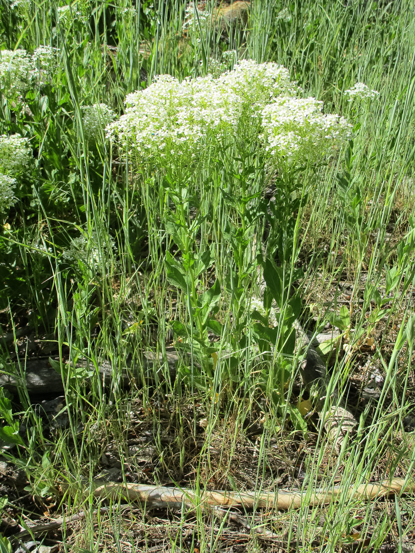

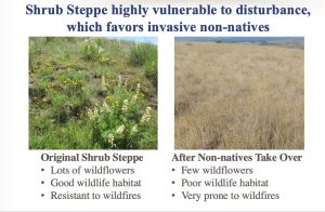

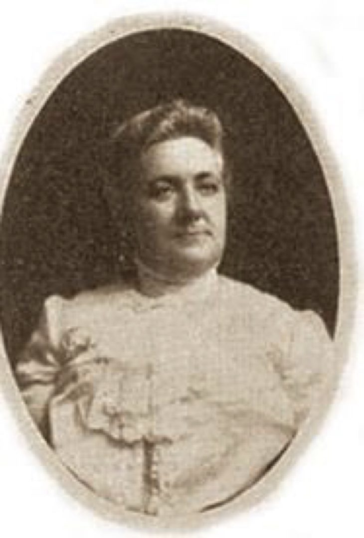
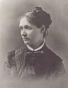
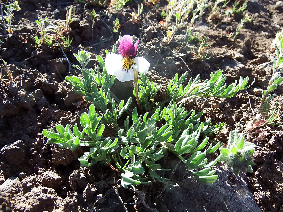
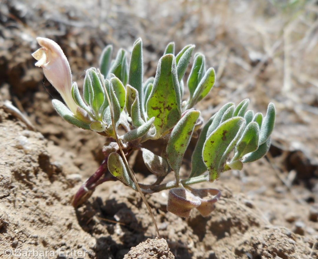
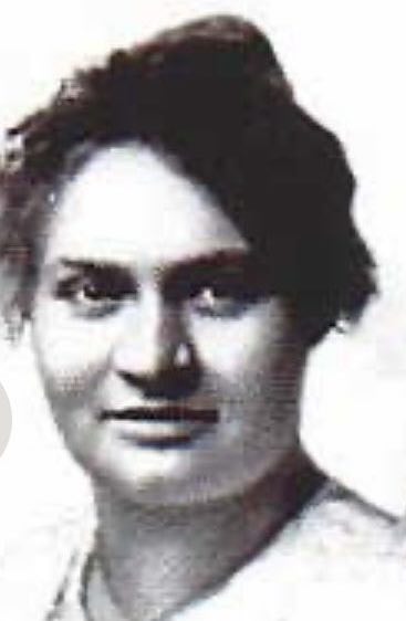
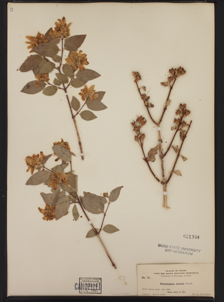
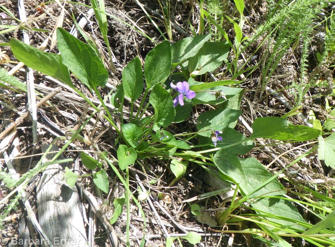

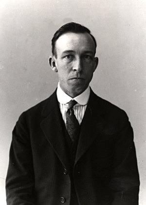
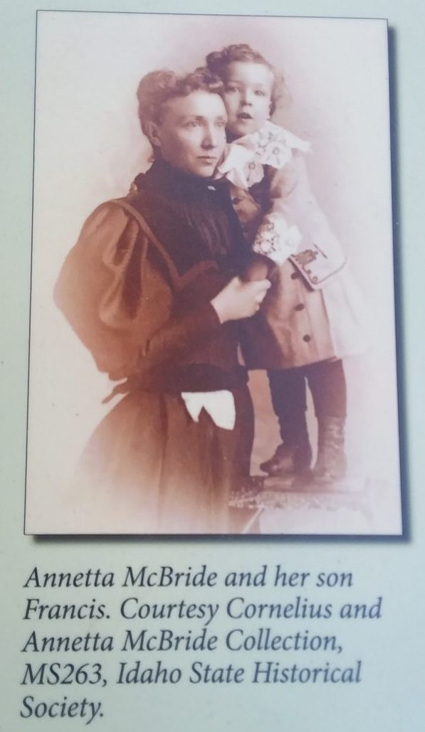
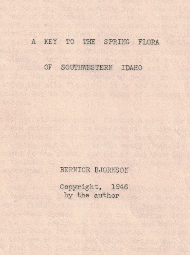
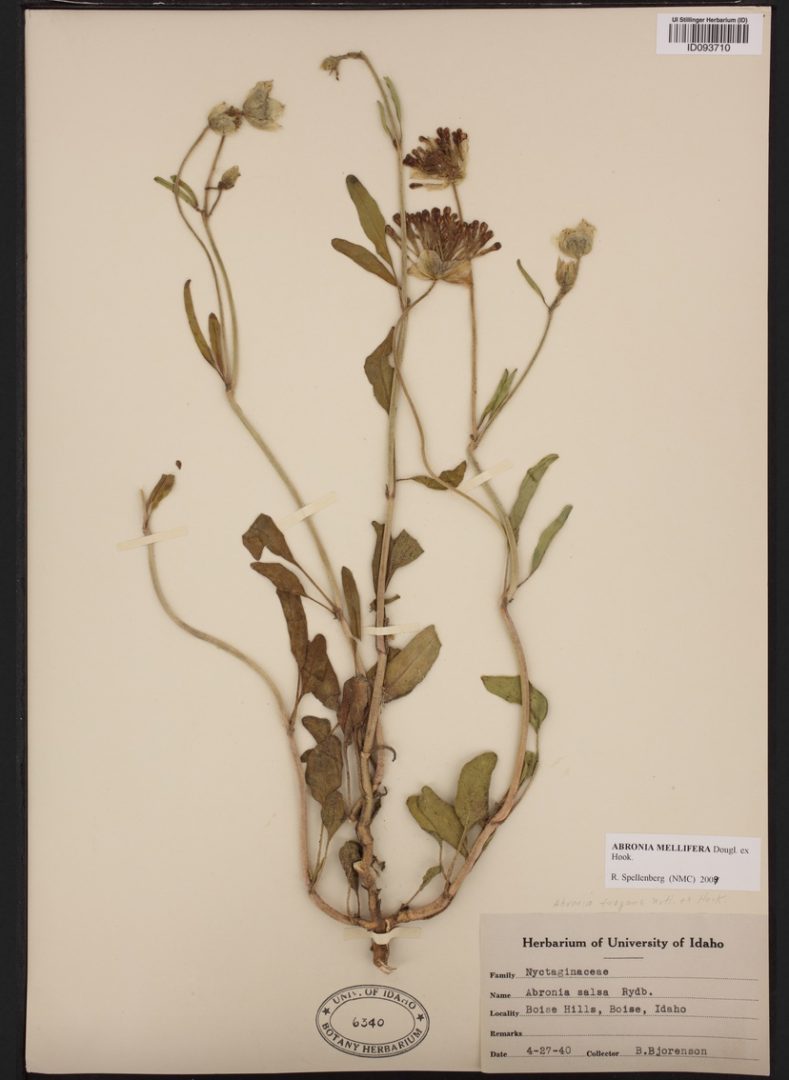
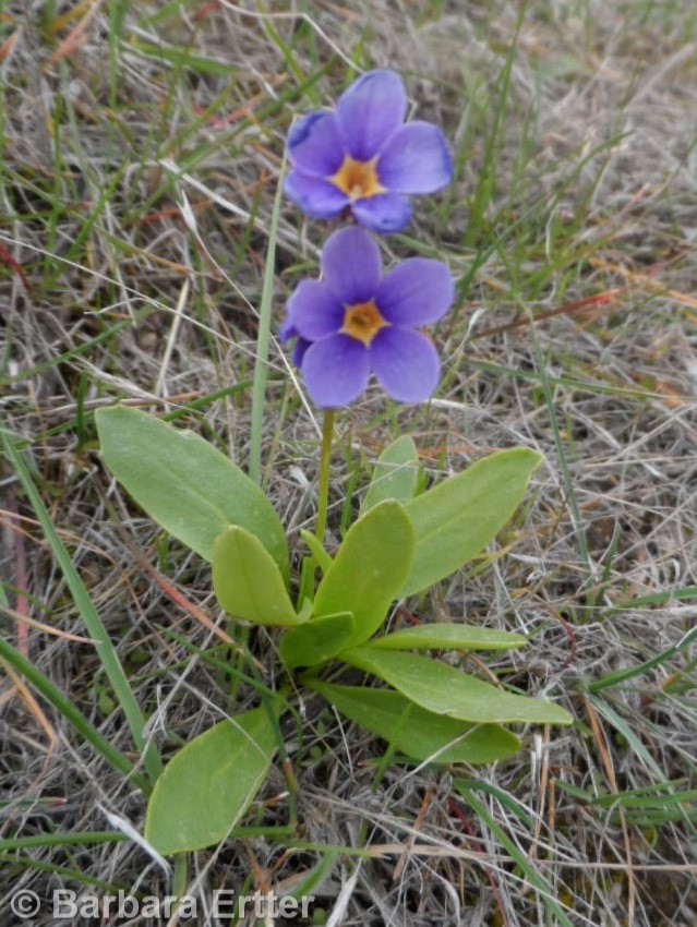
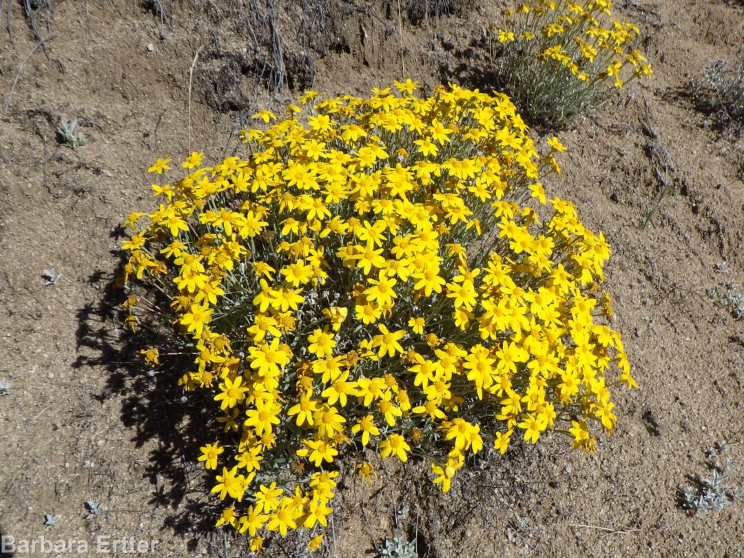


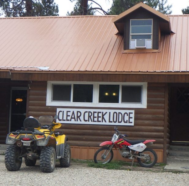
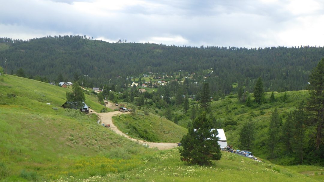
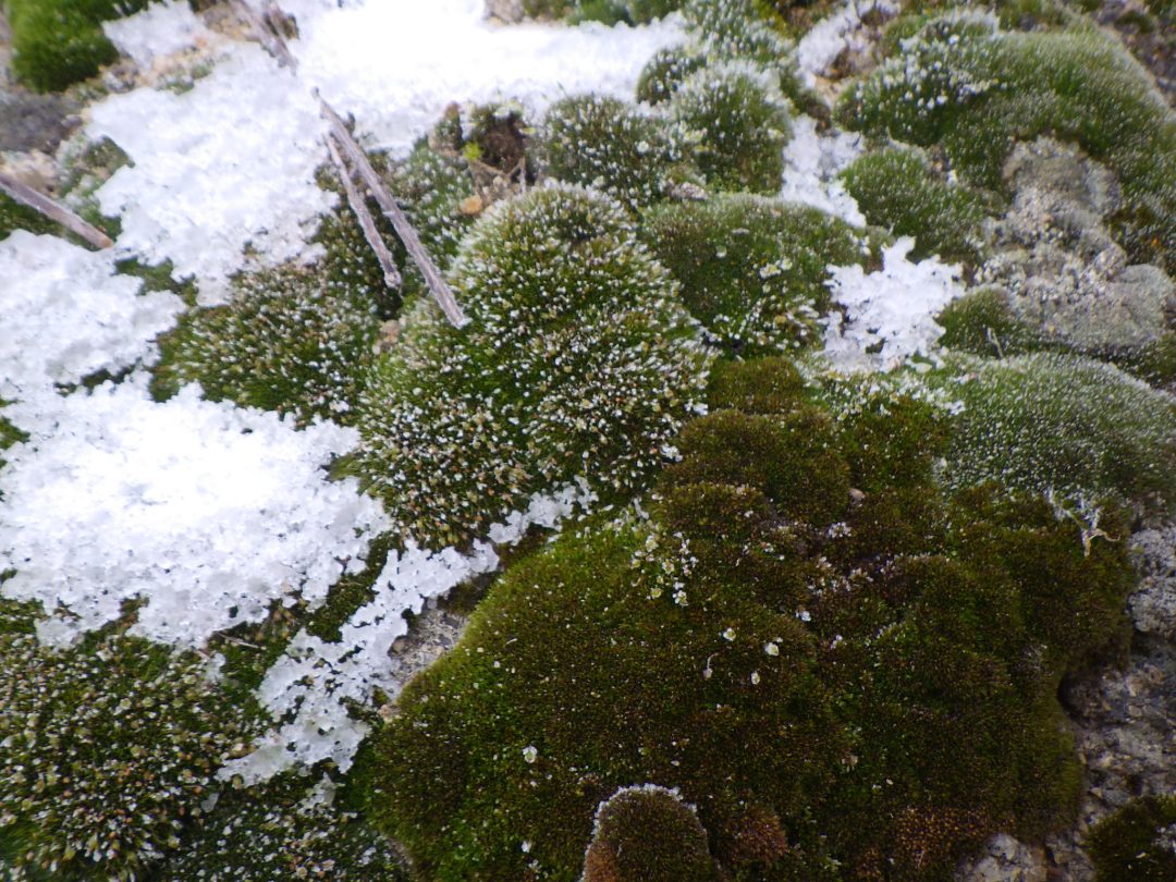
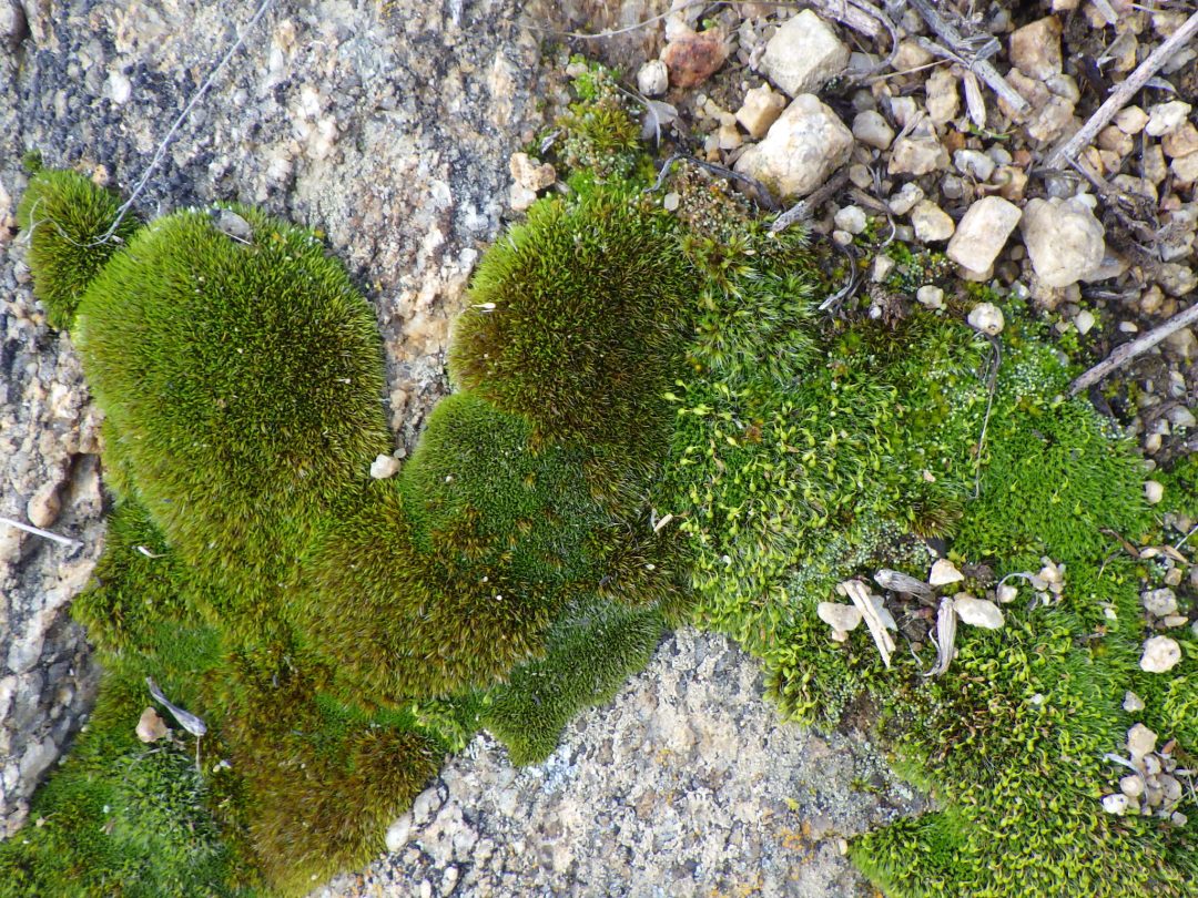
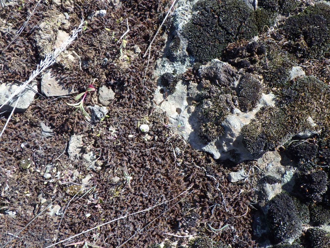
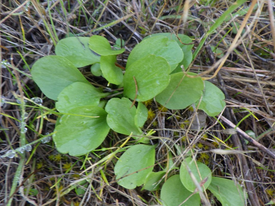
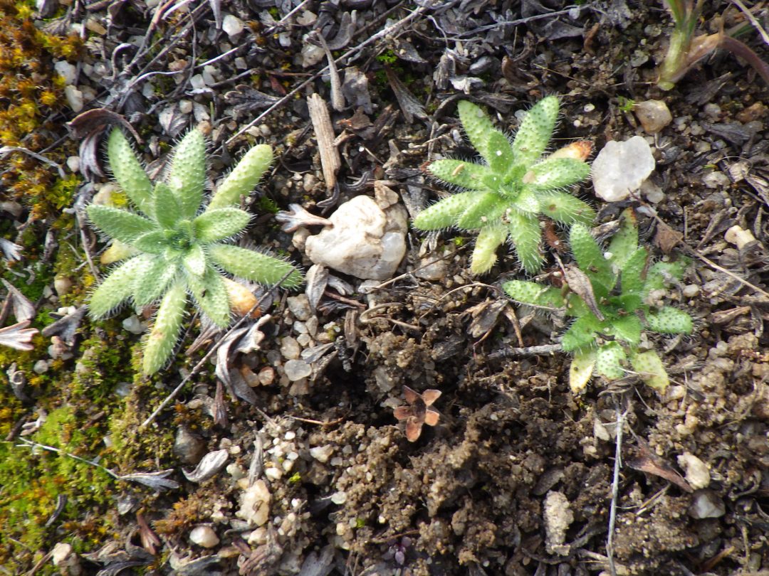
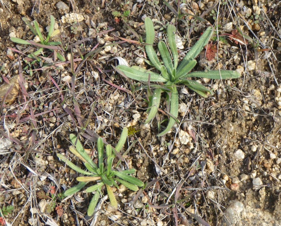
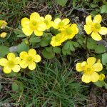
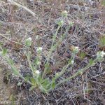
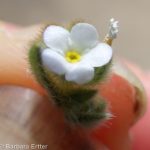
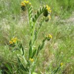
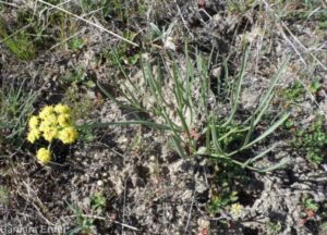
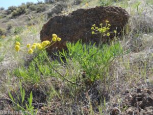
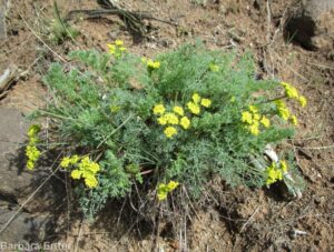
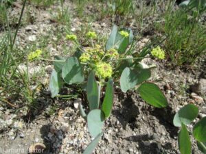
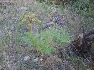
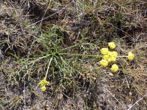
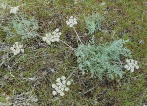
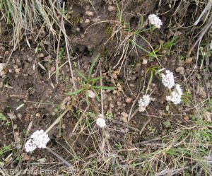
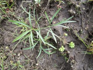

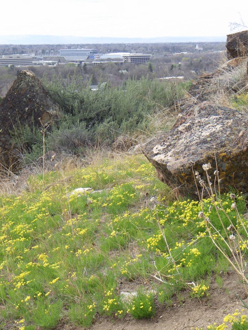
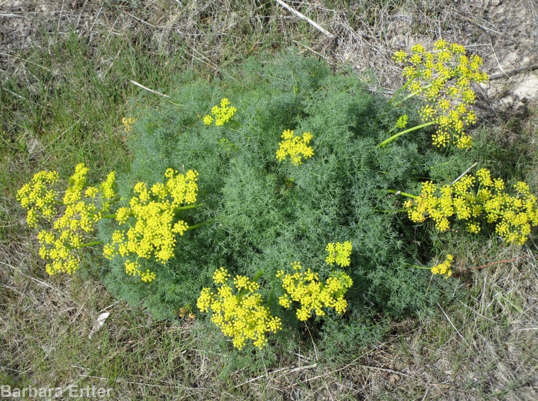

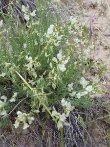
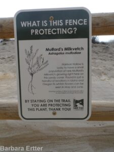

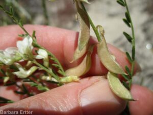

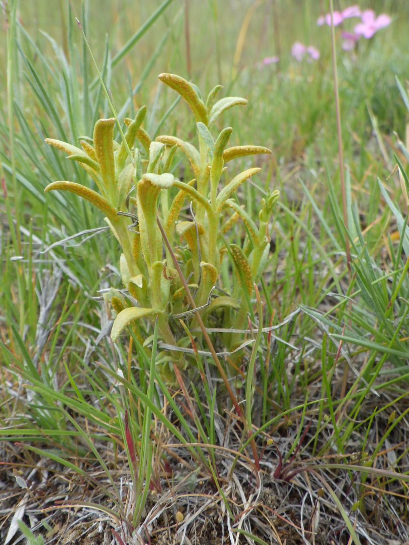
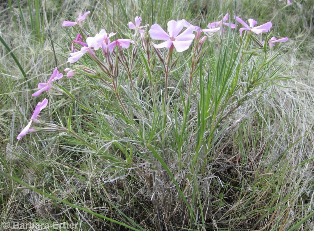
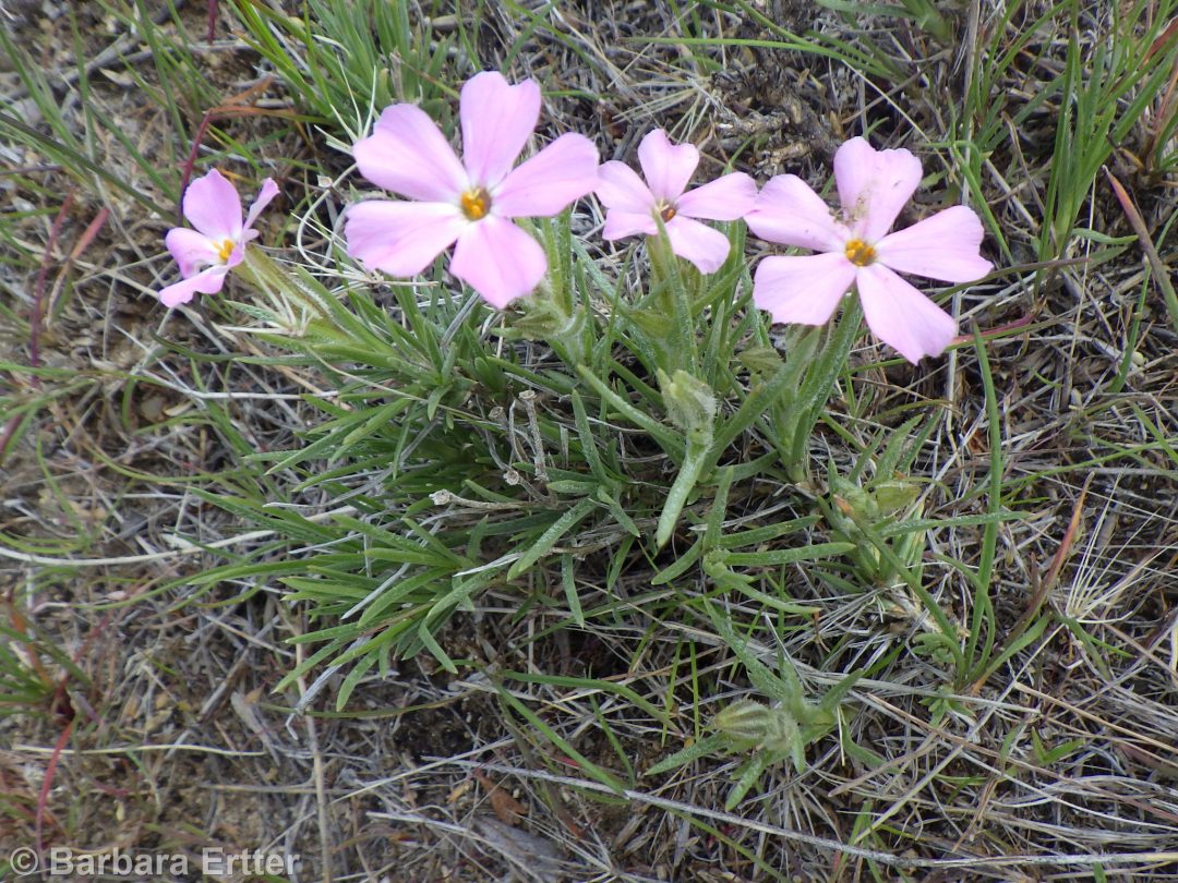
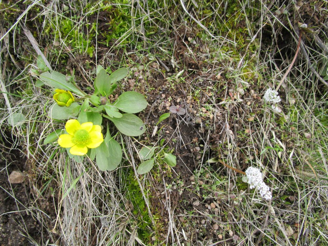

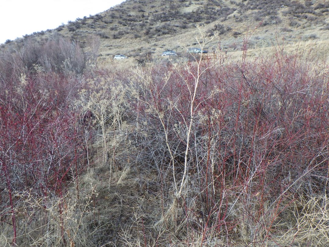
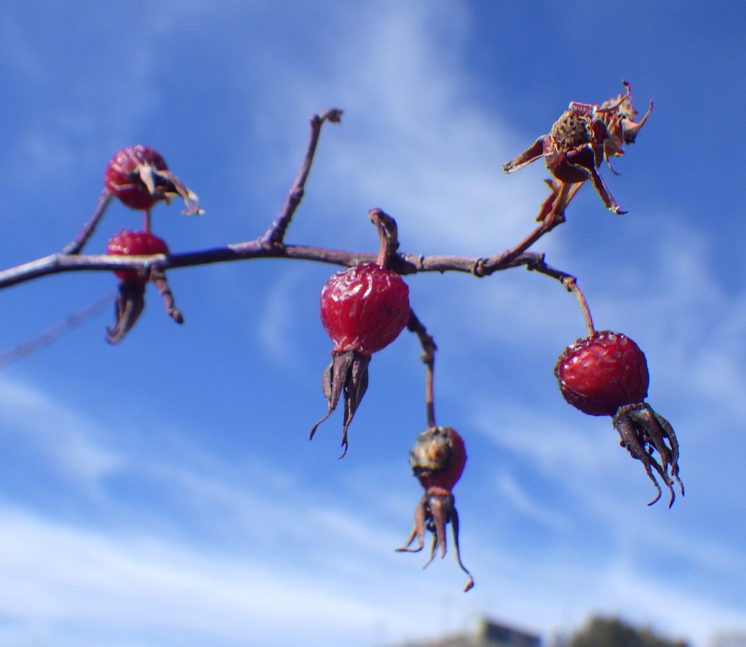
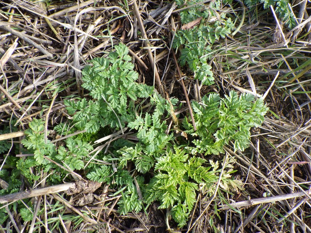

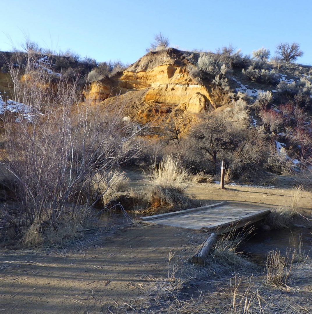
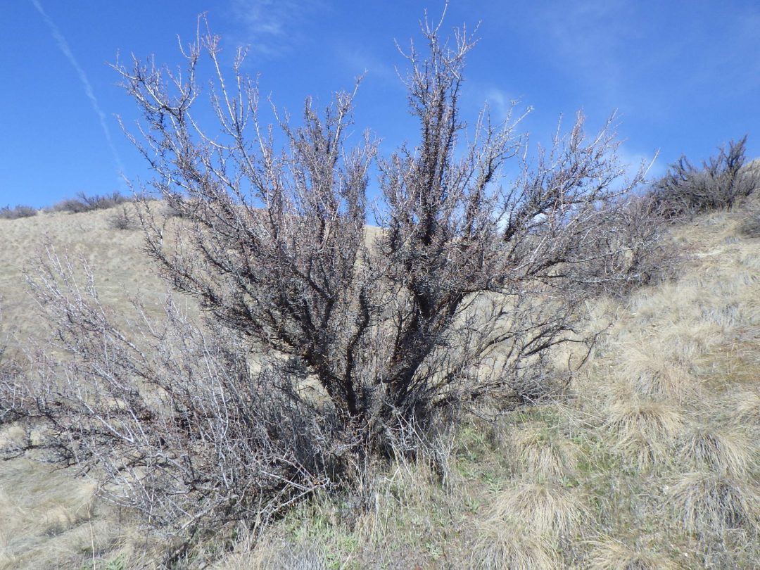

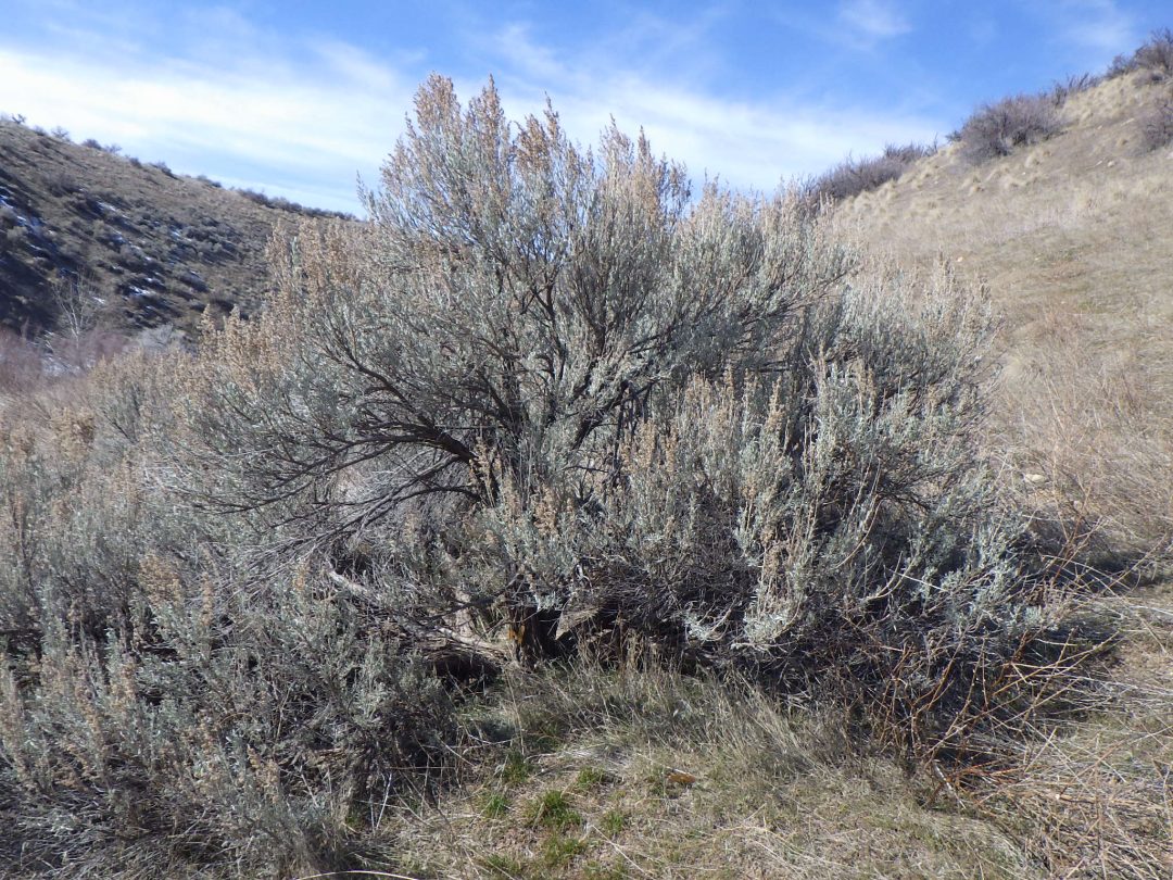
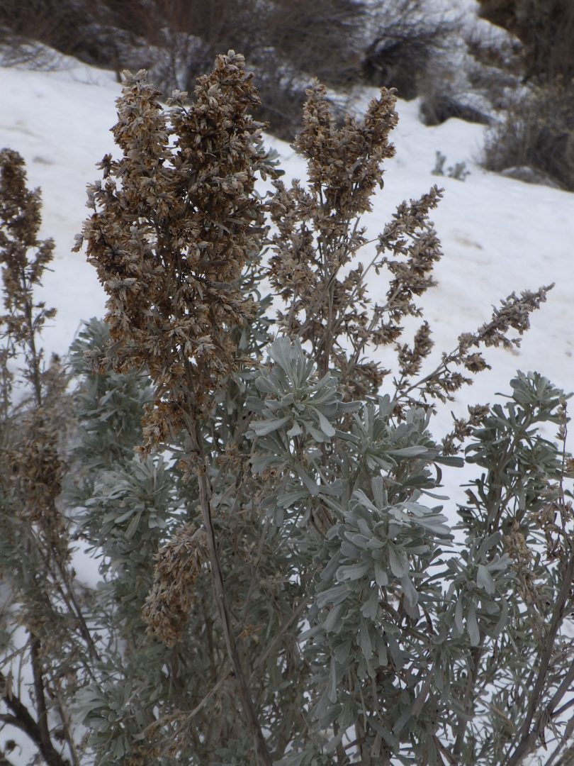
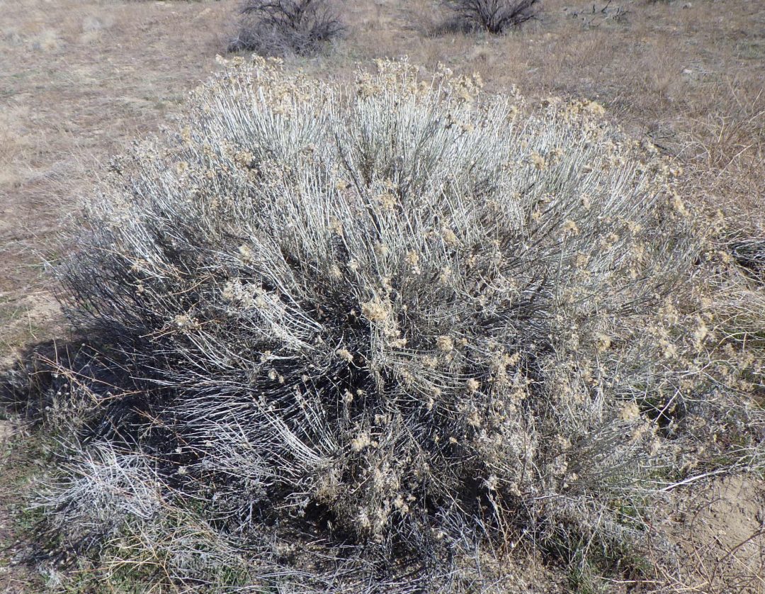
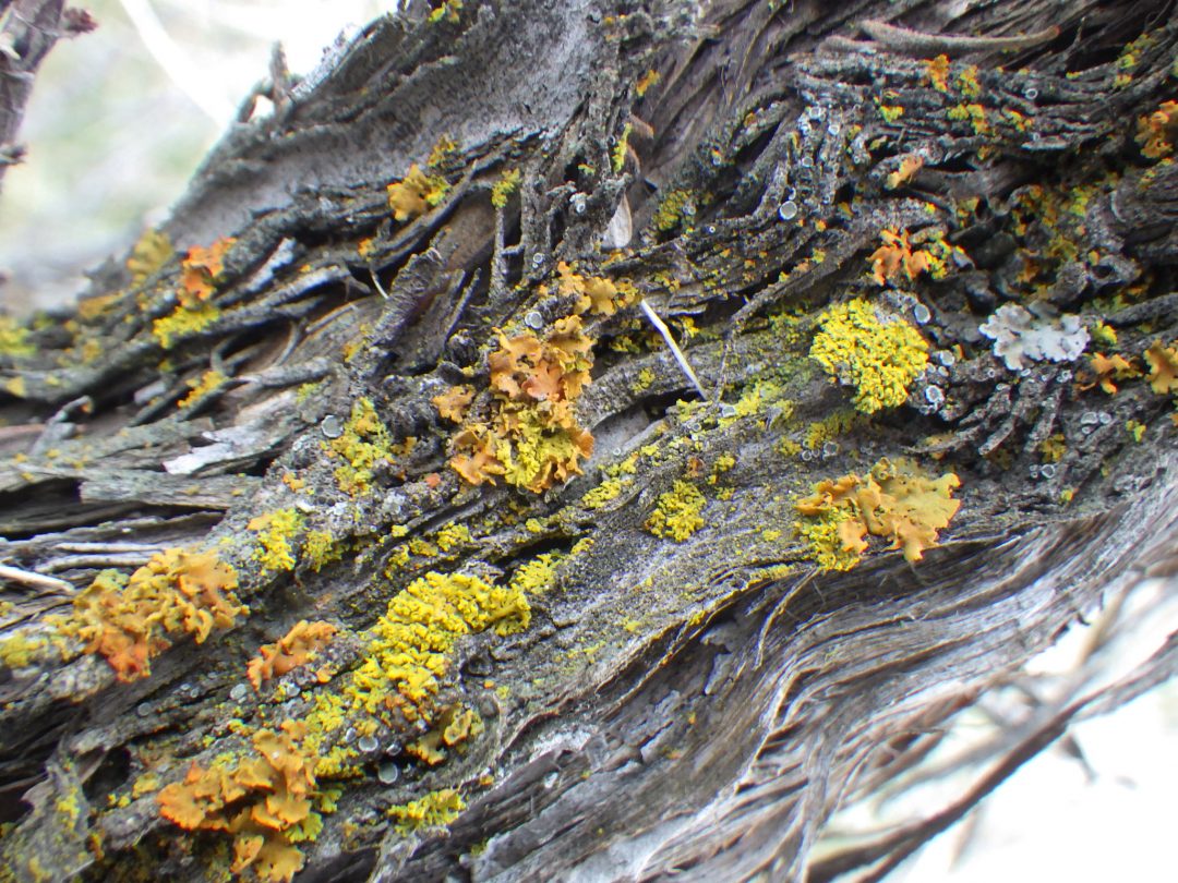
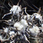
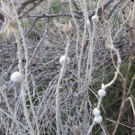
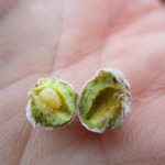
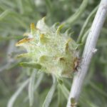
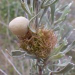
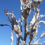
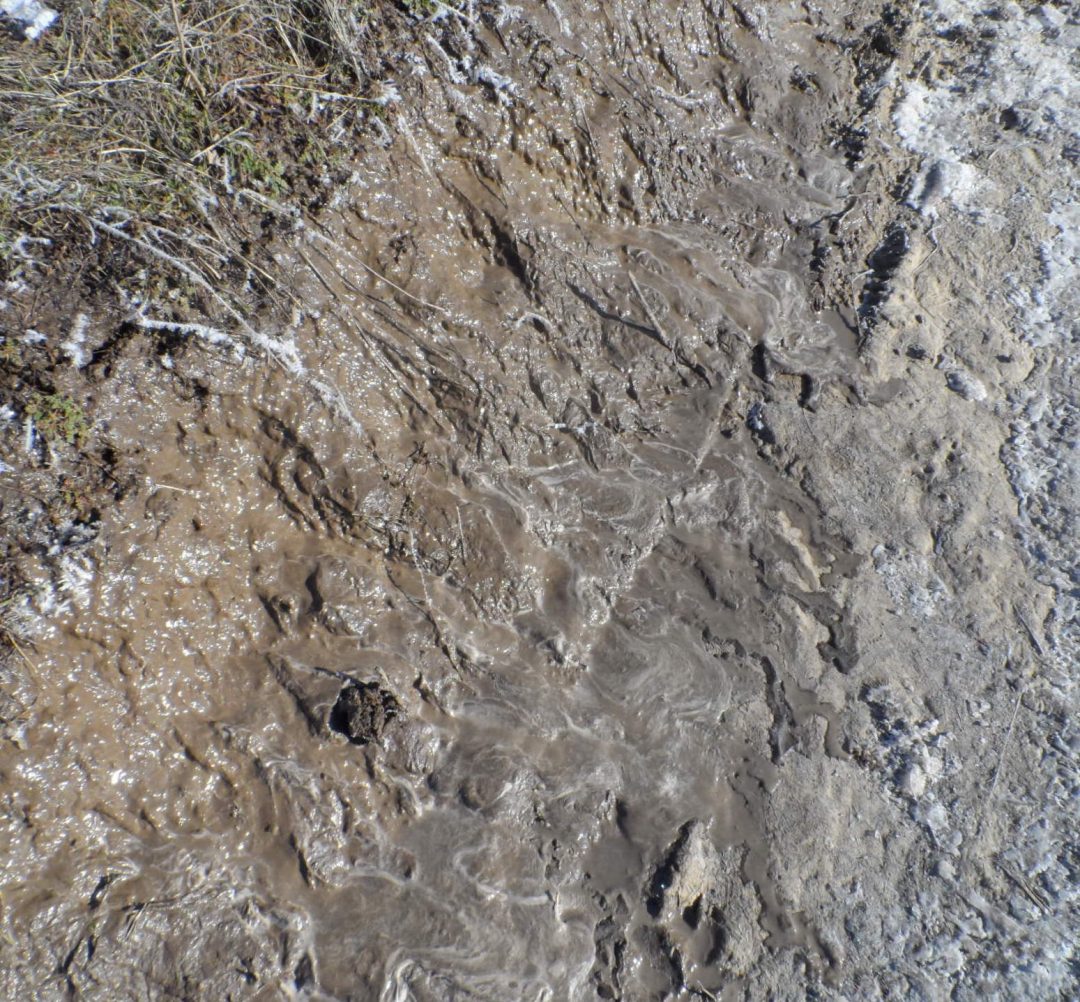
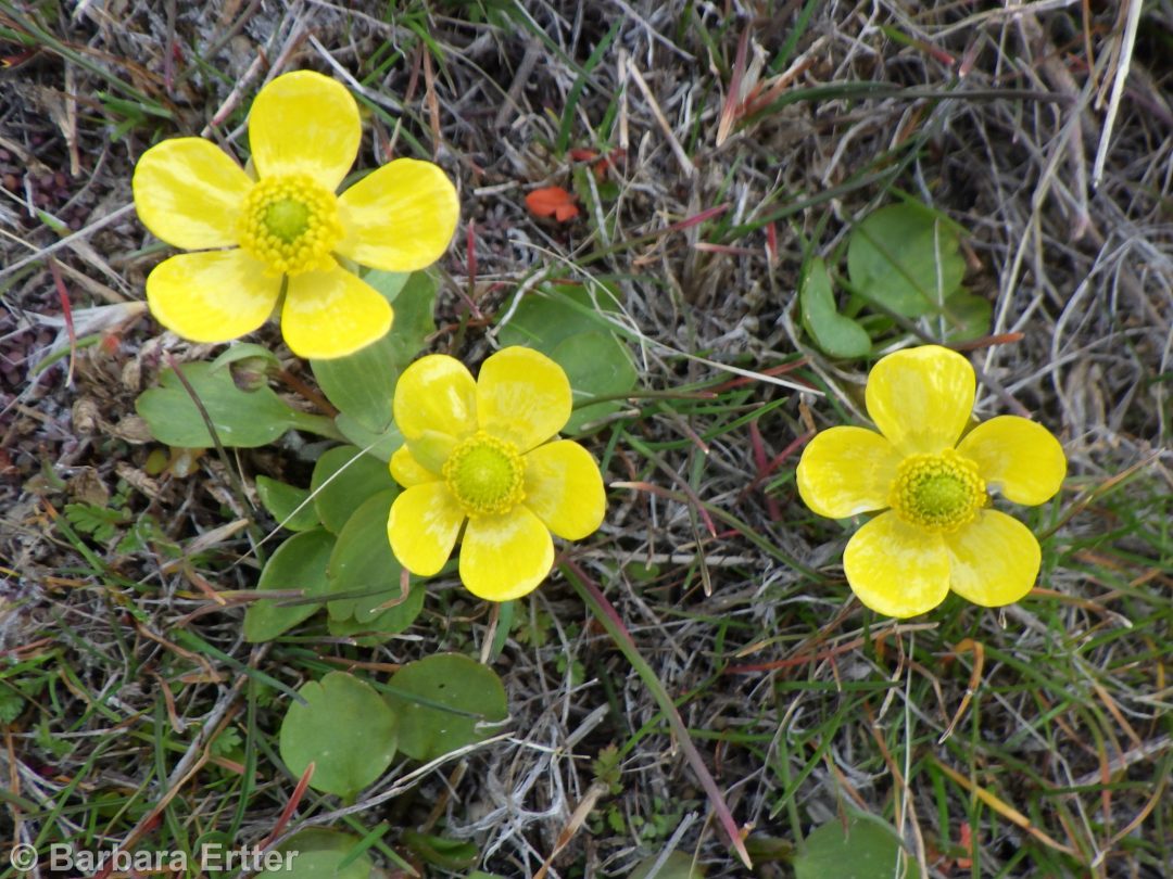
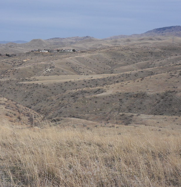
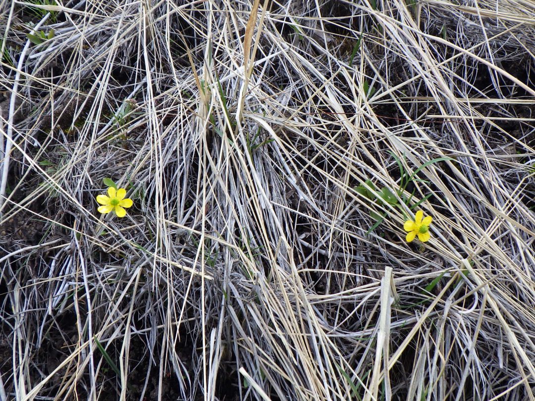
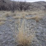
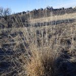
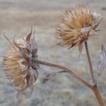
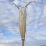
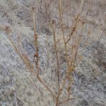
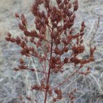
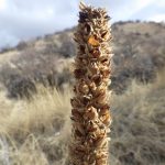
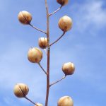

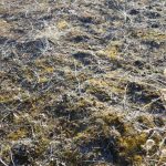
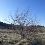
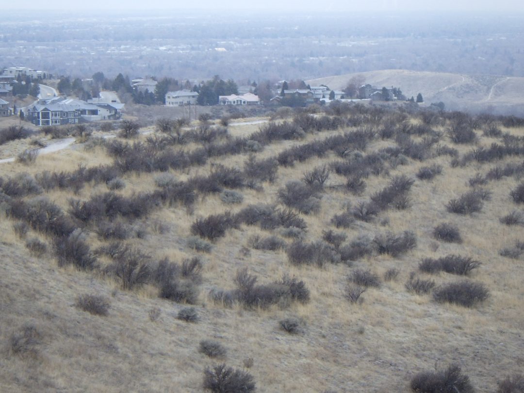
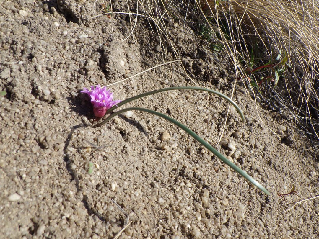

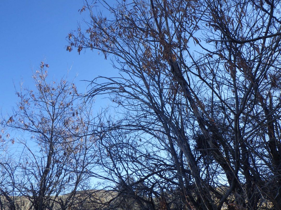
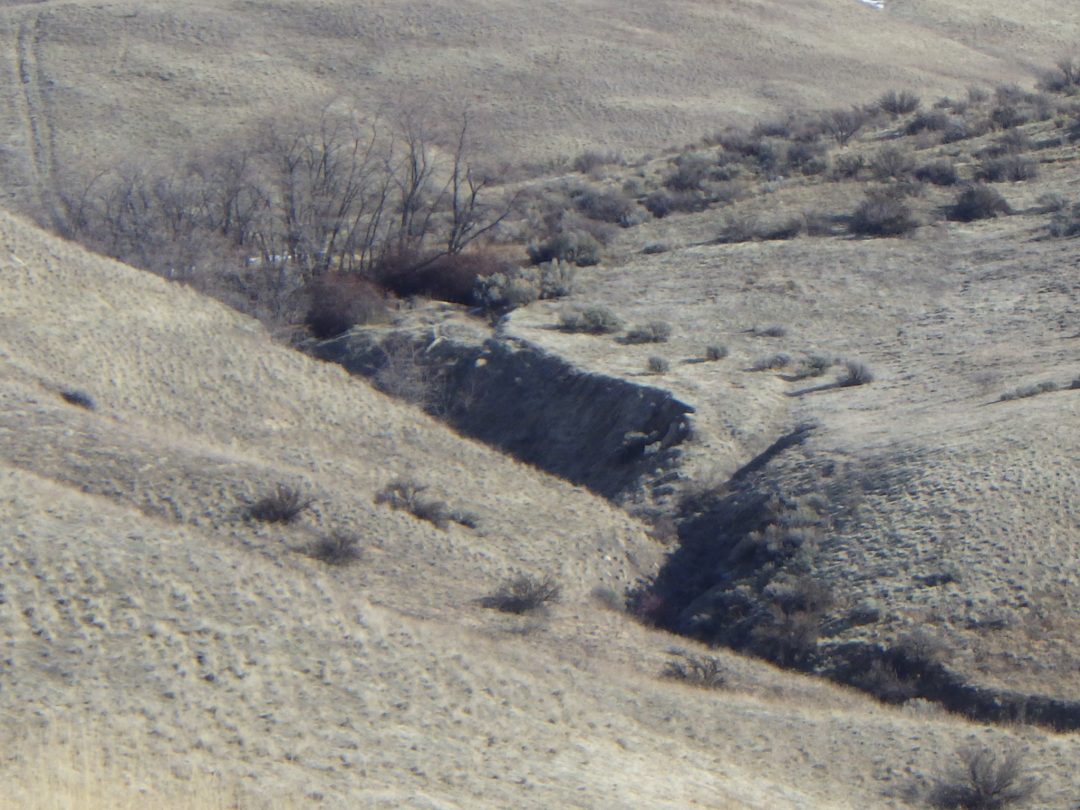

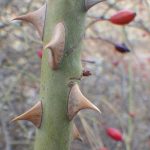
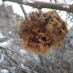
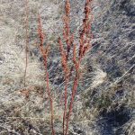
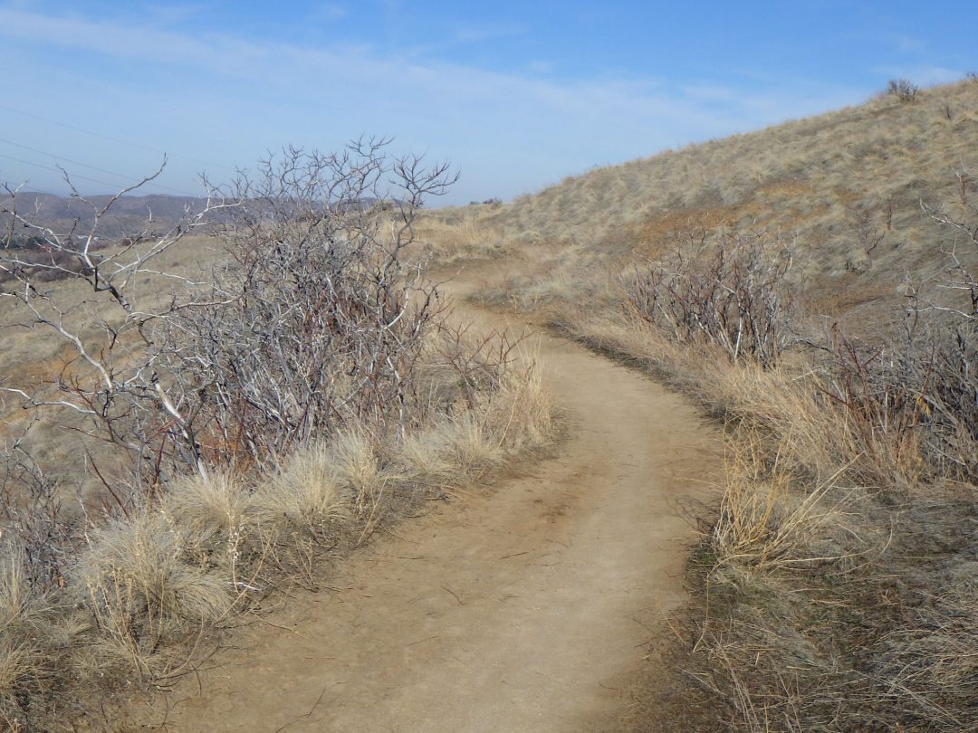
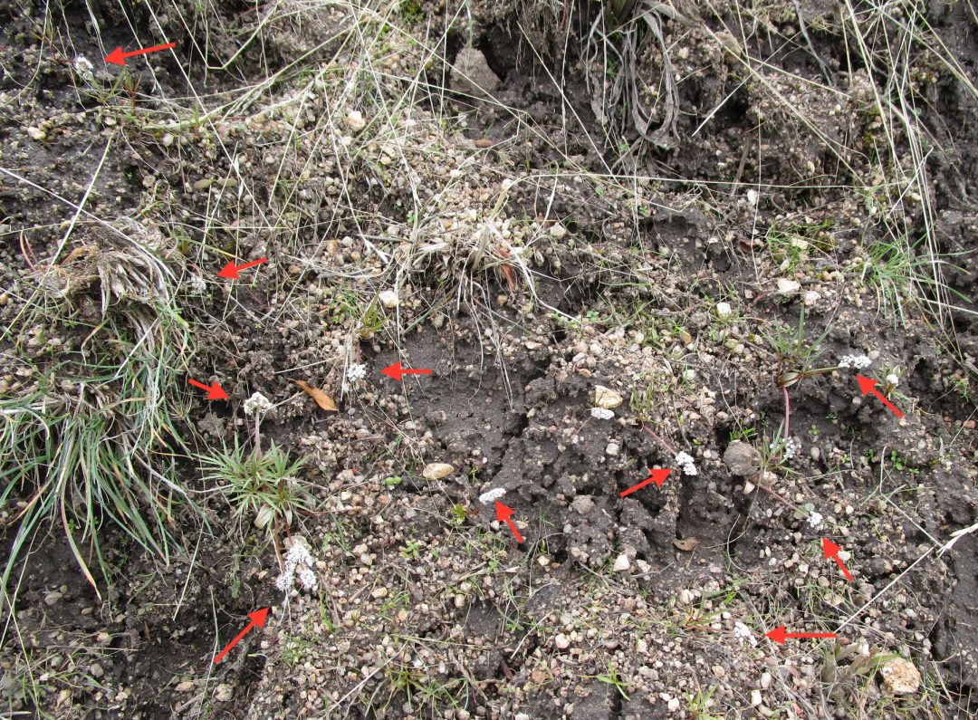
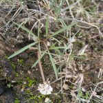
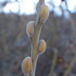
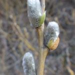
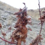
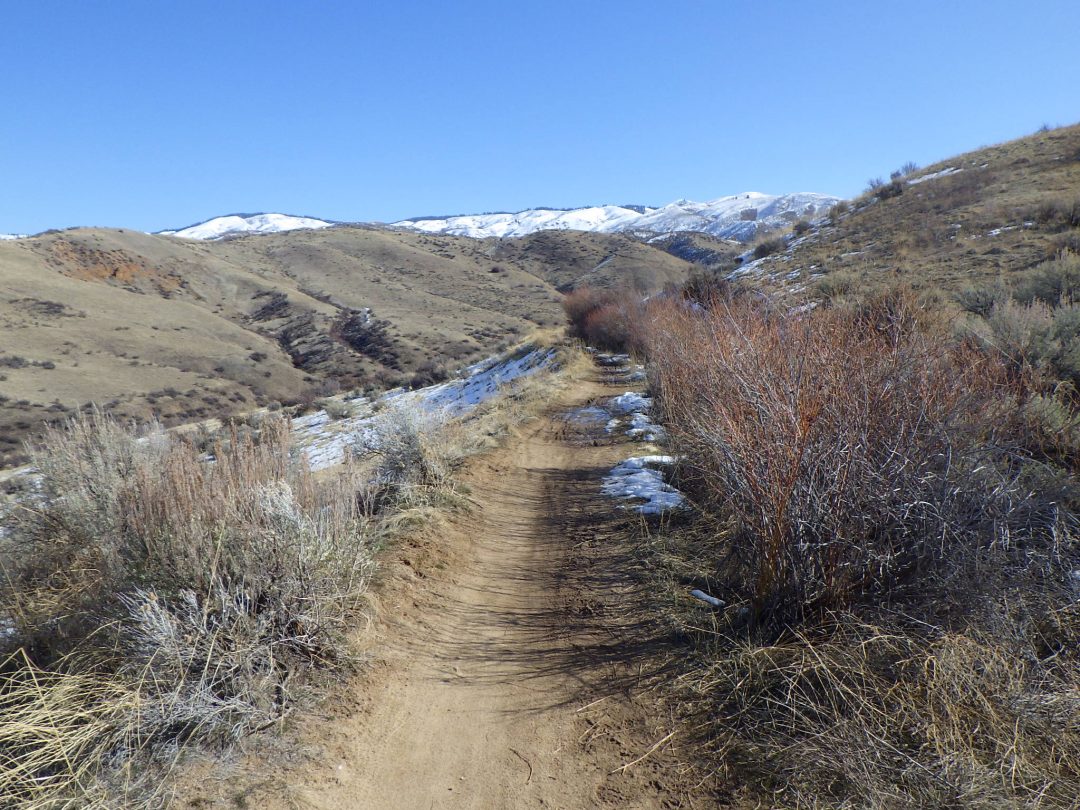
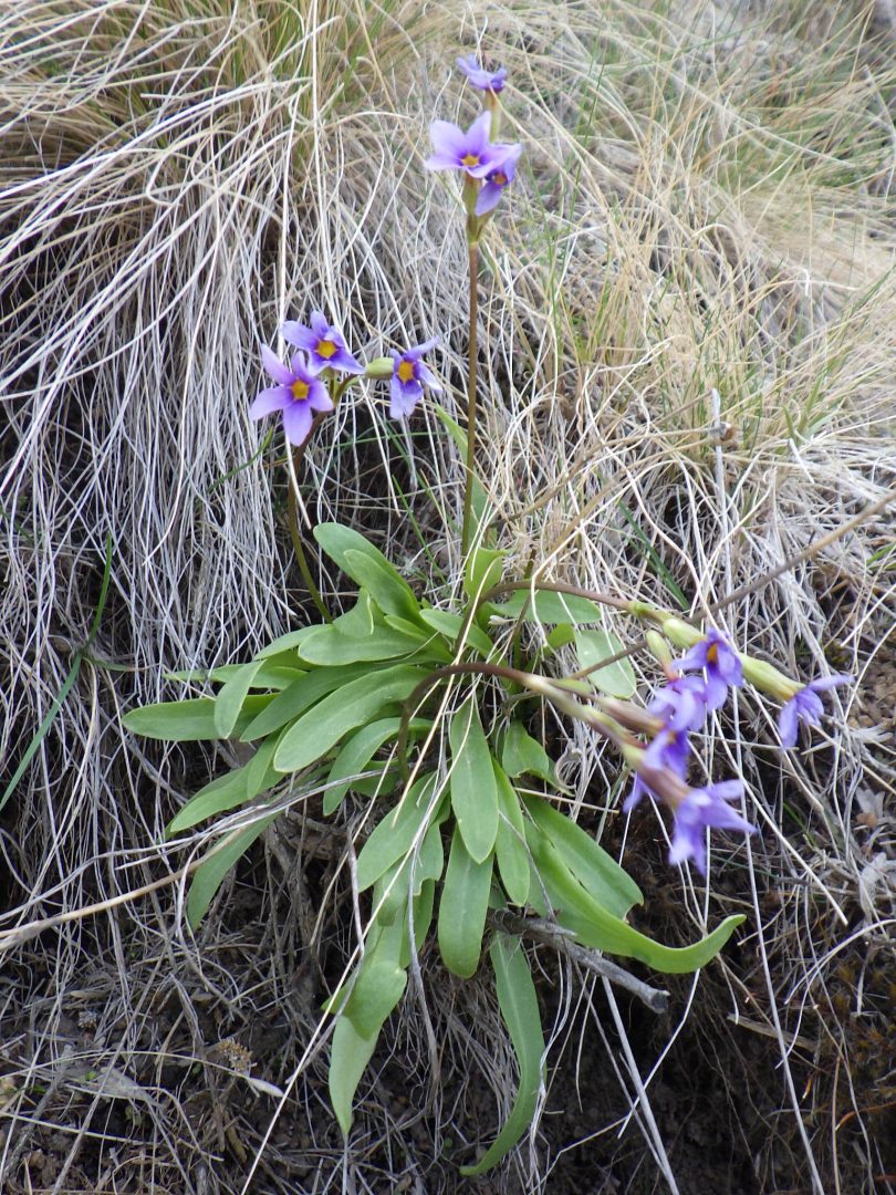
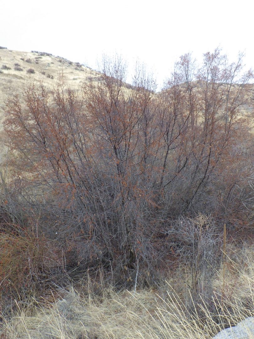
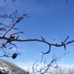
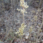

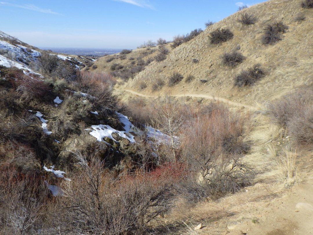
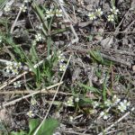
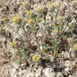
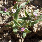
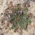
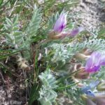
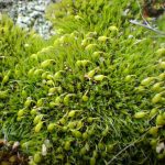
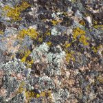
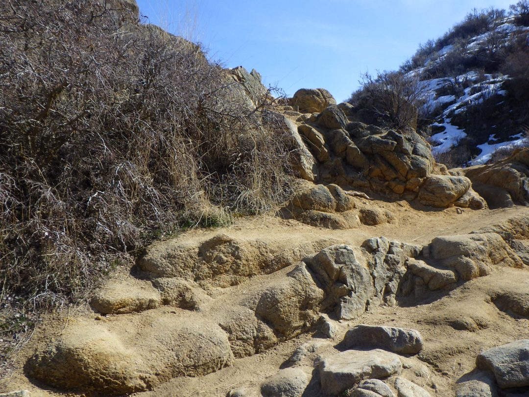
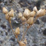
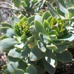
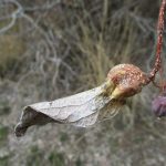
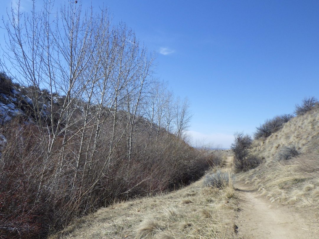
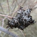
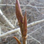
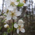
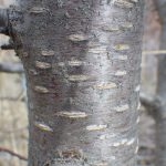
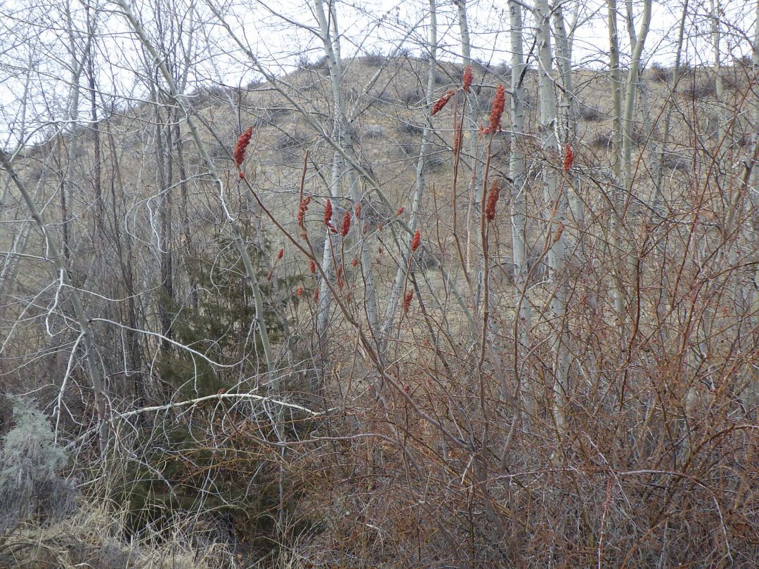
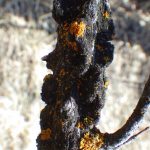
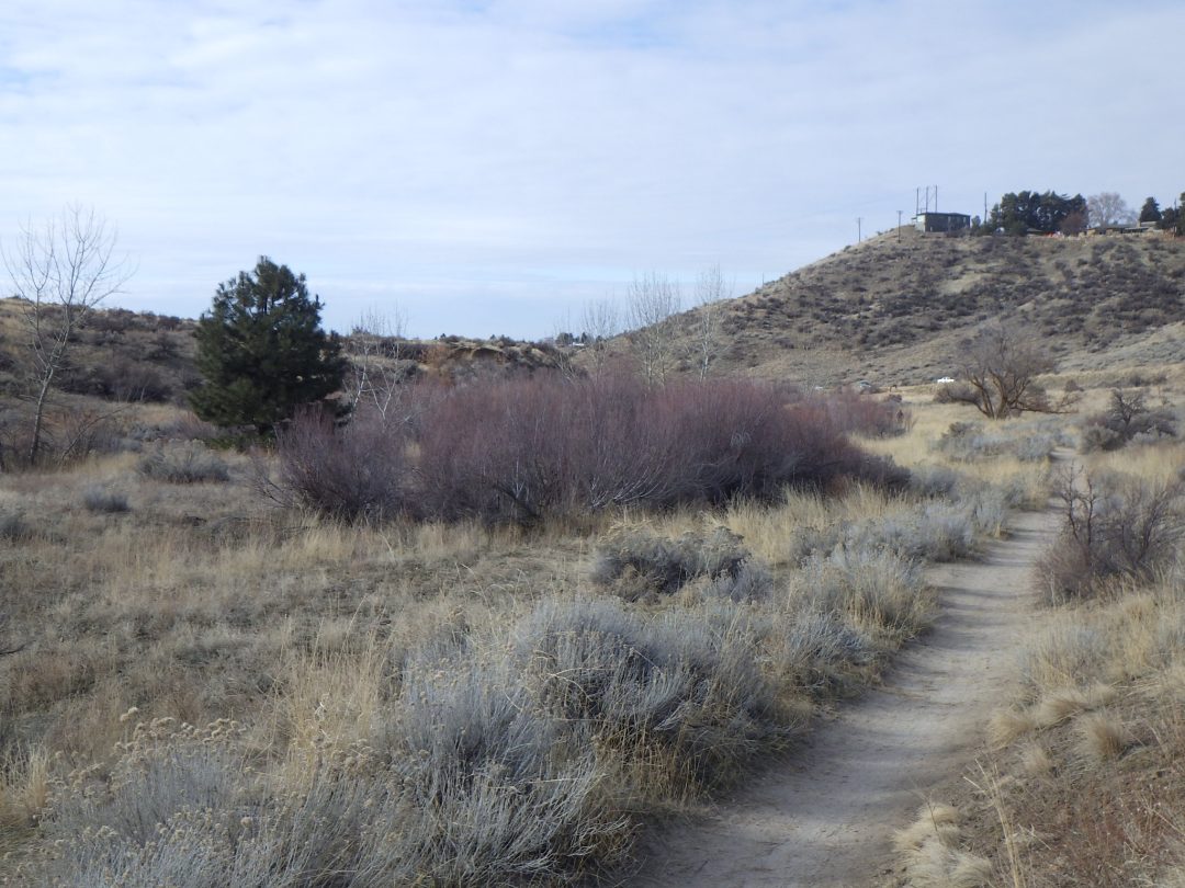
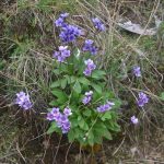
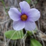


")
")
")
")
")
")
, aka \"bird-poop\" lichen")