CHIEF EAGLE EYE RESERVE (Ige dai Teviwa) WILDFLOWER WALK
End of summer
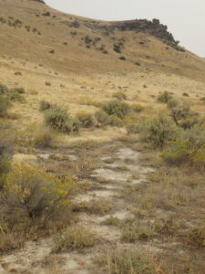
In addition to highlighting its significant Native American importance, a walk around Chief Eagle Eye Reserve (Ige dai Teviwa, previously Castle Rock Reserve) provides some geological and accompanying botanical diversity that is not represented on other wildflower walks. Situated to the northwest of the primary trailhead for the Table Rock trail system, this area is the source of Boise’s geothermal system. Although the relatively short loop described here can be a pleasant walk anytime of the year, the wildflower walk is described as an end-of-summer option, when some noteworthy fall-blooming species can be appreciated. The loop is about 1½ miles long, with about 250 feet elevation gain. Soils are heavy clay and should be avoided if at all muddy. During your visit, be respectful of the sacred significance of the area to Native Americans.
CONTENTS:
Geology
Native American Significance
Self-guided Wildflower Walk
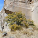
GEOLOGY: The Table Rock area as a whole is downfaulted relative to the foothills to the north, exposing one of the more complete (700-foot) stratigraphic sections in the foothills. The dominant geological feature of the local area is the 15-meter-thick layer of silicified sandstone that forms the cap of Table Rock, similar sandstone occurs in a band across the upper part of Chief Eagle Eye Reserve. Silica-saturated geothermal waters seeping upwards along the area’s numerous faults, heated by the buried batholith deep underground, percolated through Lake Idaho sediments and cemented the grains together to form the current durable sandstone, which includes fossils of snails and petrified wood. The stone has been quarried as “Boise Sandstone” for around 150 years, originally by prisoners at the adjacent Idaho State Penitentiary (now a historical site). The quarried stone has been widely used, both locally (e.g., the Idaho State Capitol Building, constructed in 1920) and across the nation (e.g., Harkness Tower at Yale University).
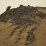
Chief Eagle Eye Reserve also is capped by a similar layer of silicified sandstone, above layers of claystone, hydrothermally altered basalt, and Idavada Group rhyolite, possibly indirectly connected with the formation of the Yellowstone hot spot. This is in fact one of the few exposures of Miocene rhyolite and basalt in the Boise Front, extending to Rocky Canyon. The rhyolite is the oldest rock locally, forming a layer at least 300 feet thick; a petrologically different rhyolite body underlies the ones that are exposed. The conspicuous landmark on the Reserve is a rhyolite outcrop previously known as Castle Rock, recently renamed Eagle Rock to acknowledge its original Native American name. Outlying populations of littleleaf brickellbush (Brickellia microphylla) can be found on the rhyolite, at the very edge of its geographic range.
 The area is also the source of Boise’s well-known geothermal system, the nation’s oldest and largest geothermal district heating network. Indigenous people and travelers on the Oregon Trail took advantage of the warm springs at the base of Table Rock. In 1890 wells started being drilled to develop the 170° subterranean hot water as a commercial resource, first for the Natatorium, then grand homes along Warm Springs Avenue, and eventually many buildings downtown. The water originates as rain and melting snow in the mountains to the north, which then percolates down along deep fracture zones to hot zones nearly a mile deep, possibly taking thousands of years before emerging naturally along other fracture zones. In the Table Rock area, the warm springs are associated with fractures in the rhyolite, which is exposed on one side of a major fault and deeply buried on the other.
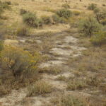
Prior to being diverted for geothermal development, the warm springs would have supported a unique wetland habitat, only hints of which currently remain. In addition to the warmer temperatures, which would have ameliorated winter conditions, the hot springs emerging from deep underground were more alkaline and mineral-laden than surface run-off and shallow springs elsewhere in the batholith-dominated Boise Front. As a result, the Reserve is one of the few sites on the north side of Boise where alkali flats and their associated species can be found, in contrast to the abundance of such habitats on the south side of the Snake River Plains and the typically alkaline soils of the Treasure Valley. Examples of this remnant flora are highlighted in the wildflower walk description.
Wood, S.H., and Burnham, W.L., 1987, Geological framework of the Boise Warm Springs geothermal area, Idaho, in Buess, S.S., ed., Rocky Mountain Section of the Geological Society of America, Centennial Field Guide, v. 2, p. 117–122.
NATIVE AMERICAN SIGNIFICANCE: Prior to the arrival of Euro-Americans, the Boise Valley was shared by several tribal nations, primarily the Shoshone, Bannock, and Northern Paiute. They were sometimes collectively referred to by others as Snake Indians, providing the current name for the major river that flowed though their territory. The three tribes traditionally spoke related Uto-Aztecan languages, followed a hunter-gatherer subsistence culture, practiced shamanistic vision quest spirituality, and generally maintained peaceable relations with one another. Although the Bannock language is closer to Paiute than to Shoshone, Bannock culture had become increasingly merged with Shoshone culture; the two groups have accordingly become known as the Shoshone-Bannock nation, or “Sho-Ban” for short. By the time Euro-Americans arrived in what would eventually be southern Idaho, the Shoshone-Bannock had already incorporated horses into their culture (probably via the Comanche, a related tribal nation), along with some of the more valor-oriented characteristics of the Plains horse-cultures, although bison rarely wandered as far west as the Boise Valley.
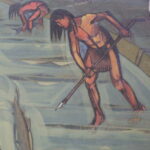
Regional environmental conditions favored a relatively mobile life style, with individual bands relocating around their territory throughout the year to take advantage of available foods and favorable temperatures. The Shoshone-Bannock territories mostly encompassed higher-elevation valleys and mountains in central Idaho, while the Paiute culture was adapted more to the expansive sagebrush steppe and pinyon-juniper woodlands of the Great Basin. At the end of summer, numerous groups would gather in the Boise Valley, coinciding with the abundant salmon runs that were also described by emigrants on the Oregon Trail. Fur trapper Donald McKenzie described a gathering of 10,000 indigenous people in 1819, scattered along the Boise River for more than seven miles (in A. Ross, “Fur Hunters of the Far West”, 1855). Then as now, relatively mild winter temperatures also made the area a popular site for over-wintering, with some bands remaining along the river throughout the summer as well. It is likely that they tended, and possibly intentionally planted, culturally important plants near preferred dwelling sites. The Table Rock-Eagle Rock area and associated warm springs were, and remain, a particularly significant sacred area for the displaced tribal people, important for healing and spiritual purposes. The hot springs once fed into bathing ponds that were ascribed with medicinal properties, frequented not only by the resident tribes but also by travelers from other tribes. The surrounding slopes were used as a major burial site, and the area remains a gathering site where the spirits of the ancestors can be honored.
The discovery of gold in the Boise Basin and Owyhee Mountains in 1862 quickly led to both an influx of Euro-Americans and the establishment of Fort Boise at the mouth of Rocky Canyon (differing from an earlier Fort Boise at the mouth of the Boise River near Parma), near a primary road to the Boise Basin. With this military backing, the inevitable conflict between the original inhabitants and the encroaching miners and settlers gave rise to the Treaty of Fort Boise in 1864, in which the Shoshone-Bannock were forced to cede their territory in the Boise River drainage in exchange for treatment as a “most favored nation” and support from the United States. The treaty was never ratified by the U.S. Senate, and the provision of “most favored nation” was certainly never realized; vigilantes nevertheless began to persecute and evict Native Americans even before a reservation was established. This ugly period in Boise’s history was later depicted in a controversial WPA mural in the old Ada County Courthouse, which includes the lynching of a Native American.
The official responsibility for enforcing this and comparable treaties fell to the military posted at Fort Boise and other outposts throughout the West, which found themselves in the unenviable position of fulfilling the demands of Euro-American settlers while still providing some measure of protection for the Native Americans in their charge. Regrettably, many of the soldiers were battle-hardened recent veterans of the American civil war, who readily adapted to the brutal pursuit of resisting groups. Surrender meant custody under marginal conditions in encampments, including on the outskirts of the booming new settlement of Boise City, where for several years hundreds of tribal members tried to eke out a living while ravaged by hunger, exposure, and disease. Conditions were such that David W. Ballard, Idaho’s territorial governor at that time, pleaded with the Commissioner of Indian Affairs in Washington for a more equitable resolution: “The Indians of southern Idaho are fast fading away, and as we occupy their root grounds, converting them into fields and pastures, we must either protect them or leave them to the destroying elements now surrounding them.” In 1869, after suffering in the encampments for five years, most of the Shoshone-Bannock survivors near Boise were marched to the newly established Fort Hall Reservation in eastern Idaho, while the Shoshone-Paiutes primarily ended up in Duck Valley Reservation on the Nevada border. Members of extended families were often separated, with some scattered among reservations in Oregon and Washington, including the short-lived Malheur Indian Reservation (succeeded by the Burns Paiute Reservation) and the Warm Springs Reservation.

Conditions on the reservations were at first only marginally better than the encampments, with provisions promised by the treaties in short supply. Faced with famine conditions in 1878, tribal members from the Fort Hall Reservation attempted to assert their right to the camas (Camassia quamash) fields of Camas Prairie in present-day Camas and Gooding counties. Continued access to this critical food source was supposed to be in the treaty, but “Camas Prairie” had been mistakenly entered as “Kansas Prairie” on the paperwork, so when the starving Native Americans arrived they found that Euro-American settlers had already staked claim to the area and turned their cattle and hogs loose in the camas fields. In desperation, about 200 Bannock and Paiute warriors decided to go to war, with the resulting conflict now referred to as the Bannock War of 1878. The last armed conflict between Native Americans and Euro-Americans in Idaho, called the Sheepeater War, took place the following year; it ended in the confinement of the Sheepeater band of central Idaho Shoshone to Fort Hall Reservation.
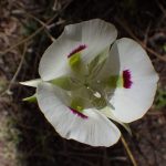
Only a decade after Fort Hall Reservation was theoretically set aside for Native Americans, it unfortunately turned out to be the optimum location for an expanding railroad network. Rapid encroachment by Euro-American squatters and a new treaty pushed through by the powerful Union Pacific Railroad lobby resulted in the entire southern half of the original reservation being opened up to a land rush in 1902, setting the stage for present-day Pocatello (ironically named for a Shoshone chief). As one short-lived compensation for a railroad right-of-way across the Fort Hall reservation, tribal members were allowed free travel on trains. Mary Hallock Foote used this as a plot element in her 1894 novella “The Trumpeter” (in Cup of Trembling and Other Stories). Even though fictionalized, the story captures the continued presence of occasional Native Americans in the Boise area during this period, as well as the unflattering attitudes of Euro-American Boiseans towards them. Foote used various wildflowers metaphorically to represent the “wild” nature of the story’s mixed heritage protagonist Meta: “They called her amongst themselves, by the name they give to the mariposa lily [Calochortus sp.], the closed bud of which is pure white as the whitest garden lily; but as each Psyche-wing petal opens it is mooned at the base with a dark purplish stain which marks the flower with a startling beauty, yet to some eyes seems to mar it as well. With every new bud the immaculate promise is renewed; but the leopard cannot change his spots nor the wild hill lily her natal stain.”
Confinement to reservations was only one more chapter in an unfolding story, with the fundamental challenge being that of finding a path forward that allows Native Americans to pursue realistic economic opportunities while still maintaining their cultural identity and dignity in a world significantly changed from that of their ancestors. Among the steps along this path was the 1924 acquisition of United States citizenship for all Native Americans born in the United States, followed a generation later by the right to vote in Idaho (HJR 2, in 1950). This effectively resulted in dual citizenship for tribal members, since the original sovereignty of tribal nations as recognized in the U.S. Constitution is still in effect. This sovereignty provided the foundation for a major improvement toward economic self-sufficiency with the 1987 Supreme Court affirmation of tribal rights to gambling, which led to the development of casinos on many reservations, including Fort Hall. The reservations continue to be home to most descendants of the displaced tribal members, but others have taken on the challenge of making their livelihood off the reservation, with many now living in the Boise Valley.
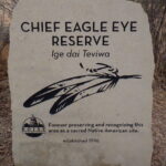 A new chapter began locally in 1990, when a proposal for a new housing development that would have impacted the Eagle Rock burial sites triggered a joint campaign by the East End Neighborhood Association and Native American tribal members at the Fort Hall and Duck Valley reservations. The campaign was successful, and the land was purchased from the developer by EENA, the Shoshone-Bannock tribes, and the City of Boise. The area was initially named Castle Rock Reserve, and 3,000 native plants were reintroduced to the site to signify healing. In 2019, the Reserve and adjacent Quarry View Park were renamed Chief Eagle Eye Reserve ( (Ige dai Teviwa) and Eagle Rock Park (Pava Kwiina’a Tiipe), honoring the area’s indigenous people. Chief Eagle Eye was the leader of 70 Weiser Shoshone who refused to to relocate to the reservation; he is buried at the top of Timber Butte north of Emmett, a significant regional source of much of the obsidian used to make arrowheads and other weapons. The trails have also been renamed to acknowledge the tribal nations whose traditional territory this area represents.
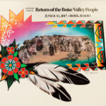 The successful defense against further development of this culturally significant site also set the stage for Return of the Boise Valley People, an annual unity gathering for descendants of the tribal diaspora. The gathering, which takes place in June at Eagle Rock Park and additional venues as needed, provides an opportunity for sharing culture, oral histories, and food, as well as healing and reconciliation. In 2017, Boise mayor David Bieter proclaimed 8 June 2017 to be Return of the Boise Valley People Day. A priority goal is the establishment of a long-overdue cultural center, with the dual purpose of ensuring cultural continuity with younger generations, and to share their history and continued presence with other inhabitants of the Boise Valley. Still Indigenous. Still Here.
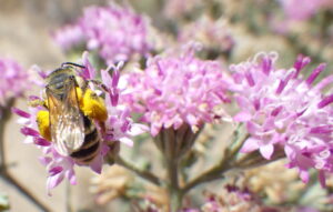 When you visit Chief Eagle Eye Reserve, treat it with the same respect that would be proper if you were visiting a cathedral, temple, mosque, or shrine. “Listen closely and you may hear a faint whisper on the breeze saying . . . tread gently for you are on sacred ground.” Going beyond the opportunity to acknowledge other humans who have been here before you, use your visit to expand your connection with all species who share this planet with us. “[I was] taught how to introduce myself to a natural place: a spring, a hillside full of wildflowers. Just sitting there with buzzing pollinators, watching the hummingbirds come up in the meadow in the morning sun. Being taught that every unique species is a different spirit that has a right to be acknowledged, that has its own life history requirements, what it needs to live. Learning that you have a responsibility to understand that, to know it, to reaffirm your responsibility for that, and to care for that as a human being.” [from Sacred Pollinators, an interview with research ecologist Frank. K. Lake, Flora 4(1); 16]
Some references for cultural history:
Chief Eagle Eye Reserve History. City of Boise. https://www.cityofboise.org/departments/parks-and-recreation/parks/chief-eagle-eye-reserve/chief-eagle-eye-reserve-history/
Shoshone-Bannock Tribes. http://www2.sbtribes.com/about/#
Derig, B. 1996. Roadside History of Idaho. Mountain Press Publishing Company, Missoula, Montana.
MacGregor, C. L. 2006. Boise, Idaho, 1882-1910: Prosperity in Isolation. Mountain Press Publishing Company, Missoula, Montana.
Walker, D. E. 1978. Indians of Idaho. University of Idaho Press, Moscow, Idaho.
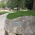 SELF-GUIDED WILDFLOWER WALK: The relatively short loop (about 1½ miles) has several access points, with the most parking available at the main trailhead for the popular hike to Table Rock. However, the walk as described here begins at Eagle Rock Park (Pava Kwiina’a Tiipe, previously Quarry View Park), north of Old Penitentiary Road. Look for a couple of sandstone boulders in the park with plaques that provide additional geological information, as well as shells and fossil wood. Access to Chief Eagle Eye Reserve ( (Ige dai Teviwa, previously Castle Rock Reserve) is at the northwest (left) corner of the park.
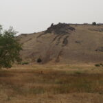
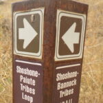
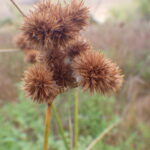
The southwest corner of the reserve is a weedy meadow dominated by non-native grasses, mostly quackgrass (Elymus repens, previously in Agropyron), with scattered Siberian elm (Ulmus pumila) and Russian-olive (Elaeagnus angustifolia). Fall-blooming curly-cup gumweed (Grindelia squarrosa) is common along the path, here and throughout the foothills. The prominent outcrop on the hillside to your right is Eagle Rock, also known as Castle Rock. At the junction in a patch of sandbar willow (Salix exigua), turn right onto the Shoshone-Bannock Tribes Trail (#19A).
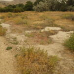
The first habitat of interest is a barren-looking alkali scald (also called slickspot or playa), indicative of the former hot springs. Around the edges is the smaller, clay-loving variety of rubber rabbitbrush (Ericameria nauseosa var. oreophila, previously in Chrysothamnus), whose yellow flowers are an important food source for pollinators in the fall. The alkaline nature of the local soils is also indicated by the abundance of non-native kochia or burningbush (Bassia scoparia, previously in Kochia).
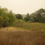
Overflow from the geothermal well has maintained a willow-lined wetland on the south (right) side of the path, paralleling the boundary with Eagle Rock Park. Signs warn against entering the wetland, since the unpredictable release of scalding water can cause serious harm, especially to unwary dogs. With proper caution, following one of several unofficial paths to the edge of the wetland might allow you to spot several late-blooming “comps” (i.e., members of the Asteraceae/Compositae family), including one or two species of aster (Symphyotrichum spp.) and one of the only local populations of giant goldenrod (Solidago gigantea), whose glabrous stems help distinguish it from the more common rough goldenrod (Solidago lepida). The central marsh area is dominated by common spikerush (Eleocharis palustris) and Baltic rush (Juncus balticus); cattails (Typha latifolia), common willow-herb (Epilobium ciliatum), western goldenrod (Euthamia occidentalis), invasive purple loosestrife (Lythrum salicaria), and Torrey’s rush (Juncus torreyi) are also present.
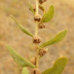
Whether you choose to return to the main path or continue along the informal trails that parallel the wetland, take note of povertyweed (Iva axillaris), an odd-looking native in the sunflower flower. Be sure also to enjoy the diversity in flower size and color in annual willowherb (Epilobium brachycarpum), abundant throughout the reserve. In addition, you might spot a few sunflower (Helianthus annuus) still in bloom, along with such non-natives as chicory (Cichorium intybus), alfalfa (Medicago sativa), two-scale orache (Atriplex heterosperma), and invasive rush skeletonweed (Chondrilla juncea). The conspicuous reddish-brown spikes of curly dock (Rumex crispus) contribute a nice touch of fall coloration. A lone greasewood (Sarcobatus vermiculatus), perched atop a rubble pile, may be the last representative of a shrub that was probably once common on the local alkali flats but which is now rare anywhere in the Boise Front.
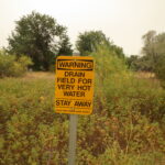
Variation in the native Rosa woodsii is on display in this wetland as well. In addition to typical intermountain rose (R. woodsii ssp. ultramontana), which is the common form in this part of Idaho, there are some plants (such as the one behind the warning sign) that differ in having solitary flowers, somewhat blunter leaflets, and abundant glands on the foliage. Trying to make sense of variation in wild roses is exceptionally challenging, due in part to their morphological plasticity and propensity for hybridization, so it remains to be determined what significance this particular variant represents.
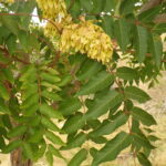
Back on the main trail, you will encounter the first of several stands of tree-of-heaven (Ailanthus altissima), a fast-growing, grove-forming, pinnate-leaved tree that can be invasive. Because of its medicinal and cultural significance, tree-of-heaven was often planted by Chinese immigrants trying to make a better life for themselves and their families in gold-rush California (gam saan, “Gold Mountain”) and elsewhere in the West. Although little physical evidence now remains, the Chinese community was prominent in Boise’s early history, declining in the face of increasing discrimination and outright persecution that included the 1882 Chinese Exclusion Act on the national level. At least in California, old groves of tree-of-heaven are often indicators of former Chinese settlements; it is tempting to speculate that the tree-of-heaven groves locally also indicate that there was once a Chinese settlement here, perhaps using the warm springs to water precursors of the Chinese gardens that gave Garden City its name, along with Chinden Boulevard.
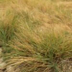
When the trail intersects the access road to the Warm Springs Water District pumphouse, a short detour to the right takes you to a nice patch of interior saltgrass (Distichlis spicata) where the road crosses the drainage. This alkali-tolerant grass is another survivor from the original warm springs wetlands, earning its common name by excreting crystals of salt on its leaves. The species has been investigated as an easy- or no-care turfgrass alternative, especially for slightly alkaline soils (like much of the Treasure Valley), since it can form dense stands that remain less than a foot tall. A good example has been thriving for years in the sidewalk strip along 16th Street between Bannock and Idaho streets in Boise, in spite of neglect and abuse. One drawback is that the grass doesn’t stay green as long as desirable, especially with no supplemental watering.
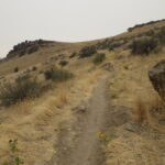
To continue the loop, follow the main trail as it curves left behind the pumphouse, continue straight on the Shoshone-Paiute Tribes Loop (#19), and then take two lefts to follow the trail as it angles up the hillside towards Eagle Rock. Note how the soil is heavy clay, deeply cracked when dried, in contrast to the sandier soils more common in the foothills. This is because the parent rock is claystone, basalt, and rhyolite, rather than granite, as mentioned under Geology. The slope is dominated by weeds, in particular the invasive (and highly flammable) annual grasses medusahead (Taeniatherum caput-medusae, previously in Elymus), which flourishes on clay soils, and feral rye (Secale cereale). Some bitterbrush (Purshia tridentata) and a few late-season natives manage to persist, including curlycup gumweed (Grindelia squarrosa), sunflower (Helianthus annuus), hoary aster (Dieteria canescens, previously in Machaeranthera), and an abundance of annual willowherb (Epilobium brachycarpum); you might also spot some pods of showy milkweed (Asclepias speciosa). What you will not see at this time of year is Andrus’s biscuitroot (Lomatium andrusianum), a recently recognized species that is abundant along this trail in spring.
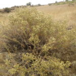
The most noteworthy plants on this slope occur mostly on the rhyolite outcrops, including Eagle Rock itself. The recommended period for this wildflower walk is in fact chosen to coincide with the blooming period of littleleaf brickellbrush (Brickellia microphylla). This creamy-flowered shrub is common on the opposite side of the Snake River Plains, and also the Hells Canyon area, but the rhyolite outcrops of the Reserve and Rocky Canyon are the only places it has been found on the north side of the Snake River Plains. There are also a few patches of plains prickly-pear (Opuntia polycantha) at one of its only localities in the Boise Front, though the striking magenta flowers will be long gone by fall. Both species can be easily seen by taking a short side path into a quarried hollow to the right of the main trail, shortly before reaching Eagle Rock. it is tempting to think of the prickly-pear as a culturally important plant that was intentionally brought to the site by Native Americans, though its presence in a post-settlement quarry argues against this idea. Also keep an eye out for broom buckwheat (Eriogonum vimineum) near the quarry, covered with tiny pink flowers; like most other annual buckwheats, its inclination to be in peak bloom when most sensible annuals have already gone to seed and dried up is a bit of a puzzler.
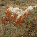
Enjoy the expansive view while treading carefully on Eagle Rock, not only out of respect for its importance to Native Americans but also to minimize damage to the colorful crustose lichens, which look a bit like paint splotches. These intriguing organisms are actually a close symbiosis between various fungi, which provide the tough matrix, and photosynthetic algae. Although amazingly hardy and long-lived, they can easily be destroyed by repeated foot traffic, so try to avoid stepping on areas that have not already been scoured away. One of the more interesting is the bright red-orange Caloplaca sp., which depends on the high nitrogen leaching from the “whitewash” deposited by perching raptors. Other locally common lichens include wall lichen (Lecanora muralis), which makes rounded gray-green colonies, and descriptively named egg yolk lichen (Candellariella sp.) [Lichen determinations provided by Roger Rosentreter. Species pages for non-vascular plants and other organisms have not (yet) been created for this website, though this would be a desirable long-term goal.]
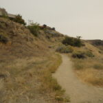
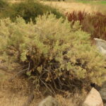
Continue straight (northwest) on Shoshone-Paiute Tribes Loop, where you might spot some white flowers of eyelashweed (Blepharipappus scaber) still in bloom. The gradually descending trail crosses a stretch of nicely exposed layers of rhyolite before widening into an old quarry road as it enters a thick band of silicified sandstone. Note the different plants that grow on this different substrate: basin big sagebrush (Artemisia tridentata ssp. tridentata) and three-awn grass (Aristida purpurea var. longiseta) are now common, and the rubber rabbitbrush is a larger, grayer variety (Ericameria nauseosa var. hololeuca) than the variety that is most common elsewhere in the Reserve. Take note also of any plants starting to escape from adjacent landscaping surrounding the homes on the ridge above; hardy pampasgrass (Tripidium ravennae, previously in Saccharum) is particularly worrisome in this regard. More tree-of-heaven (Ailanthus altissima) grows here, sometimes intermingled with look-alike staghorn sumac (Rhus typhina), which differs in having finely hairy stems, fuzzy red fruit, and leaves that turn bright red in fall. There is also a solitary juniper (Juniperus sp.); although several native species of juniper are abundant in the mountains south of the Snake River Plains, for some unknown reason only sporadic non-native junipers occur in the Boise Front.
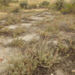
Take the sharp left-hand turn as the loop trail begins its zigzag descent, cutting through a dense grove of tree-of-heaven. Once you reach the bottom of the slope, keep an eye out for another alkali scald on the left side of the trail, shortly before reaching another junction. This is the only place known in the Boise Front where sickle saltbush (Atriplex gardneri var. falcata, previously A. nuttallii) persists, as another survivor from the vanished warm springs environment. This subshrub, which blooms in late spring/early summer, has separate male and female plants.
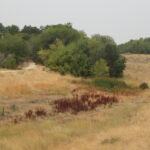
For one more habitat type, a short side trip to the right at the junction just past the sickle saltbush population will take you to the nearby drainage slough, with a shady grove of willows at the north end. You might some common evening-primrose (Oenothera biennis) still in bloom, and maybe some western goldenrod (Euthamia occidentalis). The sunny wetland has cattails (Typha latifolia), soft-stem bulrush (Schoenoplectus tabernaemontani, previously Scirpus validus), common spikerush (Eleocharis palustris). The self-guided walk description ends here, from which point you can head south back to Eagle Rock Park.
NOTE: Please enjoy the wildflowers and leave them for others to enjoy. Because our unique local flora is already under pressure from invasive weeds and habitat loss, harvesting of native plants is not encouraged on this website, especially along popular trails.
