Chief Eagle Eye Reserve

CHIEF EAGLE EYE RESERVE (Ige dai Teviwa) WILDFLOWER WALK
End of summer

Alkali flat and Eagle Rock

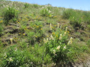
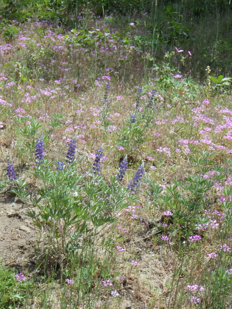
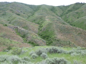
In addition to highlighting its significant Native American importance, a walk around Chief Eagle Eye Reserve (Ige dai Teviwa, previously Castle Rock Reserve) provides some geological and accompanying botanical diversity that is not represented on other wildflower walks.  Situated to the northwest of the primary trailhead for the Table Rock trail system, this area is the source of Boise’s geothermal system.  Although the relatively short loop described here can be a pleasant walk anytime of the year, the wildflower walk is described as an end-of-summer option, when some noteworthy fall-blooming species can be appreciated.  The loop is about 1½ miles long, with about 250 feet elevation gain.  Soils are heavy clay and should be avoided if at all muddy.  During your visit, be respectful of the sacred significance of the area to Native Americans.

CONTENTS:
Geology
Native American Significance
Self-guided Wildflower Walk

Netleaf hackberry (Celtis reticulata) at base of quarried face of Table Rock sandstone.

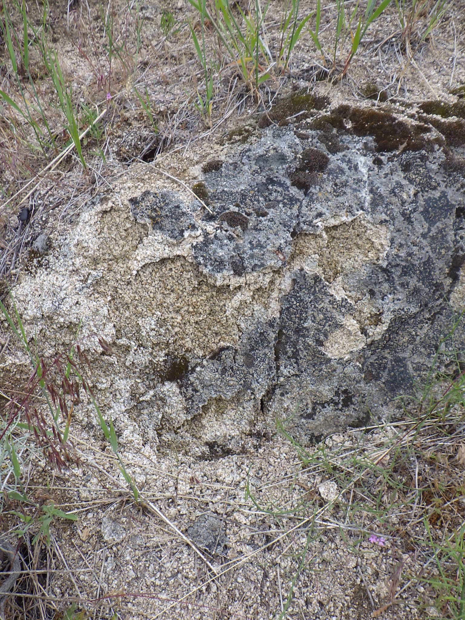
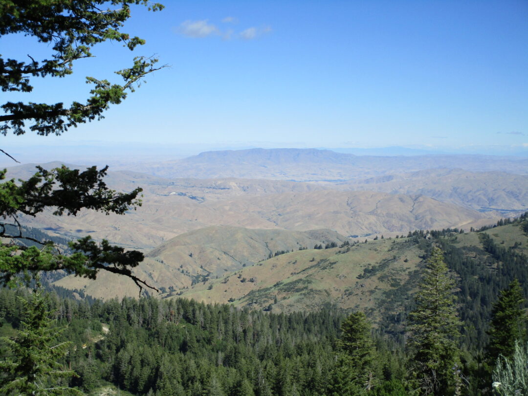
GEOLOGY:  The Table Rock area as a whole is downfaulted relative to the foothills to the north, exposing one of the more complete (700-foot) stratigraphic sections in the foothills.  The dominant geological feature of the local area is the 15-meter-thick layer of silicified sandstone that forms the cap of Table Rock, similar sandstone occurs in a band across the upper part of Chief Eagle Eye Reserve.  Silica-saturated geothermal waters seeping upwards along the area’s numerous faults, heated by the buried batholith deep underground, percolated through Lake Idaho sediments and cemented the grains together to form the current durable sandstone, which includes fossils of snails and petrified wood.  The stone has been quarried as “Boise Sandstone” for around 150 years, originally by prisoners at the adjacent Idaho State Penitentiary (now a historical site).  The quarried stone has been widely used, both locally (e.g., the Idaho State Capitol Building, constructed in 1920) and across the nation (e.g., Harkness Tower at Yale University).

Eagle Rock/Castle Rock

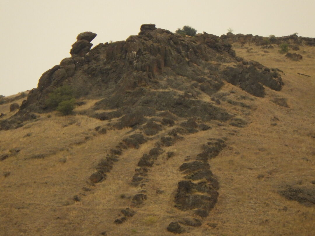
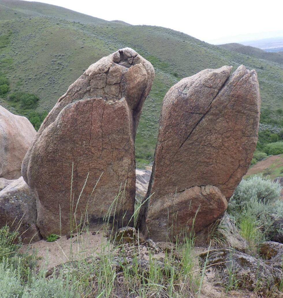
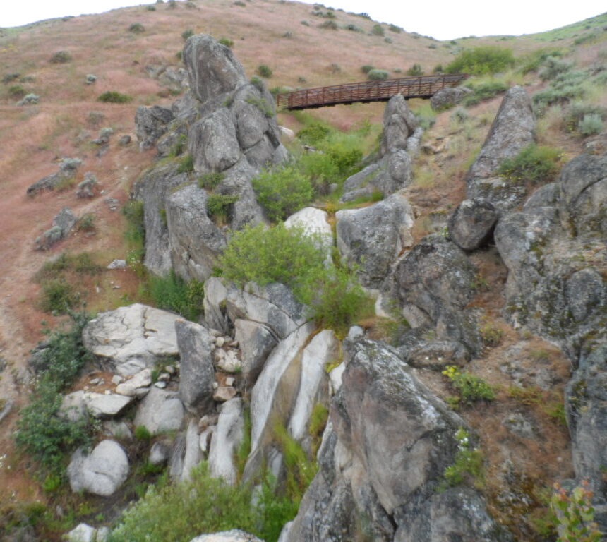
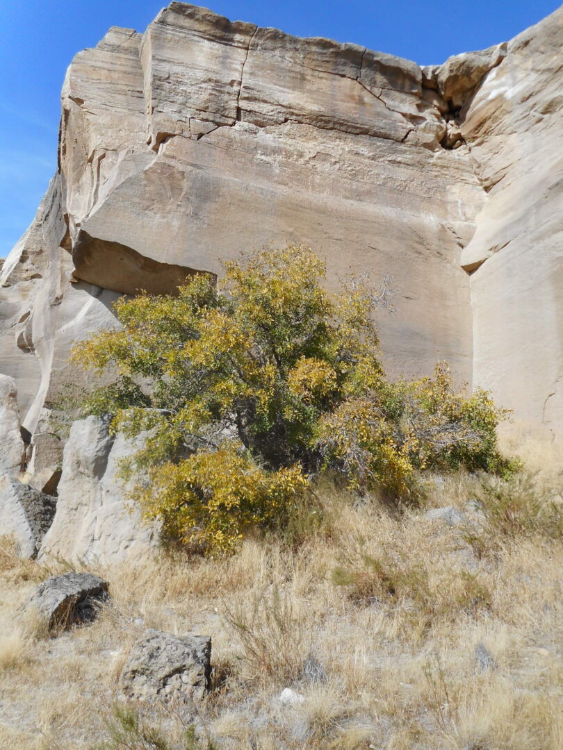
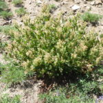
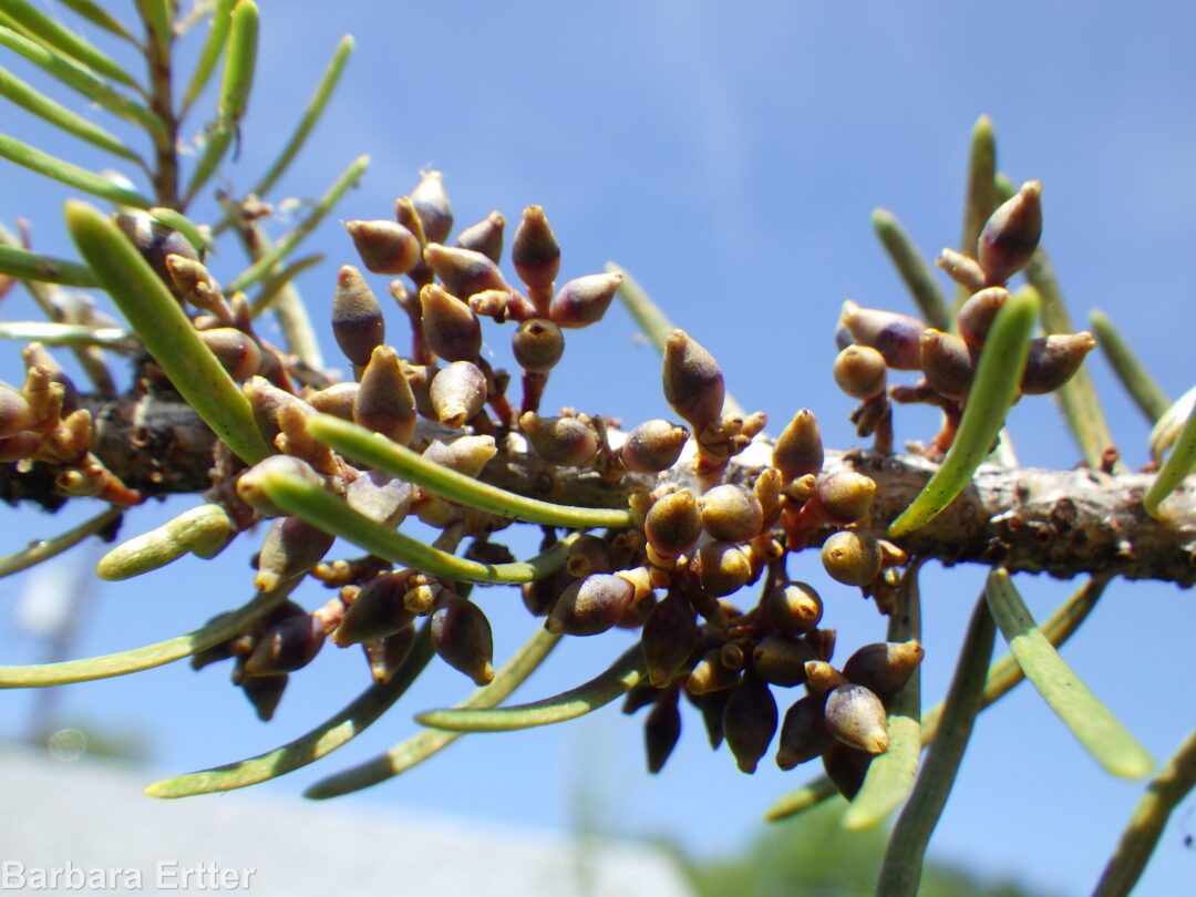
Chief Eagle Eye Reserve also is capped by a similar layer of silicified sandstone, above layers of claystone, hydrothermally altered basalt, and Idavada Group rhyolite, possibly indirectly connected with the formation of the Yellowstone hot spot.  This is in fact one of the few exposures of Miocene rhyolite and basalt in the Boise Front, extending to Rocky Canyon.  The rhyolite is the oldest rock locally, forming a layer at least 300 feet thick; a petrologically different rhyolite body underlies the ones that are exposed.  The conspicuous landmark on the Reserve is a rhyolite outcrop previously known as Castle Rock, recently renamed Eagle Rock to acknowledge its original Native American name.  Outlying populations of littleleaf brickellbush (Brickellia microphylla) can be found on the rhyolite, at the very edge of its geographic range.

The area is also the source of Boise’s well-known geothermal system, the nation’s oldest and largest geothermal district heating network.  Indigenous people and travelers on the Oregon Trail took advantage of the warm springs at the base of Table Rock.  In 1890 wells started being drilled to develop the 170° subterranean hot water as a commercial resource, first for the Natatorium, then grand homes along Warm Springs Avenue, and eventually many buildings downtown.  The water originates as rain and melting snow in the mountains to the north, which then percolates down along deep fracture zones to hot zones nearly a mile deep, possibly taking thousands of years before emerging naturally along other fracture zones.  In the Table Rock area, the warm springs are associated with fractures in the rhyolite, which is exposed on one side of a major fault and deeply buried on the other.

Remnant alkali flat

Prior to being diverted for geothermal development, the warm springs would have supported a unique wetland habitat, only hints of which currently remain.  In addition to the warmer temperatures, which would have ameliorated winter conditions, the hot springs emerging from deep underground were more alkaline and mineral-laden than surface run-off and shallow springs elsewhere in the batholith-dominated Boise Front.  As a result, the Reserve is one of the few sites on the north side of Boise where alkali flats and their associated species can be found, in contrast to the abundance of such habitats on the south side of the Snake River Plains and the typically alkaline soils of the Treasure Valley.  Examples of this remnant flora are highlighted in the wildflower walk description.

Wood, S.H., and Burnham, W.L., 1987, Geological framework of the Boise Warm Springs geothermal area, Idaho, in Buess, S.S., ed., Rocky Mountain Section of the Geological Society of America, Centennial Field Guide, v. 2, p. 117–122.

NATIVE AMERICAN SIGNIFICANCE:  Prior to the arrival of Euro-Americans, the Boise Valley was shared by several tribal nations, primarily the Shoshone, Bannock, and Northern Paiute.  They were sometimes collectively referred to by others as Snake Indians, providing the current name for the major river that flowed though their territory.  The three tribes traditionally spoke related Uto-Aztecan languages, followed a hunter-gatherer subsistence culture, practiced shamanistic vision quest spirituality, and generally maintained peaceable relations with one another.  Although the Bannock language is closer to Paiute than to Shoshone, Bannock culture had become increasingly merged with Shoshone culture; the two groups have accordingly become known as the Shoshone-Bannock nation, or “Sho-Ban” for short.  By the time Euro-Americans arrived in what would eventually be southern Idaho, the Shoshone-Bannock had already incorporated horses into their culture (probably via the Comanche, a related tribal nation), along with some of the more valor-oriented characteristics of the Plains horse-cultures, although bison rarely wandered as far west as the Boise Valley.

Detail from interpretive signage at Bonneville Point

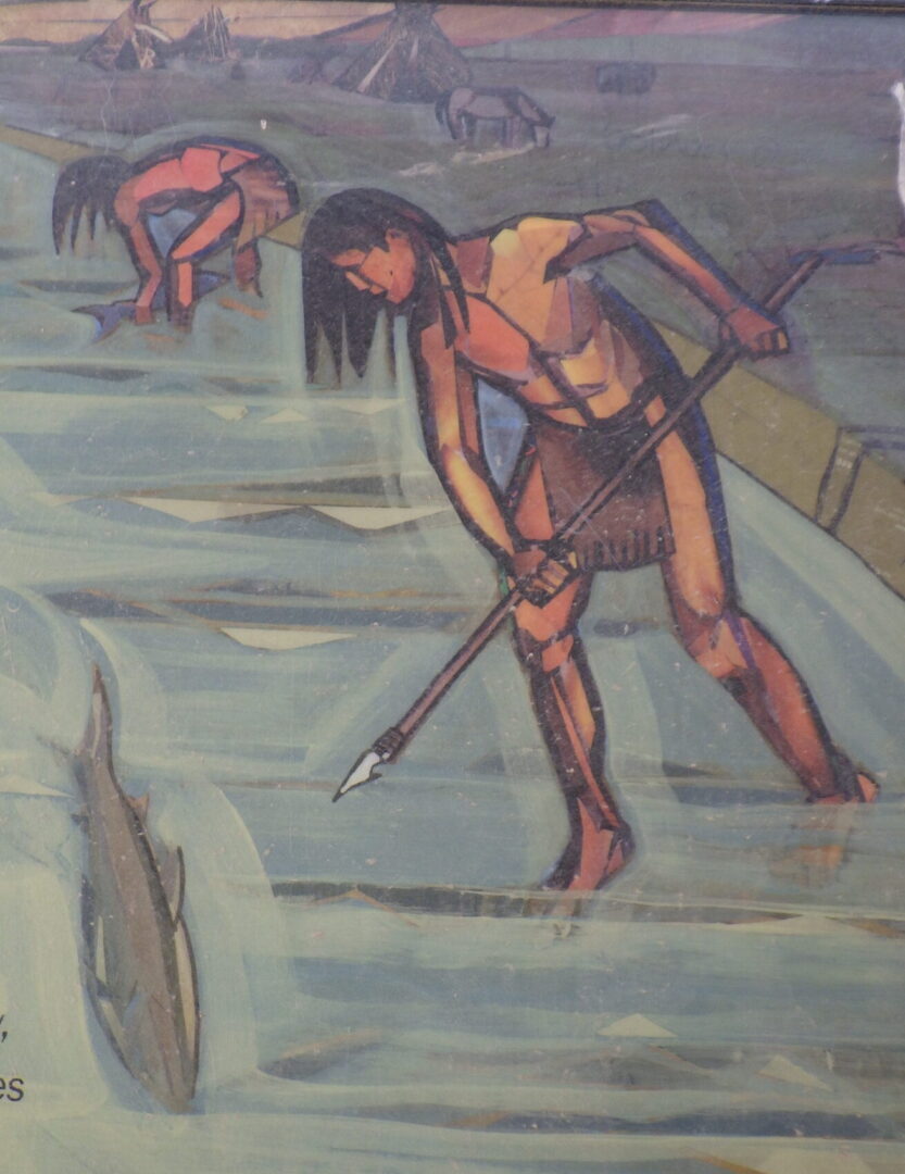
Regional environmental conditions favored a relatively mobile life style, with individual bands relocating around their territory throughout the year to take advantage of available foods and favorable temperatures.  The Shoshone-Bannock territories mostly encompassed higher-elevation valleys and mountains in central Idaho, while the Paiute culture was adapted more to the expansive sagebrush steppe and pinyon-juniper woodlands of the Great Basin.  At the end of summer, numerous groups would gather in the Boise Valley, coinciding with the abundant salmon runs that were also described by emigrants on the Oregon Trail.  Fur trapper Donald McKenzie described a gathering of 10,000 indigenous people in 1819, scattered along the Boise River for more than seven miles (in A. Ross, “Fur Hunters of the Far West”, 1855).  Then as now, relatively mild winter temperatures also made the area a popular site for over-wintering, with some bands remaining along the river throughout the summer as well.  It is likely that they tended, and possibly intentionally planted, culturally important plants near preferred dwelling sites.  The Table Rock-Eagle Rock area and associated warm springs were, and remain, a particularly significant sacred area for the displaced tribal people, important for healing and spiritual purposes.  The hot springs once fed into bathing ponds that were ascribed with medicinal properties, frequented not only by the resident tribes but also by travelers from other tribes.  The surrounding slopes were used as a major burial site, and the area remains a gathering site where the spirits of the ancestors can be honored.

The discovery of gold in the Boise Basin and Owyhee Mountains in 1862 quickly led to both an influx of Euro-Americans and the establishment of Fort Boise at the mouth of Rocky Canyon (differing from an earlier Fort Boise at the mouth of the Boise River near Parma), near a primary road to the Boise Basin.  With this military backing, the inevitable conflict between the original inhabitants and the encroaching miners and settlers gave rise to the Treaty of Fort Boise in 1864, in which the Shoshone-Bannock were forced to cede their territory in the Boise River drainage in exchange for treatment as a “most favored nation” and support from the United States.  The treaty was never ratified by the U.S. Senate, and the provision of “most favored nation” was certainly never realized; vigilantes nevertheless began to persecute and evict Native Americans even before a reservation was established.  This ugly period in Boise’s history was later depicted in a controversial WPA mural in the old Ada County Courthouse, which includes the lynching of a Native American.

The official responsibility for enforcing this and comparable treaties fell to the military posted at Fort Boise and other outposts throughout the West, which found themselves in the unenviable position of fulfilling the demands of Euro-American settlers while still providing some measure of protection for the Native Americans in their charge.  Regrettably, many of the soldiers were battle-hardened recent veterans of the American civil war, who readily adapted to the brutal pursuit of resisting groups.  Surrender meant custody under marginal conditions in encampments, including on the outskirts of the booming new settlement of Boise City, where for several years hundreds of tribal members tried to eke out a living while ravaged by hunger, exposure, and disease.  Conditions were such that David W. Ballard, Idaho’s territorial governor at that time, pleaded with the Commissioner of Indian Affairs in Washington for a more equitable resolution:  “The Indians of southern Idaho are fast fading away, and as we occupy their root grounds, converting them into fields and pastures, we must either protect them or leave them to the destroying elements now surrounding them.”  In 1869, after suffering in the encampments for five years, most of the Shoshone-Bannock survivors near Boise were marched to the newly established Fort Hall Reservation in eastern Idaho, while the Shoshone-Paiutes primarily ended up in Duck Valley Reservation on the Nevada border.  Members of extended families were often separated, with some scattered among reservations in Oregon and Washington, including the short-lived Malheur Indian Reservation (succeeded by the Burns Paiute Reservation) and the Warm Springs Reservation.

Common camas
Common camas (Camassia quamash)

Conditions on the reservations were at first only marginally better than the encampments, with provisions promised by the treaties in short supply.  Faced with famine conditions in 1878, tribal members from the Fort Hall Reservation attempted to assert their right to the camas (Camassia quamash) fields of Camas Prairie in present-day Camas and Gooding counties.  Continued access to this critical food source was supposed to be in the treaty, but “Camas Prairie” had been mistakenly entered as “Kansas Prairie” on the paperwork, so when the starving Native Americans arrived they found that Euro-American settlers had already staked claim to the area and turned their cattle and hogs loose in the camas fields.  In desperation, about 200 Bannock and Paiute warriors decided to go to war, with the resulting conflict now referred to as the Bannock War of 1878.  The last armed conflict between Native Americans and Euro-Americans in Idaho, called the Sheepeater War, took place the following year; it ended in the confinement of the Sheepeater band of central Idaho Shoshone to Fort Hall Reservation.

Wing-fruited or white mariposa lily (Calochortus eurycarpus)

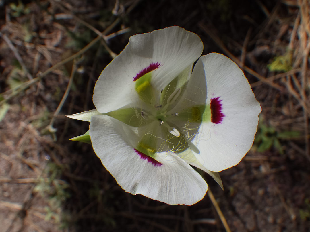
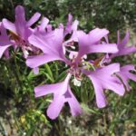
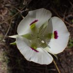
Only a decade after Fort Hall Reservation was theoretically set aside for Native Americans, it unfortunately turned out to be the optimum location for an expanding railroad network.  Rapid encroachment by Euro-American squatters and a new treaty pushed through by the powerful Union Pacific Railroad lobby resulted in the entire southern half of the original reservation being opened up to a land rush in 1902, setting the stage for present-day Pocatello (ironically named for a Shoshone chief).  As one short-lived compensation for a railroad right-of-way across the Fort Hall reservation, tribal members were allowed free travel on trains.  Mary Hallock Foote used this as a plot element in her 1894 novella “The Trumpeter” (in Cup of Trembling and Other Stories).  Even though fictionalized, the story captures the continued presence of occasional Native Americans in the Boise area during this period, as well as the unflattering attitudes of Euro-American Boiseans towards them.   Foote used various wildflowers metaphorically to represent the “wild” nature of the story’s mixed heritage protagonist Meta: “They called her amongst themselves, by the name they give to the mariposa lily [Calochortus sp.], the closed bud of which is pure white as the whitest garden lily; but as each Psyche-wing petal opens it is mooned at the base with a dark purplish stain which marks the flower with a startling beauty, yet to some eyes seems to mar it as well.  With every new bud the immaculate promise is renewed; but the leopard cannot change his spots nor the wild hill lily her natal stain.”

Confinement to reservations was only one more chapter in an unfolding story, with the fundamental challenge being that of finding a path forward that allows Native Americans to pursue realistic economic opportunities while still maintaining their cultural identity and dignity in a world significantly changed from that of their ancestors.  Among the steps along this path was the 1924 acquisition of United States citizenship for all Native Americans born in the United States, followed a generation later by the right to vote in Idaho (HJR 2, in 1950).  This effectively resulted in dual citizenship for tribal members, since the original sovereignty of tribal nations as recognized in the U.S. Constitution is still in effect.  This sovereignty provided the foundation for a major improvement toward economic self-sufficiency with the 1987 Supreme Court affirmation of tribal rights to gambling, which led to the development of casinos on many reservations, including Fort Hall.  The reservations continue to be home to most descendants of the displaced tribal members, but others have taken on the challenge of making their livelihood off the reservation, with many now living in the Boise Valley.

A new chapter began locally in 1990, when a proposal for a new housing development that would have impacted the Eagle Rock burial sites triggered a joint campaign by the East End Neighborhood Association and Native American tribal members at the Fort Hall and Duck Valley reservations.  The campaign was successful, and the land was purchased from the developer by EENA, the Shoshone-Bannock tribes, and the City of Boise.  The area was initially named Castle Rock Reserve, and 3,000 native plants were reintroduced to the site to signify healing.  In 2019, the Reserve and adjacent Quarry View Park were renamed Chief Eagle Eye Reserve ( (Ige dai Teviwa) and Eagle Rock Park (Pava Kwiina’a Tiipe), honoring the area’s indigenous people.  Chief Eagle Eye was the leader of 70 Weiser Shoshone who refused to to relocate to the reservation; he is buried at the top of Timber Butte north of Emmett, a significant regional source of much of the obsidian used to make arrowheads and other weapons.  The trails have also been renamed to acknowledge the tribal nations whose traditional territory this area represents.

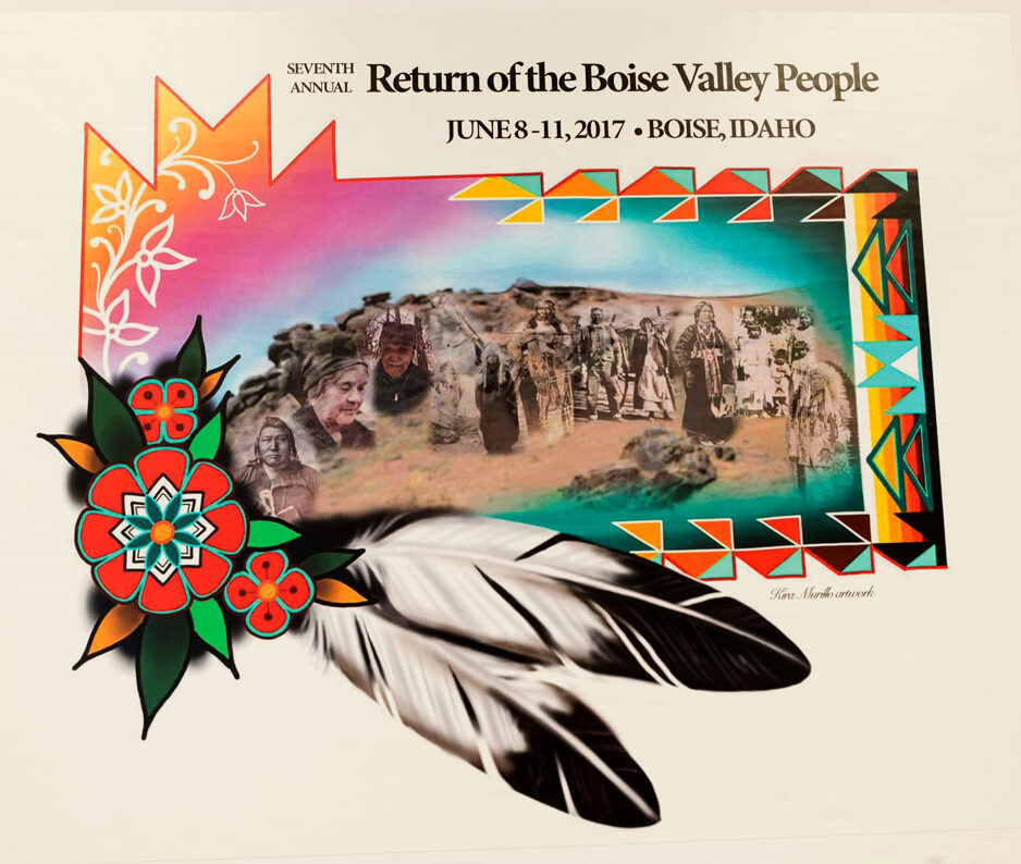
The successful defense against further development of this culturally significant site also set the stage for Return of the Boise Valley People, an annual unity gathering for descendants of the tribal diaspora.  The gathering, which takes place in June at Eagle Rock Park and additional venues as needed, provides an opportunity for sharing culture, oral histories, and food, as well as healing and reconciliation.  In 2017, Boise mayor David Bieter proclaimed 8 June 2017 to be Return of the Boise Valley People Day.  A priority goal is the establishment of a long-overdue cultural center, with the dual purpose of ensuring cultural continuity with younger generations, and to share their history and continued presence with other inhabitants of the Boise Valley.  Still Indigenous.  Still Here.

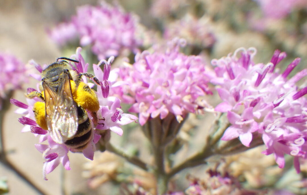
When you visit Chief Eagle Eye Reserve, treat it with the same respect that would be proper if you were visiting a cathedral, temple, mosque, or shrine.  “Listen closely and you may hear a faint whisper on the breeze saying . . . tread gently for you are on sacred ground.”  Going beyond the opportunity to acknowledge other humans who have been here before you, use your visit to expand your connection with all species who share this planet with us.  “[I was] taught how to introduce myself to a natural place: a spring, a hillside full of wildflowers. Just sitting there with buzzing pollinators, watching the hummingbirds come up in the meadow in the morning sun. Being taught that every unique species is a different spirit that has a right to be acknowledged, that has its own life history requirements, what it needs to live. Learning that you have a responsibility to understand that, to know it, to reaffirm your responsibility for that, and to care for that as a human being.”  [from Sacred Pollinators, an interview with research ecologist Frank. K. Lake, Flora 4(1); 16]

Some references for cultural history:

Chief Eagle Eye Reserve History. City of Boise.  https://www.cityofboise.org/departments/parks-and-recreation/parks/chief-eagle-eye-reserve/chief-eagle-eye-reserve-history/

Shoshone-Bannock Tribes.  http://www2.sbtribes.com/about/#

Derig, B.  1996.  Roadside History of Idaho.  Mountain Press Publishing Company, Missoula, Montana.

MacGregor, C. L.  2006.  Boise, Idaho, 1882-1910: Prosperity in Isolation.  Mountain Press Publishing Company, Missoula, Montana.

Walker, D. E. 1978.  Indians of Idaho.  University of Idaho Press, Moscow, Idaho.


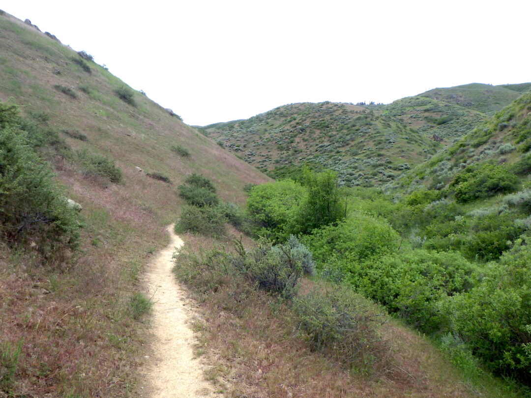
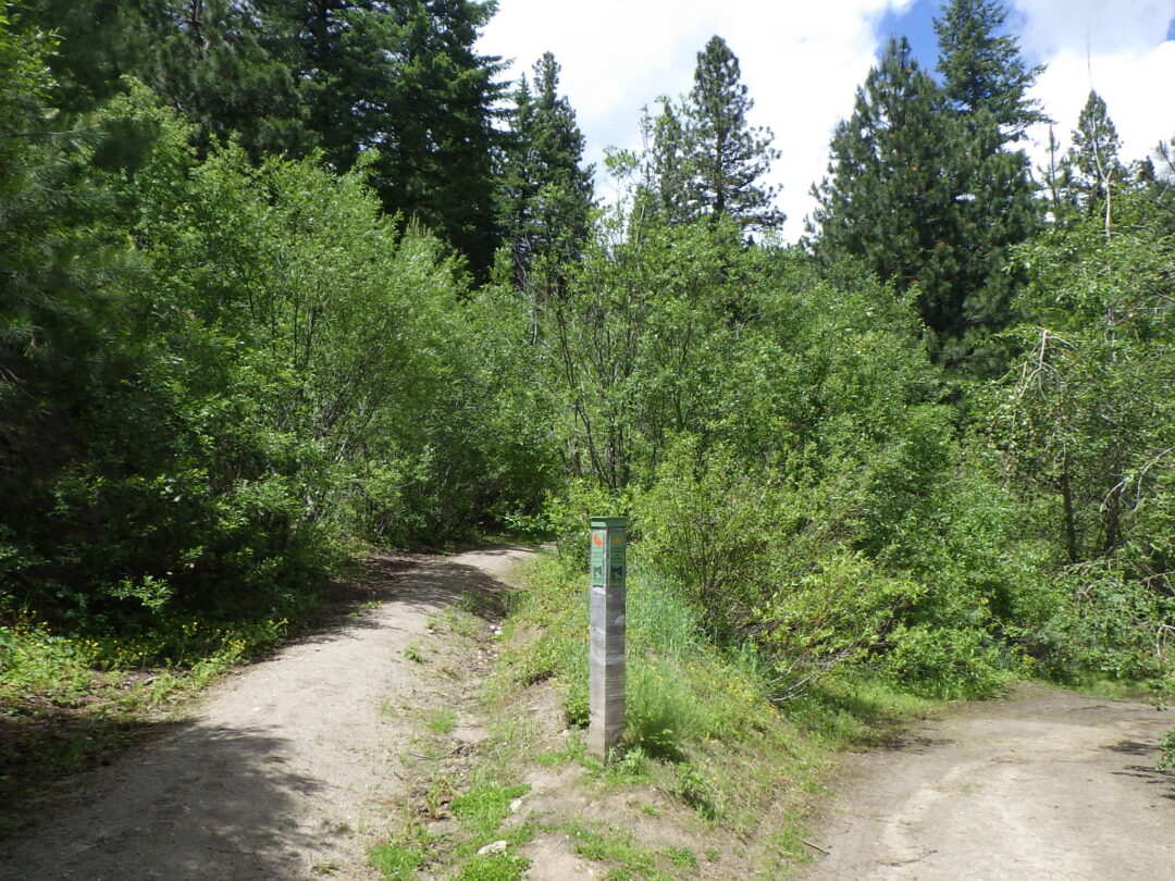
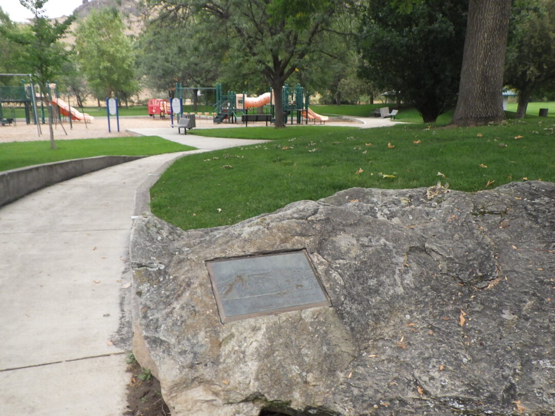
SELF-GUIDED WILDFLOWER WALK:  The relatively short  loop (about 1½ miles) has several access points, with the most parking available at the main trailhead for the popular hike to Table Rock.  However, the walk as described here begins at Eagle Rock Park (Pava Kwiina’a Tiipe, previously Quarry View Park), north of Old Penitentiary Road.  Look for a couple of sandstone boulders in the park with plaques that provide additional geological information, as well as shells and fossil wood.  Access to Chief Eagle Eye Reserve ( (Ige dai Teviwa, previously Castle Rock Reserve) is at the northwest (left) corner of the park.

Eagle Rock from SW corner of reserve.

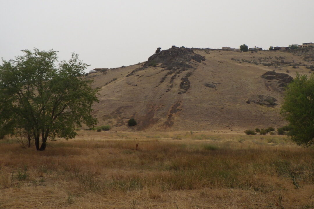
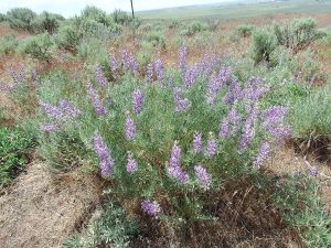
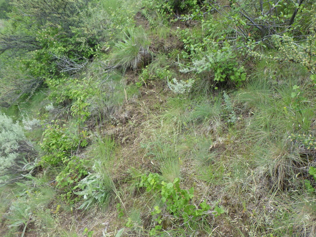
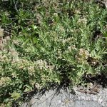
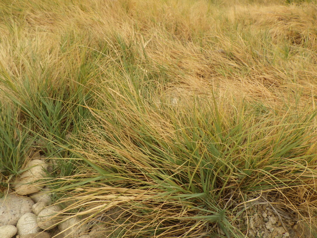
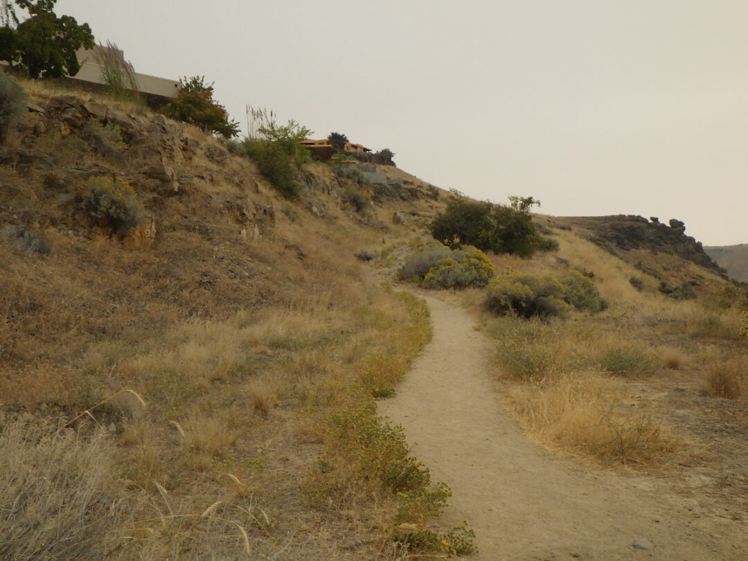
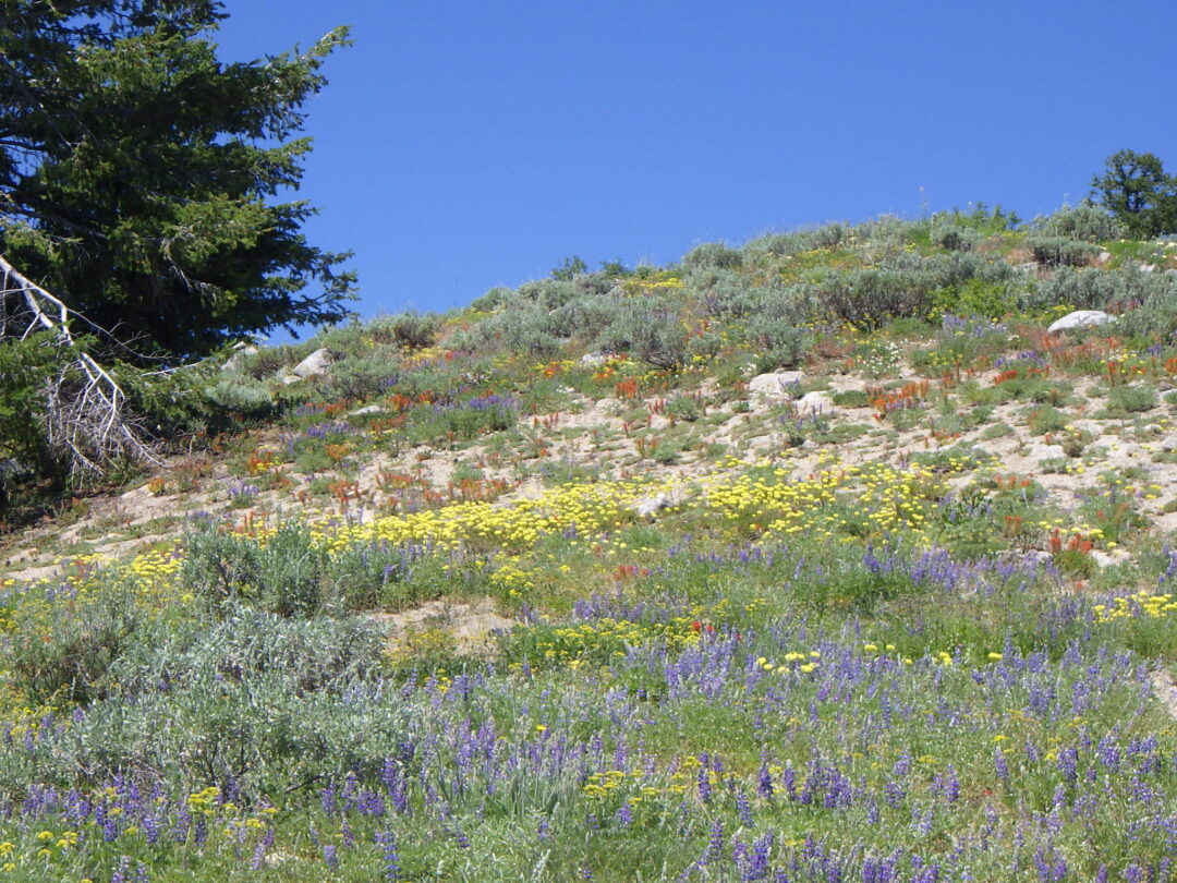
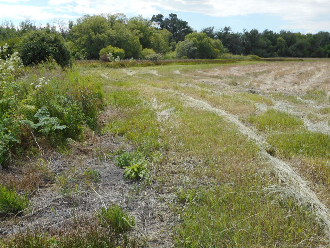
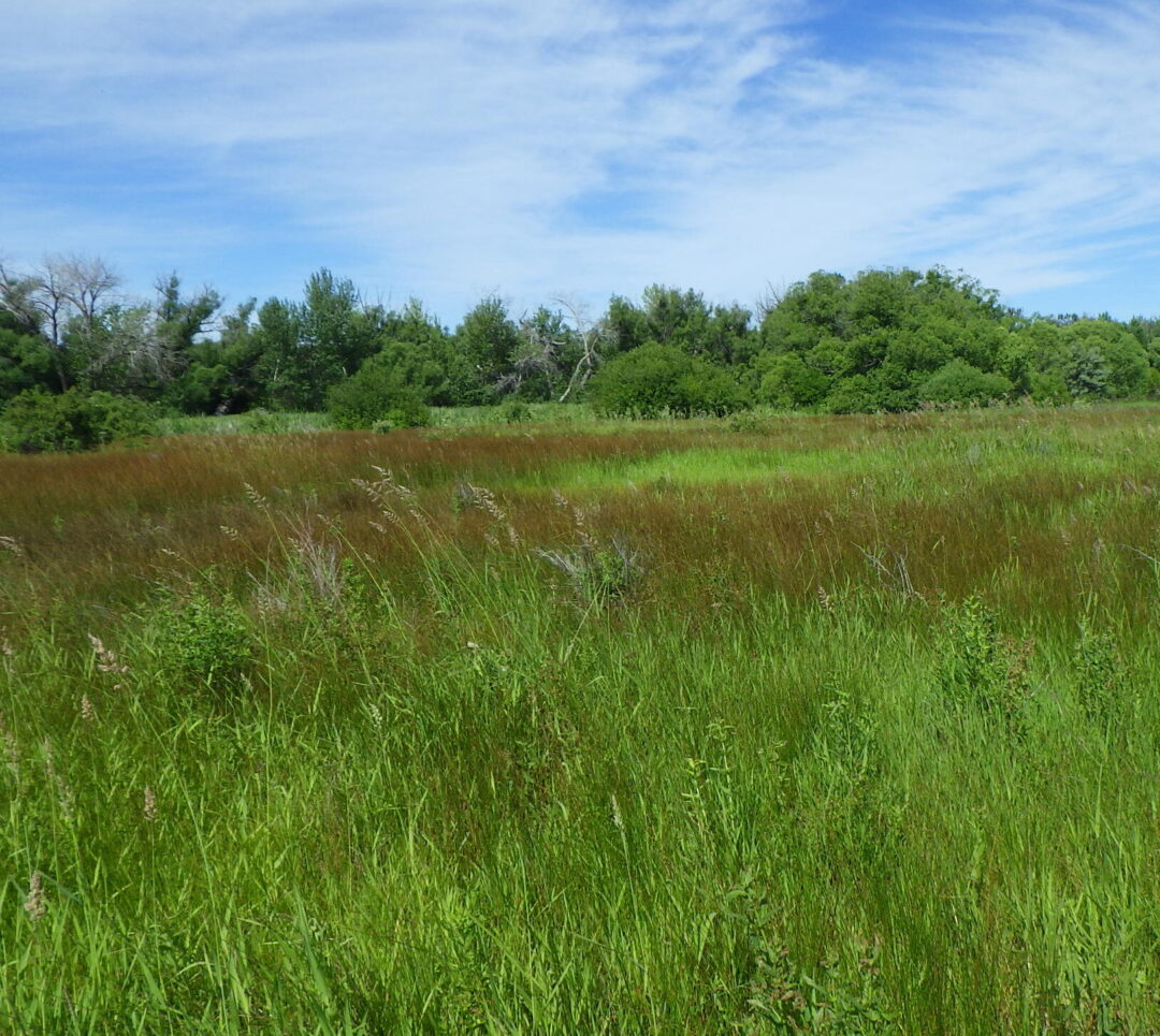
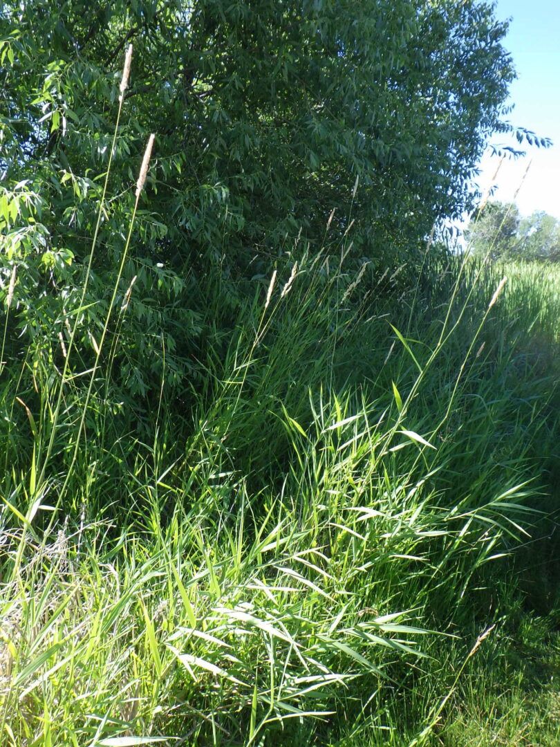
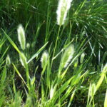
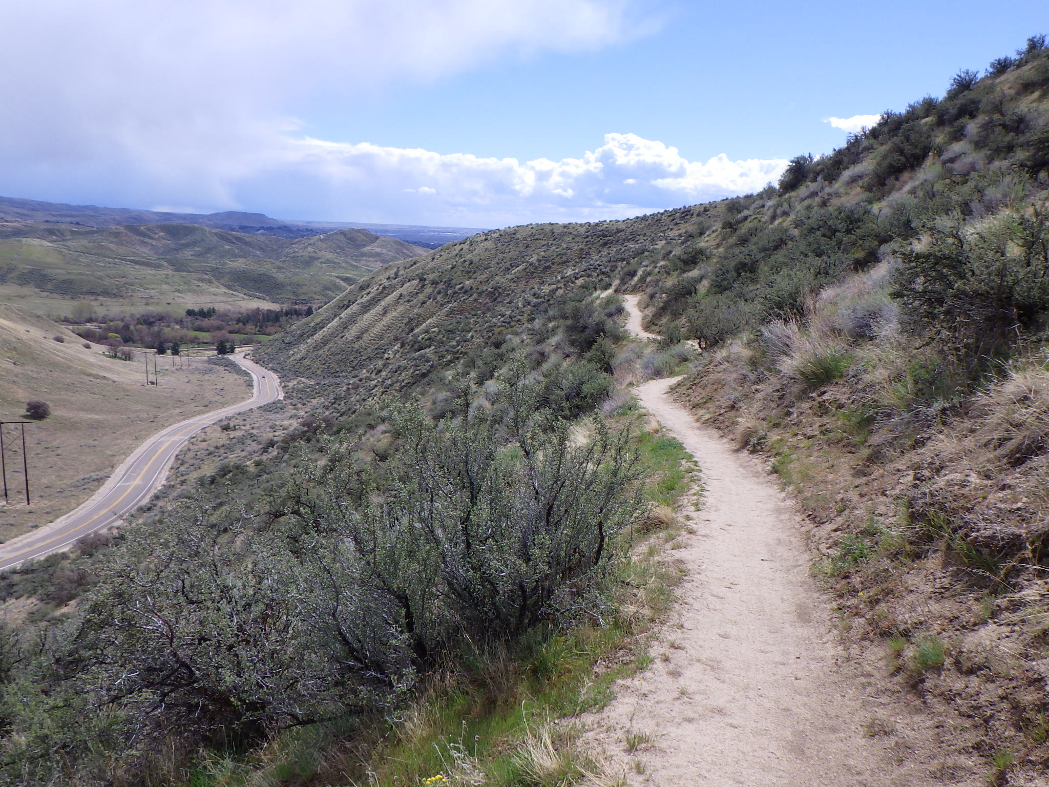
The southwest corner of the reserve is a weedy meadow dominated by non-native grasses, mostly quackgrass (Elymus repens, previously in Agropyron), with scattered Siberian elm (Ulmus pumila) and Russian-olive (Elaeagnus angustifolia).  Fall-blooming curly-cup gumweed (Grindelia squarrosa) is common along the path, here and throughout the foothills.  The prominent outcrop on the hillside to your right is Eagle Rock, also known as Castle Rock.  At the junction in a patch of sandbar willow (Salix exigua), turn right onto the Shoshone-Bannock Tribes Trail (#19A).

Alkali scald.

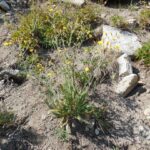
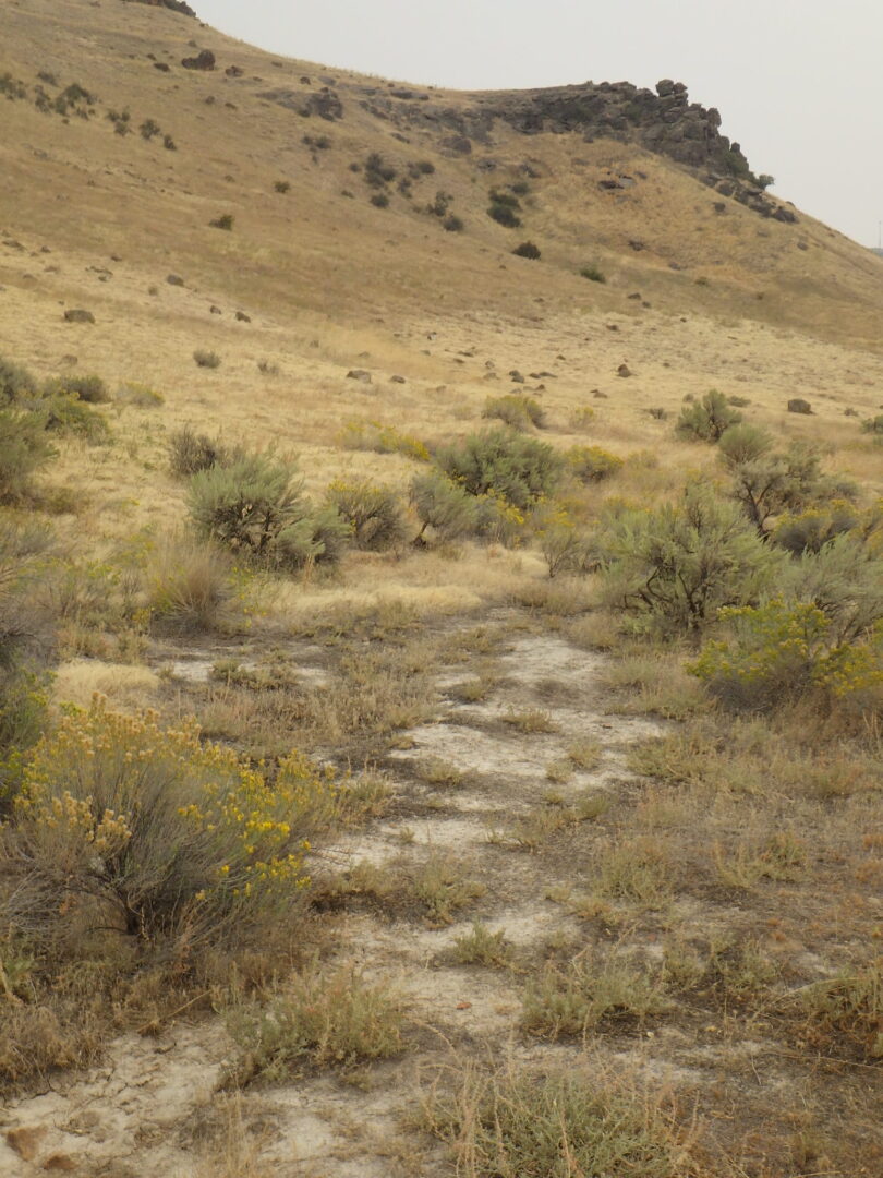
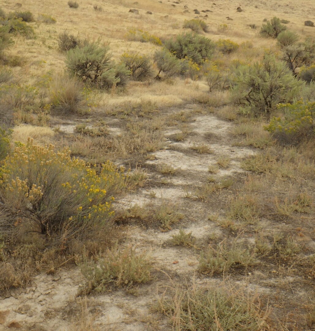
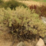
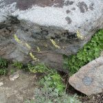
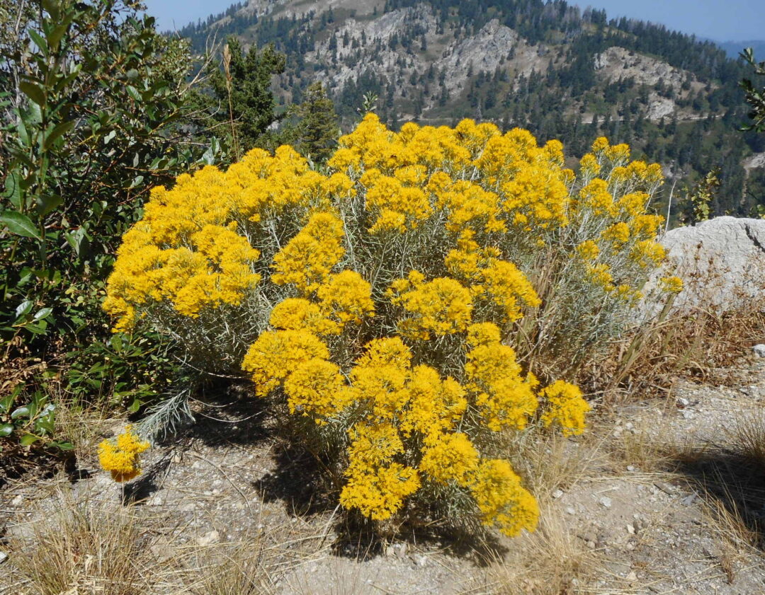
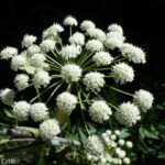
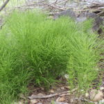
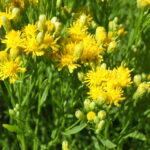
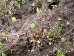
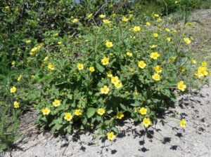
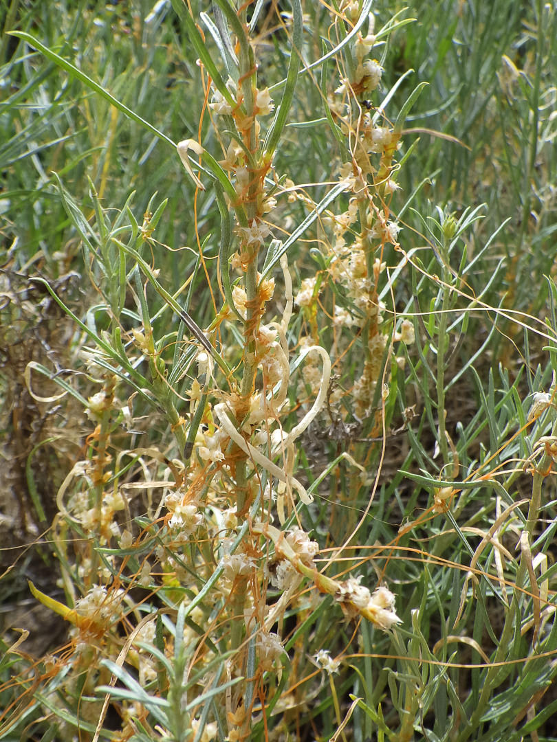
The first habitat of interest is a barren-looking alkali scald (also called slickspot or playa), indicative of the former hot springs.  Around the edges is the smaller, clay-loving variety of rubber rabbitbrush (Ericameria nauseosa var. oreophila, previously in Chrysothamnus), whose yellow flowers are an important food source for pollinators in the fall.  The alkaline nature of the local soils is also indicated by the abundance of non-native kochia or burningbush (Bassia scoparia, previously in Kochia).

Wetland at Chief Eagle Eye Reserve

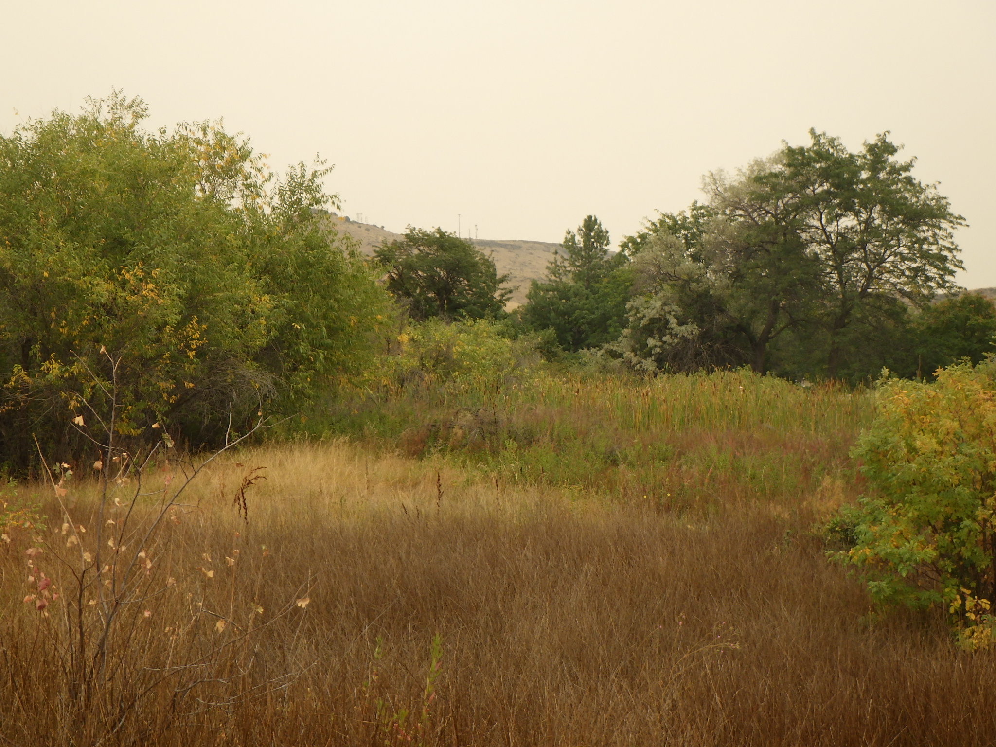
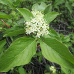
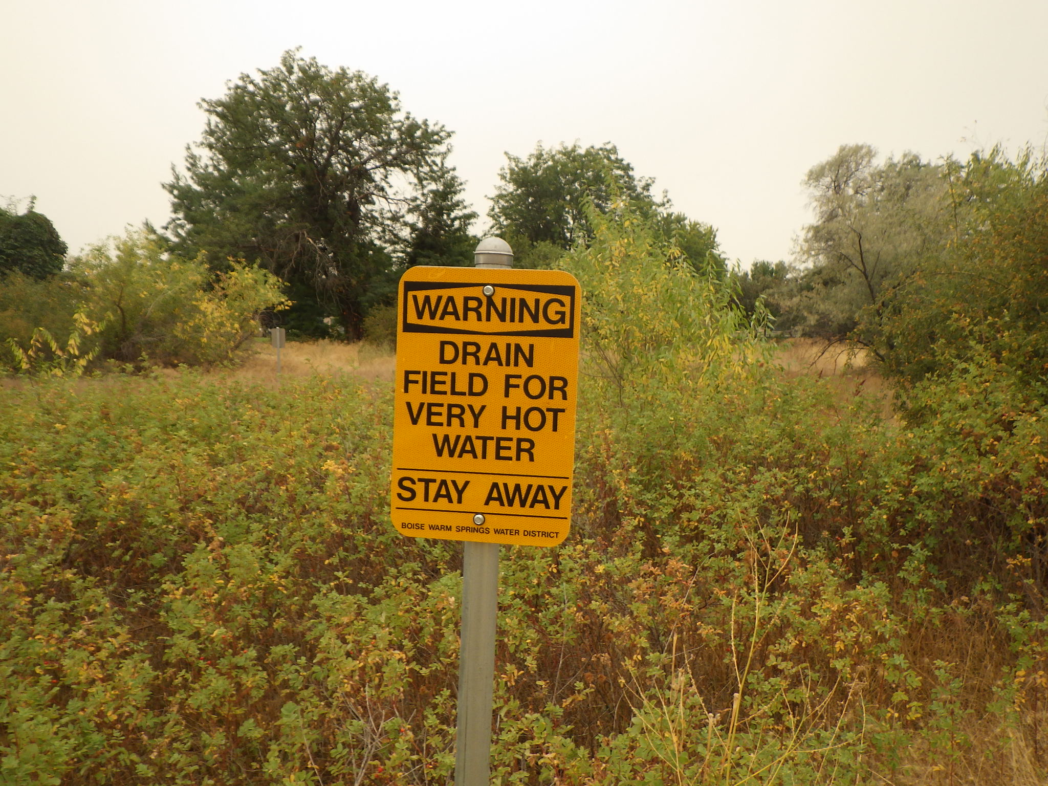
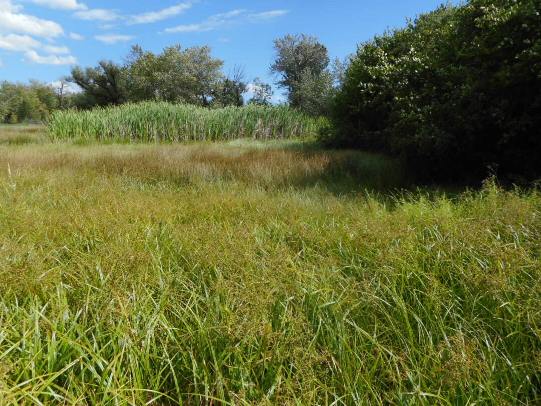
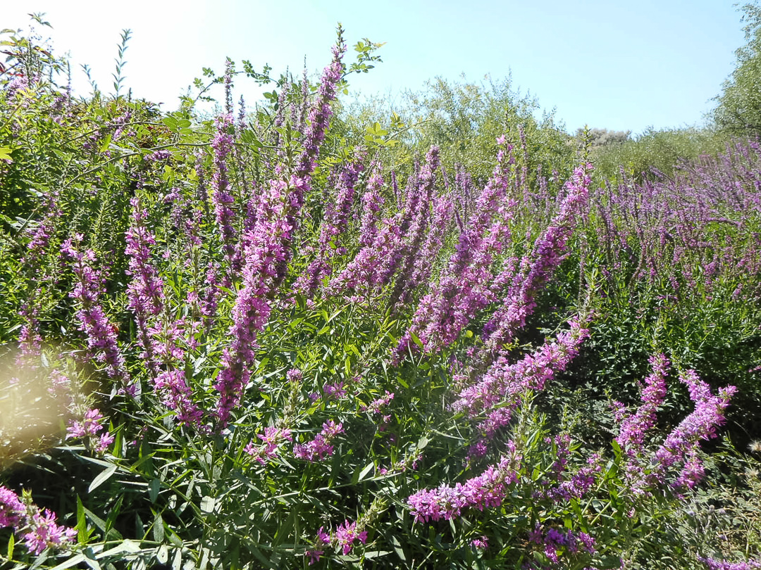
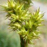
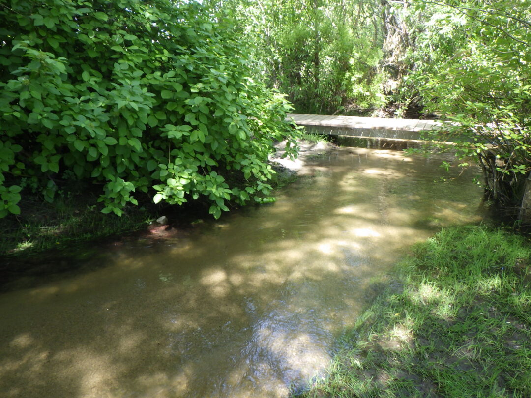
Overflow from the geothermal well has maintained a willow-lined wetland on the south (right) side of the path, paralleling the boundary with Eagle Rock Park.  Signs warn against entering the wetland, since the unpredictable release of scalding water can cause serious harm, especially to unwary dogs.  With proper caution, following one of several unofficial paths to the edge of the wetland might allow you to spot several late-blooming “comps” (i.e., members of the Asteraceae/Compositae family), including one or two species of aster (Symphyotrichum spp.) and one of the only local populations of giant goldenrod (Solidago gigantea), whose glabrous stems help distinguish it from the more common rough goldenrod (Solidago lepida).  The central marsh area is dominated by common spikerush (Eleocharis palustris) and Baltic rush (Juncus balticus); cattails (Typha latifolia), common willow-herb (Epilobium ciliatum), western goldenrod (Euthamia occidentalis), invasive purple loosestrife (Lythrum salicaria), and Torrey’s rush (Juncus torreyi) are also present.

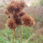
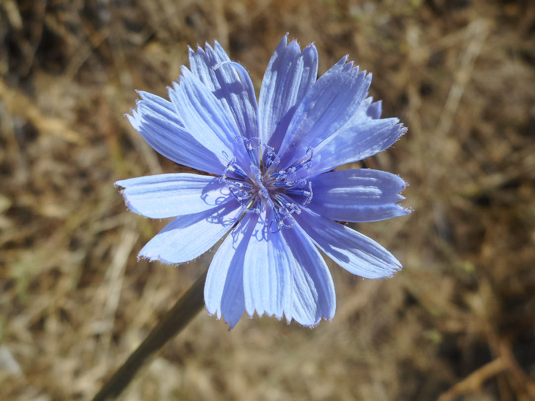
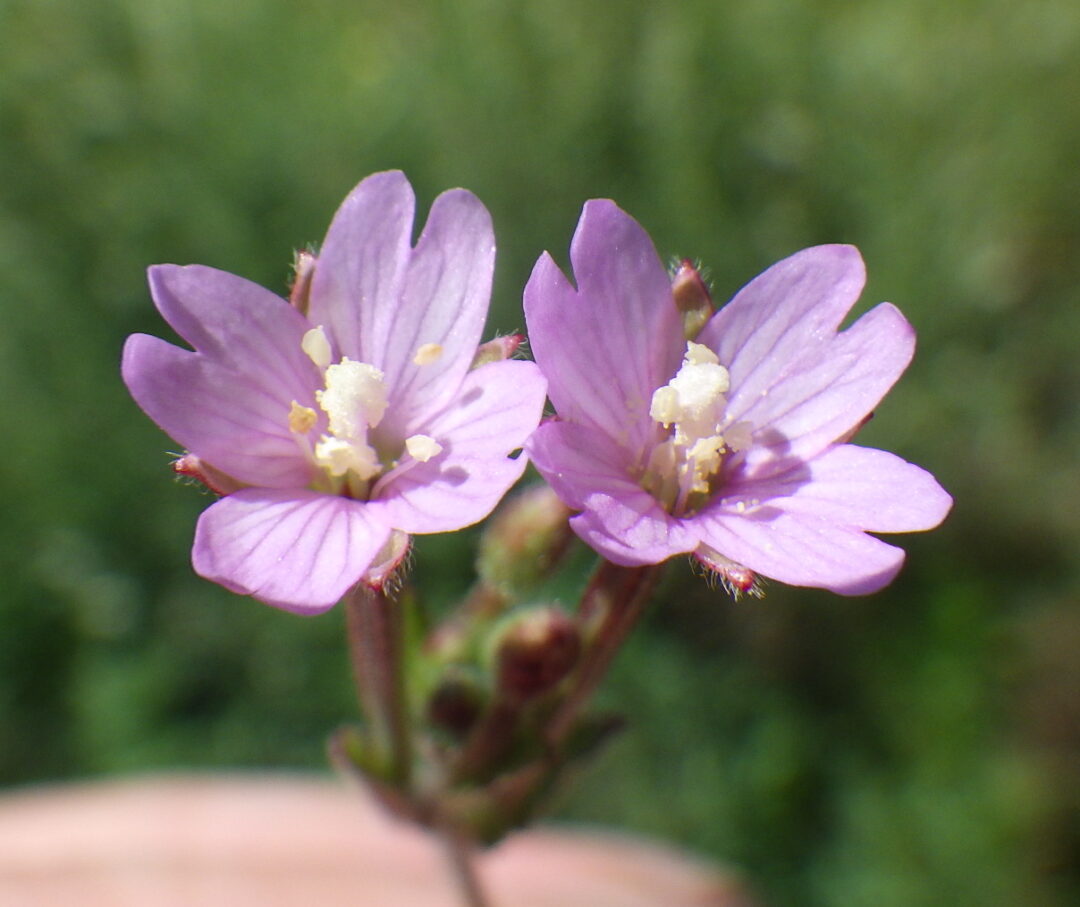
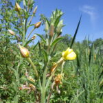
Whether you choose to return to the main path or continue along the informal trails that parallel the wetland, take note of povertyweed (Iva axillaris), an odd-looking native in the sunflower flower.  Be sure also to enjoy the diversity in flower size and color in annual willowherb (Epilobium brachycarpum), abundant throughout the reserve.  In addition, you might spot a few sunflower (Helianthus annuus) still in bloom, along with such non-natives as chicory (Cichorium intybus), alfalfa (Medicago sativa), two-scale orache (Atriplex heterosperma), and invasive rush skeletonweed (Chondrilla juncea).  The conspicuous reddish-brown spikes of curly dock (Rumex crispus) contribute a nice touch of fall coloration.  A lone greasewood (Sarcobatus vermiculatus), perched atop a rubble pile, may be the last representative of a shrub that was probably once common on the local alkali flats but which is now rare anywhere in the Boise Front.

Unusual form of Rosa woodsii behind warning sign.

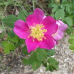
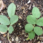
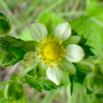
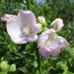
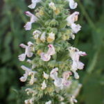
Variation in the native Rosa woodsii is on display in this wetland as well.  In addition to typical intermountain rose (R. woodsii ssp. ultramontana), which is the common form in this part of Idaho, there are some plants (such as the one behind the warning sign) that differ in having solitary flowers, somewhat blunter leaflets, and abundant glands on the foliage.  Trying to make sense of variation in wild roses is exceptionally challenging, due in part to their morphological plasticity and propensity for hybridization, so it remains to be determined what significance this particular variant represents.

Tree-of-heaven (Ailanthus altissima)

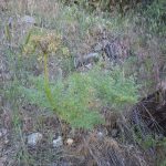
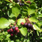
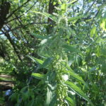
Back on the main trail, you will encounter the first of several stands of tree-of-heaven (Ailanthus altissima), a fast-growing, grove-forming, pinnate-leaved tree that can be invasive.  Because of its medicinal and cultural significance, tree-of-heaven was often planted by Chinese immigrants trying to make a better life for themselves and their families in gold-rush California (gam saan, “Gold Mountain”) and elsewhere in the West.  Although little physical evidence now remains, the Chinese community was prominent in Boise’s early history, declining in the face of increasing discrimination and outright persecution that included the 1882 Chinese Exclusion Act on the national level.   At least in California, old groves of tree-of-heaven are often indicators of former Chinese settlements; it is tempting to speculate that the tree-of-heaven groves locally also indicate that there was once a Chinese settlement here, perhaps using the warm springs to water precursors of the Chinese gardens that gave Garden City its name, along with Chinden Boulevard.

Inland saltgrass (Distichlis spicata)

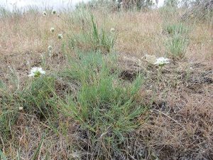
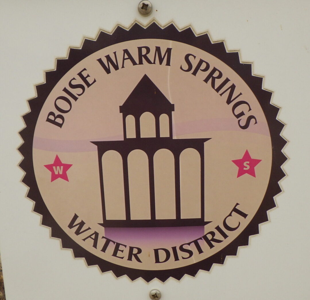
When the trail intersects the access road to the Warm Springs Water District pumphouse, a short detour to the right takes you to a nice patch of interior saltgrass (Distichlis spicata) where the road crosses the drainage.  This alkali-tolerant grass is another survivor from the original warm springs wetlands, earning its common name by excreting crystals of salt on its leaves.  The species has been investigated as an easy- or no-care turfgrass alternative, especially for slightly alkaline soils (like much of the Treasure Valley), since it can form dense stands that remain less than a foot tall.  A good example has been thriving for years in the sidewalk strip along 16th Street between Bannock and Idaho streets in Boise, in spite of neglect and abuse.  One drawback is that the grass doesn’t stay green as long as desirable, especially with no supplemental watering.

Trail to Eagle Rock

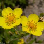
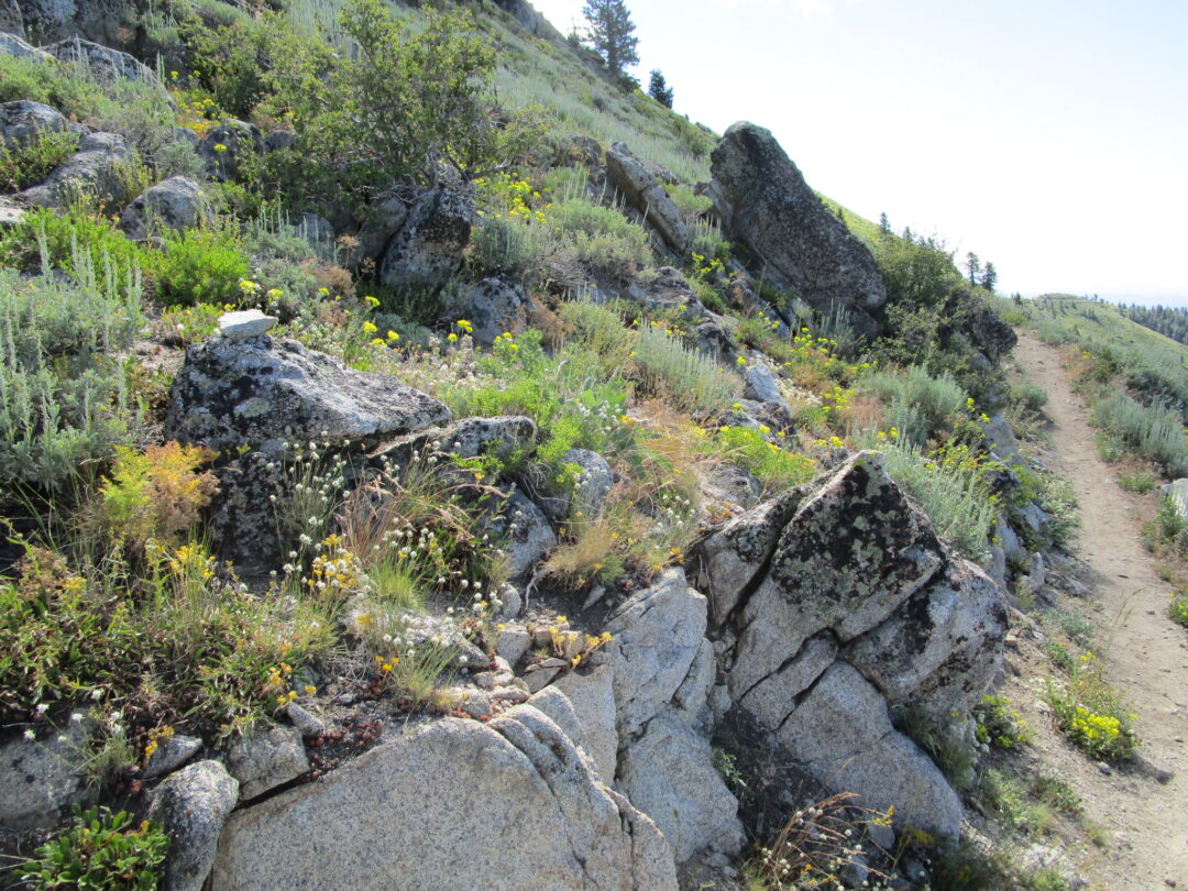
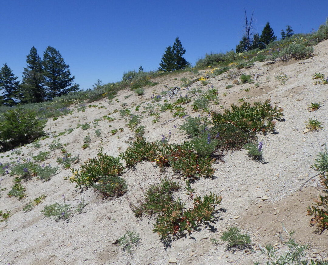
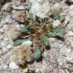
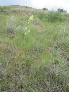
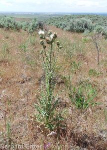
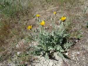
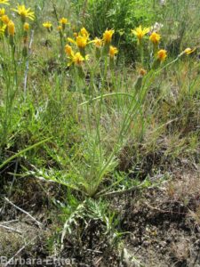
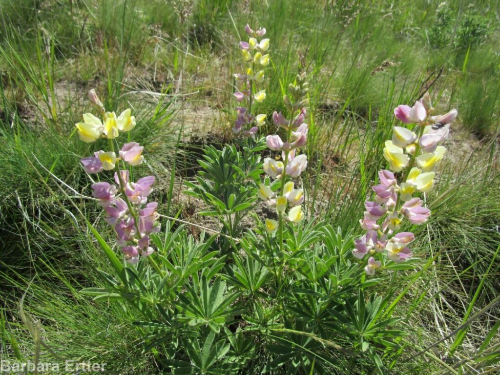
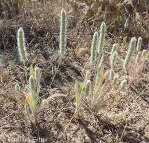
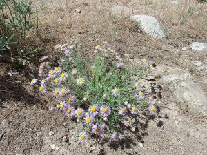
To continue the loop, follow the main trail as it curves left behind the pumphouse, continue straight on the Shoshone-Paiute Tribes Loop (#19), and then take two lefts to follow the trail as it angles up the hillside towards Eagle Rock.  Note how the soil is heavy clay, deeply cracked when dried, in contrast to the sandier soils more common in the foothills.  This is because the parent rock is claystone, basalt, and rhyolite, rather than granite, as mentioned under Geology.  The slope is dominated by weeds, in particular the invasive (and highly flammable) annual grasses medusahead (Taeniatherum caput-medusae, previously in Elymus), which flourishes on clay soils, and feral rye (Secale cereale).  Some bitterbrush (Purshia tridentata) and a few late-season natives manage to persist, including curlycup gumweed (Grindelia squarrosa), sunflower (Helianthus annuus), hoary aster (Dieteria canescens, previously in Machaeranthera), and an abundance of annual willowherb (Epilobium brachycarpum); you might also spot some pods of showy milkweed (Asclepias speciosa).  What you will not see at this time of year is Andrus’s biscuitroot (Lomatium andrusianum), a recently recognized species that is abundant along this trail in spring.

Littleleaf brickellbush (Brickellia microphylla)

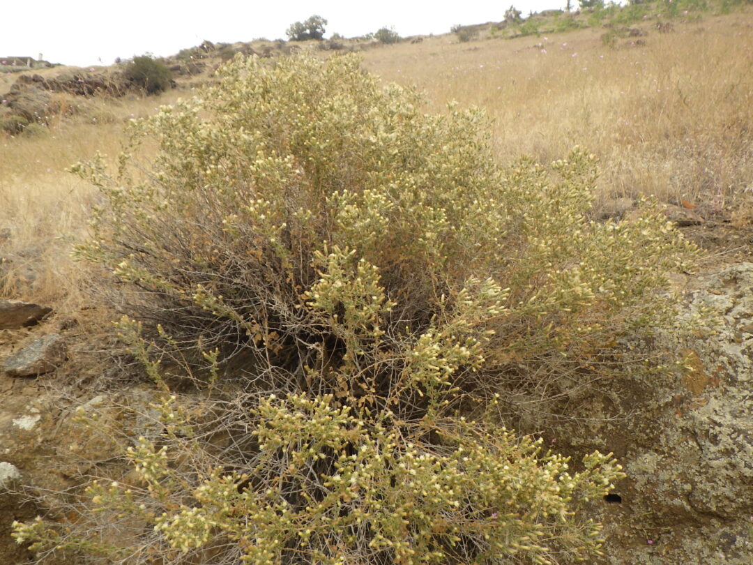
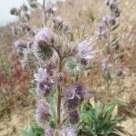
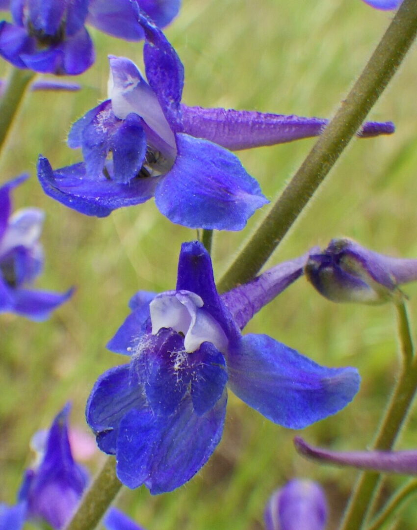
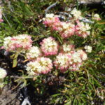
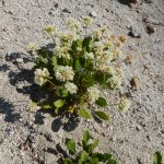
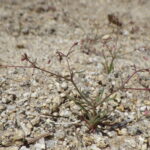
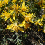
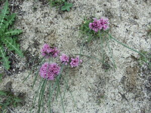
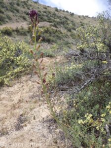
The most noteworthy plants on this slope occur mostly on the rhyolite outcrops, including Eagle Rock itself.  The recommended period for this wildflower walk is in fact chosen to coincide with the blooming period of littleleaf brickellbrush (Brickellia microphylla).  This creamy-flowered shrub is common on the opposite side of the Snake River Plains, and also the Hells Canyon area, but the rhyolite outcrops of the Reserve and Rocky Canyon are the only places it has been found on the north side of the Snake River Plains.  There are also a few patches of plains prickly-pear (Opuntia polycantha) at one of its only localities in the Boise Front, though the striking magenta flowers will be long gone by fall.  Both species can be easily seen by taking a short side path into a quarried hollow to the right of the main trail, shortly before reaching Eagle Rock.  it is tempting to think of the prickly-pear as a culturally important plant that was intentionally brought to the site by Native Americans, though its presence in a post-settlement quarry argues against this idea.  Also keep an eye out for broom buckwheat (Eriogonum vimineum) near the quarry, covered with tiny pink flowers; like most other annual buckwheats, its inclination to be in peak bloom when most sensible annuals have already gone to seed and dried up is a bit of a puzzler.

Caloplaca and other lichens on Eagle Rock.

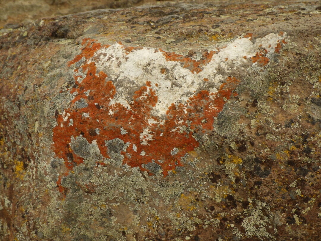
Enjoy the expansive view while treading carefully on Eagle Rock, not only out of respect for its importance to Native Americans but also to minimize damage to the colorful crustose lichens, which look a bit like paint splotches.  These intriguing organisms are actually a close symbiosis between various fungi, which provide the tough matrix, and photosynthetic algae.  Although amazingly hardy and long-lived, they can easily be destroyed by repeated foot traffic, so try to avoid stepping on areas that have not already been scoured away.  One of the more interesting is the bright red-orange Caloplaca sp., which depends on the high nitrogen leaching from the “whitewash” deposited by perching raptors.  Other locally common lichens include wall lichen (Lecanora muralis), which makes rounded gray-green colonies, and descriptively named egg yolk lichen (Candellariella sp.)  [Lichen determinations provided by Roger Rosentreter.  Species pages for non-vascular plants and other organisms have not (yet) been created for this website, though this would be a desirable long-term goal.]

Trail northwest of Eagle Rock.

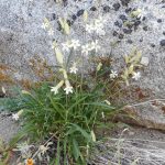
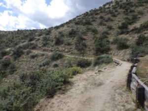
Continue straight (northwest) on Shoshone-Paiute Tribes Loop, where you might spot some white flowers of eyelashweed (Blepharipappus scaber) still in bloom.  The gradually descending trail crosses a stretch of nicely exposed layers of rhyolite before widening into an old quarry road as it enters a thick band of silicified sandstone.  Note the different plants that grow on this different substrate:  basin big sagebrush (Artemisia tridentata ssp. tridentata) and three-awn grass (Aristida purpurea var. longiseta) are now common, and the rubber rabbitbrush is a larger, grayer variety (Ericameria nauseosa var. hololeuca) than the variety that is most common elsewhere in the Reserve.  Take note also of any plants starting to escape from adjacent landscaping surrounding the homes on the ridge above; hardy pampasgrass (Tripidium ravennae, previously in Saccharum) is particularly worrisome in this regard.  More tree-of-heaven (Ailanthus altissima) grows here, sometimes intermingled with look-alike staghorn sumac (Rhus typhina), which differs in having finely hairy stems, fuzzy red fruit, and leaves that turn bright red in fall.  There is also a solitary juniper (Juniperus sp.); although several native species of juniper are abundant in the mountains south of the Snake River Plains, for some unknown reason only sporadic non-native junipers occur in the Boise Front.

Sickle saltbush (Atriplex gardneri var. falcata)

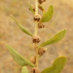
Take the sharp left-hand turn as the loop trail begins its zigzag descent, cutting through a dense grove of tree-of-heaven.  Once you reach the bottom of the slope, keep an eye out for another alkali scald on the left side of the trail, shortly before reaching another junction.  This is the only place known in the Boise Front where sickle saltbush (Atriplex gardneri var. falcata, previously A. nuttallii) persists, as another survivor from the vanished warm springs environment.  This subshrub, which blooms in late spring/early summer, has separate male and female plants.

Drainage slough at edge of Chief Eagle Eye Reserve

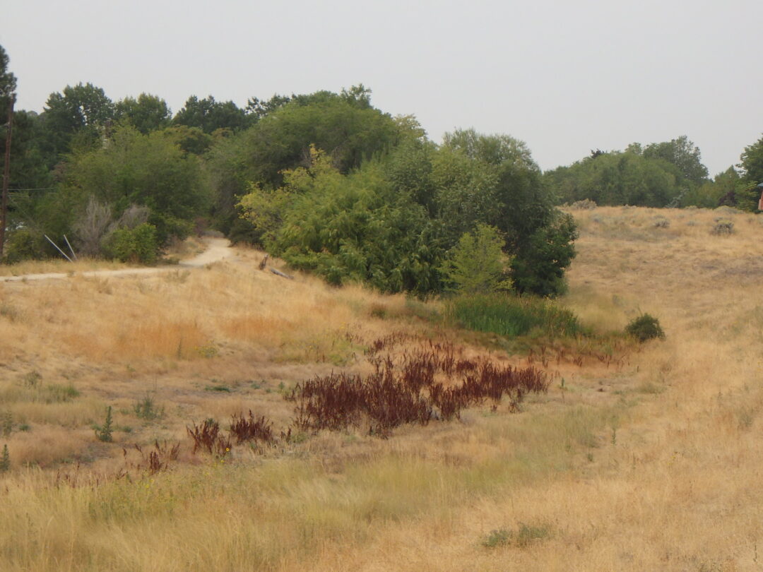
For one more habitat type, a short side trip to the right at the junction just past the sickle saltbush population will take you to the nearby drainage slough, with a shady grove of willows at the north end.  You might some common evening-primrose (Oenothera biennis) still in bloom, and maybe some western goldenrod (Euthamia occidentalis).  The sunny wetland has cattails (Typha latifolia), soft-stem bulrush (Schoenoplectus tabernaemontani, previously Scirpus validus), common spikerush (Eleocharis palustris).  The self-guided walk description ends here, from which point you can head south back to Eagle Rock Park.

NOTE: Please enjoy the wildflowers and leave them for others to enjoy.  Because our unique local flora is already under pressure from invasive weeds and habitat loss, harvesting of native plants is not encouraged on this website, especially along popular trails.

Shafer Butte Loop

SHAFER BUTTE LOOP WILDFLOWER WALK
July through August

Wildflowers on Shafer Butte

Shafer Butte Loop is one of the premier wildflower walks in the Boise Front, with extraordinary displays of mountain wildflowers throughout the summer, a wide diversity of habitats, and outstanding views in all directions (at least if not blocked by smoke).  At elevations mostly above 7000′, the walk also provides a refreshing respite from the summer heat in the valley floor 4000′ lower down.  The complete loop is about 4½ miles long, with 620′ elevation gain; give yourself enough time to enjoy the flowers and views, as well as travel time to Pioneer Lodge where the walk begins.

View to Sawtooth Range from Shafer Butte.

ABOUT SHAFER BUTTE:  Shafer Butte (7582′) and nearby Mores Mountain (7237′) are the highest points on the Boise Ridge, essentially functioning as elevational “islands” at the very edge of the northern Rocky Mountains.  Although the mid-elevation mixed conifer forest is relatively continuous to the north and east, except where too hot or dry, the Boise Ridge as a whole is separated from the rest of the Idaho Batholith by the Mores Creek/Grimes Creek drainage to the east and the Harris Creek/Granite Creek divide between Horseshoe Bend and Idaho City to the north.  With a high point of 5200′ at Harris Creek Summit, these drainages and divides serve as barriers to plants that are restricted to higher elevations, and beyond are additional barriers created by the complex network of drainages that dissect the Boise Mountains.  Among the archipelago of other scattered peaks that exceed 7000′ in this part of Idaho, the closest to Shafer Butte are Hawley Mountain (7293′) 15 miles to the north and Thorn Creek Butte (7515′) 17 miles to the east.   The closest significantly larger expanse of high elevations is Trinity Mountain (9451′), 35 miles to the east; the crest of the popular Sawtooth Range is 50 miles away.

Common paintbrush on Shafer Butte combining features of Castilleja miniata and C. rhexifolia

The island nature of Shafer Butte is amplified by its location at the very edge of the Idaho Batholith and Rocky Mountains, an outlier in the archipelago of isolated peaks of comparable elevation to the north and east.  Its south and west slopes overlook the western Snake River Plains on the northern edge of the Intermountain Desert, with distant views of the Owyhee Range and uplands to the south and the Blue Mountains to the west.  One result is a rich diversity of habitats as the peak is circumnavigated, from dry rocky south-facing slopes to moist meadows and conifer forests on the northeast side, artificially enhanced by wildflower-rich meadows where brush is cleared for ski runs.  Another likely result of the island-like isolation is local endemism (i.e., species unique to a geographically restricted area), at least genetically.  No plants are currently considered endemic to Shafer Butte, but this might simply indicate that the flora has not previously been given the attention it deserves; the lure of higher mountains in Idaho’s backcountry has disproportionately determined the summer destination of the relatively few local botanists.  A prime candidate for overlooked endemism is the common paintbrush on Shafer Butte, which has the morphology of Castilleja miniata but the more crimson (violet-red) coloration of rosy paintbrush (C. rhexifolia), in contrast to the characteristic scarlet (orange-red) color of populations just below the conifer zone.  Several other plants growing on this island peak are also slightly different from those found growing elsewhere and deserving of further study.

Summit of Shafer Butte.

Even though not flat-topped, Shafer Butte and several other comparable peaks are sometimes called buttes locally, particularly if the summit area is barren of trees.  This absence of trees is not an indication of normal timberline, which is several thousand feet higher in central Idaho, but is more likely the result of insufficient soil moisture on the rocky exposed summits to sustain trees through the hot dry summers.  These scattered peaks are also prime locations for a variety of uses, historically for fire lookouts and more recently for communication towers; the summit of Shafer Butte is no exception, with a restricted-access road to the top and a plethora of communication and other structures.  It is also the upper terminus for two ski-lifts of the non-profit Bogus Basin Mountain Recreation Area:  Superior Express and Pine Creek Express.  Regular skiers on Bogus Basin will enjoy seeing the different face the mountain puts on in summer.

View north from Tempest Trail.

SELF-GUIDED WILDFLOWER WALK:  The 4½ mile loop begins and ends at the Pioneer Lodge parking area at 6770 feet and soon climbs to 7390 feet, followed by a circumnavigation and gradual descent around the summit of Shafer Butte.  The walk is described counterclockwise with the recommendation of starting no later than mid-morning, so that the exposed south-facing slope can be traversed before midday heat.  Be sure to bring sufficient water for several hours, especially on hot days.  Although unlikely, be alert for signs of altitude sickness, primarily if recently coming from sea level.  Sturdy footwear and a hat are recommended; hiking poles may help with balance, though most trails are well-graded.  About two-thirds of the loop consists of single-track trails shared with mountain bikes, so it is often a good idea to avoid peak cyclist times (though the longer Round the Mountain loop at lower elevations is preferred by most mountain bikers).

Patience dock (Rumex patientia)

Pioneer Lodge is part of the Bogus Basin Recreation Area, accessible on a paved (except for a short stretch through the lower parking area) but windy road.  Park in the public portion of the lot, not that reserved for condominium use.  For those wishing to enjoy a scenic ride for a modest fee, the Morning Star chairlift provides an alternate means to reach the starting point from the lower base area parking. One plant to take note of in the parking area itself is patience dock (Rumex patientia), which looks like the common curlydock (Rumex crispus) on steroids.  This is recently arrived invasive species that is unfortunately making itself at home at Bogus Basin and a few other sites in the Boise Front.  Spotted knapweed (Centaurea stoebe ssp. australis, previously C. maculosa) is another invasive species that is well-established here and elsewhere in Bogus Basin.

Flower-filled meadow near Pioneer Lodge.

From the parking lot, head uphill behind the lodge, keeping left to skirt the bicycle-only area and chairlift terminus.  A good introduction to some of the showy wildflowers that are common on the loop is provided by a meadow on the north side of the designated walking trail.  Depending on the season, you can enjoy displays of blue-flowered taperleaf penstemon (Penstemon attenuatus var. militaris), yellow-flowered Idaho woodbeauty (Drymocallis glabrata, previously Potentilla glandulosa var. glabrata), pink-flowered sticky geranium (Geranium viscosissimum), lavender-flowered silky lupine (Lupinus sericeus), white-flowered wing-fruited sego lily (Calochortus eurycarpus), and yellow-flowered sulphur buckwheat (Eriogonum umbellatum, mostly var. stragulum).  The grasses are primarily intentionally planted species, most notably smooth brome (Bromus inermis) that is capable of eventually displacing much of the native wildflower diversity.

South end of Lodge Trail.

Turn left on LODGE TRAIL/Lodge Cat Road (#140), used as a snowcat track during skiing season.  Douglas-fir  (Pseudotsuga menziesii) and ponderosa pine (Pinus ponderosa) are the dominant trees throughout the hike, with an occasional quaking aspen (Populus tremuloides) in relatively moist sites.  Common shrubs include snowbrush ceanothus (Ceanothus velutinus), bittercherry (Prunus emarginata), Rocky Mountain maple (Acer glabrum), Scouler’s willow (Salix scouleriana), and mountain snowberry (Symphoricarpos rotundifolius var. vaccinioides, previously S. oreophilus), along with an occasional mountain-ash (Sorbus scopulina) and mountain big sagebrush (Artemisia tridentata ssp. vaseyana).

Horsemint, Oregon sunshine, and little sunflower on Lodge Trail.

The roadcuts along Lodge Trail provide habitat for a rich diversity of wildflowers; in addition to those already mentioned, look for little sunflower (Helianthella uniflora), horsemint (Agastache urticifolia), scarlet gilia (Ipomopsis aggregata), Oregon sunshine (Eriophyllum lanatum), western columbine (Aquilegia formosa), arrowleaf balsamroot (Balsamorhiza sagitatta), western sweetroot (Osmorhiza occidentalis), ballhead gilia (Ipomopsis congesta), western hawkweed (Hieracium scouleri), spreading groundsmoke (Gayophytum diffusum), and wormleaf stonecrop (Sedum stenopetalum).  Keep an eye out in particular for patches of dwarf monkeyflower (Diplacus nanus, previously in Mimulus), tiny plants with startlingly out-sized magenta flowers.  Another unusual plant is clustered bird’s-beak (Cordylanthus captatus), a late-season dusty-looking annual that doesn’t appear to be in bloom until you look closely.  Several large plants of mountain hollyhock (Illiamna rivularis) might also be in bloom along the roadside, mostly opposite the roadcuts.

Silver lupines in peak bloom.

Turn right on TEMPEST TRAIL (#95), about half a mile from Pioneer Lodge.  This single-track trail, which zigzags up a northwest-facing slope, is where you will accomplish your primary elevation gain, so take your time to enjoy the wildflowers and views (while also keeping an eye out for cyclists!)  Sparse Douglas-fir, some beautifully old and gnarled, are scattered across the slope, which is covered with a high quality high-elevation habitat of perennial wildflowers, bunchgrasses, and low shrubs.  Silver lupine (Lupinus argenteus var. heteranthus) forms solid stands in some areas, reflecting the blue of the sky at peak bloom.  Other wildflowers that you might not yet have already seen include Coville’s paintbrush (Castilleja covilleana), blue stickseed (Hackelia micrantha), Nuttall’s linanthus (Leptosiphon nuttallii, previously Linanthastrum), gooseberry-leaf alumroot (Heuchera grossulariifolia), prickly sandwort (Eremogone aculeata, previously in Arenaria), western groundsel (Senecio integerrimus), western wallflower (Erysimum capitatum), and fernleaf biscuitroot (Lomatium multifidum).  Lewis’s flax (Linum lewisii) is native here, on contrast to its smaller-flowered counterpart that is commonly seeded in the lower foothills.  Early-season hikers might even catch mountain kittentails (Synthyris missurica) still in bloom, especially near lingering snowbanks.

Wildflowers along the Face trail

The FACE TRAIL (#93), which heads right at a marked junction on a switchback about half a mile from the Lodge Trail, cuts a mile-long transect across the southwest face of Shafer Butte.  Enjoy the view across the Boise Valley and upper Snake River Plains to the distant Owyhee Mountains (curiously sharing the same name, with an alternate spelling, as Hawai’i, in memory of three Hawai’ian members of an 1819 fur-trapping expedition who disappeared after being sent into the area to look for beaver).  Closer topographic features include the tower-studded twin summits of Deer and Doe Points to the left, and conical Stack Rock, a popular hiking and cycling destination, on the forested ridge to the right.

New wildflowers that you might see along this more exposed segment of the loop include ballhead sandwort (Eremogone congesta), Payette penstemon (Penstemon payettensis), and dusty maidens (Chaenactis douglasii) as well as a diversity of annuals such as diamond-petal farewell-to-spring (Clarkia rhomboidea), common tarweed (Madia gracilis), largeflower collomia (Collomia grandiflora), and several species of bristly-haired Cryptantha.  Large outcrops midway along the trail provide special habitat for other plants; look for Douglas’s catchfly (Silene douglasii), shrubby penstemon (Penstemon fruticosus), and Alberta penstemon (Penstemon albertinus).

Cow-parsnip (Heracleum lanatum) patch on Face trail.

Occasional seepage areas add diversity to the east part of the Face trail, with conspicuous patches of cow-parsnip (Heracleum maximum, previously H. lanatum) intermixed with mountain stinging nettle (Urtica dioica ssp. gracilis).  A narowly green-leaved form of Wyeth’s buckwheat (Eriogonum heracleoides), whose cream-colored flowers turn reddish with age, is also common along this stretch of trail, along with little sunflower (Helianthella uniflora), horsemint (Agastache urticifolia), and scarlet gilia (Ipomopsis aggregata).  A few curiously white-flowered plants combine characters of widespread sticky geranium (Geranium viscosissimum) and white geranium (Geranium richardsonii), which is not otherwise known from the Boise Front. 

Barren slope on Face trail.

Near the east end of the Face trail is an unusual barren slope of coarse sand, cause unknown, that harbors an interesting suite of plants.  The most curious is a prostrate form of fleeceflower (Aconogonon phytolaccifolium, previously in Polygonum).  Another noteworthy plant is the alpine buckwheat (Eriogonum pyrolifolium); although two varieties are commonly recognized in this species, based on leaf pubescence, both forms often grow intermixed on Shafer Butte.  Other wildflowers on this site include prickly sandwort (Eremogone aculeata), ballhead gilia (Ipomopsis congesta), Oregon sunshine (Eriophyllum lanatum), and a narrow-leaved form of silver lupine (Lupinus argenteus var. heterophyllus).

Wildflower display on Shafer Butte saddle

The most spectacular display of wildflowers, especially if you are lucky enough to arrive at the peak season in a good year, is the natural rock garden on the open slopes at the saddle where the loop crosses the Cabin Traverse (# 144, the access road to Shafer Butte summit).  The yellow flowers of sulphur buckwheat (Eriogonum umbellatum) and Piper’s buckwheat (E. flavum var. piperi), blue flowers of silver lupine, and red flowers of Coville’s paintbrush (Castilleja covilleana) combine in a colorful mosaic.   After admiring the showier wildflowers, look closer for more alpine buckwheat (Eriogonum pyrolifolium) and the diminutive annual spurry buckwheat (Eriogonum spergulinum var. reddingianum), which in a good year can cover the ground with a smoky cast.  The display continues along the beginning of Elk Meadows trail, where you can also find some more typically erect fleeceflower (Aconogonon phytolaccifolium) growing at the base of a dramatic rock-face that is more sharply angled than most outcrops of Idaho batholith granite.

Near beginning of Elk Meadows trail

New habitats quickly add to the loop’s diversity as you follow ELK MEADOWS TRAIL (#94) for about a mile around the more forested east side of Shafer Butte.  After passing another lupine-covered slope, a lovely wet meadow appears on your right, full of California false hellebore or corn-lily (Veratrum californicum), northern bluebells (Mertensia paniculata var. borealis), Cusick’s corydalis (Corydalis caseana var. cusickii), western coneflower (Rudbeckia occidentalis), and western larkspur (Delphinium occidentale).  Shrubs around the margins include mountain-ash (Sorbus scopulina) and black elderberry (Sambucus racemosa var. melanocarpa).  The path itself cuts across a drier portion of the flat, brightened mid-season with yellow Idaho wood-beauty (Drymocallis glabrata) and blue taperleaf penstemon (Penstemon attenuatus var. militaris), changing to purple at the end of summer with thickstem aster (Eurybia integrifolia, previously in Aster).

View east from shaded resting site on Elk Meadows trail.

The path jogs to the right as it enters a shaded grove (at least as of 2020; many of the trees are marked for logging with the blue ring of death).  Take time to look for western columbine (Aquilegia formosa), western meadowrue (Thalictrum occidentale, which has leaves very similar to those of the columbine), licorice-scented western sweetroot (Osmorhiza occidentalis), and monotypic kelloggia (Kelloggia galioides, named for Albert Kellogg, one of the more eccentric founders of the California Academy of Sciences).  Farther along the path crosses an open stretch, kept clear for the Wildcat ski run (Black Diamond).  Shortly before the Pine Creek Express lift is a perfect rest spot (if not already occupied), in the cleared ground beneath a dense grove of trees on a small knoll left of the path.  Enjoy the view looking across the mountains to the east; try to pick out Trinity Mountain and Soldier Mountains to the right, Smoky Mountains in the distant middle, and the jagged white peaks of the Sawtooth Mountain on the horizon to the left.  You can also look for the small white flowers of Menzies’s catchfly (Silene menziesii), tucked at the base of some of the trees.

Open slope at N end of Elk Meadows trail.

Elk Meadows trail continues through a sequence of more patches of wet meadow with California corn-lily (Veratrum californicum), cow-parsnip (Heracleum maximum), and fireweed (Chamaenerion angustifolium, previously in Epilobium), and cleared ski runs, where the Shafer Butte form of the common paintbrush (Castilleja miniata) is abundant, along with regularly sheared mountain snowberry (Symphoricarpos rotundifolius var. vaccinioides, previously S. oreophilus).  An open lupine-covered slope, eroded with runoff from late-lingering snowpack, deserves a closer look.  Keep an eye out in particular for pussypaws (Calyptridium umbellatum), growing with its look-alike alpine buckwheat (Eriogonum pyrolifolium).  Late-season color is provided by two similar yellow-flowered shrubs:  the montane form of rubber rabbitbrush (Ericameria nauseosa, previously in Chrysothamnus) and Greene’s goldenbrush (Ericameria greenei), in addition to vivid fall foliage and the red berries of mountain-ash (Sorbus scopulina).

Mores Mountain from Shafer Butte

Mores Mountain comes into view as Elk Meadows trail wraps around to the north side of Shafer Butte; a future wildflower walk is planned for its excellent network of pedestrian-only trails and natural rock-gardens on its craggy outcrops.  The single-track trail soon ends and rejoins the road back to Pioneer Lodge (a final mile or so to go!)  Keep to the left at the fork where an unmarked road drops down to connect with Mores Mountain, and continue straight on Lodge Road (#140) where the Packing Trail (#149) doubles back to the left and zigzags up to the summit. One noteworthy plant in the along this stretch is the mountain lupine (Lupinus argenteus var. argentatus), a green-leaved relative of the more common silver lupine (Lupinus argenteus var. heteranthus).

Seepage slope on Shafer Butte Loop

A short distance past the Packing Trail junction is a lovely seepage-covered slope with small springs flowing next to the road that merits a closer look.  The conspicuous large plants are California false hellebore (Veratrum californicum), northern bluebells (Mertensia paniculata var. borealis), Cusick’s corydalis (Corydalis caseana var. cusickii), white angelica (Angelica arguta), Lewis’s monkeyflower (Erythranthe lewisii), arrowleaf groundsel (Senecio triangularis), and mountain stinging nettle (Urtica dioica ssp. gracilis).  Heartleaf springbeauty (Claytonia cordifolia) grows tucked in the shade along the streamlets, and you might even find a few leaves of heartleaf cardamine (Cardamine cordifolia) which is currently known in the Boise Front only from this site, and not yet found in flower.  Unfortunately, invasive reed canarygrass (Phalaris arundinacea) also has a foothold here, and has the potential to displace the rich wildflower diversity.

Sehewoki’l Newenee’an Katete from Shafer Butte

The road then crosses several more cleared ski runs and passes under the Superior chairlift, completing the loop at the base of Tempest Trail.  In addition to keeping an eye out for wildflowers that you overlooked at the beginning of the walk, or which are now open or in better lighting, take time to admire the view to the northwest.  The dark ridge in the middle distance is the recently renamed Sehewoki’l Newenee’an Katete (previously Sq*** Butte), an isolated fault block at the southeastern edge of the massive Columbia Basalt flows.  The Blue Mountains in Oregon form the horizon in the background, with the often snow-capped Wallowa Mountains to the right, peeking around the Cuddy Mountains.


Logging at Bogus Basin

NOTE ON FIRE CONTROL EFFORTS:  A major tree-removal project (aka logging) is currently underway in the area around Shafer Butte, initiated in 2019 to reduce the risk of devastating fires especially given the increasing number of dead and dying Douglas-fir trees.  Fires are certainly a real concern, and the evident tree mortality is indisputable, but in my analysis the proposed solution should be understood as fundamentally experimental, with long-term consequences remaining to be determined.  There is strong evidence that many forest types depend on regular fires to keep fuels at non-destructive levels, and that fire-suppression efforts during the last century have resulted in overly dense forests and the build-up of fuels (aka living and dead plants) in the understory.  Uncertainties include the extent that this applies to all forest types, how equivalent mechanical thinning efforts are to regular fires, the relative importance of other contributing factors such as climate change and highly flammable invasive species, and the likelihood of any follow-up management needed in the long run.

Douglas-fir dwarf mistletoe (Arceuthobium douglasii) in fruit

Most media coverage (e.g., “Logging starts at Bogus Basin in major forest health project“) tends to focus on Douglas-fir dwarf-mistletoe (Arceuthobium douglasii) as the primary culprit behind tree mortality.  However, this native species is probably analogous to lice;  unlikely to lead to death in a healthy individual, but potentially increasingly dramatically and ultimately contributing to mortality in an already stressed tree.  The plant itself is an inconspicuous parasite that requires a close look to spot, but the host tree often responds by developing a dense growth called “witch’s broom” (which can also be caused by fungi and other factors).  These growths can be conspicuous on many (but not all) dead and dying trees, easily leading to the conclusion that they are the cause of death, but they are also often present (with or without dwarf mistletoe) on otherwise healthy trees.

Dead and dying trees on the Boise Ridge

Given all this, what might be stressing the forest around Bogus Basin?  The most obvious explanation is a long-term trend towards hotter and drier conditions (aka climate change), especially for trees that are already outliers teetering at the very edge of their climatic envelope for long-term survival.  On the one hand, reducing the number of trees might leave more water available for the remaining trees; on the other hand, less shade could easily result in the forest floor drying out faster, thereby increasing the drought stress and fire potential.  If the latter dominates, then thinning efforts might actually speed up the demise of the remaining trees, and the drying up of springs and other moist habitats, rather than the intended outcome.  Economic factors also often dictate that sufficient marketable trees be included in the cut, independent of what might otherwise be optimum environmentally.  Tragically, it is possible that the current natural forest on the Boise Ridge is doomed no matter what measures are taken locally, along with the various ferns, orchids, and other wildflowers that are dependent on the various unique microhabitats within the conifer zone.

Staging area for logging operation between Shafer Butte and Mores Mountain

Even in the short term, it remains to be seen how existing diversity responds to the current logging activities, including the wildflower sites profiled above.  Soil disturbance can be severe, especially in staging areas; this can benefit certain pioneering species like lupines, but other species will suffer from the disturbance and reduced shade.  Invasive non-natives, notably spotted knapweed (Centaurea stoebe ssp. australis) and patience dock (Rumex patientia) locally, can rapidly spread into disturbed sites, and the intentional planting of non-native perennial grasses such as smooth brome (Bromus inermis) could also significantly interfere with the recovery of native wildflowers.  Of course, a megafire would be even more devastating, so let us fervently hope that the current experiment is successful, and that all the lovely wildflowers profiled in this wildflower walk will continue to be available for all to enjoy, along with the shade- and moisture-dependent ferns, orchids, and other special wildflowers found elsewhere in the conifer zone.

To learn more about the ski resort’s history, see Rick Just’s “Building Bogus Basin“.

Highlights of Hidden Springs Wetlands

HIGHLIGHTS OF HIDDEN SPRINGS WETLANDS WILDFLOWER WALK
mid June through July

Wetlands at Hidden Springs

As an alternative to heading to higher elevations for wildflowers during the summer months, when the foothills proper have largely dried out, check our what’s growing in your local wetlands for a whole new suite of interesting plants, some of which are just hitting their stride.  The wildflower walk described here, through the exceptionally rich remnant wetlands at Hidden Springs, is the shortest walk in the series, a half-mile ramble that is a pleasant morning or evening outing even on a hot summer day. 

Description:  The walk as described begins at the main trailhead on the south side of Dry Creek Road  between Cartwright Road and Seamans Gulch Road.  A trail at the east side of the trailhead cuts south through a selection of marshland habitats to a well-shaded bridge across Dry Creek, where the described portion of the walk ends.  Be sure to enjoy the birds as well, and don’t forget your mosquito repellent!

Purple loosestrife (Lythrum salicaria)

As a generalized introduction, wetland floristics differ from upland floristics in that, thanks to the ease that seeds and other propagules are transported by waterfowl, plant distribution is determined less by geographic range per se and more by water seasonality, depth, and chemistry, as well as how long the wetland habitat has existed.  Because of this, the distinction between “native” and “non-native” becomes increasingly problematic for many species, if not outright arbitrary in some cases (does the plant care if it arrived via waterfowl or human agency?)  In spite of this, some rare plants do occur as regional endemics, often threatened by wetland invaders that can shove everything else out, given the chance.  Among the worst invasive species that are present at Hidden Springs wetlands are purple loosestrife (Lythrum salicaria), mis-named Canada thistle (Cirsium arvense), and reed canarygrass (Phalaris arundinacea).

Mowed area around central thicket at Hidden Springs wetlands.

Prior to Euro-American settlement, there were undoubtedly numerous natural wetlands on the fertile flatlands at the base of the foothills, where creeks or springs supported rich meadows throughout the summer months.  These would have been prime sites for the earliest homesteaders, who quickly converted the meadows into pastures and farmlands.  The very name “Hidden Springs” is a clue that the existing wetlands here are in fact remnants that have persisted from pre-settlement times, among the very few examples in existence locally (Council Springs being another).  Even these persisting wetlands have been variously altered; most of the Hidden Springs wetlands are regularly mowed midsummer, except for the central thicket and surrounding areas that harbor the greatest diversity.

The presence of several locally rare plants in the Hidden Springs wetlands bolsters the interpretation of this site as a persisting remnant, in particular the large stands of Nuttall’s cinquefoil (Potentilla gracilis var. fastigiata) and common avens (Geum aleppicum), as well as scattered Macoun’s buttercup (Ranunculus macounii) and pale bulrush (Scirpus pallidus).  These are the special “treasures” of this particular wildflower walk; most can be seen from the trail itself, though some might require a stroll along the edge of the mowed area to spot.

Chicory (Cichorium intybus)

Begin your walk at the east end of the parking lot, where you can easily see three conspicuous noxious weeds (if not recently mowed).  Large patches of purple-flowered Canada thistle (Cirsium arvense) grow at the edge of the marsh, interspersed with tall stalks of poison-hemlock (Conium maculatum) covered with small white flowers.  Field bindweed or wild morning-glory (Convolvulus arvensis) sprawls along the edge of the path, some plants with lovely pink flowers instead of the usual white. Several other relatively showy non-natives are also present, including red clover (Trifolium pratense) and chicory (Cichorium intybus).

Marsh at Hidden Springs wetlands.

Where the path splits, take the right-hand option to follow the main cattail-lined trail bisecting the marsh.  The marsh itself is dominated by members of the three primary families of graminoids:  grasses (Poaceae), sedges (Cyperaceae), and rushes (Juncaceae).  A popular rule of thumb is that “sedges have edges while rushes are round”; while it is true that 3-angled stems are found only in Cyperaceae, and most rush stems are in fact round, there are also a lot of Cyperaceae with round stems.  True grasses differ from both in having hollow stems than are partitioned at regularly spaced nodes; the leaf that arises from each node has a sheathing base and spreading blade.  The inflorescence is the real give-away:  rushes have small but recognizable six-parted flowers, while grasses and sedges have highly reduced floral parts intermixed with various scale-like structures.  In grasses, these are organized into well-defined spikelets that are often bilaterally flattened; the scales of sedges are more often arranged in tightly overlapping spirals.

Pink-flowered form of common willow-herb (Epilobium ciliatum)

The most abundant rush in the marsh is Baltic rush (Juncus balticus), which tends to form large brownish swaths; plants in the path itself often have spirally twisted stems.  One of the most abundant members of the sedge family is common spike-rush (Eleocharis palustris), which has a single narrow inflorescence atop a cylindrical, pith-filled stem.  Common wildflowers in the marsh include pinnate-leaved yellow avens (Geum aleppicum) and both pink- and white-flowered forms of the highly variable common willow-herb (Epilobium ciliatum), both finely hairy.  Also keep an eye out for Macoun’s buttercup (Ranunculus macounii) growing opposite the first patch of cattails (Typha latifolia), and occasional palmate-leaved Nuttall’s cinquefoil (Potentilla gracilis var. fastigiata).

Reed canary-grass (Phalaris arundinacea)

A stand of reed canary-grass (Phalaris arundinacea) grows next to an isolated willow (Salix sp.) on the left; left unchecked, this highly invasive grass can from monocultures in wetlands, reducing diversity and wildlife value.  A lone obtuse-leaf rose (Rosa obtusifolia) grows on the right side of the path; compare the hairy leaves to the glabrous leaves of dog rose (Rosa canina) farther down the path.  Also keep an eye out for a wet depression on the right with an abundance of water speedwell (Veronica anagallis-aquatica) and Nuttall’s cinquefoil (Potentilla gracilis), surrounded by spikerush (Eleocharis palustris) and panicled bulrush (Scirpus microcarpus). 

The path wraps around a thicket consisting primarily of black hawthorn (Crataegus douglasii) and dog rosa (Rosa canina).  Among the plants growing at the moist edge of this stretch of path are rabbitsfoot grass (Polypogon monspeliensis), toad rush (Juncus bufonius), jointed rush (Juncus articulatus), and strawberry clover (Trifolium fragiferum) with its curiously swollen fruiting heads.  Large clumps of awl-fruit sedge (Carex stipata) are conspicuous just before the thicket; this is one of the more easily identified sedges, along with woolly sedge (Carex pellita) which might also be spotted here.  Catnip (Nepeta cataria) grows on the back side of the thicket, where there is also an easily accessible colony of hairy evening-primrose (Oenothera villosa ssp. strigosa).  Pale bulrush (Scirpus pallidus) grows near the thicket but is not usually visible from the path.

After paralleling the back side of the thicket for a short distance, the path cuts across a weedy area (possibly mowed) with both yellow and white color morphs of moth mullein (Verbascum blattaria), common mullein (Verbascum thapsus), and unusually pink forms of bindweed (Convolvulus arvensis); also keep an eye out for bracted verbena (Verbena bracteata). 

Dry Creek at Hidden Springs.

The guided portion of the walk ends in the gallery forest along Dry Creek, where the path crosses a sturdy bridge.  Dominant trees and shrubs include black cottonwood (Populus trichocarpa), red-osier dogwood (Cornus stolonifera). interior rose (Rosa woodsii ssp. ultramontana), and various willows (Salix spp.)  Look carefully and you might see some common horsetail (Equisetum arvense) and American speedwell (Veronica americana) growing along the creek, and possibly western goldenrod (Eucephalus occidentalis) depending on the season.  Turn left after crossing the creek to look for twining wild-cucumber (Echinocystis lobata) and a small patch of stinging nettle (Urtica dioica), whose stinging hairs can give you a rash if you brush against it.  Being careful not to touch the stinging nettle, compare it to plants of catnip (Nepeta cataria), which grows next to the bridge; the leaves are somewhat similar, but those of stinging nettle are more sharply toothed, and its tiny wind-pollinated flowers are in tassels.

Continuing wandering on your own from this point, or retrace your steps to the trailhead.

PLANT LIST [updating needed]

Plants listed in alphabetical order by genus within category. *Indicates native species (or at least possibly native; see Introduction to this walk).

Download plant list pdf

WILDFLOWERS

FERN RELATIVES

NOXIOUS AND/OR INVASIVE WEEDS (not all in bloom)

OTHER GRASSES AND GRASSLIKE PLANTS (partial list)

SHRUBS, TREES, AND WOODY VINES (mostly not in bloom)

  • *Red-osier dogwood (Cornus stolonifera)
  • *Black hawthorn (Crataegus douglasii)
  • Russian-olive (Elaeagnus angustifolia) – invasive non-native
  • Black walnut (Juglans nigra)
  • *Black cottonwood (Populus trichocarpa) – other species and/or hybrids possibly present
  • *Golden currant (Ribes aureum)
  • Dog rose (Rosa canina) – non-native, invasive in some spots
  • Obtuse- or round-leaf rose (Rosa obtusifolia) — like dog rose, but leaflets hairy
  • *Interior or Wood’s rose (Rosa woodsii subsp. ultramontana) – native, with slender prickles
  • *Willows (Salix spp.) – several species locally, most are difficult to distinguish
  • *Western poison-ivy (Toxicodendron rydbergii, alternatively Rhus radicans) – CAUSES DERMATITIS


POLECAT GULCH WILDFLOWER WALK

POLECAT LOOP WILDFLOWER WALK
late March through April

THIS WALK IS CURRENTLY NOT AN OPTION AS DESCRIBED, DUE TO THE TRAIL NOW BEING PART OF A ONE-WAY LOOP AS PART OF A PILOT PROGRAM BY RIDGE-TO-RIVERS.  As so designated, the described section can only be accessed as part of a minimum 4-mile loop.  The Pilot Program is scheduled to run through November 1, 2021, after which its continuation will depend on feedback.

Polecat Loop view
Sandy slopes on east segment of Polecat Loop Trail, with best selection of wildflowers.

Description: This is no longer an easy walk for enjoying a good selection of spring wildflowers, including a diversity of tiny “belly flowers” (best enjoyed at close range). One tiny “treasure” is the elusive, eponymous Idahoa, if only for the name; a challenge to find, and in only one spot along the trail. Other special plants include the rare Aase’s onion (Allium aaseae) and uncommon hairy wild-cabbage (Caulanthus pilosus).


The highlighted walk is the east segment of Polecat Loop Trail (#81) paralleling Cartwright Road. The plant list covers 1.5 miles from the Cartwright Road trailhead to the southern dogleg on the path, with the option of then doubling back (for 3 miles roundtrip), or continuing for loop options with few additional flowers. Most of the recommended section is sandy, but there are stretches with more clay content that should be avoided when muddy. The single-track trail is popular with cyclists, so be alert and courteous.


PLANT LIST [updating needed]

NOTE: Please enjoy the wildflowers and leave them for others to enjoy.  Because our unique local flora is already under pressure from invasive weeds and habitat loss, harvesting of native plants is not encouraged on this website, especially along popular trails.

Flowering plants are listed in likely order of occurrence from trailhead; some might not yet be in bloom, or present during a particular year. * designates native plants

Download plant list pdf

BELLY FLOWERS

OTHER WILDFLOWERS IN BLOOM

SHRUBS (not in bloom)

  • *Rubber rabbitbrush (Ericameria [formerly Chrysothamnus] nauseosa) — var. hololeuca is the more common larger variety; the smaller, more spindly var. oreophila is mostly on plateaus
  • *Big sagebrush (Artemisia tridentata)most plants are ssp. tridentata, with some sporadic ssp. vaseyana (shorter plants with broader leaves, possibly planted)
  • *Bitterbrush, Antelope brush (Purshia tridentata)
  • *Netleaf hackberry (Celtis reticulata) – visible on opposite slope across Cartwright Road]

PRIMARY BUNCHGRASSES (mostly not in bloom, but evident)

SIGNIFICANT NOXIOUS WEEDS (not in bloom, but evident)


OREGON TRAIL WILDFLOWER WALK

OREGON TRAIL WILDFLOWER WALK
mid March through April

Description: For this wildflower walk we venture south of the Boise River, to see what’s in bloom above basalt cliffs along the Oregon Trail. Meet at Oregon Trail Recreation Area parking lot on the south side of Hwy 21/Gowen Road opposite E Lake Forest Drive (NOT the Oregon Trail Reserve accessed from E Lake Forest Drive). We’ll enjoy the early spring flowers of the basalt flats, including several not known from the foothills north of the river. Difficulty: 2-3 miles roundtrip, modest elevation gain. Heavy clay soils; avoid when muddy! No dogs, please.

[THIS WALK NOT YET EDITED]

PLANT LIST [updating needed]

Plants listed in approximate order of encounter within category. * indicates native species

Download plant list pdf

WILDFLOWERS POSSIBLY IN BLOOM

FERNS

SHRUBS

PRIMARY BUNCHGRASSES (not in bloom, but evident)

SIGNIFICANT NOXIOUS WEEDS (not in bloom, but evident)


MILLER GULCH WILDFLOWER WALK

MILLER GULCH WILDFLOWER WALK
early to mid May

Description: This short walk is primarily to enjoy a magnificent population of spurred or ‘polychrome’ lupine at peak bloom (and fragrance!), along with a nice selection of other locally unusual plants on good-quality habitat. The walk to the lupines is only 1 mile round-trip, with 300 feet elevation gain; several options exist for anyone wanting to go farther on Corrals Trail.

From the Miller Gulch trailhead (just past milepost 3 on Bogus Basin Road), follow the trail across a grassy west-facing slope, where you might spot foothills death-camas (Toxicoscordion aniculatum, previously in Zigadenus), our native gray-green thistle (Cirsium cymosum var. canovirens), and western hawksbeard (Crepis occidentalis).

As the trail curves around to the north side of hill, you will start seeing lupines, but keep going! Take time to appreciate the good-quality shrub-steppe habitat, with abundant perennial wildflowers, bunchgrasses, and scattered shrubs separated by open areas that are largely free of invasive annual grasses. These open areas are a critical component of this habitat type, providing critical ecosystem functions and also reducing the spread of wildfires. Among the plants you might notice are Modoc hawksbeard (Crepis modocensis), which blooms earlier and has much more divided leaves than the western hawksbeard.

Your patience eventually pays off when you reach the main lupine patch at the crest of the ridge. With luck, you will have arrived at peak bloom, when the air is scented with the fragrance given off by the lupine flowers. Although longspur lupine is the “official” common name, I like to call the populations in the Boise foothills the “polychrome lupine”, because the flowers are so wildly varied in color, even more so locally than is the norm for this species. Some of the color difference, especially on the same plant, is how the plant communicates with its pollinators (most bees); the flowers change color when they are ready for pollinating, and then change again to a different color when the have already been pollinated, or are at least past peak.


The plant list for this walk continues to the junction with Corrals Trail, not far beyond the main lupine patch. Doing so adds some “plateau” habitat and a few additional species, depending on the season. Possibilities include native woolly plantain (Plantago patagonica), shaggy fleabane (Erigeron pumilus var. intermedius), and Douglas’ sedge. From the junction, you have the option of turning left and continuing your walk as far as you want on Corrals Trail, retracing your route, or turning right to make a loop with Corrals trailhead and a walk along the side of the road back to Millers Gulch trailhead.

PLANT LIST [updating needed]

NOTE: Please enjoy the wildflowers and leave them for others to enjoy.  Because our unique local flora is already under pressure from invasive weeds and habitat loss, harvesting of native plants is not encouraged on this website, especially along popular trails.

Download plant list pdf

Flowering plants are listed in likely order of occurrence from trailhead; some might not yet be in bloom, or present during a particular year. * indicates native species

WILDFLOWERS

SHRUBS AND TREES (mostly not in bloom)

PRIMARY BUNCHGRASSES & GRASSLIKE PLANTS (mostly not in bloom, but evident)

SIGNIFICANT NOXIOUS WEEDS (some not yet in bloom, but evident)


MILEPOST 12 WILDFLOWER WALK

MILEPOST 12 / UPPER DRY CREEK WILDFLOWER WALK
mid June to mid July

Ponderosa Pine Overlook in Upper Dry Creek.

Enjoy spectacular mountain flowers and views along the Upper Dry Creek trail system from the Milepost 12 trailhead at the lower edge of the conifer forest, 2500 feet above the Boise Valley heat.  This is the quickest driving access to a hike in the conifers for most residents of Boise, with the least carbon footprint.  In addition to penstemon and other showy floral treasures, special treats of  this wildflower walk include two native (albeit inconspicuous) orchids and several types of parasitic plants.

Description: The Upper Dry Creek trail system is on private land owned by the Grossman Family, with public access made possible (at least for now) thanks to a partnership with the Land Trust of the Treasure Valley and Ridge to Rivers.  The wildflower walk begins at the side road taking off from the dogleg on Bogus Basin Road just past Milepost 12.  Parking options are informal and very limited, so carpooling is recommended for groups; note that there is also roadside parking for several cars on the opposite side of Bogus Basin Road.  The walk as described (Ponderosa Pine Overlook trail and Snowshow Hare Loop) is about 3 miles long, with about 350 foot elevation gain.  The trails follow old logging roads, mostly fairly level but eroded in places and with some steep sections.

Silver lupine and ragged-robin at Milepost 12 trailhead.

Begin by appreciating the wildflowers on the open sandy roadcuts, starting in the parking area itself.  Among the locally common plants that might be in bloom are ragged-robin (Clarkia pulchella), sticky geranium (Geranium viscosissimum), wand phacelia (Phacelia heterophylla), Payette penstemon (Penstemon payettensis), sulphur buckwheat (Eriogonum umbellatum), common tarweed (Madia gracilis), and large-flowered groundsmoke (Gayophytum diffusum).  Both silver lupine (Lupinus argenteus) and silky lupine (Lupinus sericeus) are present; the former has blue-violet flowers, while the latter has lavendar flowers that turn tan after being pollinated.  Sharp eyes might even spot a small patch of narrowleaf skullcap (Scutellaria angustifolia) tucked under a bittercherry not far from Bogus Basin Road, or an odd-looking buckwheat broomrape (Aphyllon sp. nov., previously in Orobanche fasciculata) parasitizing the roots of the sulphur buckwheat.  Common shrubs at the trailhead include bittercherry (Prunus emarginata), chokecherry (Prunus virginiana), Macdougal’s rose (Rosa nutkana ssp. macdougalii), and Scouler’s willow (Salix scouleriana)

Streamlet at Milepost 12 trailhead.

Take time to look for some interesting plants where a small streamlet flows over rocks, in the bend of the road just before the vehicle gate.  The streamlet and adjacent steep slope is sensitive habitat, so please avoid the temptation to clamber up for a closer peek.  In addition to field monkeyflower (Erythranthe arvensis, previously in Mimulus guttatus), wormleaf stonecrop (Sedum stenopetalum), brittlefern (Cystopteris fragilis), this is an excellent place to see pearlwort (Heterocodon rariflorum), a strong contender for our least visually attractive native wildflower.  The species epithet refers to its rarely produced small blue chasmogamous bellflowers; the plant usually depends instead on inconspicuous self-pollinating cleistogamous flowers.  It is nevertheless one of my favorite plants to find, and maybe you’ll be lucky to catch it with a blue flower or two!  Late in the season, the dried streamlet can be white with the delicate blossoms of mountain or Gairdner’s yampah (Perideridia montana).

Upper Dry Creek forest.

Following the road (DC5) beyond the gate, the vegetation gradually transitions from mid-elevation brushland to a shaded conifer forest, mostly Douglas-fir (Pseudotsuga menziesii) with a few ponderosa pine (Pinus ponderosa).  Shrubs and small trees that make their appearance in the transition zone include snowbrush ceanothus (Ceanothus velutinus), Rocky Mountain maple (Acer glabrum), mountain snowberry (Symphoricarpos rotundifolius var. vaccinioides), mallowleaf ninebark (Physocarpus malvaceus), and even a few quaking aspen (Populus tremuloides), among others.  One noteworthy roadside rosebush differs from the locally common solitary-flowered Macdougal’s rose (Rosa nutkana ssp. macdougalii) in having multiple flowers; it is probably a natural hybrid between Macdougal’s rose and interior rose (Rosa woodsii ssp. ultramontana), which is the common native rose below the conifer zone.  The partly shaded roadbanks provide habitat for an increased diversity of wildflowers, notably Wilcox’s penstemon (Penstemon wilcoxii), branched phacelia (Phacelia ramosissima var. subglabra), diamond-petal farewell-to-spring (Clarkia rhomboidea), scarlet gilia (Ipomopsis aggregata), and western sweet-cicely (Osmorhiza occidentalis).  A colony of horsemint (Agastache urticifolia) can be spotted (and smelled) at one bend in the road, while a patch of thimbleberry (Rubus nutkanus, previously R. parviflorus) grows at a brushy streamlet.

Junction of Ponderosa Pine and Snowshoe Hare Loop trails.

Keep to the left at unmarked junctions until reaching the intersection with the Snowshoe Hare Loop (DC4) at about 3/4 mile from the trailhead.  To follow this wildflower walk as described, take the left-hand fork and do the loop in a clockwise direction.  The road winds its way up the slope, with an abundance of sheltered north- and east-facing slopes in relatively dense forest.  This is excellent habitat to look for the slender spires of Alaska rein-orchid (Platanthera unalascensis), a true native orchid that is fun to find even though the tiny green flowers are not particularly showy.  Be sure to also peek under roadside thickets of Scouler’s willow (Salix scouleriana) for the distinctively mottled leaves of rattlesnake-plantain (Goodyera oblongifolia), another native orchid; the spikes of cream-colored flowers generally don’t develop until mid-summer.  You might also notice the sweetly scented leaves of fragrant bedstraw (Galium trifolium) in the same habitat, more restrained than its rambuctious relative common bedstraw (Galium aparine).   Sections of this loop are also brightened by large roadside stands of Idaho woodbeauty (Drymocallis glabrata), and if the timing is right (mid-summer), you can enjoy the lovely mountain hollyhock (Illiamna rivularis).

Field dodder
Western dodder (Cuscuta occidentalis)

Snowshoe Hare Loop levels out for a while, before intersecting Doug Fir Trail (DC3).  Turn right to continue on Snowshoe Hare Loop, down a fairly steep grade that can be slippery in spots.  The road cuts through a dense thicket of snowbrush ceanothus (Ceanothus velutinus), whose white flower clusters and shiny resinous leaves can scent the air on a sunny day.   Midway down the slope is a flat opening, possibly an old logging staging area, with abundant large-flowered groundsmoke (Gayophytum diffusum), common tarweed (Madia gracilis), and other annuals.  In the center of the clearing are several large clumps of mountain stinging nettle (Urtica dioica ssp. gracilis); note the sharply toothed leaves and dangling inflorescences of tiny flowers, so you know what to avoid.  Some of the rubber rabbitbrush (Ericameria nauseosa) at the lower edge of the clearing are unwilling hosts to tangled orange threads and small white flowers of western dodder (Cuscuta occidentalis), a native parasitic plant. 

Pinedrops (Pterospora andromedea)

Ponderosa Pine Overlook is  at the bottom of the grade, where Snowshoe Hare Loop reconnects with Ponderosa Pine trail.  Several large boulders, scenic views, and a shaded flat opening make this site a destination point and pleasant place to take a break.  A few hotrock penstemon (Penstemon deustus) grow among the boulders, but the flowers tend to finish blooming fairly early.  Turn right on a well-shaded road to return to complete the loop and return to the trailhead, keeping a sharp eye out for more Alaska rein-orchid and, if you are lucky, some pinedrops (Pterospora andromedea) in the open forest floor.   This curious plant, which lacks chlorophyll, has traditionally been categorized as a saprophyte, meaning a plant that obtains its nourishment from decomposing vegetation.  It is now better interpreted to be a freeloader on the forest’s intricate mycorrhizal network that connects fungal mycelium and tree roots.  The mycelium effectively extends the nutrient and water collecting capacity of the tree roots, while obtaining photosynthetic nourishment produced by the tree; as far as is known, supposed “saprophytes” like pinedrops also tap into the network for their nourishment, but provide nothing in return.

Musk monkeyflower (Erythranthe moschata)

Once back at the trailhead, there is the option of a few bonus wildflowers by walking up Bogus Basin Road a couple of hundred feet to a roadside wet spot where a streamlet intersects the road.  There are good-sized patches here of musk monkeyflower (Erythranthe moschata, previously in Mimulus), with its unusual slimy hairs, and American speedwell (Veronica americana).  There might even be some flowering stalks of white bog-orchid (Platanthera dilatata), a much showier species than the Alaska rein-orchid.


PLANT LIST [updating needed]

NOTE: Please enjoy the wildflowers and leave them for others to enjoy.  Because our unique local flora is already under pressure from invasive weeds and habitat loss, harvesting of native plants is not encouraged on this website, especially along popular trails.

Plants listed alphabetically by genus within category. * indicates native species

Download plant list pdf

WILDFLOWERS

FERNS AND RELATIVES

SHRUBS AND TREES (not all in bloom)

SIGNIFICANT NOXIOUS WEEDS (some not yet in bloom, but evident)

OTHER GRASSES & GRASSLIKE PLANTS


LYDLE GULCH WILDFLOWER WALK

LYDLE GULCH WILDFLOWER WALK
mid April to mid May

Description: Begin at Lydle Gulch trailhead opposite Barclay Bay parking lot after crossing Lucky Peak Dam from Highway 21 (VERY FRAGILE SOILS near trailhead; stay on well-established trails!). South to trail crossing Lydle Creek ca 1/2 mile above Foote Park; trail cuts north to top of slope. Turn around at gate (with option of exploring network of dirt roads from Bonneville Point to Oregon Trail trailhead on Hwy 21), return to Lydle Creek and follow trail to Foote Park on east side of creek. Difficulty: 2 miles roundtrip, modest elevation gain. Heavy clay soils; avoid when muddy, and stay on trails!

[THIS WALK NOT YET EDITED]

PLANT LIST [updating needed]

Plants listed in approximate order of encounter within category. * indicates native species

Download plant list pdf

WILDFLOWERS POSSIBLY IN BLOOM (or fruit)

UPLAND SHRUBS

PRIMARY BUNCHGRASSES (mostly not in bloom, but evident)

SIGNIFICANT NOXIOUS WEEDS (not all in bloom, but evident)

STREAMSIDE SHRUBS AND TREES (mostly not yet in bloom)

LYDLE GULCH WILDFLOWER WALK

LYDLE GULCH WILDFLOWER WALK
mid March to early April

Description: Begin at Lydle Gulch trailhead opposite Barclay Bay parking lot after crossing Lucky Peak Dam from Highway 21 (VERY FRAGILE SOILS near trailhead; stay on well-established trails!). South to trail crossing Lydle Creek ca 1/2 mile above Foote Park; trail cuts north to top of slope. Turn around at gate (with option of exploring network of dirt roads from Bonneville Point to Oregon Trail trailhead on Hwy 21), return to Lydle Creek and follow trail to Foote Park on east side of creek. Difficulty: 2 miles roundtrip, modest elevation gain. Heavy clay soils; avoid when muddy, and stay on trails!

[THIS WALK NOT YET EDITED]

PLANT LIST [updating needed]

Plants listed in approximate order of encounter within category. * indicates native species

Download plant list pdf

WILDFLOWERS IN BLOOM (or soon to be)

UPLAND SHRUBS (not in bloom)

PRIMARY BUNCHGRASSES (not in bloom, but evident)

SIGNIFICANT NOXIOUS WEEDS (not in bloom, but evident)

STREAMSIDE SHRUBS AND TREES (mostly not yet in bloom)

INTERPRETIVE LOOP WILDFLOWER WALK

HULL’S GULCH INTERPRETIVE LOOP WILDFLOWER WALK
June/early July

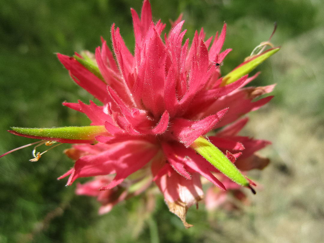
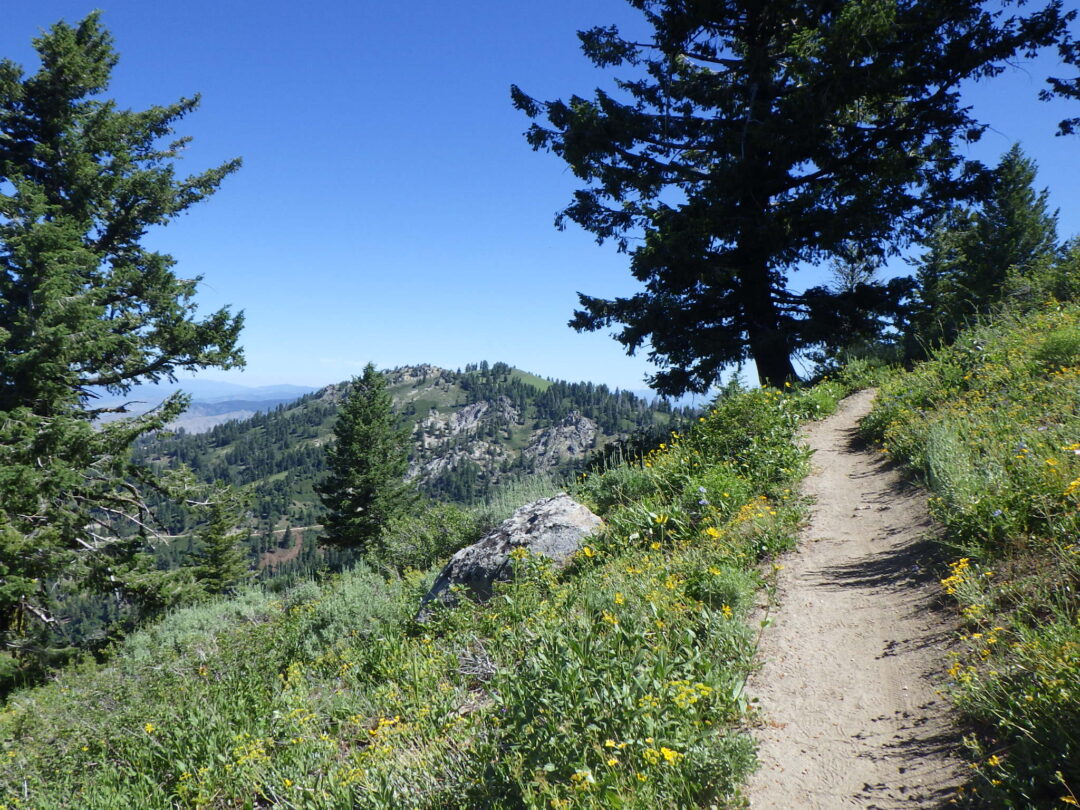
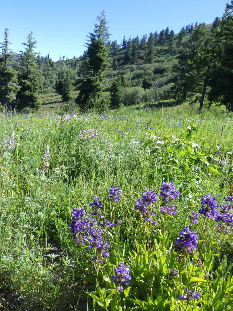
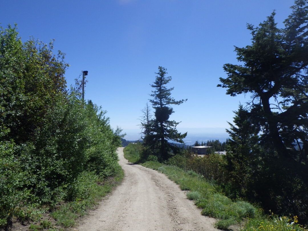
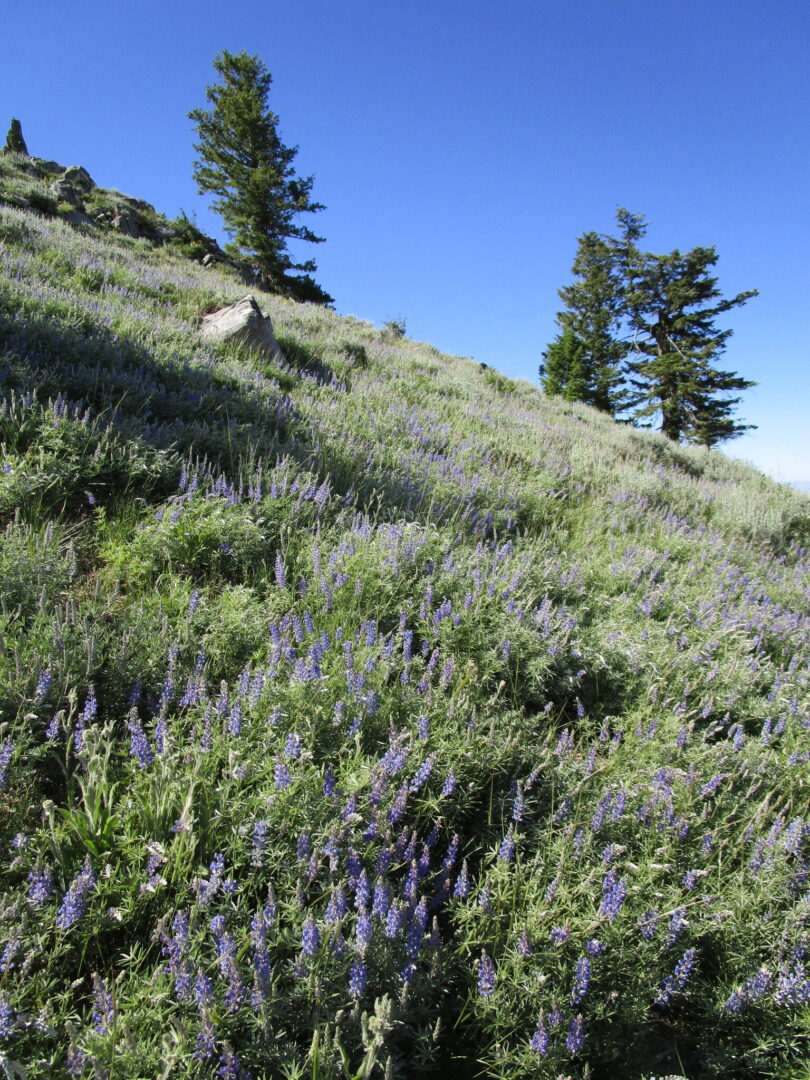
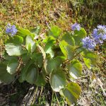
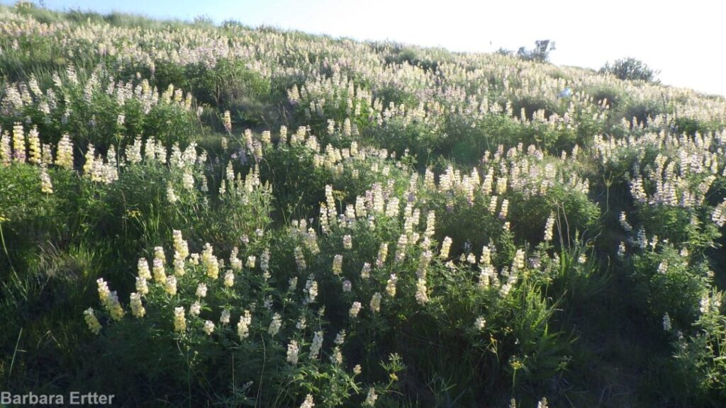
As the days heat up, take advantage of somewhat cooler temperatures at higher elevations (1500-2000 feet above the Boise Valley) to explore the upper reaches of Hulls Gulch. In addition to spectacular scenery and fascinating rock outcrops, enjoy a wonderful diversity of mid-elevation wildflowers, including Wilcox’s penstemon, white mariposa-lily, and two different varieties of sulphur-flowered buckwheat.

Description: The 2½ mile loop described here begins at the uppermost trailhead (“Upper Hulls Gulch” on Ridge to Rivers map) on the 8th Street Extension/Sunset Peak Road, nearly 6 miles beyond Foothills Learning Center.  The dirt road is often somewhat rutted in spots, requiring careful driving even in an SUV.  An alternative, especially if one wants a longer hike with less driving, is to start at the Hull’s Gulch Interpretive trailhead ( “Lower Hulls Gulch”) 2½ miles past the Foothills Learning Center, 0.2 miles past the larger 8th Street ATV trailhead.  This is a popular option that adds a 2 mile long “cherry stem” each way to get to the self-guided portion of the Interpretative Loop.

Descriptively named “decomposed granite”

As described, the walk begins on the ridgeline at nearly 4900 feet elevation, descends steeply to creekside at 4370 feet, and returns by a more moderate grade.  The entire loop is accordingly above the finer-grained sediments of pre-glacial Lake Idaho, occurring instead on coarse-grained substrates derived directly from disintegrating or “decomposed” granite of the Idaho Batholith.  Among the highlights of the loop are the wonderfully sculpted granite monoliths and outcrops.  Sturdy shoes with good traction are highly recommended, as the coarse grains can act as ball-bearings on steep surfaces; hiking poles can also be useful.  Also be sure to bring sufficient water for the expected temperatures and length of hike.

Flood-control terracing in Hulls Gulch.

Before starting your descent, take note of the prominent contour terracing on the slopes above you.  Trenches were first bulldozed across the highly erodible slopes of the Boise Ridge following three major fires and subsequent catastrophic flooding in 1959, immortalized in the video “When the Pot Boiled Over“.  Another 40 miles of trenches were bulldozed after the devastating, human-caused 8th Street Fire in 1996 (Fend et al. 1999); dead trees from this fire are still prominent on slopes above the terracing. Burned areas were then seeded with a mixture of perennial grasses, sagebrush (Artemisia tridentata), alfalfa (Medicago sativa), and yarrow (Achillea millefolium); subsequent plantings included bitterbrush (Purshia tridentata) and silver sagebrush (Artemisia cana).  It is unlikely that even the native species were locally sourced, with the current gene pool now significantly altered from the indigenous vegetation.

Hulls Gulch National Recreation Trail sign.

The Interpretive Loop is part of the Hulls Gulch National Recreation Trail built by the Bureau of Land Management in the 1970’s, when such a trail was a novel idea.  Unlike most other trails in the multi-partner Ridge to Rivers trail system, this one is restricted to pedestrians.  Cattle grazing is also excluded, though stray cows occasionally end up on the wrong side of the fencing (as happened in 2019).  The 1998 fire burned all the large streamside trees to the ground and reduced diversity especially on the south-facing slopes.  Although much of the vegetation has seemingly recovered (with some help from planting efforts), it is still heartbreaking for those who knew the area beforehand (A. DeBolt, pers. comm. 2019).   Occasional signs along the trail provide additional insights and inspiriration.

Seeded bluebunch wheatgrass (Pseudoroegneria spicata) in Hulls Gulch.

The dominant plants as you start down the trail are the perennial grasses and shrubs that were seeded and planted as part of the post-fire rehabilitation effort.  Although there are native forms of bluebunch wheatgrass (Pseudoroegneria spicata, previously in Agropyron) in the Boise Front, seeding mixtures consist of commercially available forms from other parts of the species’ range that have been selected for exceptional vigor and adaptability; some forms are now even recognized as distinct species.  Intermediate wheatgrass (Thinopyron intermedium, alternatively in Agropyron, Elymus, or Elytrigia), a rhizomatous Eurasian grass, is also commonly included in seeding mixes.  Unfortunately, the very features that make both of these grasses valuable for post-fire erosion control and livestock grazing (i.e., rapid and aggressive growth) can permanently convert a previously diverse open shrub-steppe habitat into a near monoculture in which only a limited subset of the previous native species are able to persist. 

Among the native wildflowers that are still prominent along the initial stretch of trail are silver lupine (Lupinus argenteus), wing-fruited or white mariposa lily (Calochortus eurycarpus), yarrow (Achillea millefolium), and arrowleaf balsamroot (Balsamorhiza sagittata, probably past bloom).  Also keep an eye out for ballhead sandwort (Eremogone congesta, previously in Arenaria) and Hood’s phlox (Phlox caespitosa, probably past bloom) in open sites on shallow rocky soils.  Non-native yellow salsify (Tragopogon dubius) is also common.  For rare-plant aficionados, there are a few plants of Boise milkvetch (Astragalus adanus) on the left side of the path shortly before the sign where the trail splits, though these can be difficult to spot when not in bloom (as is likely).  Shrubs include bitterbrush (Purshia tridentata), flat-topped mountain big sagebrush (Artemisia tridentata ssp. vaseyana, intergrading with ssp. tridentata), rubber rabbitbrush (Ericameria nauseosa, previously in Chrysothamnus), and patches of bitter cherry (Prunus emarginata). 

“Split Rock” on Interpretive Loop.

The trail forks about 0.2 miles from the trailhead, beginning the loop proper.  The self-guided walk takes the right fork (“Loop Trail”) for the relatively steep descent, saving the gentler left-hand option (“Main Trail”) for the return ascent (unless one wishes to forego the loop and instead go straight to the upper bridge overlooking a waterfall).  Dramatic granite outcrops are key features of the right fork option, surrounded by shallow coarse soils that harbor a selection of interesting wildflowers, including silverleaf phacelia (Phacelia hastata), sulphur buckwheat (Eriogonum umbellatum), and western wallflower (Erysimum capitatum).  If you’re lucky, you might spot some clustered broomrape (Aphyllon fasciculatum, previously in Orobanche) parasitizing the roots of the silverleaf phacelia.  Patches of spreading dogbane (Apocynum androsaemifolium) are also common along this segment of trail, as well as the return stretch.

Interpretive Trail in upper Hulls Gulch.

Turn left when you reach the creekside trail, possibly after a short downstream detour to admire an exceptionally large mound of creamy-flowered Wyeth’s buckwheat (Eriogonum heracleoides).  The path follows a densely brush-lined creek, with a rich diversity of trees and shrubs including black-barked river birch (Betula occidentalis), Rocky Mountain maple (Acer glabrum), mountain alder (Alnus incana), red-osier dogwood (Cornus stolonifera), syringa (Philadelphus lewisii), blue elderberry (Sambucus cerulea), chokecherry (Prunus virginiana), mallowleaf ninebark (Physocarpus malvaceus), golden currant (Ribes aureum), various willows (Salix), and even a few quaking aspen (Populus tremuloides).  A localized patch of non-native Himalayan blackberry (Rubus bifrons, by the most recent taxonomy) is a tasty but worrisome invader.  Take note of the dramatic difference between the southeast-facing slope on your left (heading upstream) and the northwest-facing slope on your right.  The former is now dominated by invasive annual and planted grasses, including the notorious cheatgrass (Bromus tectorum), medusahead (Taeniatherum caput-medusae), and recently invading North African wiregrass (Ventenata dubia).  In contrast, the opposite slope boasts a rich diversity of native shrubs and wildflowers.  This difference is presumably driven by differing intensities of sunlight on the contrasting exposures, which preceded but was probably exacerbated by the 8th Street Fire. 

High quality habitat on north-facing slope in Hulls Gulch.

A sturdy bridge crossing the main creek soon provides an up-close opportunity to appreciate the botanical treasures of the opposite slope.  The trail doglegs across a deeply shaded tributary and then traverses a short stretch of  high quality sagebrush steppe habitat on a north-facing slope, before doubling back once again.  Take note of the oddly named enchanter’s-nightshade (Circaea alpina), with its tiny white flowers, on the shaded tributary; surprisingly, it turns out to be closely related to fuchsias and has no connection to true nightshades (Solanum spp.).   Take time to enjoy the wealth of wildflowers on the more open portion of the slope, possibly including (depending on your timing) gooseberry-leaf alumroot (Heuchera grossulariifolia), ragged-robin (Clarkia pulchella), diamond-petal farewell-to-spring (Clarkia rhomboidea), few-flower sweetpea (Lathyrus pauciflorus), wormleaf stonecrop (Sedum stenopetalum), western hawkweed (Hieracium scouleri), bastard toadflax (Comandra umbellata), and Payette penstemon (Penstemon payettensis), as well as brittle fern (Cystopteris fragilis) and the lovely native bunchgrasses Idaho fescue (Festuca idahoensis) and junegrass (Koeleria macrantha).  Note also the structure of this increasingly threatened habitat, consisting of a complex diversity of shrubs, bunchgrasses, and perennial wildflowers, all spaced out on a matrix of “bare ground” that is perhaps the most critical component of this ecosystem, covered with a protective layer of microflora (e.g., mosses and lichens) and providing habitat for annual wildflowers.

Looking back at stretch of Interpretive Loop through dense vegetation on north-facing slope.

My favorite stretch some up soon after the trail doubles back to continue its upstream direction, when it enters a partly shaded tunnel of tall shrubs below a large outcrop.  The combination of moisture and aspect creates favorable conditions for a wonderful selection of plants that are more commonly found at higher elevations in the conifer zone, bringing together species that are not usually found together.  Special plants to look for here include Scouler’s willow (Salix scouleriana) with its broadly blunt leaves, Brown’s peony (Paeonia brownii), Wilcox’s penstemon (Penstemon wilcoxii), heartleaf arnica (Arnica cordifolia), fernleaf biscuitroot (Lomatium multifidum), and Ross’s sedge (Carex rossii).  You can also find Macdougal’s or Nootka rose (Rosa nutkana ssp. macdougalii) intergrading with interior or Wood’s rose (Rosa woodsii ssp. ultramontana), which is the common native rose below the conifer zone; the former has larger, generally solitary flowers, and the leaflets are greener and often double-toothed.  There are also three species of woodbeauty (Drymocallis, previously sticky cinquefoil in Potentilla glandulosa and P. arguta) growing in close proximity and possibly also hybridizing:  yellow-petaled Idaho woodbeauty (D. glabrata), common woodbeauty (D. glandulosa) with small cream-colored petals and a widely branched stem, and a few plants of cordilleran woodbeauty (D. convallaria), which generally has a single tall narrowly branched stem and relatively large cream-colored petals.

Eriogonum umbellatum var. ellipticum (left) and var. stragulum (right)

After emerging from the shaded tunnel and crossing a small brush-lined stream, take note of our two local varieties of sulphur buckwheat (Eriogonum umbellatum) growing next to one another.  One variety (var. ellipticum) has a twice-branched inflorescence with numerous flower heads.  The other variety (var. stragulum) has a single-branched inflorescence with fewer, larger flower heads; it appears to bloom slightly earlier than var. ellipticum.  Unsurprisingly, intermediates can also be found (part of why these are varieties rather than full species), so this spot is very useful to demonstrate the two extremes side by side.  Sulphur buckwheat is an exceptionally diverse species, with at least 40 varieties currently recognized throughout western North America, some highly localized.

Larkspur (Delphinium) on Interpretive Loop.

The trail cuts back and forth in its continued ascent, at one point crossing a small grass-lined streamlet where Nuttall’s cinquefoil (Potentilla gracilis var. fastigiata) and a dark blue larkspur (Delphinium) can often be found, along with other moisture-loving wildflowers.  Potentilla and Delphinium are notoriously difficult genera, with complex variation and rampant hybridization that defy standard taxonomic analysis.  At present, P. gracilis var. fastigiata encompasses a broad swath of variation that will probably be divvied up among multiple varieties eventually.  The Delphinium at this site doesn’t cleanly fit into any of the currently recognized species; it falls somewhere between a broadly defined slim larkspur (Delphinium depauperatum) and twospike larkspur (Delphinium distichum, previously D. burkei).

High bridge and waterfall on Interpretive Loop.

The destination point for many trail users is the high bridge overlooking a small seasonal waterfall at the head of the interpretive loop; an adjacent rocky flat that offers excellent views is a popular spot for rest breaks and/or lunch.  The outcrops make the site scenic at any time of the year, but particularly so when the syringa (Philadelphus lewisii) is in bloom, and again when fall colors are at their peak.  You may be able to spot a patch of yellow monkeyflowers (Erythranthe guttata, previously in Mimulus) at the base of the falls; to avoid damaging the delicate streamside vegetation, please do not scramble down for a closer look.

From this point the loop trail leaves the creek and ascends the southeast-facing slope back to the trailhead.  Most of this stretch is relatively weedy, with some more outcrops but little in the way of new diversity.  The primary exception is a short stretch not far from the high bridge, where the trail doubles back along a northwest-facing slope before crossing a small densely vegetated tributary.  Keep an eye out for Oregon sunshine (Eriophyllum lanatum) and scarlet gilia (Ipomopsis aggregata, previously in Gilia) on the open slope above the trail.  Also look for more few-flower sweetpea (Lathyrus pauciflora) in the denser brush, and see if you can find both the broad-leaved and narrow-leaved forms.

Stray cow on Bogus Basin road.

Note on grazing:  Livestock grazing has been a primary economic use of the Boise Front ever since Euro-American settlement of the Treasure Valley in the late 1800’s.  Cattle continue to be a familiar sight to trail users, and many of our favorite trails are actually public easements through private ranchlands where access is dependent on our respect for the owners’ rights and compliance with basic rules (e.g., closing gates).  Additional grazing allotments are established and regulated on some, but not all, federal lands (Idaho’s Open Range law notwithstanding, which ultimately has more to do with whether fences are for keeping livestock in or out).  Simply put, there are some areas where cattle are to be expected, and other areas where they’re on the wrong side of a fence (which could be miles away).  The presence of stray cows on the road to Bogus Basin is one example of “wrong side of the fence”, at least below the cattle guard; the Interpretive Loop is another.

Brown’s peony (Paeonia brownii)

Livestock grazing as a cost-effective tool for fuel reduction is widely publicized and well documented, in particular for areas now dominated by invasive annual grasses from Eurasia.  What is less well publicized is that the benefits often come with ecological trade-offs, especially at grazing levels that are economically viable.  Cattle have no native analog in our local sage-steppe ecosystem, where buffalo infrequently roamed, and much of our native flora is accordingly intolerant of even moderate cattle grazing.  This was evident on the Interpretive Loop in 2019, when a few stray cows targeted native plants that were like candy to them, including Brown’s peony (Paeonia brownii) that was eaten to the ground.  Streamside plants were also disproportionately impacted, and trampling damaged portions of steep north-facing slopes, thereby increasing the opportunity for invasion by non-native species in these high-quality habitats.  Some recovery was evident in 2020, but the peonies had declined in number and vigor, and would undoubtedly disappear completely along with many of the other special wildflowers if grazing were not excluded from the Interpretive Loop.

Fend, J. F., J. Thornton, D. Rittenhouse, F. Pierson, C. R. Mickelson, and C. W. Slaughter.  1999.  The science & politics of the 1996 Boise Front Fire – What we have learned from the 8th Street Fire rehabilitation.  Proceedings of the Seventh Biennial Watershed Management Conference, C. W. Slaughter, editor.  Water Resources Center Report No. 98, Univ. California, Davis.

PLANT LIST [updating needed]

NOTE: Please enjoy the wildflowers and leave them for others to enjoy.  Because our unique local flora is already under pressure from invasive weeds and habitat loss, harvesting of native plants is not encouraged on this website, especially along popular trails.

Plants listed alphabetically by genus within category. * indicates native species

Download plant list pdf

WILDFLOWERS

FERNS AND RELATIVES

SIGNIFICANT NOXIOUS WEEDS (some not yet in bloom, but evident)

SHRUBS AND TREES (not all in bloom)

GRASSES & GRASSLIKE PLANTS (not all in bloom, but evident)