HIGHLIGHTS OF HIDDEN SPRINGS WETLANDS WILDFLOWER WALK mid June through July
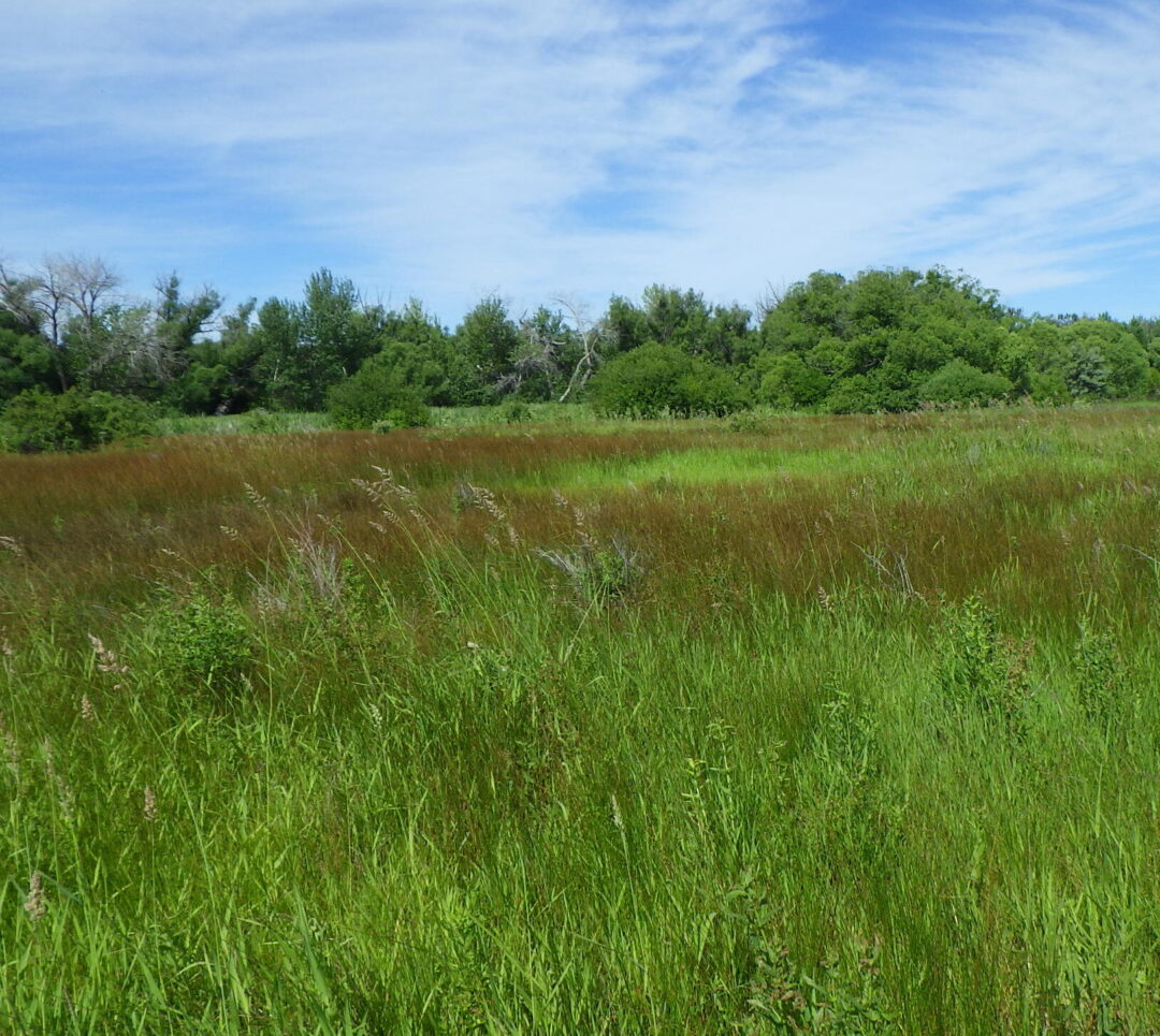
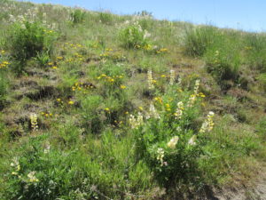
Wetlands at Hidden Springs
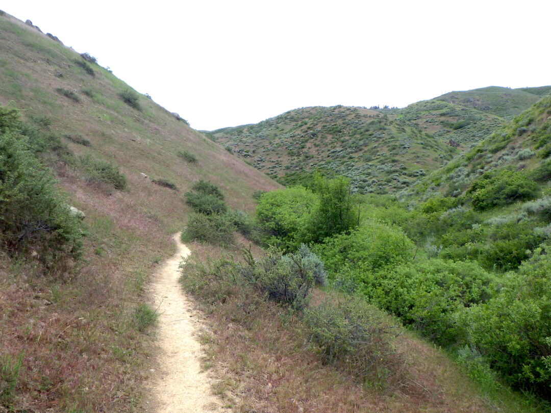
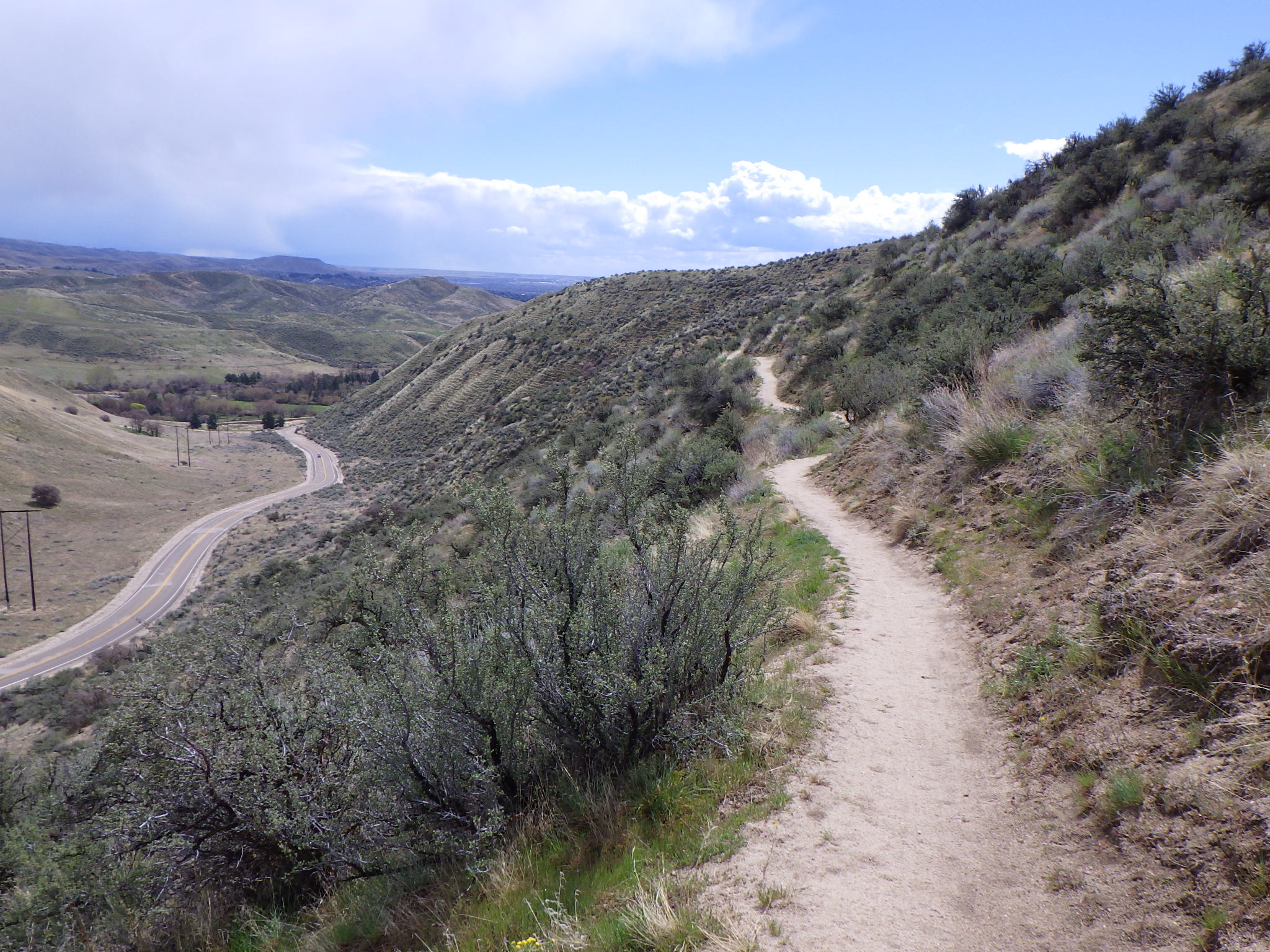
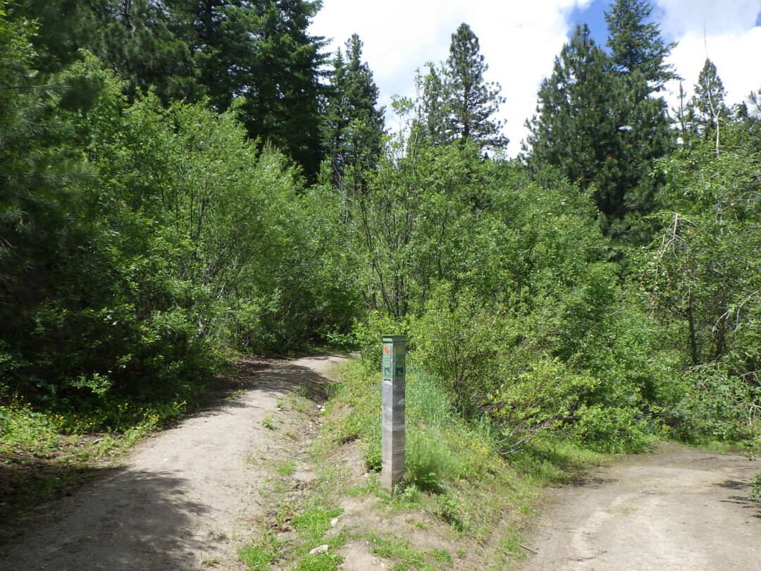
As an alternative to heading to higher elevations for wildflowers during the summer months, when the foothills proper have largely dried out, check our what’s growing in your local wetlands for a whole new suite of interesting plants, some of which are just hitting their stride. The wildflower walk described here, through the exceptionally rich remnant wetlands at Hidden Springs, is the shortest walk in the series, a half-mile ramble that is a pleasant morning or evening outing even on a hot summer day.
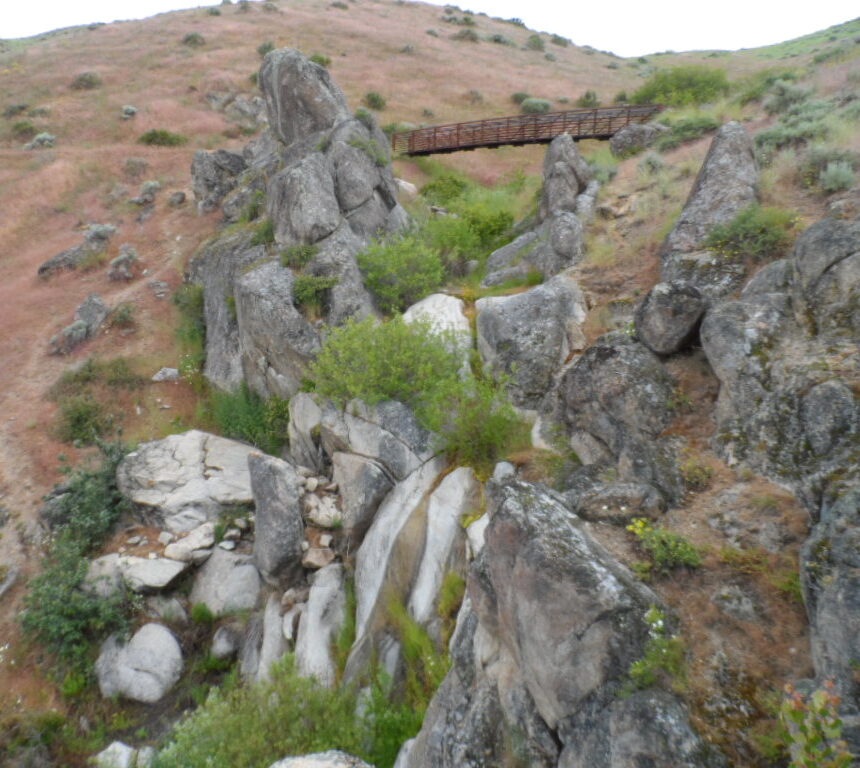
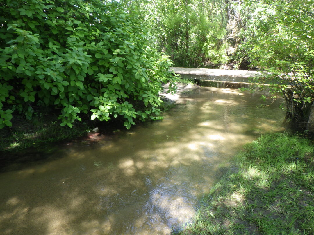
Description: The walk as described begins at the main trailhead on the south side of Dry Creek Road between Cartwright Road and Seamans Gulch Road. A trail at the east side of the trailhead cuts south through a selection of marshland habitats to a well-shaded bridge across Dry Creek, where the described portion of the walk ends. Be sure to enjoy the birds as well, and don’t forget your mosquito repellent!
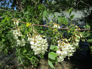
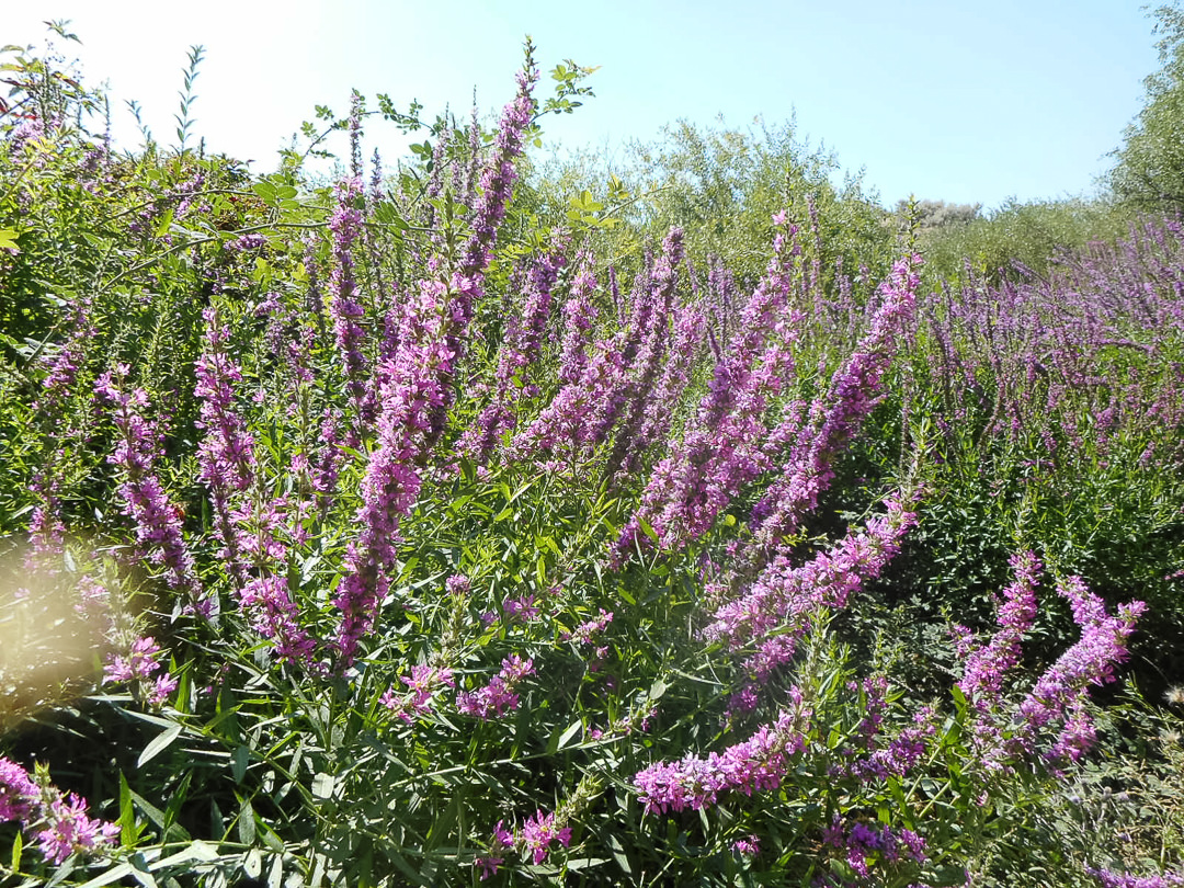
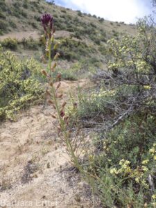
Purple loosestrife (Lythrum salicaria)
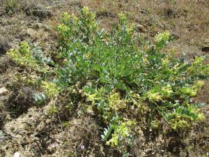
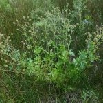
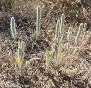
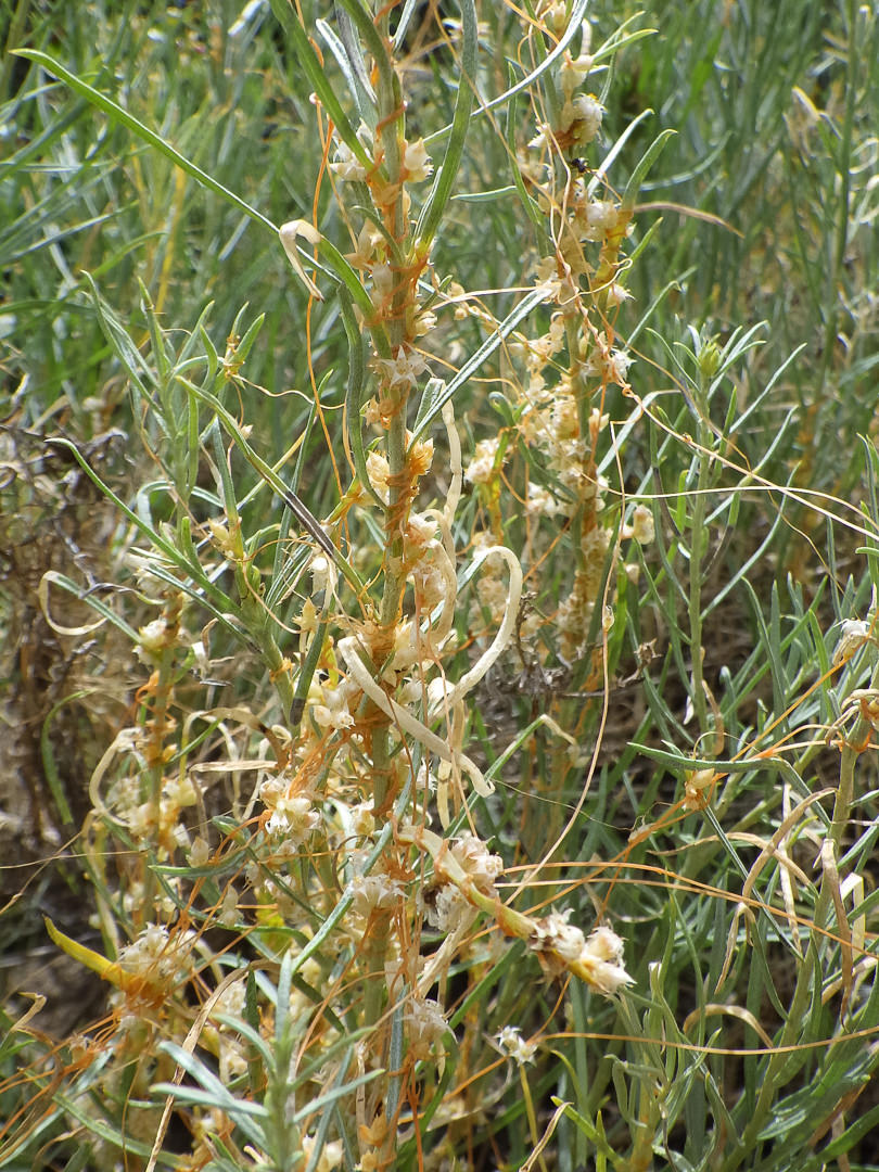
As a generalized introduction, wetland floristics differ from upland floristics in that, thanks to the ease that seeds and other propagules are transported by waterfowl, plant distribution is determined less by geographic range per se and more by water seasonality, depth, and chemistry, as well as how long the wetland habitat has existed. Because of this, the distinction between “native” and “non-native” becomes increasingly problematic for many species, if not outright arbitrary in some cases (does the plant care if it arrived via waterfowl or human agency?) In spite of this, some rare plants do occur as regional endemics, often threatened by wetland invaders that can shove everything else out, given the chance. Among the worst invasive species that are present at Hidden Springs wetlands are purple loosestrife (Lythrum salicaria), mis-named Canada thistle (Cirsium arvense), and reed canarygrass (Phalaris arundinacea).
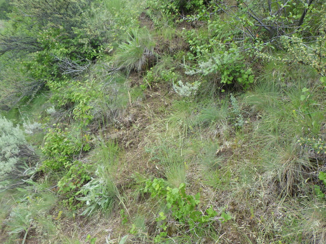
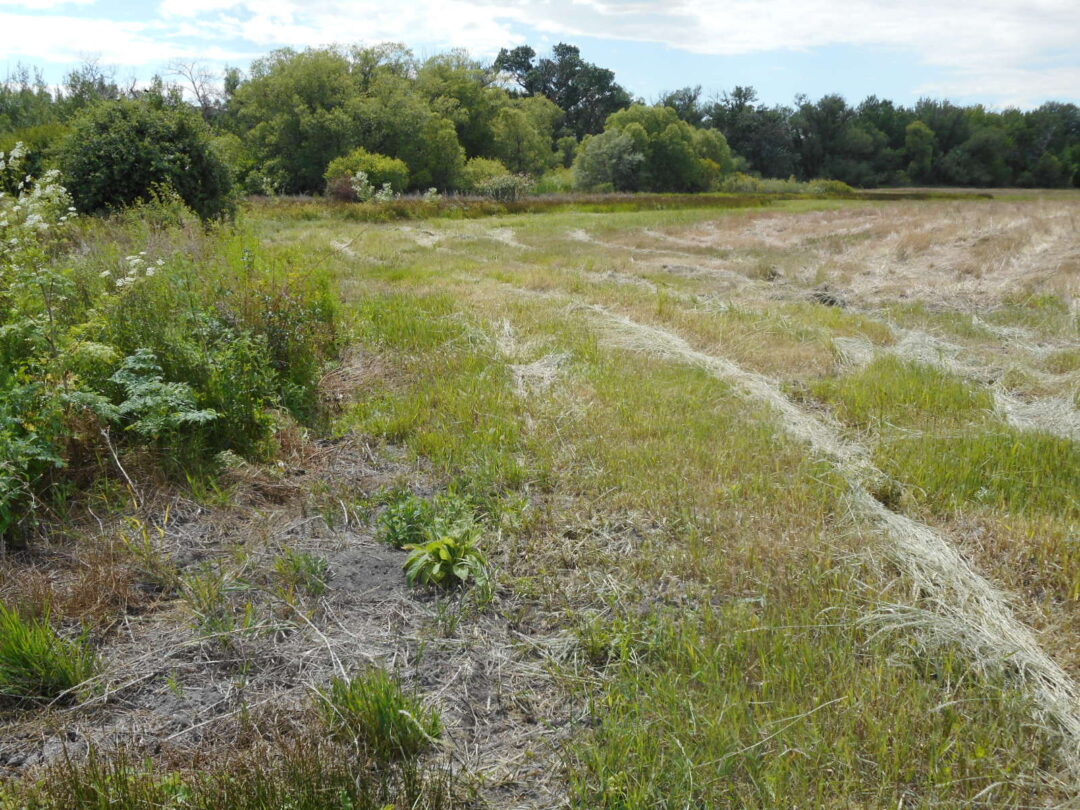
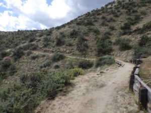
Mowed area around central thicket at Hidden Springs wetlands.
Prior to Euro-American settlement, there were undoubtedly numerous natural wetlands on the fertile flatlands at the base of the foothills, where creeks or springs supported rich meadows throughout the summer months. These would have been prime sites for the earliest homesteaders, who quickly converted the meadows into pastures and farmlands. The very name “Hidden Springs” is a clue that the existing wetlands here are in fact remnants that have persisted from pre-settlement times, among the very few examples in existence locally (Council Springs being another). Even these persisting wetlands have been variously altered; most of the Hidden Springs wetlands are regularly mowed midsummer, except for the central thicket and surrounding areas that harbor the greatest diversity.
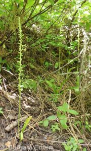
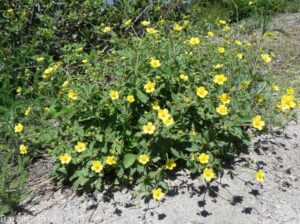
The presence of several locally rare plants in the Hidden Springs wetlands bolsters the interpretation of this site as a persisting remnant, in particular the large stands of Nuttall’s cinquefoil (Potentilla gracilis var. fastigiata) and common avens (Geumaleppicum), as well as scattered Macoun’s buttercup (Ranunculus macounii) and pale bulrush (Scirpus pallidus). These are the special “treasures” of this particular wildflower walk; most can be seen from the trail itself, though some might require a stroll along the edge of the mowed area to spot.
Common avens (Geum aleppicum)
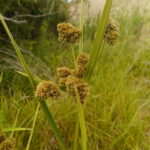
Pale rush (Scirpus pallidus)
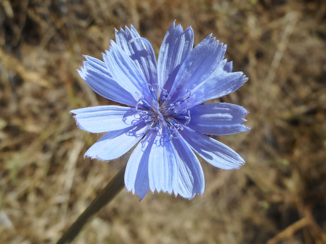
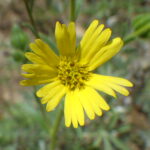
Chicory (Cichorium intybus)
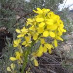
Begin your walk at the east end of the parking lot, where you can easily see three conspicuous noxious weeds (if not recently mowed). Large patches of purple-flowered Canada thistle (Cirsium arvense) grow at the edge of the marsh, interspersed with tall stalks of poison-hemlock (Conium maculatum) covered with small white flowers. Field bindweed or wild morning-glory (Convolvulus arvensis) sprawls along the edge of the path, some plants with lovely pink flowers instead of the usual white. Several other relatively showy non-natives are also present, including red clover (Trifolium pratense) and chicory (Cichorium intybus).
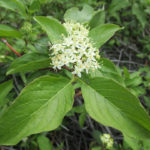
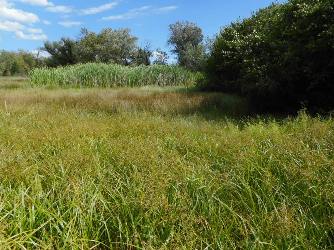
Marsh at Hidden Springs wetlands.
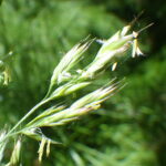
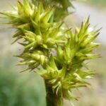
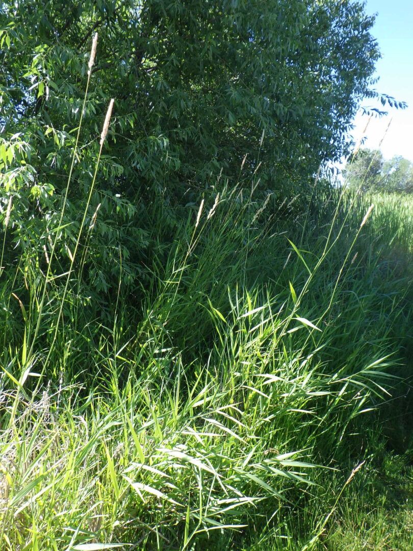
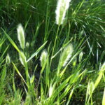
Where the path splits, take the right-hand option to follow the main cattail-lined trail bisecting the marsh. The marsh itself is dominated by members of the three primary families of graminoids: grasses (Poaceae), sedges (Cyperaceae), and rushes (Juncaceae). A popular rule of thumb is that “sedges have edges while rushes are round”; while it is true that 3-angled stems are found only in Cyperaceae, and most rush stems are in fact round, there are also a lot of Cyperaceae with round stems. True grasses differ from both in having hollow stems than are partitioned at regularly spaced nodes; the leaf that arises from each node has a sheathing base and spreading blade. The inflorescence is the real give-away: rushes have small but recognizable six-parted flowers, while grasses and sedges have highly reduced floral parts intermixed with various scale-like structures. In grasses, these are organized into well-defined spikelets that are often bilaterally flattened; the scales of sedges are more often arranged in tightly overlapping spirals.
Open and closed flowers of Baltic rush (Juncus balticus)
Grass spikelets
Inflorescence of awl-fruit sedge (Carex stipata)
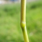
Node on grass.
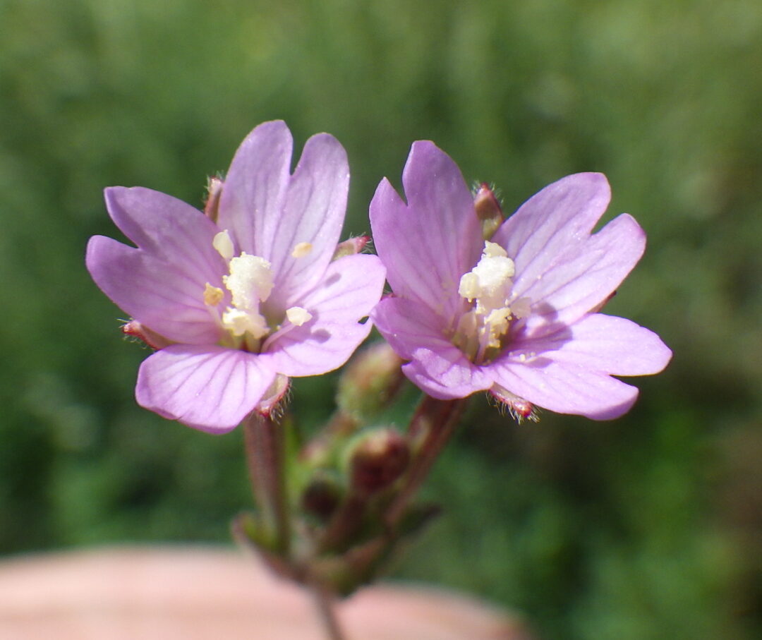
Pink-flowered form of common willow-herb (Epilobium ciliatum)
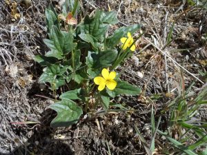
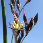
The most abundant rush in the marsh is Baltic rush (Juncus balticus), which tends to form large brownish swaths; plants in the path itself often have spirally twisted stems. One of the most abundant members of the sedge family is common spike-rush (Eleocharis palustris), which has a single narrow inflorescence atop a cylindrical, pith-filled stem. Common wildflowers in the marsh include pinnate-leaved yellow avens (Geum aleppicum) and both pink- and white-flowered forms of the highly variable common willow-herb (Epilobium ciliatum), both finely hairy. Also keep an eye out for Macoun’s buttercup (Ranunculus macounii) growing opposite the first patch of cattails (Typha latifolia), and occasional palmate-leaved Nuttall’s cinquefoil (Potentilla gracilis var. fastigiata).
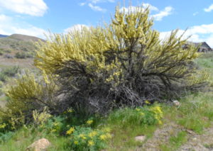
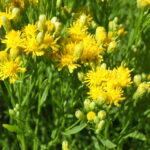
Reed canary-grass (Phalaris arundinacea)
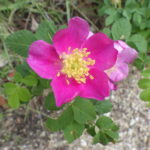
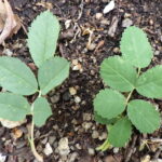
A stand of reed canary-grass (Phalaris arundinacea) grows next to an isolated willow (Salix sp.) on the left; left unchecked, this highly invasive grass can from monocultures in wetlands, reducing diversity and wildlife value. A lone obtuse-leaf rose (Rosa obtusifolia) grows on the right side of the path; compare the hairy leaves to the glabrous leaves of dog rose (Rosa canina) farther down the path. Also keep an eye out for a wet depression on the right with an abundance of water speedwell (Veronica anagallis-aquatica) and Nuttall’s cinquefoil (Potentilla gracilis), surrounded by spikerush (Eleocharis palustris) and panicled bulrush (Scirpus microcarpus).
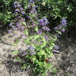
The path wraps around a thicket consisting primarily of black hawthorn (Crataegus douglasii) and dog rosa (Rosa canina). Among the plants growing at the moist edge of this stretch of path are rabbitsfoot grass (Polypogon monspeliensis), toad rush (Juncus bufonius), jointed rush (Juncus articulatus), and strawberry clover (Trifolium fragiferum) with its curiously swollen fruiting heads. Large clumps of awl-fruit sedge (Carex stipata) are conspicuous just before the thicket; this is one of the more easily identified sedges, along with woolly sedge (Carex pellita) which might also be spotted here. Catnip (Nepeta cataria) grows on the back side of the thicket, where there is also an easily accessible colony of hairy evening-primrose (Oenothera villosa ssp. strigosa). Pale bulrush (Scirpus pallidus) grows near the thicket but is not usually visible from the path.
After paralleling the back side of the thicket for a short distance, the path cuts across a weedy area (possibly mowed) with both yellow and white color morphs of moth mullein (Verbascum blattaria), common mullein (Verbascum thapsus), and unusually pink forms of bindweed (Convolvulus arvensis); also keep an eye out for bracted verbena (Verbena bracteata).
Dry Creek at Hidden Springs.
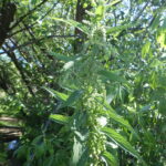
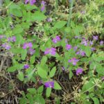
The guided portion of the walk ends in the gallery forest along Dry Creek, where the path crosses a sturdy bridge. Dominant trees and shrubs include black cottonwood (Populus trichocarpa), red-osier dogwood (Cornus stolonifera). interior rose (Rosa woodsii ssp. ultramontana), and various willows (Salix spp.) Look carefully and you might see some common horsetail (Equisetum arvense) and American speedwell (Veronica americana) growing along the creek, and possibly western goldenrod (Eucephalus occidentalis) depending on the season. Turn left after crossing the creek to look for twining wild-cucumber (Echinocystis lobata) and a small patch of stinging nettle (Urtica dioica), whose stinging hairs can give you a rash if you brush against it. Being careful not to touch the stinging nettle, compare it to plants of catnip (Nepeta cataria), which grows next to the bridge; the leaves are somewhat similar, but those of stinging nettle are more sharply toothed, and its tiny wind-pollinated flowers are in tassels.
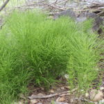
Common horsetail (Equisetum arvense)
Western goldenrod (Euthamia occidentalis)
Wild-cucumber (Equisetum laevigatum)
Stinging nettle (Urtica dioica ssp. holosericea)
Continuing wandering on your own from this point, or retrace your steps to the trailhead.
PLANT LIST [updating needed]
Plants listed in alphabetical order by genus within category. *Indicates native species (or at least possibly native; see Introduction to this walk).
POLECAT LOOP WILDFLOWER WALK late March through April
THIS WALK IS CURRENTLY NOT AN OPTION AS DESCRIBED, DUE TO THE TRAIL NOW BEING PART OF A ONE-WAY LOOP AS PART OF A PILOT PROGRAM BY RIDGE-TO-RIVERS. As so designated, the described section can only be accessed as part of a minimum 4-mile loop. The Pilot Program is scheduled to run through November 1, 2021, after which its continuation will depend on feedback.
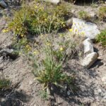
Sandy slopes on east segment of Polecat Loop Trail, with best selection of wildflowers.
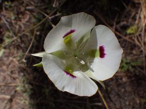
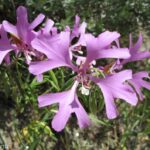
Description: This is no longer an easy walk for enjoying a good selection of spring wildflowers, including a diversity of tiny “belly flowers” (best enjoyed at close range). One tiny “treasure” is the elusive, eponymous Idahoa, if only for the name; a challenge to find, and in only one spot along the trail. Other special plants include the rare Aase’s onion (Allium aaseae) and uncommon hairy wild-cabbage (Caulanthuspilosus).
Aase’s onion (Allium aaseae)
idahoa, pepperpod, scalepod (Idahoa scapigera)
hairy wild-cabbage (Caulanthus pilosus)
The highlighted walk is the east segment of Polecat Loop Trail (#81) paralleling Cartwright Road. The plant list covers 1.5 miles from the Cartwright Road trailhead to the southern dogleg on the path, with the option of then doubling back (for 3 miles roundtrip), or continuing for loop options with few additional flowers. Most of the recommended section is sandy, but there are stretches with more clay content that should be avoided when muddy. The single-track trail is popular with cyclists, so be alert and courteous.
PLANT LIST [updating needed]
NOTE: Please enjoy the wildflowers and leave them for others to enjoy. Because our unique local flora is already under pressure from invasive weeds and habitat loss, harvesting of native plants is not encouraged on this website, especially along popular trails.
Flowering plants are listed in likely order of occurrence from trailhead; some might not yet be in bloom, or present during a particular year. * designates native plants
*Idahoa, pepperpod, or scalepod (Idaho scapigera) – “perhaps the most unique and appealing of those members of the mustard family endemic to western North America” (Intermountain Flora)
*Rubber rabbitbrush (Ericameria [formerly Chrysothamnus] nauseosa) — var. hololeuca is the more common larger variety; the smaller, more spindly var. oreophila is mostly on plateaus
*Big sagebrush (Artemisia tridentata) – most plants are ssp. tridentata, with some sporadic ssp. vaseyana (shorter plants with broader leaves, possibly planted)
*Bluebunch wheatgrass (Pseudoroegneria spicata, alternatively in Agropyron or Elymus) – both native-to-site and planted races from other sites probably present
SIGNIFICANT NOXIOUS WEEDS (not in bloom, but evident)
OREGON TRAIL WILDFLOWER WALK mid March through April
Description: For this wildflower walk we venture south of the Boise River, to see what’s in bloom above basalt cliffs along the Oregon Trail. Meet at Oregon Trail Recreation Area parking lot on the south side of Hwy 21/Gowen Road opposite E Lake Forest Drive (NOT the Oregon Trail Reserve accessed from E Lake Forest Drive). We’ll enjoy the early spring flowers of the basalt flats, including several not known from the foothills north of the river. Difficulty: 2-3 miles roundtrip, modest elevation gain. Heavy clay soils; avoid when muddy! No dogs, please.
[THIS WALK NOT YET CONVERTED INTO SELF-GUIDED FORMAT]
PLANT LIST [updating needed]
Plants listed in approximate order of encounter within category. * indicates native species
*Bluebunch wheatgrass (Pseudoroegneria spicata, alternatively in Agropyron or Elymus) – both native-to-site and planted races from other sites probably present
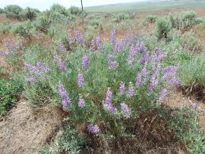
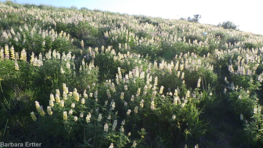
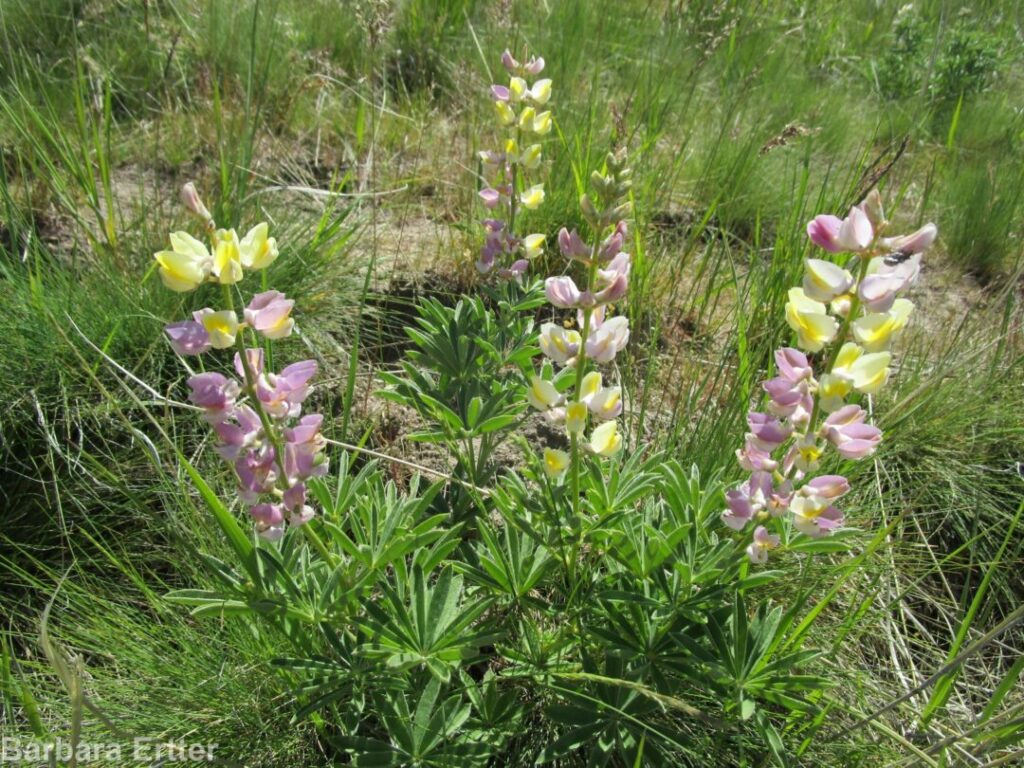
Description: This short walk is primarily to enjoy a magnificent population of longspur or ‘polychrome’ lupine at peak bloom (and fragrance!), along with a nice selection of other locally unusual plants on good-quality habitat. The walk to the lupines is only 1 mile round-trip, with 300 feet elevation gain; several options exist for anyone wanting to go farther on Corrals Trail.
From the Miller Gulch trailhead (just past milepost 3 on Bogus Basin Road), follow the trail across a grassy west-facing slope, where you might spot foothills death-camas (Toxicoscordion paniculatum, previously in Zigadenus), our native gray-green thistle (Cirsium cymosum var. canovirens), and western hawksbeard (Crepis occidentalis).
foothill or panicled death-camas (Toxicoscordion paniculatum)
gray-green thistle (Cirsium cymosum var. canovirens)
Western hawksbeard (Crepis occidentalis)
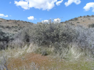
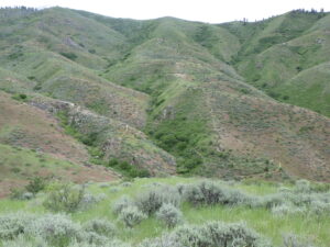
As the trail curves around to the north side of hill, you will start seeing lupines, but keep going! Take time to appreciate the good-quality shrub-steppe habitat, with abundant perennial wildflowers, bunchgrasses, and scattered shrubs separated by open areas that are largely free of invasive annual grasses. These open areas are a critical component of this habitat type, providing critical ecosystem functions and also reducing the spread of wildfires. Among the plants you might notice are Modoc hawksbeard (Crepis modocensis), which blooms earlier and has much more divided leaves than the western hawksbeard.
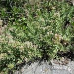
Good quality shrub-steppe at Millers Gulch.
Modoc hawksbeard (Crepis modocensis)
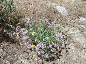
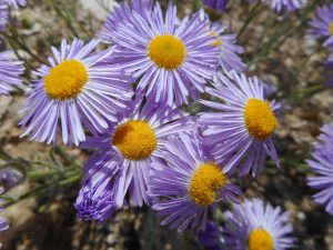
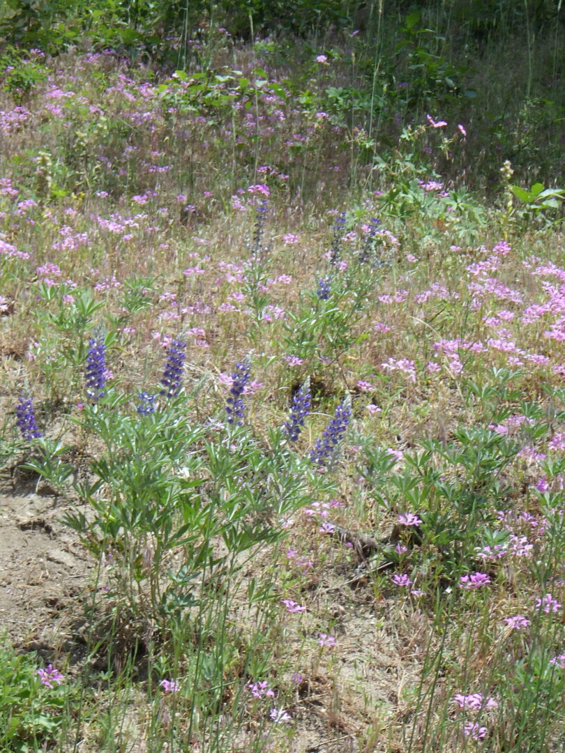
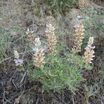
Your patience eventually pays off when you reach the main lupine patch at the crest of the ridge. With luck, you will have arrived at peak bloom, when the air is scented with the fragrance given off by the lupine flowers. Although longspur lupine is the “official” common name, I like to call the populations in the Boise foothills the “polychrome lupine”, because the flowers are so wildly varied in color, even more so locally than is the norm for this species. Some of the color difference, especially on the same plant, is how the plant communicates with its pollinators (mostly bees); the flowers change color when they are ready for pollinating, and then change again to a different color when the have already been pollinated, or are at least past peak.
longspur or polychrome lupine (Lupinus arbustus)
longspur or polychrome lupine (Lupinus arbustus)
The plant list for this walk continues to the junction with Corrals Trail, not far beyond the main lupine patch. Doing so adds some “plateau” habitat and a few additional species, depending on the season. Possibilities include native woolly plantain (Plantago patagonica), shaggy fleabane (Erigeron pumilus var. intermedius), and Douglas’ sedge. From the junction, you have the option of turning left and continuing your walk as far as you want on Corrals Trail, retracing your route, or turning right to make a loop with Corrals trailhead and a walk along the side of the road back to Millers Gulch trailhead.
shaggy fleabane (Erigeron pumilus var. intermedius)
shaggy fleabane (Erigeron pumilus var. intermedius)
PLANT LIST [updating needed]
NOTE: Please enjoy the wildflowers and leave them for others to enjoy. Because our unique local flora is already under pressure from invasive weeds and habitat loss, harvesting of native plants is not encouraged on this website, especially along popular trails.
Flowering plants are listed in likely order of occurrence from trailhead; some might not yet be in bloom, or present during a particular year. * indicates native species
WILDFLOWERS
*Fiddleneck (Amsinckia spp.) species difficult to distinguish
*Small or garden burnet (Sanguisorba minor, alternatively Poterium sanguisorba) non-native, frequently included in post-fire seeding mixes for livestock and wildlife forage
*Bluebunch wheatgrass (Pseudoroegneria spicata, alternatively in Agropyron or Elymus) both native-to-site and planted races from other sites probably present
MILEPOST 12 / UPPER DRY CREEK WILDFLOWER WALK mid June to mid July
Ponderosa Pine Overlook in Upper Dry Creek.
Enjoy spectacular mountain flowers and views along the Upper Dry Creek trail system from the Milepost 12 trailhead at the lower edge of the conifer forest, 2500 feet above the Boise Valley heat. This is the quickest driving access to a hike in the conifers for most residents of Boise, with the least carbon footprint. In addition to penstemon and other showy floral treasures, special treats of this wildflower walk include two native (albeit inconspicuous) orchids and several types of parasitic plants.
Description: The Upper Dry Creek trail system is on private land owned by the Grossman Family, with public access made possible (at least for now) thanks to a partnership with the Land Trust of the Treasure Valley and Ridge to Rivers. The wildflower walk begins at the side road taking off from the dogleg on Bogus Basin Road just past Milepost 12. Parking options are informal and very limited, so carpooling is recommended for groups; note that there is also roadside parking for several cars on the opposite side of Bogus Basin Road. The walk as described (Ponderosa Pine Overlook trail and Snowshow Hare Loop) is about 3 miles long, with about 350 foot elevation gain. The trails follow old logging roads, mostly fairly level but eroded in places and with some steep sections.
Silver lupine and ragged-robin at Milepost 12 trailhead.
Begin by appreciating the wildflowers on the open sandy roadcuts, starting in the parking area itself. Among the locally common plants that might be in bloom are ragged-robin (Clarkia pulchella), sticky geranium (Geranium viscosissimum), wand phacelia (Phacelia heterophylla), Payette penstemon (Penstemon payettensis), sulphur buckwheat (Eriogonum umbellatum), common tarweed (Madia gracilis), and large-flowered groundsmoke (Gayophytum diffusum). Both silver lupine (Lupinus argenteus) and silky lupine (Lupinus sericeus) are present; the former has blue-violet flowers, while the latter has lavendar flowers that turn tan after being pollinated. Sharp eyes might even spot a small patch of narrowleaf skullcap (Scutellaria angustifolia) tucked under a bittercherry not far from Bogus Basin Road, or an odd-looking Franciscan broomrape (Aphyllonfranciscanum, previously in Orobanche fasciculata) parasitizing the roots of adjacent wildflowers. Common shrubs at the trailhead include bittercherry (Prunus emarginata), chokecherry (Prunus virginiana), Macdougal’s rose (Rosa nutkana ssp. macdougalii), and Scouler’s willow (Salix scouleriana).
Take time to look for some interesting plants where a small streamlet flows over rocks, in the bend of the road just before the vehicle gate. The streamlet and adjacent steep slope is sensitive habitat, so please avoid the temptation to clamber up for a closer peek. In addition to field monkeyflower (Erythranthe arvensis, previously in Mimulus guttatus), wormleaf stonecrop (Sedum stenopetalum), brittlefern (Cystopterisfragilis), this is an excellent place to see pearlwort (Heterocodon rariflorum), a strong contender for our least visually attractive native wildflower. The species epithet refers to its rarely produced small blue chasmogamous bellflowers; the plant usually depends instead on inconspicuous self-pollinating cleistogamous flowers. It is nevertheless one of my favorite plants to find, and maybe you’ll be lucky to catch it with a blue flower or two! Late in the season, the dried streamlet can be white with the delicate blossoms of mountain or Gairdner’s yampah (Perideridia montana).
Upper Dry Creek forest.
Following the road (DC5) beyond the gate, the vegetation gradually transitions from mid-elevation brushland to a shaded conifer forest, mostly Douglas-fir (Pseudotsuga menziesii) with a few ponderosa pine (Pinus ponderosa). Shrubs and small trees that make their appearance in the transition zone include snowbrush ceanothus (Ceanothus velutinus), Rocky Mountain maple (Acer glabrum), mountain snowberry (Symphoricarpos rotundifolius var. vaccinioides), mallowleaf ninebark (Physocarpus malvaceus), and even a few quaking aspen (Populus tremuloides), among others. One noteworthy roadside rosebush differs from the locally common solitary-flowered Macdougal’s rose (Rosa nutkana ssp. macdougalii) in having multiple flowers; it is probably a natural hybrid between Macdougal’s rose and interior rose (Rosa woodsii ssp. ultramontana), which is the common native rose below the conifer zone. The partly shaded roadbanks provide habitat for an increased diversity of wildflowers, notably Wilcox’s penstemon (Penstemon wilcoxii), branched phacelia (Phacelia ramosissima var. subglabra), diamond-petal farewell-to-spring (Clarkia rhomboidea), scarlet gilia (Ipomopsis aggregata), and western sweet-cicely (Osmorhiza occidentalis). A colony of horsemint (Agastache urticifolia) can be spotted (and smelled) at one bend in the road, while a patch of thimbleberry (Rubus nutkanus, previously R. parviflorus) grows at a brushy streamlet.
Wilcox’s penstemon (Penstemon wilcoxii)
branched phacelia (Phacelia ramosissima var. subglabra)
diamond-petal clarkia or farewell-to-spring (Clarkia rhomboidea)
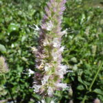
Horsemint (Agastache urticifolia)
Junction of Ponderosa Pine and Snowshoe Hare Loop trails.
Keep to the left at unmarked junctions until reaching the intersection with the Snowshoe Hare Loop (DC4) at about 3/4 mile from the trailhead. To follow this wildflower walk as described, take the left-hand fork and do the loop in a clockwise direction. The road winds its way up the slope, with an abundance of sheltered north- and east-facing slopes in relatively dense forest. This is excellent habitat to look for the slender spires of Alaska rein-orchid (Platanthera unalascensis), a true native orchid that is fun to find even though the tiny green flowers are not particularly showy. Be sure to also peek under roadside thickets of Scouler’s willow (Salix scouleriana) for the distinctively mottled leaves of rattlesnake-plantain (Goodyera oblongifolia), another native orchid; the spikes of cream-colored flowers generally don’t develop until mid-summer. You might also notice the sweetly scented leaves of fragrant bedstraw (Galium trifolium) in the same habitat, more restrained than its rambuctious relative common bedstraw (Galium aparine). Sections of this loop are also brightened by large roadside stands of Idaho woodbeauty (Drymocallis glabrata), and if the timing is right (mid-summer), you can enjoy the lovely mountain hollyhock (Illiamna rivularis).
Alaska rein orchid (Platanthera unalascensis)
rattlesnake plantain, jade orchids or ladies’ tresses
Snowshoe Hare Loop levels out for a while, before intersecting Doug Fir Trail (DC3). Turn right to continue on Snowshoe Hare Loop, down a fairly steep grade that can be slippery in spots. The road cuts through a dense thicket of snowbrush ceanothus (Ceanothus velutinus), whose white flower clusters and shiny resinous leaves can scent the air on a sunny day. Midway down the slope is a flat opening, possibly an old logging staging area, with abundant large-flowered groundsmoke (Gayophytum diffusum), common tarweed (Madia gracilis), and other annuals. In the center of the clearing are several large clumps of mountain stinging nettle (Urtica dioica ssp. gracilis); note the sharply toothed leaves and dangling inflorescences of tiny flowers, so you know what to avoid. Some of the rubber rabbitbrush (Ericameria nauseosa) at the lower edge of the clearing are unwilling hosts to tangled orange threads and small white flowers of western dodder (Cuscuta occidentalis), a native parasitic plant.
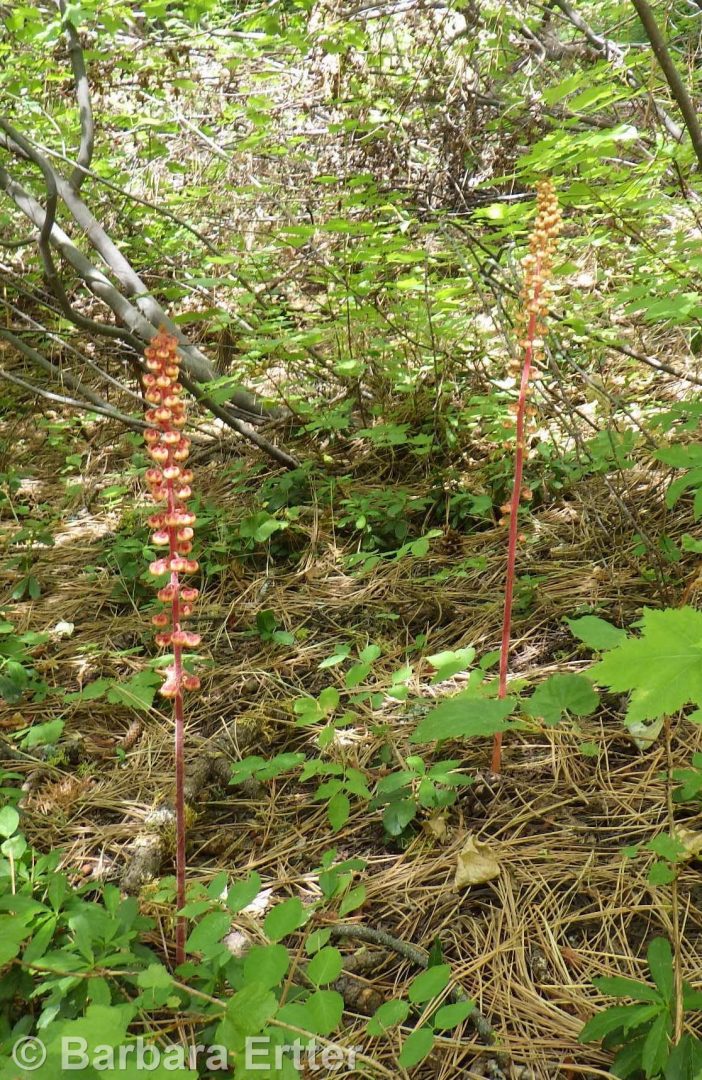
Pinedrops (Pterospora andromedea)
Ponderosa Pine Overlook is at the bottom of the grade, where Snowshoe Hare Loop reconnects with Ponderosa Pine trail. Several large boulders, scenic views, and a shaded flat opening make this site a destination point and pleasant place to take a break. A few hotrock penstemon (Penstemon deustus) grow among the boulders, but the flowers tend to finish blooming fairly early. Turn right on a well-shaded road to return to complete the loop and return to the trailhead, keeping a sharp eye out for more Alaska rein-orchid and, if you are lucky, some pinedrops (Pterospora andromedea) in the open forest floor. This curious plant, which lacks chlorophyll, has traditionally been categorized as a saprophyte, meaning a plant that obtains its nourishment from decomposing vegetation. It is now better interpreted to be a mycotroph, which is basically a freeloader on the forest’s intricate mycorrhizal network that connects fungal mycelium and tree roots. The mycelium effectively extends the nutrient and water collecting capacity of the tree roots, while obtaining photosynthetic nourishment produced by the tree; as far as is known, mycotrophs like pinedrops also tap into the network for their nourishment, but provide nothing in return.
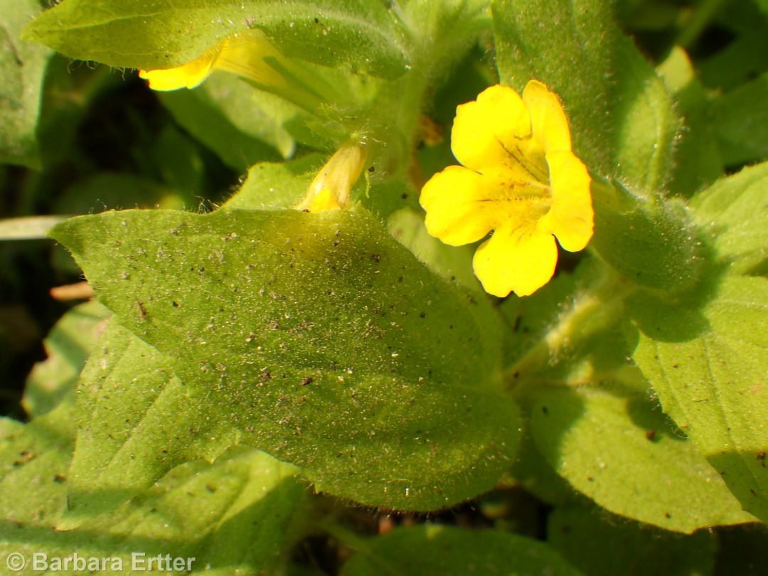
musk monkeyflower (Erythranthe moschata)
Once back at the trailhead, there is the option of a few bonus wildflowers by walking up Bogus Basin Road a couple of hundred feet to a roadside wet spot where a streamlet intersects the road. There are good-sized patches here of musk monkeyflower (Erythranthe moschata, previously in Mimulus), with its unusual slimy hairs, and American speedwell (Veronica americana). There might even be some flowering stalks of white bog-orchid (Platanthera dilatata), a much showier species than the Alaska rein-orchid.
PLANT LIST [updating needed]
NOTE: Please enjoy the wildflowers and leave them for others to enjoy. Because our unique local flora is already under pressure from invasive weeds and habitat loss, harvesting of native plants is not encouraged on this website, especially along popular trails.
Plants listed alphabetically by genus within category. * indicates native species
*Idaho woodbeauty, sticky cinquefoil (Drymocallis glabrata, formerly Potentilla glandulosa var. intermedia) – petals yellow, longer than sepals
*Common woodbeauty, sticky cinquefoil (Drymocallis glandulosa var. glandulosa, previously in Potentilla) – petals cream-white to pale yellow, no longer than sepals
*Macdougal’s, Nootka, or Spalding’s rose (R. nutkana subsp. macdougalii) — large solitary flowers; also probable hybrids with *Interior or Wood’s rose (Rosa woodsii subsp. ultramontana)
Description: Begin at Lydle Gulch trailhead opposite Barclay Bay parking lot after crossing Lucky Peak Dam from Highway 21 (VERY FRAGILE SOILS near trailhead; stay on well-established trails!). South to trail crossing Lydle Creek ca 1/2 mile above Foote Park; trail cuts north to top of slope. Turn around at gate (with option of exploring network of dirt roads from Bonneville Point to Oregon Trail trailhead on Hwy 21), return to Lydle Creek and follow trail to Foote Park on east side of creek. Difficulty: 2 miles roundtrip, modest elevation gain. Heavy clay soils; avoid when muddy, and stay on trails!
[THIS WALK NOT YET EDITED]
PLANT LIST [updating needed]
Plants listed in approximate order of encounter within category. * indicates native species
*Bluebunch wheatgrass (Pseudoroegneria spicata, alternatively in Agropyron or Elymus) – both native-to-site and planted races from other sites probably present
LYDLE GULCH WILDFLOWER WALK mid March to early April
Description: Begin at Lydle Gulch trailhead opposite Barclay Bay parking lot after crossing Lucky Peak Dam from Highway 21 (VERY FRAGILE SOILS near trailhead; stay on well-established trails!). South to trail crossing Lydle Creek ca 1/2 mile above Foote Park; trail cuts north to top of slope. Turn around at gate (with option of exploring network of dirt roads from Bonneville Point to Oregon Trail trailhead on Hwy 21), return to Lydle Creek and follow trail to Foote Park on east side of creek. Difficulty: 2 miles roundtrip, modest elevation gain. Heavy clay soils; avoid when muddy, and stay on trails!
[THIS WALK NOT YET EDITED]
PLANT LIST [updating needed]
Plants listed in approximate order of encounter within category. * indicates native species
*Bluebunch wheatgrass (Pseudoroegneria spicata, alternatively in Agropyron or Elymus) – both native-to-site and planted races from other sites probably present
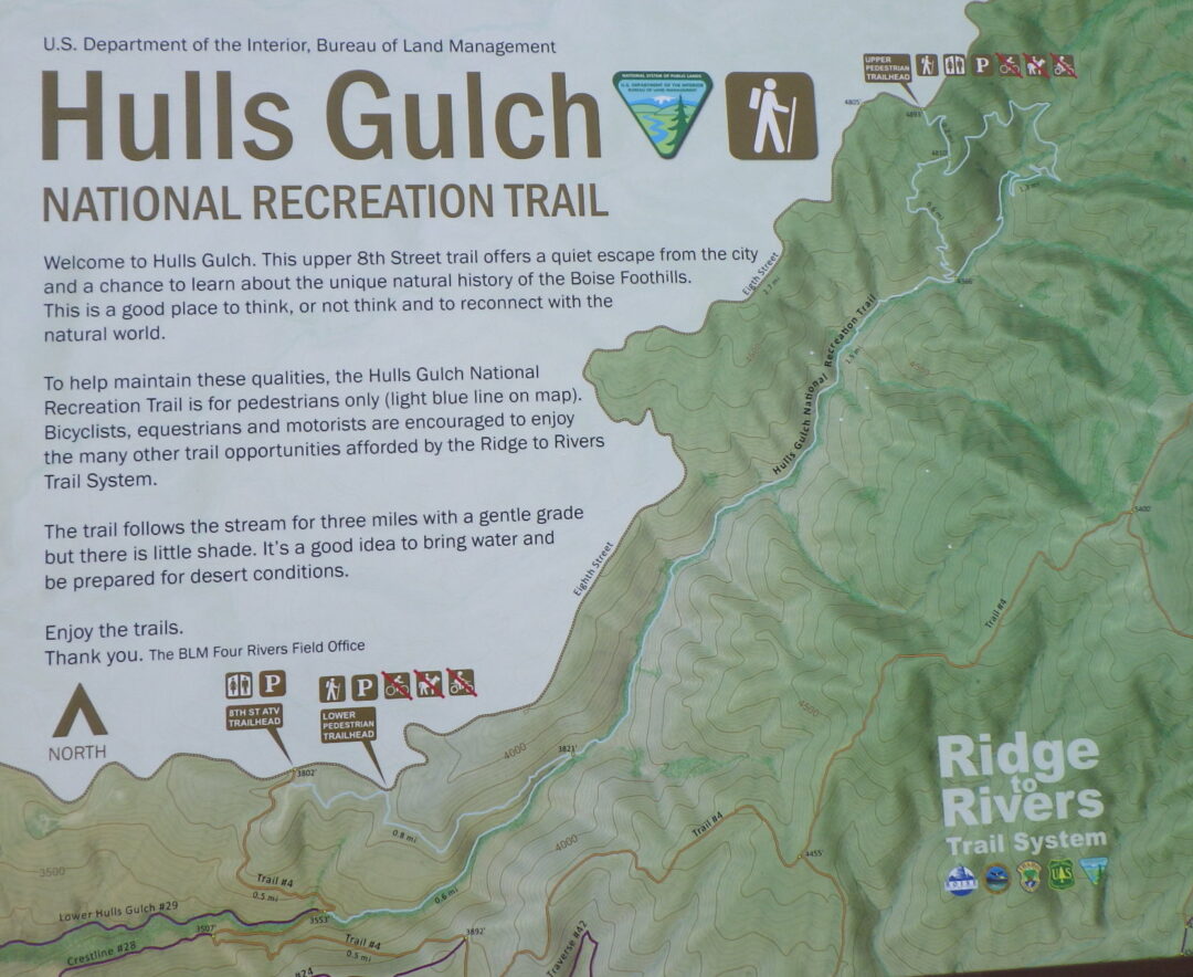
HULL’S GULCH INTERPRETIVE LOOP WILDFLOWER WALK June/early July
As the days heat up, take advantage of somewhat cooler temperatures at higher elevations (1500-2000 feet above the Boise Valley) to explore the upper reaches of Hulls Gulch. In addition to spectacular scenery and fascinating rock outcrops, enjoy a wonderful diversity of mid-elevation wildflowers, including Wilcox’s penstemon, white mariposa-lily, and two different varieties of sulphur-flowered buckwheat.
Description: The 2½ mile loop described here begins at the uppermost trailhead (“Upper Hulls Gulch” on Ridge to Rivers map) on the 8th Street Extension/Sunset Peak Road, nearly 6 miles beyond Foothills Learning Center. The dirt road is often somewhat rutted in spots, requiring careful driving even in an SUV. An alternative, especially if one wants a longer hike with less driving, is to start at the Hull’s Gulch Interpretive trailhead ( “Lower Hulls Gulch”) 2½ miles past the Foothills Learning Center, 0.2 miles past the larger 8th Street ATV trailhead. This is a popular option that adds a 2 mile long “cherry stem” each way to get to the self-guided portion of the Interpretative Loop.
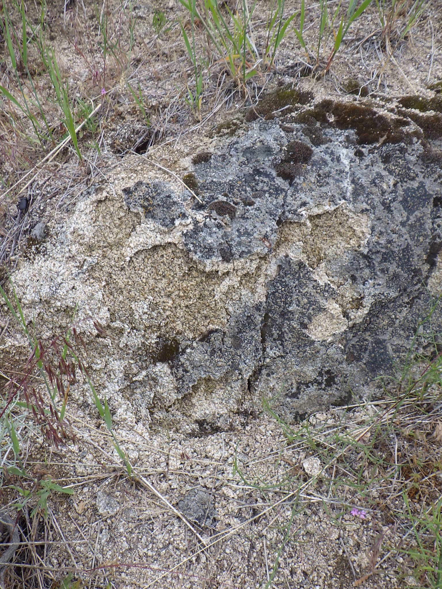
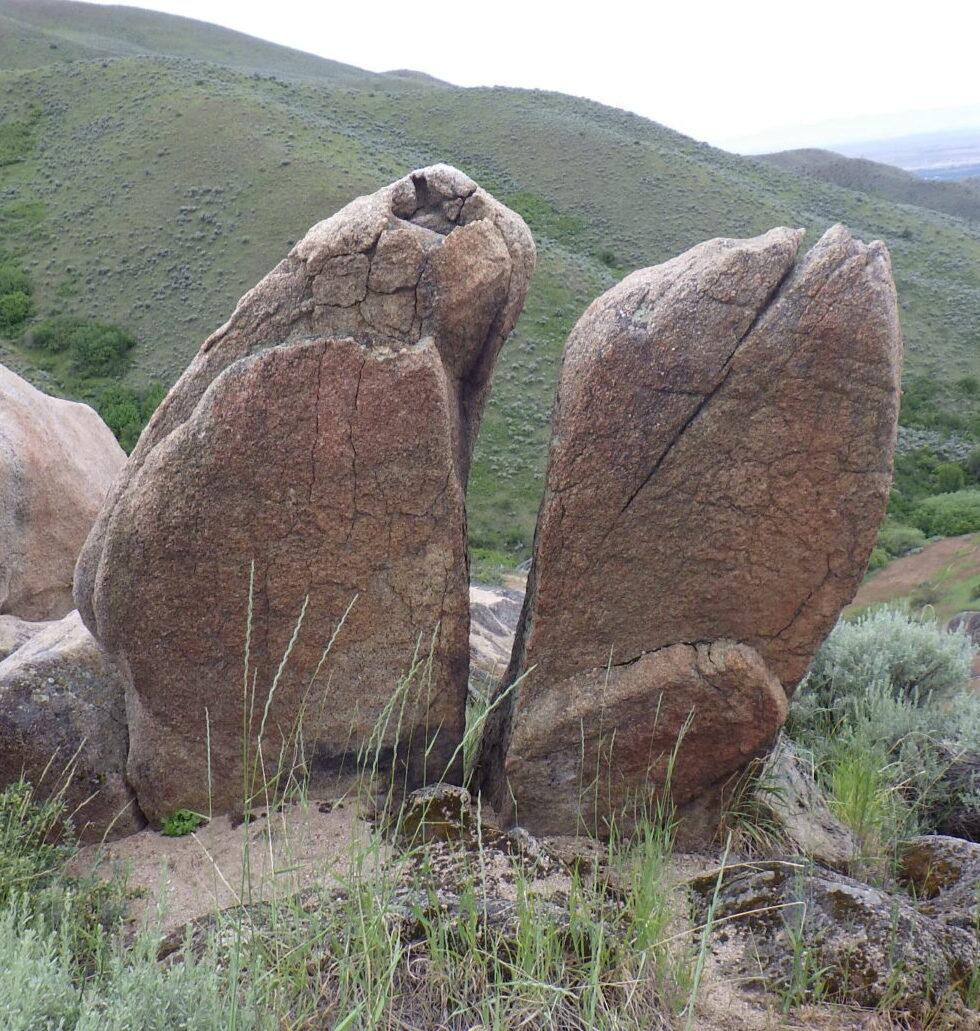
Descriptively named “decomposed granite”
As described, the walk begins on the ridgeline at nearly 4900 feet elevation, descends steeply to creekside at 4370 feet, and returns by a more moderate grade. The entire loop is accordingly above the finer-grained sediments of pre-glacial Lake Idaho, occurring instead on coarse-grained substrates derived directly from disintegrating or “decomposed” granite of the Idaho Batholith. Among the highlights of the loop are the wonderfully sculpted granite monoliths and outcrops. Sturdy shoes with good traction are highly recommended, as the coarse grains can act as ball-bearings on steep surfaces; hiking poles can also be useful. Also be sure to bring sufficient water for the expected temperatures and length of hike.
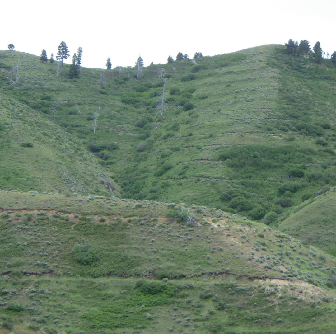
Flood-control terracing in Hulls Gulch.
Before starting your descent, take note of the prominent contour terracing on the slopes above you. Trenches were first bulldozed across the highly erodible slopes of the Boise Ridge following three major fires and subsequent catastrophic flooding in 1959, immortalized in the video “When the Pot Boiled Over“. Another 40 miles of trenches were bulldozed after the devastating, human-caused 8th Street Fire in 1996 (Fend et al. 1999); dead trees from this fire are still prominent on slopes above the terracing. Burned areas were then seeded with a mixture of perennial grasses, sagebrush (Artemisia tridentata), alfalfa (Medicago sativa), and yarrow (Achillea millefolium); subsequent plantings included bitterbrush (Purshia tridentata) and silver sagebrush (Artemisia cana). It is unlikely that even the native species were locally sourced, with the current gene pool now significantly altered from the indigenous vegetation.
Hulls Gulch National Recreation Trail sign.
The Interpretive Loop is part of the Hulls Gulch National Recreation Trail built by the Bureau of Land Management in the 1970’s, when such a trail was a novel idea. Unlike most other trails in the multi-partner Ridge to Rivers trail system, this one is restricted to pedestrians. Cattle grazing is also excluded, though stray cows occasionally end up on the wrong side of the fencing (as happened in 2019). The 1998 fire burned all the large streamside trees to the ground and reduced diversity especially on the south-facing slopes. Although much of the vegetation has seemingly recovered (with some help from planting efforts), it is still heartbreaking for those who knew the area beforehand (A. DeBolt, pers. comm. 2019). Occasional signs along the trail provide additional insights and inspiriration.
Seeded bluebunch wheatgrass (Pseudoroegneria spicata) in Hulls Gulch.
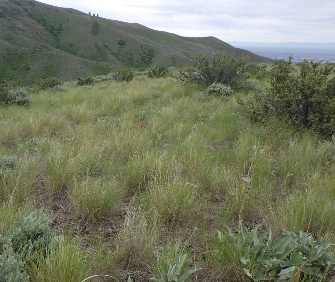
The dominant plants as you start down the trail are the perennial grasses and shrubs that were seeded and planted as part of the post-fire rehabilitation effort. Although there are native forms of bluebunch wheatgrass (Pseudoroegneria spicata, previously in Agropyron) in the Boise Front, seeding mixtures consist of commercially available forms from other parts of the species’ range that have been selected for exceptional vigor and adaptability; some forms are now even recognized as distinct species. Intermediate wheatgrass (Thinopyron intermedium, alternatively in Agropyron, Elymus, or Elytrigia), a rhizomatous Eurasian grass, is also commonly included in seeding mixes. Unfortunately, the very features that make both of these grasses valuable for post-fire erosion control and livestock grazing (i.e., rapid and aggressive growth) can permanently convert a previously diverse open shrub-steppe habitat into a near monoculture in which only a limited subset of the previous native species are able to persist.
Among the native wildflowers that are still prominent along the initial stretch of trail are silver lupine (Lupinus argenteus), wing-fruited or white mariposa lily (Calochortus eurycarpus), yarrow (Achillea millefolium), and arrowleaf balsamroot (Balsamorhiza sagittata, probably past bloom). Also keep an eye out for ballhead sandwort (Eremogone congesta, previously in Arenaria) and Hood’s phlox (Phlox caespitosa, probably past bloom) in open sites on shallow rocky soils. Non-native yellow salsify (Tragopogon dubius) is also common. For rare-plant aficionados, there are a few plants of Boise milkvetch (Astragalus adanus) on the left side of the path shortly before the sign where the trail splits, though these can be difficult to spot when not in bloom (as is likely). Shrubs include bitterbrush (Purshia tridentata), flat-topped mountain big sagebrush (Artemisia tridentata ssp. vaseyana, intergrading with ssp. tridentata), rubber rabbitbrush (Ericameria nauseosa, previously in Chrysothamnus), and patches of bitter cherry (Prunus emarginata).
wing-fruited or white mariposa lily (Calochortus eurycarpus)
Silver lupine (Lupinus argenteus)
Ballhead sandwort (Eremogone congesta var. cephaloidea)
“Split Rock” on Interpretive Loop.
The trail forks about 0.2 miles from the trailhead, beginning the loop proper. The self-guided walk takes the right fork (“Loop Trail”) for the relatively steep descent, saving the gentler left-hand option (“Main Trail”) for the return ascent (unless one wishes to forego the loop and instead go straight to the upper bridge overlooking a waterfall). Dramatic granite outcrops are key features of the right fork option, surrounded by shallow coarse soils that harbor a selection of interesting wildflowers, including silverleaf phacelia (Phacelia hastata), sulphur buckwheat (Eriogonum umbellatum), and western wallflower (Erysimum capitatum). If you’re lucky, you might spot some clustered broomrape (Aphyllon fasciculatum, previously in Orobanche) parasitizing the roots of the silverleaf phacelia. Patches of spreading dogbane (Apocynum androsaemifolium) are also common along this segment of trail, as well as the return stretch.
Western wallflower (Erysimum capitatum)
Silverleaf phacelia (Phacelia hastata)
Clustered broomrape (Aphyllon fasciculatum) on silverleaf phacelia.
spreading dogbane (Apocynum androsaemifolium)
Interpretive Trail in upper Hulls Gulch.
Turn left when you reach the creekside trail, possibly after a short downstream detour to admire an exceptionally large mound of creamy-flowered Wyeth’s buckwheat (Eriogonum heracleoides). The path follows a densely brush-lined creek, with a rich diversity of trees and shrubs including black-barked river birch (Betula occidentalis), Rocky Mountain maple (Acer glabrum), mountain alder (Alnus incana), red-osier dogwood (Cornus stolonifera), syringa (Philadelphus lewisii), blue elderberry (Sambucus cerulea), chokecherry (Prunus virginiana), mallowleaf ninebark (Physocarpus malvaceus), golden currant (Ribes aureum), various willows (Salix), and even a few quaking aspen (Populus tremuloides). A localized patch of non-native Himalayan blackberry (Rubus bifrons, by the most recent taxonomy) is a tasty but worrisome invader. Take note of the dramatic difference between the southeast-facing slope on your left (heading upstream) and the northwest-facing slope on your right. The former is now dominated by invasive annual and planted grasses, including the notorious cheatgrass (Bromus tectorum), medusahead (Taeniatherum caput-medusae), and recently invading North African wiregrass (Ventenata dubia). In contrast, the opposite slope boasts a rich diversity of native shrubs and wildflowers. This difference is presumably driven by differing intensities of sunlight on the contrasting exposures, which preceded but was probably exacerbated by the 8th Street Fire.
River birch (Betula occidentalis)
red-osier dogwood (Cornus stolonifera)
High quality habitat on north-facing slope in Hulls Gulch.
A sturdy bridge crossing the main creek soon provides an up-close opportunity to appreciate the botanical treasures of the opposite slope. The trail doglegs across a deeply shaded tributary and then traverses a short stretch of high quality sagebrush steppe habitat on a north-facing slope, before doubling back once again. Take note of the oddly named enchanter’s-nightshade (Circaea alpina), with its tiny white flowers, on the shaded tributary; surprisingly, it turns out to be closely related to fuchsias and has no connection to true nightshades (Solanum spp.). Take time to enjoy the wealth of wildflowers on the more open portion of the slope, possibly including (depending on your timing) gooseberry-leaf alumroot (Heuchera grossulariifolia), ragged-robin (Clarkia pulchella), diamond-petal farewell-to-spring (Clarkia rhomboidea), few-flower sweetpea (Lathyrus pauciflorus), wormleaf stonecrop (Sedum stenopetalum), western hawkweed (Hieracium scouleri), bastard toadflax (Comandra umbellata), and Payette penstemon (Penstemon payettensis), as well as brittle fern (Cystopteris fragilis) and the lovely native bunchgrasses Idaho fescue (Festuca idahoensis) and junegrass (Koeleria macrantha). Note also the structure of this increasingly threatened habitat, consisting of a complex diversity of shrubs, bunchgrasses, and perennial wildflowers, all spaced out on a matrix of “bare ground” that is perhaps the most critical component of this ecosystem, covered with a protective layer of microflora (e.g., mosses and lichens) and providing habitat for annual wildflowers.
western or Scouler’s hawkweed (Hieracium scouleri)
Bastard toadflax (Comandra umbellata var. pallida)
Looking back at stretch of Interpretive Loop through dense vegetation on north-facing slope.
My favorite stretch some up soon after the trail doubles back to continue its upstream direction, when it enters a partly shaded tunnel of tall shrubs below a large outcrop. The combination of moisture and aspect creates favorable conditions for a wonderful selection of plants that are more commonly found at higher elevations in the conifer zone, bringing together species that are not usually found together. Special plants to look for here include Scouler’s willow (Salix scouleriana) with its broadly blunt leaves, Brown’s peony (Paeonia brownii), Wilcox’s penstemon (Penstemon wilcoxii), heartleaf arnica (Arnica cordifolia), fernleaf biscuitroot (Lomatium multifidum), and Ross’s sedge (Carex rossii). You can also find Macdougal’s or Nootka rose (Rosa nutkana ssp. macdougalii) intergrading with interior or Wood’s rose (Rosa woodsii ssp. ultramontana), which is the common native rose below the conifer zone; the former has larger, generally solitary flowers, and the leaflets are greener and often double-toothed. There are also three species of woodbeauty (Drymocallis, previously sticky cinquefoil in Potentilla glandulosa and P. arguta) growing in close proximity and possibly also hybridizing: yellow-petaled Idaho woodbeauty (D. glabrata), common woodbeauty (D. glandulosa) with small cream-colored petals and a widely branched stem, and a few plants of cordilleran woodbeauty (D. convallaria), which generally has a single tall narrowly branched stem and relatively large cream-colored petals.
fernleaf biscuitroot (Lomatium multifidum)
Macdougal’s rose (Rosa nutkana ssp. macdougalii)
Leaves of interior rose (left) and Macdougal’s rose (right)
Cordilleran woodbeauty (Drymocallis convallaria)
Eriogonum umbellatum var. ellipticum (left) and var. stragulum (right)
After emerging from the shaded tunnel and crossing a small brush-lined stream, take note of our two local varieties of sulphur buckwheat (Eriogonum umbellatum) growing next to one another. One variety (var. ellipticum) has a twice-branched inflorescence with numerous flower heads. The other variety (var. stragulum) has a single-branched inflorescence with fewer, larger flower heads; it appears to bloom slightly earlier than var. ellipticum. Unsurprisingly, intermediates can also be found (part of why these are varieties rather than full species), so this spot is very useful to demonstrate the two extremes side by side. Sulphur buckwheat is an exceptionally diverse species, with at least 40 varieties currently recognized throughout western North America, some highly localized.
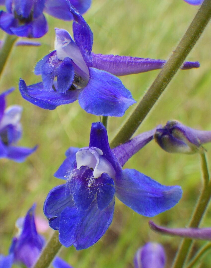
Larkspur (Delphinium) on Interpretive Loop.
The trail cuts back and forth in its continued ascent, at one point crossing a small grass-lined streamlet where Nuttall’s cinquefoil (Potentilla gracilis var. fastigiata) and a dark blue larkspur (Delphinium) can often be found, along with other moisture-loving wildflowers. Potentilla and Delphinium are notoriously difficult genera, with complex variation and rampant hybridization that defy standard taxonomic analysis. At present, P. gracilis var. fastigiata encompasses a broad swath of variation that will probably be divvied up among multiple varieties eventually. The Delphinium at this site doesn’t cleanly fit into any of the currently recognized species; it falls somewhere between a broadly defined slim larkspur (Delphinium depauperatum) and twospike larkspur (Delphinium distichum, previously D. burkei).
High bridge and waterfall on Interpretive Loop.
The destination point for many trail users is the high bridge overlooking a small seasonal waterfall at the head of the interpretive loop; an adjacent rocky flat that offers excellent views is a popular spot for rest breaks and/or lunch. The outcrops make the site scenic at any time of the year, but particularly so when the syringa (Philadelphus lewisii) is in bloom, and again when fall colors are at their peak. You may be able to spot a patch of yellow monkeyflowers (Erythranthe guttata, previously in Mimulus) at the base of the falls; to avoid damaging the delicate streamside vegetation, please do not scramble down for a closer look.
From this point the loop trail leaves the creek and ascends the southeast-facing slope back to the trailhead. Most of this stretch is relatively weedy, with some more outcrops but little in the way of new diversity. The primary exception is a short stretch not far from the high bridge, where the trail doubles back along a northwest-facing slope before crossing a small densely vegetated tributary. Keep an eye out for Oregon sunshine (Eriophyllum lanatum) and scarlet gilia (Ipomopsis aggregata, previously in Gilia) on the open slope above the trail. Also look for more few-flower sweetpea (Lathyrus pauciflora) in the denser brush, and see if you can find both the broad-leaved and narrow-leaved forms.
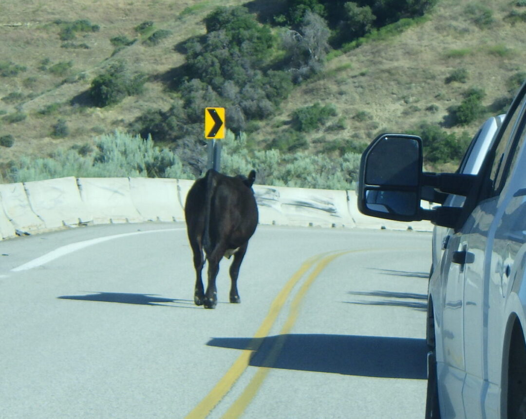
Stray cow on Bogus Basin road.
Note on grazing: Livestock grazing has been a primary economic use of the Boise Front ever since Euro-American settlement of the Treasure Valley in the late 1800’s. Cattle continue to be a familiar sight to trail users, and many of our favorite trails are actually public easements through private ranchlands where access is dependent on our respect for the owners’ rights and compliance with basic rules (e.g., closing gates). Additional grazing allotments are established and regulated on some, but not all, federal lands (Idaho’s Open Range law notwithstanding, which ultimately has more to do with whether fences are for keeping livestock in or out). Simply put, there are some areas where cattle are to be expected, and other areas where they’re on the wrong side of a fence (which could be miles away). The presence of stray cows on the road to Bogus Basin is one example of “wrong side of the fence”, at least below the cattle guard; the Interpretive Loop is another.
Brown’s peony (Paeonia brownii)
Livestock grazing as a cost-effective tool for fuel reduction is widely publicized and well documented, in particular for areas now dominated by invasive annual grasses from Eurasia. What is less well publicized is that the benefits often come with ecological trade-offs, especially at grazing levels that are economically viable. Cattle have no native analog in our local sage-steppe ecosystem, where buffalo infrequently roamed, and much of our native flora is accordingly intolerant of even moderate cattle grazing. This was evident on the Interpretive Loop in 2019, when a few stray cows targeted native plants that were like candy to them, including Brown’s peony (Paeonia brownii) that was eaten to the ground. Streamside plants were also disproportionately impacted, and trampling damaged portions of steep north-facing slopes, thereby increasing the opportunity for invasion by non-native species in these high-quality habitats. Some recovery was evident in 2020, but the peonies had declined in number and vigor, and would undoubtedly disappear completely along with many of the other special wildflowers if grazing were not excluded from the Interpretive Loop.
Fend, J. F., J. Thornton, D. Rittenhouse, F. Pierson, C. R. Mickelson, and C. W. Slaughter. 1999. The science & politics of the 1996 Boise Front Fire – What we have learned from the 8th Street Fire rehabilitation. Proceedings of the Seventh Biennial Watershed Management Conference, C. W. Slaughter, editor. Water Resources Center Report No. 98, Univ. California, Davis.
PLANT LIST [updating needed]
NOTE: Please enjoy the wildflowers and leave them for others to enjoy. Because our unique local flora is already under pressure from invasive weeds and habitat loss, harvesting of native plants is not encouraged on this website, especially along popular trails.
Plants listed alphabetically by genus within category. * indicates native species
*Common woodbeauty, sticky cinquefoil (Drymocallis glandulosa var. glandulosa, previously Potentilla glandulosa var. g.) – petals cream-white to pale yellow, inflorescence open
*Ballhead sandwort (Eremogone congesta var. cephaloidea, previously in Arenaria) – uncommon near trailhead
Small or garden burnet (Poteridium sanguisorba, alternatively Sanguisorba minor) – non-native, frequently included in post-fire seeding mixes for livestock and wildlife forage
*Interior or Wood’s rose (Rosa woodsii subsp. ultramontana) – intergrading with *Macdougal’s, Nootka, or Spalding’s rose (R. nutkana ssp. macdougalii) with solitary larger flowers
*Himalayan blackberry (Rubus bifrons, alternatively R. armeniacus, R. discolor, or R. procerus) – tasty but invasive non-native
*Thimbleberry (Rubus nutkanus, previously R. parviflorus)
*Blue elderberry (Sambucus cerulea, alternatively S. mexicana)
*Bluebunch wheatgrass (Pseudoroegneria spicata, alternatively in Agropyron or Elymus) – both native-to-site and planted races from other sites probably present
RED TAIL/CURRANT CREEK WILDFLOWER WALK — early May
Description: This is a moderate walk (2 to 2.5 miles roundtrip,~300 foot total elevation gain) at the north edge of the Hidden Springs community,with highlights being the primary (or only) populations of camas, Tolmie’s onion, and freckled milkvetch in the Boise Front. Much of the trail is heavy clay,so avoid when wet. This works well as an evening walk, especially as the daytime temperatures are heating up.
From the Dry Creek Road trailhead (on the south side of Dry Creek Road between Cartwright Road and Seamans Gulch Road),cross the road and follow the path that doubles back up the southwest-facing slope. Note the heavy clay soil of this slope,in contrast to the sandy soils that are more common in the Foothills. Most of our native wildflowers are not adapted to this soil type,so the slope is relatively bare or weedy,but there is a large population of an unusual onion as the path curves around to a northwest-facing slope. This is the only known locality for Tolmie’s onion (Allium tolmiei) in the Boise Front, additionally noteworthy in that our plants do not quite “fit” the existing descriptions of the recognized varieties.
Tolmie’s onion (Allium tolmiei)
Pale bastard toadflax
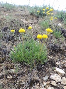
The northwest-facing slope itself is a good example of relatively intact sagebrush-steppe habitat,with a nice selection of wildflowers. The common dandelion-like plant is sagebrush false-dandelion (Nothocalais troximoides); the leaves differ from similar plants in having undulating,untoothed margins. Another interesting plant is more noteworthy for its unusual common name than its flowers: bastard toadflax (Comandra umbellata ssp. pallida),a distant relative of sandalwood.
Continue following Red Tail Trail as it doubles back to the east,recrossing both the northwest- and southwest-facing slopes. This part of the slope is much sandier than lower down,and the wildflowers are accordingly also different. Keep an eye out for distinctive native annuals,such as whitestem blazingstar (Mentzelia albicaulis) and threadleaf phacelia (Phacelia linearis). The lovely tufted evening-primrose (Oenothera cespitosa ssp. marginata) is scattered along the path (flowers closed midday),as is the only known population of freckled milkvetch (Astragalus lentiginosus var. chartaceus) in the Boise Front.
Whitestem blazingstar (yellow) and threadleaf phacelia (blue).
Freckled or broadleaf milkvetch
If you are lucky enough to catch the longspur or “polychrome” lupine (Lupinus arbustus) and arrowleaf balsamroot (Balsamorhiza sagittata) in bloom,you might wish to make a short side trip to the amazing display at the beginning of Bitterbrush Trail. Otherwise (or afterwards) continue north on Red Tail Trail,crossing the residential Deerpath and Sage Creek drives,and dropping down to Currant Creek. You are now on clay soils derived from volcanic rocks,with occasional outcrops of basalt. Bitterbrush (Purshia tridentata) is abundant here,as is butterfly biscuitroot (Lomatium papilioniferum) with its feathery,cilantro-scented leaves. Until very recently,butterfly biscuitroot was included in Gray’s biscuitroot (Lomatium grayii),until someone noticed that swallowtail butterflies would use one,but not the other,as a larval host plant. Subsequent molecular research confirmed what the butterflies already knew: that the two similar-looking plants are different species. Only butterfly biscuitroot occurs in this part of Idaho.
Longspur lupines and arrowleaf balsamroot
Bitterbrush and butterfly biscuitroot
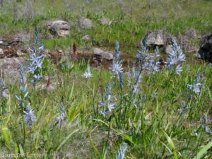
common camas (Camassia quamash)
The special plant along the creek is the common camas (Camassia quamash). Scattered plants can also be found elsewhere on Currant Creek and Daniel Creek,but this by far the largest and most accessible population of this lovely wildflower. Although edible,please do NOT dig any up; there are too few for the number of people who might want to do the same,so leave them for everyone to enjoy. As with so many species in the Boise Front,our plants do not quite fit the existing descriptions of currently recognized varieties,and the leaves are a bit broader than elsewhere.
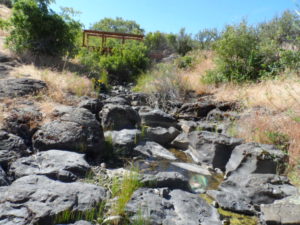
Depending on your timing and inclination,you can either retrace your steps to the trailhead,or alternatively follow the path west along the north side of tree-lined Currant Creek,crossing the bridge over a wonderfully sculpted basalt stream bed,and returning via the south side of Lookout Loop. Among the more interesting creekside plants that are likely to be in bloom in May are starry Solomon’s-seal (Maianthemum stellatum) and upland yellow violet (Viola praemorsa).
Water-sculpted basalt in streambed of Currant Creek
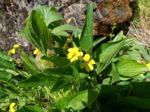
Upland yellow violet
PLANT LIST [needs updating]
NOTE: Please enjoy the wildflowers and leave them for others to enjoy. Because our unique local flora is already under pressure from invasive weeds and habitat loss, harvesting of native plants is not encouraged on this website, especially along popular trails.
Plants are listed within categories in likely order of occurrence from trailhead; some might not yet be in bloom,or present during a particular year. * indicates native species
*Small or garden burnet (Sanguisorba minor,alternatively Poterium sanguisorba) – non-native,frequently included in post-fire seeding mixes for livestock and wildlife forage
*Bluebunch wheatgrass (Pseudoroegneria spicata,alternatively in Agropyron or Elymus) ) – both native-to-site and planted races from other sites probably present
*Sheep fescue (Festuca ovina) – local populations probably all intentionally introduced
*Cherry plum (Prunus cerasifera) – non-native tree
*Velvetweed or small-flowered gaura (Oenothera curtiflora,previously Gaura parviflora or G. mollis) – not native to Boise foothills,possibly in post-fire seeding; not in bloom
Description: This is one of the more challenging of the recommended wildflower walks, approximately 4 miles roundtrip (out and back) with 1000 foot elevation gain, on a (mostly) well-graded road. The goal is an uncommon “windswept ridge” habitat, with other interesting plants en route.
NOTE: Please enjoy the wildflowers and leave them for others to enjoy. Because our unique local flora is already under pressure from invasive weeds and habitat loss, harvesting of native plants is not encouraged on this website, especially along popular trails.
The walk begins at Highland Valley trailhead at the end of West Highland Valley Road off of east Warm Springs Road, in the East Valley development of Harris Ranch. Follow the West Highland Valley trail about 1/3 mile, taking note of shrubs and flowers along the roadside bank. Turn left on Cobb Trail, which immediately drops down to a small shrub-lined creek. There is a good diversity of wildflowers on the relatively intact north-facing slope above the creek, including the lovely longspur (“polychrome”) lupine (Lupinus arbutus).
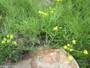
About another 1/3 mile from the creek crossing, the trail traverses a ridge where the recently described Andrus’s biscuitroot (Lomatium andrusianum) grows. This plant had previously been shoe-horned into nine-leaved biscuitroot (Lomatium triternatum), but recent molecular work by botanists at Boise State University and The College of Idaho showed that it was a distinct species. In an attempt to generate funds to continue their research on Lomatium, the “naming rights” for the new species were auctioned off, with the winning bid choosing to honor former Idaho governor Cecil D. Andrus.
Andrus’s biscuitroot (Lomatium andrusianum)
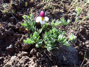
Beckwith’s violet, sagebrush pansy
goosefoot or purplish violet (Viola purpurea ssp. venosa)
From the ridgeline, the trail traverses a west-facing slope where sharp eyes can sometimes spot the early-blooming Beckwith’s violet or sagebrush pansy (Viola beckwithii) and goosefoot violet (Viola purpurea ssp. venosa). An old homestead is encountered at about 1.5 miles from the trailhead, recognized by the naturalized grove of black locust (Robinia pseudoacacia, not in bloom until mid summer) and associated weeds growing around a spring.
A couple of hundred feet north of the homestead area, mostly on the south side of the trail, look for rigidly branched white-flowered shrubs whose presence in the Boise foothills is a bit of a head-scratcher. This the Mojave ceanothus (Ceanothus vestitus), growing a long way from its Mojave Desert home. This is presumably one of the survivors of experimental plantings by the Rocky Mountain Research Station in the 1960’s and 1970’s when the goal was to improve deer winter range, with a focus on growth rates, protein content, winter leafiness, and palatability, but little regard for native range except the western US in general. There are also a couple of Apache plume (Fallugia paradoxa) from the same origin, but not doing as well as the ceanothus. Bitterbrush (Purshia tridentata) planted in rows on the hillside above are further evidence of experimental plantings.
The final half mile ascent (ca 400 feet elevation gain) is relatively steep and rocky; hiking poles recommended if so inclined. The reward is both fine views and an entirely new suite of plants on the wind-swept knoll. Although the summit is tempting, please stay on the path, since this seemingly barren site is actually a delicate habitat. If your timing is right, you’ll be able to enjoy both tufted carpet phlox (Phlox caespitosa) and scabland fleabane (Erigeron bloomeri).
Wind-swept knoll on Cobb Trail
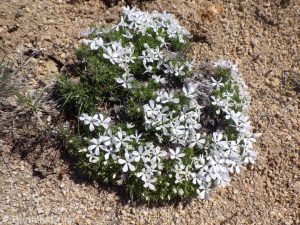
carpet or Hood”s phlox (Phlox caespitosa)
scabland or Bloomer’s fleabane (Erigeron bloomeri var. bloomeri)
From this point, you can either retrace your steps, or else continue on a 5.7 mile loop via Lucky Peak and West Highland Valley trails (described in reverse in Scott Marchant’s The Hiker’s Guide: Greater Boise).
PLANT LIST [updating needed]
NOTE: Please enjoy the wildflowers and leave them for others to enjoy. Because our unique local flora is already under pressure from invasive weeds and habitat loss, harvesting of native plants is not encouraged on this website, especially along popular trails.
Plants listed in approximate order of occurrence within category; some might not yet be in bloom, or present during a particular year. * indicates native
*Rubber rabbitbrush (Ericameria [formerly Chrysothamnus] nauseosa) — var. hololeuca is the more common larger variety; the smaller, more spindly var. oreophila is mostly on plateaus
*Bluebunch wheatgrass (Pseudoroegneria spicata, alternatively in Agropyron or Elymus) – both native-to-site and planted races from other sites probably present


 As the days heat up, take advantage of somewhat cooler temperatures at higher elevations (1500-2000 feet above the Boise Valley) to explore the upper reaches of Hulls Gulch. In addition to spectacular scenery and fascinating rock outcrops, enjoy a wonderful diversity of mid-elevation wildflowers, including Wilcox’s penstemon, white mariposa-lily, and two different varieties of sulphur-flowered buckwheat.