HULL’S GULCH INTERPRETIVE LOOP WILDFLOWER WALK
June/early July
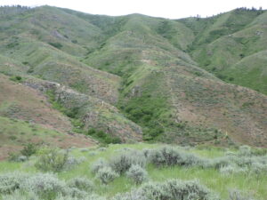 As the days heat up, take advantage of somewhat cooler temperatures at higher elevations (1500-2000 feet above the Boise Valley) to explore the upper reaches of Hulls Gulch. In addition to spectacular scenery and fascinating rock outcrops, enjoy a wonderful diversity of mid-elevation wildflowers, including Wilcox’s penstemon, white mariposa-lily, and two different varieties of sulphur-flowered buckwheat.
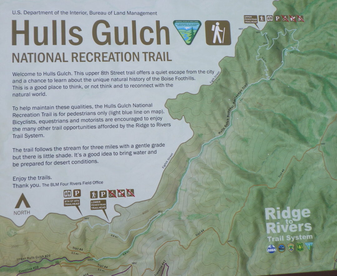
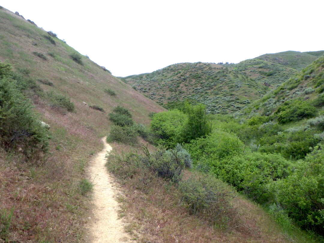
Description: The 2½ mile loop described here begins at the uppermost trailhead (“Upper Hulls Gulch” on Ridge to Rivers map) on the 8th Street Extension/Sunset Peak Road, nearly 6 miles beyond Foothills Learning Center. The dirt road is often somewhat rutted in spots, requiring careful driving even in an SUV. An alternative, especially if one wants a longer hike with less driving, is to start at the Hull’s Gulch Interpretive trailhead ( “Lower Hulls Gulch”) 2½ miles past the Foothills Learning Center, 0.2 miles past the larger 8th Street ATV trailhead. This is a popular option that adds a 2 mile long “cherry stem” each way to get to the self-guided portion of the Interpretative Loop.
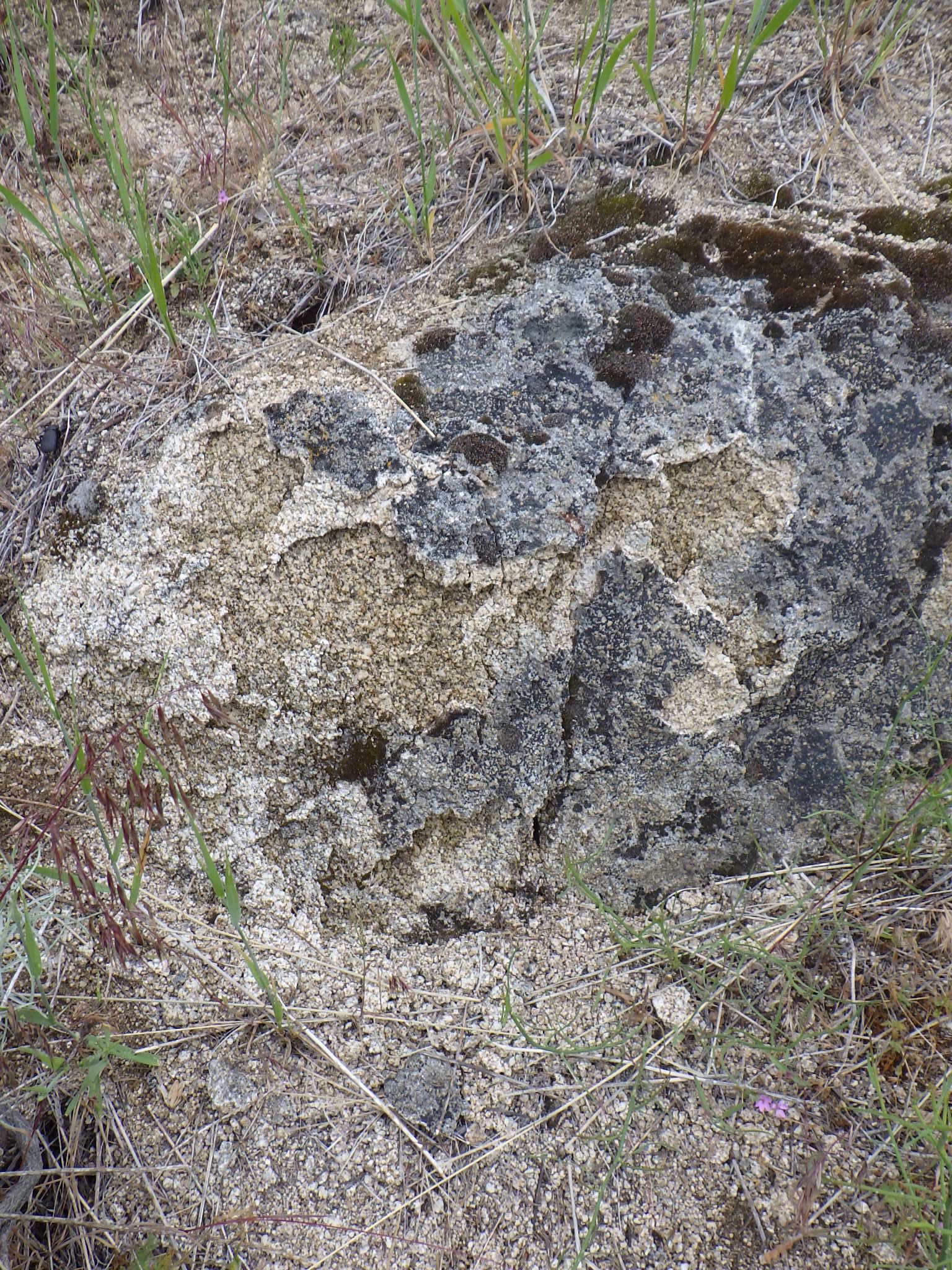
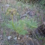
As described, the walk begins on the ridgeline at nearly 4900 feet elevation, descends steeply to creekside at 4370 feet, and returns by a more moderate grade. The entire loop is accordingly above the finer-grained sediments of pre-glacial Lake Idaho, occurring instead on coarse-grained substrates derived directly from disintegrating or “decomposed” granite of the Idaho Batholith. Among the highlights of the loop are the wonderfully sculpted granite monoliths and outcrops. Sturdy shoes with good traction are highly recommended, as the coarse grains can act as ball-bearings on steep surfaces; hiking poles can also be useful. Also be sure to bring sufficient water for the expected temperatures and length of hike.
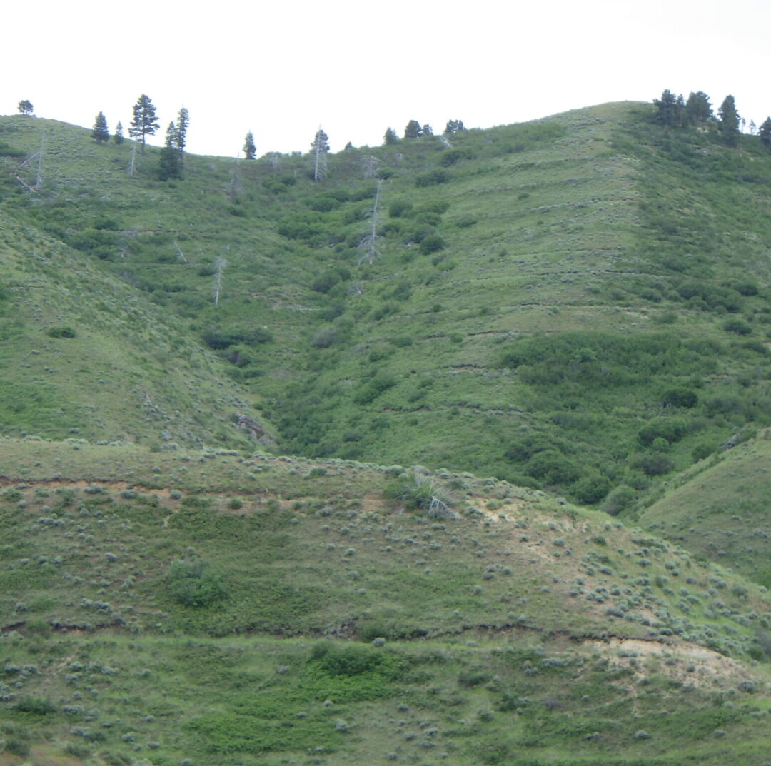
Before starting your descent, take note of the prominent contour terracing on the slopes above you. Trenches were first bulldozed across the highly erodible slopes of the Boise Ridge following three major fires and subsequent catastrophic flooding in 1959, immortalized in the video “When the Pot Boiled Over“. Another 40 miles of trenches were bulldozed after the devastating, human-caused 8th Street Fire in 1996 (Fend et al. 1999); dead trees from this fire are still prominent on slopes above the terracing. Burned areas were then seeded with a mixture of perennial grasses, sagebrush (Artemisia tridentata), alfalfa (Medicago sativa), and yarrow (Achillea millefolium); subsequent plantings included bitterbrush (Purshia tridentata) and silver sagebrush (Artemisia cana). It is unlikely that even the native species were locally sourced, with the current gene pool now significantly altered from the indigenous vegetation.
The Interpretive Loop is part of the Hulls Gulch National Recreation Trail built by the Bureau of Land Management in the 1970’s, when such a trail was a novel idea. Unlike most other trails in the multi-partner Ridge to Rivers trail system, this one is restricted to pedestrians. Cattle grazing is also excluded, though stray cows occasionally end up on the wrong side of the fencing (as happened in 2019). The 1998 fire burned all the large streamside trees to the ground and reduced diversity especially on the south-facing slopes. Although much of the vegetation has seemingly recovered (with some help from planting efforts), it is still heartbreaking for those who knew the area beforehand (A. DeBolt, pers. comm. 2019). Occasional signs along the trail provide additional insights and inspiriration.
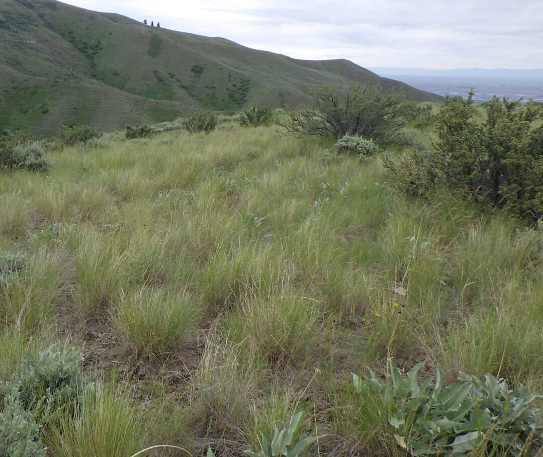
The dominant plants as you start down the trail are the perennial grasses and shrubs that were seeded and planted as part of the post-fire rehabilitation effort. Although there are native forms of bluebunch wheatgrass (Pseudoroegneria spicata, previously in Agropyron) in the Boise Front, seeding mixtures consist of commercially available forms from other parts of the species’ range that have been selected for exceptional vigor and adaptability; some forms are now even recognized as distinct species. Intermediate wheatgrass (Thinopyron intermedium, alternatively in Agropyron, Elymus, or Elytrigia), a rhizomatous Eurasian grass, is also commonly included in seeding mixes. Unfortunately, the very features that make both of these grasses valuable for post-fire erosion control and livestock grazing (i.e., rapid and aggressive growth) can permanently convert a previously diverse open shrub-steppe habitat into a near monoculture in which only a limited subset of the previous native species are able to persist.
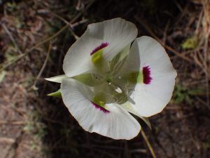
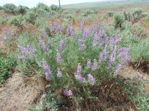
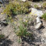
Among the native wildflowers that are still prominent along the initial stretch of trail are silver lupine (Lupinus argenteus), wing-fruited or white mariposa lily (Calochortus eurycarpus), yarrow (Achillea millefolium), and arrowleaf balsamroot (Balsamorhiza sagittata, probably past bloom). Also keep an eye out for ballhead sandwort (Eremogone congesta, previously in Arenaria) and Hood’s phlox (Phlox caespitosa, probably past bloom) in open sites on shallow rocky soils. Non-native yellow salsify (Tragopogon dubius) is also common. For rare-plant aficionados, there are a few plants of Boise milkvetch (Astragalus adanus) on the left side of the path shortly before the sign where the trail splits, though these can be difficult to spot when not in bloom (as is likely). Shrubs include bitterbrush (Purshia tridentata), flat-topped mountain big sagebrush (Artemisia tridentata ssp. vaseyana, intergrading with ssp. tridentata), rubber rabbitbrush (Ericameria nauseosa, previously in Chrysothamnus), and patches of bitter cherry (Prunus emarginata).
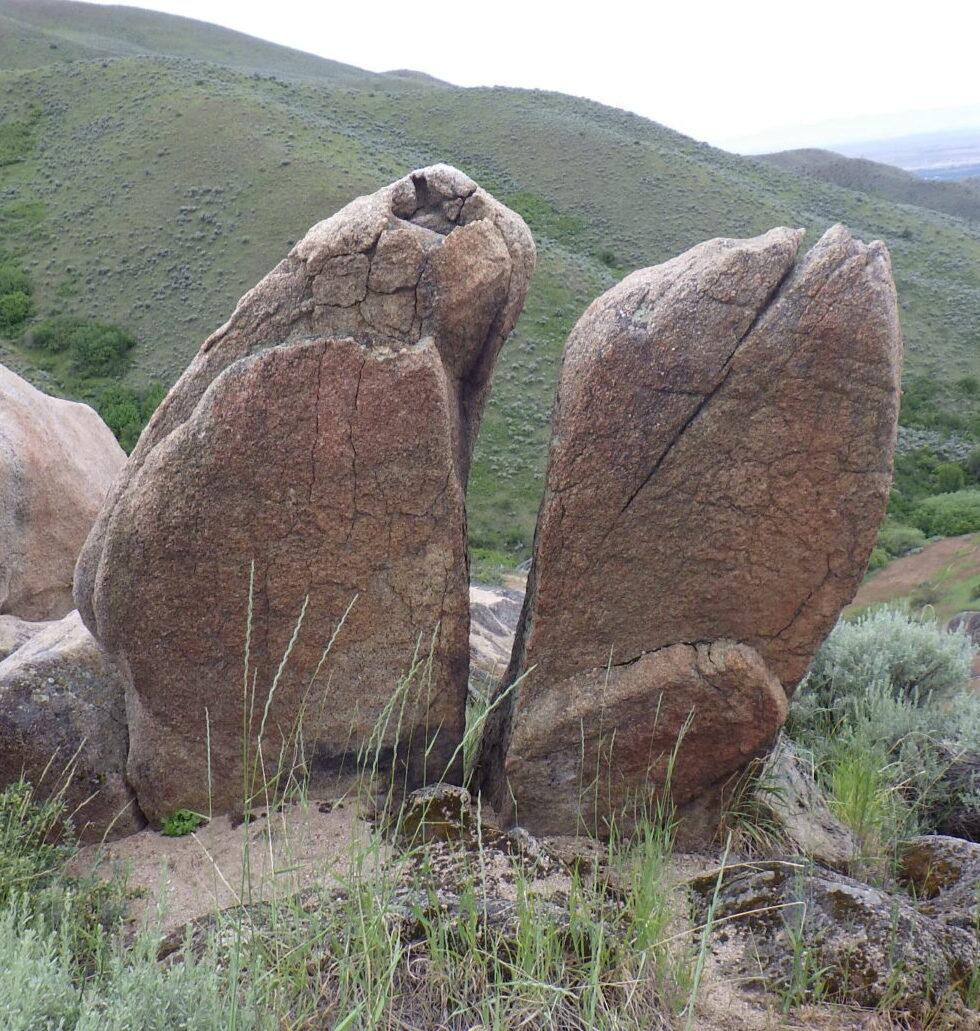
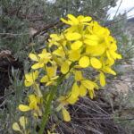
The trail forks about 0.2 miles from the trailhead, beginning the loop proper. The self-guided walk takes the right fork (“Loop Trail”) for the relatively steep descent, saving the gentler left-hand option (“Main Trail”) for the return ascent (unless one wishes to forego the loop and instead go straight to the upper bridge overlooking a waterfall). Dramatic granite outcrops are key features of the right fork option, surrounded by shallow coarse soils that harbor a selection of interesting wildflowers, including silverleaf phacelia (Phacelia hastata), sulphur buckwheat (Eriogonum umbellatum), and western wallflower (Erysimum capitatum). If you’re lucky, you might spot some clustered broomrape (Aphyllon fasciculatum, previously in Orobanche) parasitizing the roots of the silverleaf phacelia. Patches of spreading dogbane (Apocynum androsaemifolium) are also common along this segment of trail, as well as the return stretch.

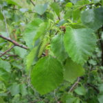
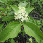
Turn left when you reach the creekside trail, possibly after a short downstream detour to admire an exceptionally large mound of creamy-flowered Wyeth’s buckwheat (Eriogonum heracleoides). The path follows a densely brush-lined creek, with a rich diversity of trees and shrubs including black-barked river birch (Betula occidentalis), Rocky Mountain maple (Acer glabrum), mountain alder (Alnus incana), red-osier dogwood (Cornus stolonifera), syringa (Philadelphus lewisii), blue elderberry (Sambucus cerulea), chokecherry (Prunus virginiana), mallowleaf ninebark (Physocarpus malvaceus), golden currant (Ribes aureum), various willows (Salix), and even a few quaking aspen (Populus tremuloides). A localized patch of non-native Himalayan blackberry (Rubus bifrons, by the most recent taxonomy) is a tasty but worrisome invader. Take note of the dramatic difference between the southeast-facing slope on your left (heading upstream) and the northwest-facing slope on your right. The former is now dominated by invasive annual and planted grasses, including the notorious cheatgrass (Bromus tectorum), medusahead (Taeniatherum caput-medusae), and recently invading North African wiregrass (Ventenata dubia). In contrast, the opposite slope boasts a rich diversity of native shrubs and wildflowers. This difference is presumably driven by differing intensities of sunlight on the contrasting exposures, which preceded but was probably exacerbated by the 8th Street Fire.
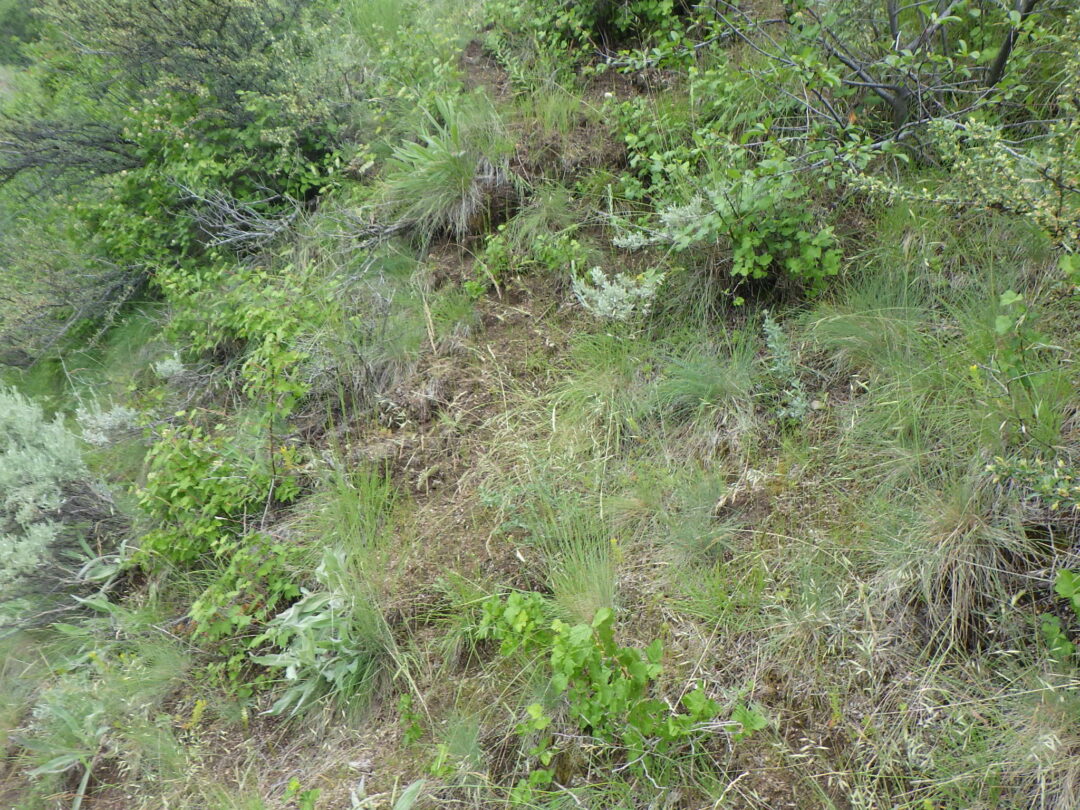
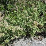
A sturdy bridge crossing the main creek soon provides an up-close opportunity to appreciate the botanical treasures of the opposite slope. The trail doglegs across a deeply shaded tributary and then traverses a short stretch of high quality sagebrush steppe habitat on a north-facing slope, before doubling back once again. Take note of the oddly named enchanter’s-nightshade (Circaea alpina), with its tiny white flowers, on the shaded tributary; surprisingly, it turns out to be closely related to fuchsias and has no connection to true nightshades (Solanum spp.). Take time to enjoy the wealth of wildflowers on the more open portion of the slope, possibly including (depending on your timing) gooseberry-leaf alumroot (Heuchera grossulariifolia), ragged-robin (Clarkia pulchella), diamond-petal farewell-to-spring (Clarkia rhomboidea), few-flower sweetpea (Lathyrus pauciflorus), wormleaf stonecrop (Sedum stenopetalum), western hawkweed (Hieracium scouleri), bastard toadflax (Comandra umbellata), and Payette penstemon (Penstemon payettensis), as well as brittle fern (Cystopteris fragilis) and the lovely native bunchgrasses Idaho fescue (Festuca idahoensis) and junegrass (Koeleria macrantha). Note also the structure of this increasingly threatened habitat, consisting of a complex diversity of shrubs, bunchgrasses, and perennial wildflowers, all spaced out on a matrix of “bare ground” that is perhaps the most critical component of this ecosystem, covered with a protective layer of microflora (e.g., mosses and lichens) and providing habitat for annual wildflowers.
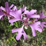

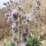
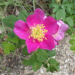
My favorite stretch some up soon after the trail doubles back to continue its upstream direction, when it enters a partly shaded tunnel of tall shrubs below a large outcrop. The combination of moisture and aspect creates favorable conditions for a wonderful selection of plants that are more commonly found at higher elevations in the conifer zone, bringing together species that are not usually found together. Special plants to look for here include Scouler’s willow (Salix scouleriana) with its broadly blunt leaves, Brown’s peony (Paeonia brownii), Wilcox’s penstemon (Penstemon wilcoxii), heartleaf arnica (Arnica cordifolia), fernleaf biscuitroot (Lomatium multifidum), and Ross’s sedge (Carex rossii). You can also find Macdougal’s or Nootka rose (Rosa nutkana ssp. macdougalii) intergrading with interior or Wood’s rose (Rosa woodsii ssp. ultramontana), which is the common native rose below the conifer zone; the former has larger, generally solitary flowers, and the leaflets are greener and often double-toothed. There are also three species of woodbeauty (Drymocallis, previously sticky cinquefoil in Potentilla glandulosa and P. arguta) growing in close proximity and possibly also hybridizing: yellow-petaled Idaho woodbeauty (D. glabrata), common woodbeauty (D. glandulosa) with small cream-colored petals and a widely branched stem, and a few plants of cordilleran woodbeauty (D. convallaria), which generally has a single tall narrowly branched stem and relatively large cream-colored petals.

After emerging from the shaded tunnel and crossing a small brush-lined stream, take note of our two local varieties of sulphur buckwheat (Eriogonum umbellatum) growing next to one another. One variety (var. ellipticum) has a twice-branched inflorescence with numerous flower heads. The other variety (var. stragulum) has a single-branched inflorescence with fewer, larger flower heads; it appears to bloom slightly earlier than var. ellipticum. Unsurprisingly, intermediates can also be found (part of why these are varieties rather than full species), so this spot is very useful to demonstrate the two extremes side by side. Sulphur buckwheat is an exceptionally diverse species, with at least 40 varieties currently recognized throughout western North America, some highly localized.
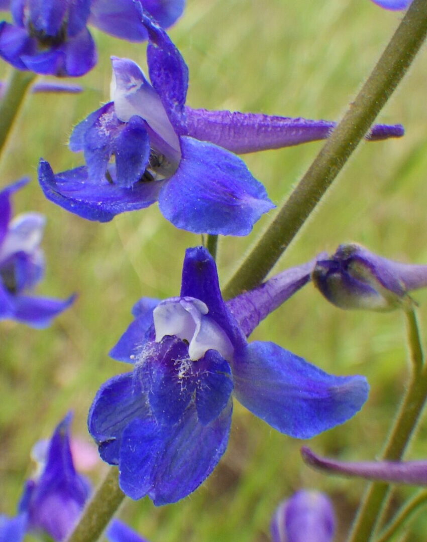
The trail cuts back and forth in its continued ascent, at one point crossing a small grass-lined streamlet where Nuttall’s cinquefoil (Potentilla gracilis var. fastigiata) and a dark blue larkspur (Delphinium) can often be found, along with other moisture-loving wildflowers. Potentilla and Delphinium are notoriously difficult genera, with complex variation and rampant hybridization that defy standard taxonomic analysis. At present, P. gracilis var. fastigiata encompasses a broad swath of variation that will probably be divvied up among multiple varieties eventually. The Delphinium at this site doesn’t cleanly fit into any of the currently recognized species; it falls somewhere between a broadly defined slim larkspur (Delphinium depauperatum) and twospike larkspur (Delphinium distichum, previously D. burkei).
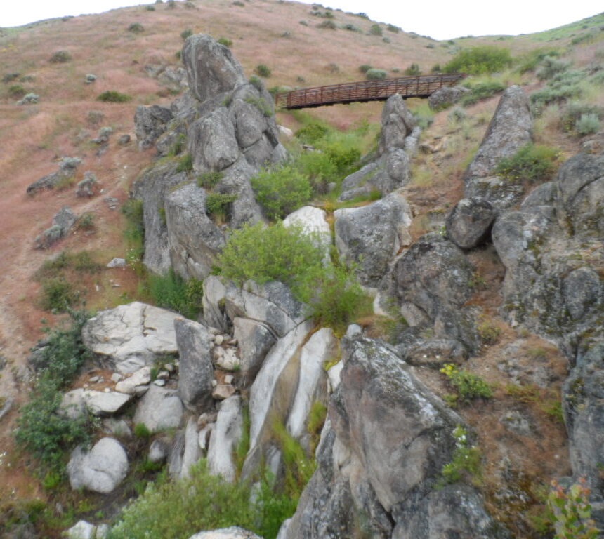
The destination point for many trail users is the high bridge overlooking a small seasonal waterfall at the head of the interpretive loop; an adjacent rocky flat that offers excellent views is a popular spot for rest breaks and/or lunch. The outcrops make the site scenic at any time of the year, but particularly so when the syringa (Philadelphus lewisii) is in bloom, and again when fall colors are at their peak. You may be able to spot a patch of yellow monkeyflowers (Erythranthe guttata, previously in Mimulus) at the base of the falls; to avoid damaging the delicate streamside vegetation, please do not scramble down for a closer look.
From this point the loop trail leaves the creek and ascends the southeast-facing slope back to the trailhead. Most of this stretch is relatively weedy, with some more outcrops but little in the way of new diversity. The primary exception is a short stretch not far from the high bridge, where the trail doubles back along a northwest-facing slope before crossing a small densely vegetated tributary. Keep an eye out for Oregon sunshine (Eriophyllum lanatum) and scarlet gilia (Ipomopsis aggregata, previously in Gilia) on the open slope above the trail. Also look for more few-flower sweetpea (Lathyrus pauciflora) in the denser brush, and see if you can find both the broad-leaved and narrow-leaved forms.
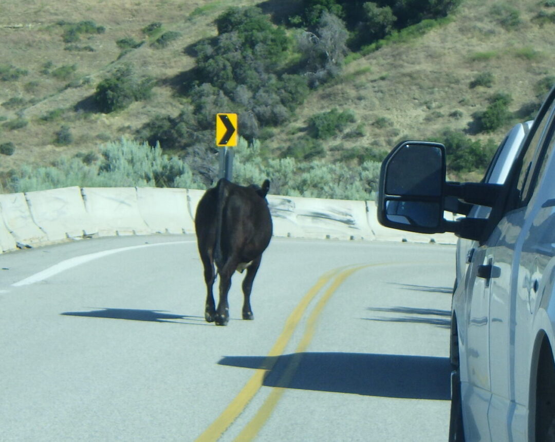
Note on grazing: Livestock grazing has been a primary economic use of the Boise Front ever since Euro-American settlement of the Treasure Valley in the late 1800’s. Cattle continue to be a familiar sight to trail users, and many of our favorite trails are actually public easements through private ranchlands where access is dependent on our respect for the owners’ rights and compliance with basic rules (e.g., closing gates). Additional grazing allotments are established and regulated on some, but not all, federal lands (Idaho’s Open Range law notwithstanding, which ultimately has more to do with whether fences are for keeping livestock in or out). Simply put, there are some areas where cattle are to be expected, and other areas where they’re on the wrong side of a fence (which could be miles away). The presence of stray cows on the road to Bogus Basin is one example of “wrong side of the fence”, at least below the cattle guard; the Interpretive Loop is another.

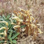
Livestock grazing as a cost-effective tool for fuel reduction is widely publicized and well documented, in particular for areas now dominated by invasive annual grasses from Eurasia. What is less well publicized is that the benefits often come with ecological trade-offs, especially at grazing levels that are economically viable. Cattle have no native analog in our local sage-steppe ecosystem, where buffalo infrequently roamed, and much of our native flora is accordingly intolerant of even moderate cattle grazing. This was evident on the Interpretive Loop in 2019, when a few stray cows targeted native plants that were like candy to them, including Brown’s peony (Paeonia brownii) that was eaten to the ground. Streamside plants were also disproportionately impacted, and trampling damaged portions of steep north-facing slopes, thereby increasing the opportunity for invasion by non-native species in these high-quality habitats. Some recovery was evident in 2020, but the peonies had declined in number and vigor, and would undoubtedly disappear completely along with many of the other special wildflowers if grazing were not excluded from the Interpretive Loop.
Fend, J. F., J. Thornton, D. Rittenhouse, F. Pierson, C. R. Mickelson, and C. W. Slaughter. 1999. The science & politics of the 1996 Boise Front Fire – What we have learned from the 8th Street Fire rehabilitation. Proceedings of the Seventh Biennial Watershed Management Conference, C. W. Slaughter, editor. Water Resources Center Report No. 98, Univ. California, Davis.
PLANT LIST [updating needed]
NOTE: Please enjoy the wildflowers and leave them for others to enjoy. Because our unique local flora is already under pressure from invasive weeds and habitat loss, harvesting of native plants is not encouraged on this website, especially along popular trails.
Plants listed alphabetically by genus within category. * indicates native species
WILDFLOWERS
- *Yarrow (Achillea millefolium)
- *Bigflower agoseris or mountain-dandelion (Agoseris grandiflora)
- *Annual agoseris or mountain-dandelion (Agoseris heterophylla)
- Pale alyssum or madwort (Alyssum alyssoides) – dried pods of desert alyssum (A. desertorum) also present
- *Fiddleneck (Amsinckia spp.) – species difficult to distinguish
- Clustered broomrape (Aphyllon fasciculatum, previously in Orobanche) – parasitic on roots of Phacelia hastata
- *Spreading dogbane (Apocynum androsaemifolium) – some varying toward intermediate dogbane (A. floribundum)
- *Heartleaf arnica (Arnica cordifolia)
- *Silver or western mugwort (Artemisia ludoviciana var. ludoviciana)
- *Boise milkvetch (Astragalus adanus) – single small patch at upper junction
- *Woolly-pod milkvetch (Astragalus purshii var. glareosus)
- *Arrowleaf balsamroot (Balsamorhiza sagittata)
- *Eyelashweed or blepharipappus (Blepharipappus scaber)
- *Rockcress (Boechera sp.) – species difficult to distinguish, esp. without fruit
- Corn gromwell (Buglossoides/Lithospermum arvensis)
- *Wing-fruited or white mariposa lily (Calochortus eurycarpus)
- *Enchanter’s-nightshade (Circaea alpina ssp. pacifica)
- *Ragged-robin (Clarkia pulchella)
- *Diamond-petal farewell-to-spring (Clarkia rhomboidea)
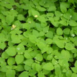
- *Common miner’s lettuce (Claytonia perfoliata, possibly other species as well)
- *Largeflower collomia (Collomia grandiflora)
- *Narrowleaf collomia, tiny trumpet (Collomia linearis)
- *Bastard toadflax (Comandra umbellata var. pallida)
- *Western hawksbeard (Crepis occidentalis)
- *Weakstem cryptantha (Cryptantha flaccida)
- *Larkspur (Delphinium sp.) – species difficult to distinguish; some local plants don’t fit existing species descriptions very well
- *Cordilleran woodbeauty, tall cinquefoil (Drymocallis convallaria, previously Potentilla arguta var. convallaria)
- *Idaho woodbeauty, sticky cinquefoil (Drymocallis glabrata, previouslyly Potentilla glandulosa var. intermedia)
- *Common woodbeauty, sticky cinquefoil (Drymocallis glandulosa var. glandulosa, previously Potentilla glandulosa var. g.) – petals cream-white to pale yellow, inflorescence open
- *Ballhead sandwort (Eremogone congesta var. cephaloidea, previously in Arenaria) – uncommon near trailhead
- *Wyeth’s buckwheat (Eriogonum heracleoides var. heracleoides)
- *Proliferous or strict wild-buckwheat (Eriogonum strictum var. proliferum)
- *Starry sulpher-flowered buckwheat (Eriogonum umbellatum var. ellipticum) – umbels compound, blooming later than var. stragulum
- *Spreading sulpher-flowered buckwheat (Eriogonum umbellatum var. stragulum) – umbels simple, blooming earlier than var. ellipticum
- *Broom buckwheat (Eriogonum vimineum)
- Stork- or cranesbill, filaree (Erodium cicutarium) – non-native
- *Western wallflower (Erysimum capitatum)
- *Yellow monkeyflower (Erythranthe guttata, previously in Mimulus)
- *Cleavers, bedstraw, stickywilly, goose-grass (Galium aparine)
- *Sticky geranium (Geranium viscosissimum)
- *Little sunflower (Helianthella uniflora)
- *Gooseberry-leaf alumroot (Heuchera grossulariifolia var. tenuifolia)
- *Western or Scouler’s hawkweed (Hieracium scouleri, previously H. cynoglossoides)
- *Ballhead waterleaf (Hydrophyllum capitatum)
- *Scarlet gilia, skyrocket, timpiute (Ipomopsis aggregata, previously in Gilia)
- Prickly lettuce (Lactuca serriola)
- *Few-flower sweetpea (Lathyrus pauciflorus var. pauciflorus)
- Lewis’s flax (Linum lewisii) – native to Idaho, but most (all?) populations in Boise foothills result from post-fire seeding
- *Smallflower woodlandstar/prairiestar (Lithophragma parviflorum)
- *Stoneseed, Puccoon, Gromwell (Lithospermum ruderale)
- *Fernleaf biscuitroot (Lomatium multifidum)
- *Narrowleaf biscuitroot (Lomatium simplex, previously included in L. triternatum, nine-leaf biscuitroot)
- *Silver lupine (Lupinus argenteus)
- *False Solomon’s-seal (Maianthemum racemosum, previously in Smilacina)
- *Bigleaf sandwort (Moehringia macrophylla, previously in Arenaria)
- Mouse-ear forget-me-not, blue scorpion-grass (Myosotis micrantha [alt: M. stricta])
- *Sweet-cicely (Osmorhiza sp.)
- *Brown’s peony (Paeonia brownii)
- *Payette penstemon (Penstemon payettensis)
- *Wilcox’s penstemon (Penstemon wilcoxii)
- *Silverleaf phacelia (Phacelia hastata var. hastata)
- *Wand or virgate phacelia (Phacelia heterophylla var. heterophylla)
- *Threadleaf phacelia (Phacelia linearis)
- *Carpet or Hood’s phlox (Phlox caespitosa)
- *Cross-seed or slender popcorn-flower (Plagiobothrys tenellus)
- *Longspur plectritis, Wedding-cake plant (Plectritis macrocera)
- Small or garden burnet (Poteridium sanguisorba, alternatively Sanguisorba minor) – non-native, frequently included in post-fire seeding mixes for livestock and wildlife forage
- *Wormleaf stonecrop (Sedum stenopetalum)
- *Sand fringepod (Thysanocarpus curvipes)
- *Wild-hyacinth, large-flowered triteleia, or Douglas’s brodiaea (Triteleia grandiflora, previously Brodiaea douglasii)
- *Foothill death-camas (Toxicoscordion paniculatum)
- Yellow salsify or goat’s-beard (Tragopogon dubius)
FERNS AND RELATIVES
- *Brittle fern (Cystopteris fragilis)
- *Smooth scouring-rush (Equisetum laevigatum)
SIGNIFICANT NOXIOUS WEEDS (some not yet in bloom, but evident)
- Cheatgrass (Bromus tectorum)
- Rush skeletonweed (Chondrilla juncea)
- St. Johnswort, Klamathweed (Hypericum perforatum)
- Tumble or Jim Hill mustard (Sisymbrium altissimum)
- Medusahead grass (Taeniatherum caput-medusae)
- North African wiregrass (Ventenata dubia)
SHRUBS AND TREES (not all in bloom)
- *Rocky Mountain maple (Acer glabrum var. douglasii)
- *Mountain or thinleaf alder (Alnus incana ssp. tenuifolia) – small tree
- *Serviceberry (Amelanchier sp.) – taxonomy in flux
- *Mountain big sagebrush (Artemisia tridentata ssp. vaseyana; some intergrading with ssp. tridentata)
- *Creeping Oregon-grape (Berberis repens, alternatively in Mahonia)
- *Water birch (Betula occidentalis) – large shrub to small tree
- *Red-osier dogwood (Cornus stolonifera)
- *Black hawthorn (Crataegus douglasii)
- *Rubber rabbitbrush (Ericameria [previously Chrysothamnus] nauseosa)
- *Syringa or Lewis’s mockorange(Philadelphus lewisii)
- *Mallowleaf ninebark (Physocarpus malvaceus)
- *Ponderosa pine (Pinus ponderosa)
- *Quaking aspen (Populus tremuloides)
- Black cottonwood (Populus trichocarpa)
- *Bitter cherry (Prunus emarginata)
- *Chokecherry (Prunus virginiana var. melanocarpa)
- *Bitterbrush, Antelope brush (Purshia tridentata)
- *Golden currant (Ribes aureum)
- *Wax currant (Ribes cereum)
- *Interior or Wood’s rose (Rosa woodsii subsp. ultramontana) – intergrading with *Macdougal’s, Nootka, or Spalding’s rose (R. nutkana ssp. macdougalii) with solitary larger flowers
- *Himalayan blackberry (Rubus bifrons, alternatively R. armeniacus, R. discolor, or R. procerus) – tasty but invasive non-native
- *Thimbleberry (Rubus nutkanus, previously R. parviflorus)
- *Blue elderberry (Sambucus cerulea, alternatively S. mexicana)
- *Scouler’s willow (Salix scouleriana)
- *Willows (Salix spp.) – several other difficult-to-distinguish species
- *Mountain snowberry (Symphoricarpos rotundifolius var. vaccinioides, previously S. oreophilus var. utahensis)
- *Western poison-ivy (Toxicodendron rydbergii, alternatively Rhus radicans) – CAUSES DERMATITIS
GRASSES & GRASSLIKE PLANTS (not all in bloom, but evident)
- *Threeawn grass (Aristida purpurea var. longiseta)
- Rattlesnake brome (Bromus briziformis)
- *Meadow brome (Bromus commutatus) and/or other similar species
- *Ross’s sedge (Carex rossii)
- *Orchard grass (Dactylis glomerata)
- *Squirreltail grass (Elymus elymoides, formerly Sitanion hystrix)
- *Idaho fescue (Festuca idahoensis)
- *Junegrass (Koeleria macrantha, previously K. cristata)
- *Great Basin wildrye (Leymus/Elymus cinereus)
- *Bulbous bluegrass (Poa bulbosa)
- *Sandberg bluegrass (Poa secunda)
- *Bluebunch wheatgrass (Pseudoroegneria spicata, alternatively in Agropyron or Elymus) – both native-to-site and planted races from other sites probably present
- *Intermediate wheatgrass (Thinopyrum intermedium, alternatively in Elytrigia or Elymus)
- *Tall or rush wheatgrass (Thinopyrum ponticum; alternatively in Agropyron, Elymus, Elytrigia)
- *Rattail fescue (Vulpia/Festuca myuros)