SELF-GUIDED WILDFLOWER WALKS IN THE BOISE FRONT
The self-guided wildflower walks described on this site are based on the “Treasures of the Boise Front” series of guided walks developed as an introduction to a selection of public trails with as great a diversity as possible of the botanical “treasures” that are readily accessible to residents and visitors to the Boise area. The walks cover a wide variety of noteworthy plants and habitat types throughout the Boise Front (broadly defined) and seasons of the year. In addition to the wildflowers themselves, each walk includes other aspects of natural and human history; collectively the walks provide a wide-ranging “sense of place” for this unique part of the planet that an increasing number of us are calling home.
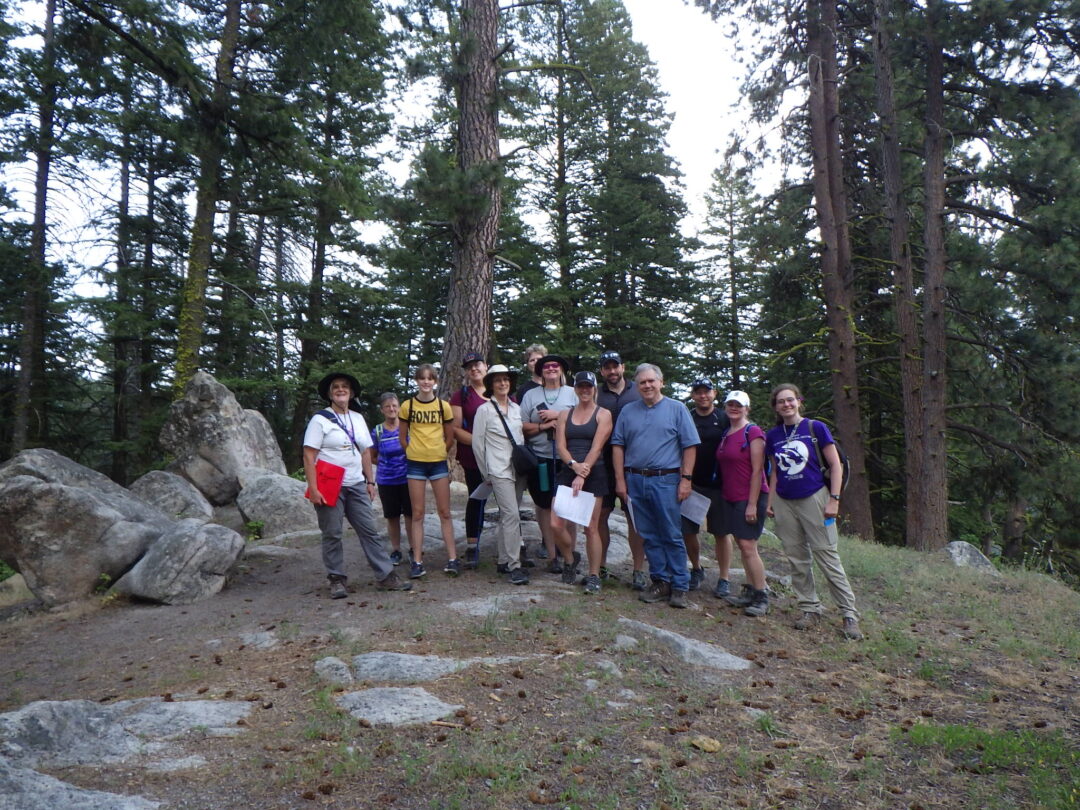
Most of the original guided walks were scheduled as evening walks, lasting 2-3 hours and ending by dusk. These walks are relatively short by hiking standards, in order to provide sufficient time to enjoy the wildflowers and have discussions on particular plants of interest and general natural history. Each of these walks included a hand-out of plants expected to be in bloom or otherwise noteworthy. When the scheduled walks for 2020 were cancelled because of COVID-19, the current website was developed, with one goal being to convert the entire existing walk series into self-guided format; additional walks will be added as they are developed and time allows.
Recommended dates for the different hikes indicate the peak times to catch the wildflowers that are the highlights for that particular walk. Most of the walks can nevertheless be worthwhile outings at any time of the year, as long as trail conditions are suitable.
IMPORTANT: Please enjoy the wildflowers and leave them for others to enjoy. Because our unique local flora is already under pressure from invasive weeds and habitat loss, harvesting of native plants is not encouraged on this website, especially along popular trails, and rare plants in particular should be given the best chance possible to continue existing in the wild, where everyone can enjoy them.
Synopsis of current wildflower walks in self-guided format, in seasonal order:
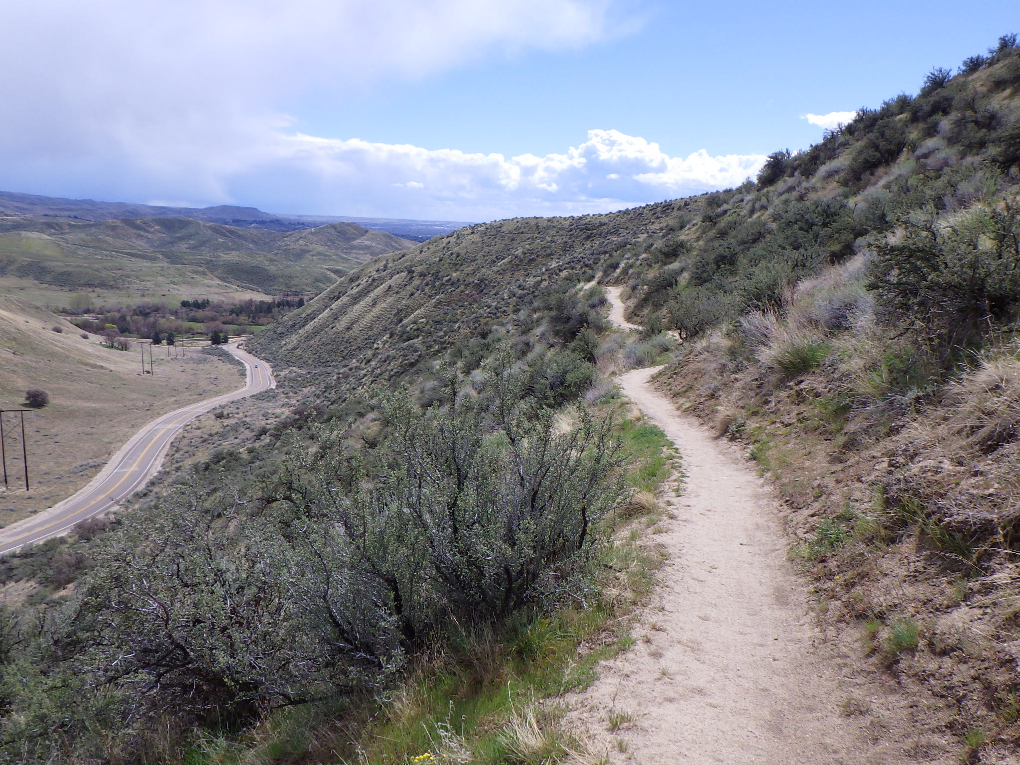
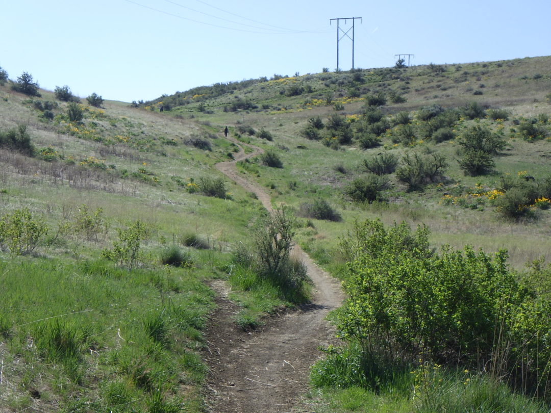
GET THE JUMP ON SPRING NATURE WALK (recommended for mid February to late March): As days start to lengthen, triggering once again the urge to seek out the floristic treasures that the Boise Front has to offer, this walk offers an excellent chance to “get the jump on spring”, as well as providing an introductory overview to the natural history of the Boise foothills. With luck, you will be rewarded with at least two of the earliest blooming wildflowers and the spring serenade of meadowlarks, supplemented with a diversity of natural history and cultural tidbits that can be enjoyed throughout the winter months. The loop described here is about 5 miles long, with about 600 feet elevation gain. The full loop is now accessible to hikers only on even-numbered days, with the last leg (Lower Hulls Gulch #29) restricted to downhill cyclists on odd-numbered days; plan your hike accordingly!
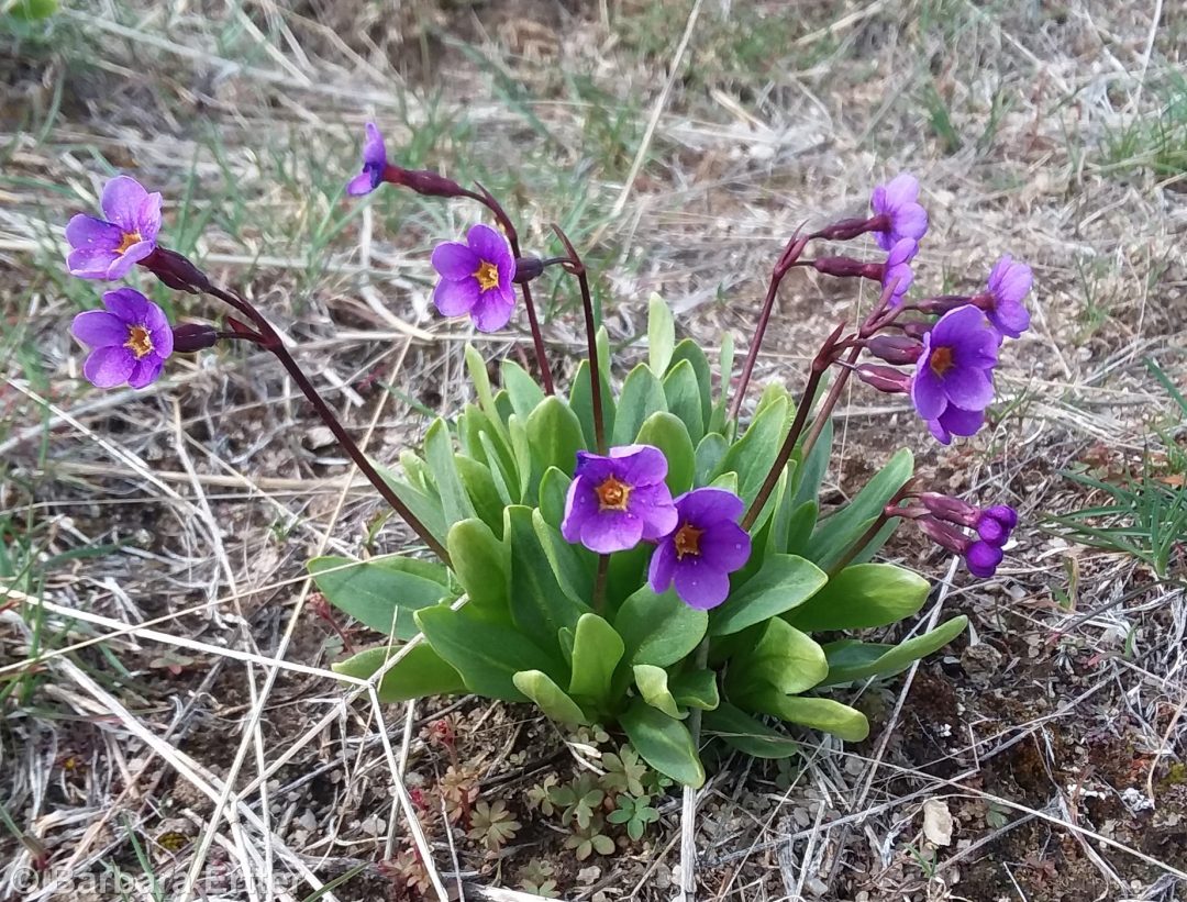
BUENA VISTA TRAIL WILDFLOWER WALK (mid March to early April for profiled rare plants): For a good selection of early blooming spring flowers, including a couple of our rarest species, the Buena Vista loop in Hillside to Hollow Reserve is hard to beat! The route described circumnavigates the upper slopes of the western ridge, traversing some of the best remaining good-quality habitat on both south- and north-facing slopes in the lower Foothills. Special plants for this trail Aase’s onion (Allium aaseae) and our only native true primrose, Cusick’s primrose (Primula cusickiana), Full loop requires trail-only access through private land. Difficulty: 2-3 miles roundtrip, 130 feet elevation gain. Avoid when muddy!
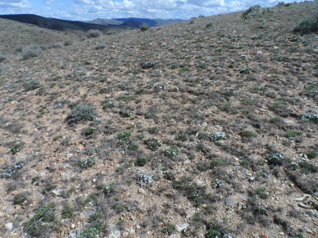
POLECAT LOOP WILDFLOWER WALK (peak bloom: late March through April): THIS WALK IS CURRENTLY NOT AN OPTION AS DESCRIBED, DUE TO THE TRAIL NOW BEING PART OF A ONE-WAY LOOP. This is no longer an easy walk for enjoying a good selection of spring wildflowers, including a diversity of tiny “belly flowers” (best enjoyed at close range). One tiny “treasure” is the elusive, eponymous Idahoa, if only for the name; a challenge to find, and in only one spot along the trail. Other special plants include the rare Aase’s onion (Allium aaseae) and uncommon hairy wild-cabbage (Caulanthus pilosus).
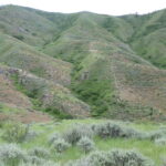
COBB TRAIL WILDFLOWER WALK (peak bloom: mid April to mid May): BURNED IN 2024. This is one of the more challenging of the recommended wildflower walks, approximately 4 miles roundtrip (out and back) with 1000 foot elevation gain, on a (mostly) well-graded road. The goal is an uncommon “windswept ridge” habitat, with other interesting plants en route including the recently described Andrus’s biscuitroot (Lomatium andrusianum).

RED TAIL/CURRANT CREEK WILDFLOWER WALK(peak bloom: early May): This is a moderate walk (2 to 2.5 miles roundtrip,~300 foot total elevation gain) at the north edge of the Hidden Springs community, with highlights being the primary (or only) populations of camas, Tolmie’s onion, and freckled milkvetch in the Boise Front. Much of the trail is heavy clay, so avoid when wet. This works well as an evening walk, especially as the daytime temperatures are heating up.
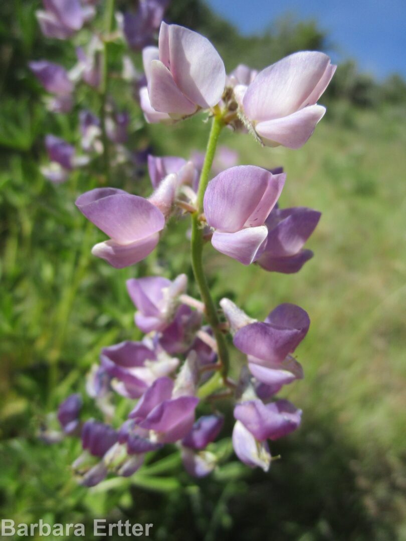
MILLER GULCH WILDFLOWER WALK(peak bloom: early to mid May): This short walk is primarily to enjoy a magnificent population of spurred or ‘polychrome’ lupine (Lupinus arbustus) at peak bloom (and fragrance!), along with a nice selection of other locally unusual plants on good-quality habitat. The walk to the lupines is only 1 mile round-trip, with 300 feet elevation gain; several options exist for anyone wanting to go farther on Corrals Trail.
CURRANT CREEK EAST (May): This short but scenic walk covers the first mile or so of a trail that users might want to explore further on their own. Most of the trail has a relatively high clay content, so best used when fully dry; 420 foot elevation gain. Pallid milkweed (Asclepias cryptoceras), rare in the Boise Front, is a special “treasure” of this walk.
CAMEL’S BACK/HULLS GULCH WILDFLOWER WALK (peak bloom: mid to late May): This walk explores a diversity of habitats on Camel’s Back and lower Hull’s Gulch, showcasing late-spring wildflowers (including Mulford’s milkvetch) and riparian woodland consisting of native and non-native trees and shrubs. The walk begins at the trailhead at the end of 9th Street and is described in a counterclockwise direction. This makes the walk good for an after-dinner hike on a warm day, beginning along the shaded streamside corridor and then ascending the hilltop to catch the sunset. Much of the walk is on pedestrian-only, dog on-leash trails. Total distance is a 1½ mile loop; total elevation gain is about 350 feet.
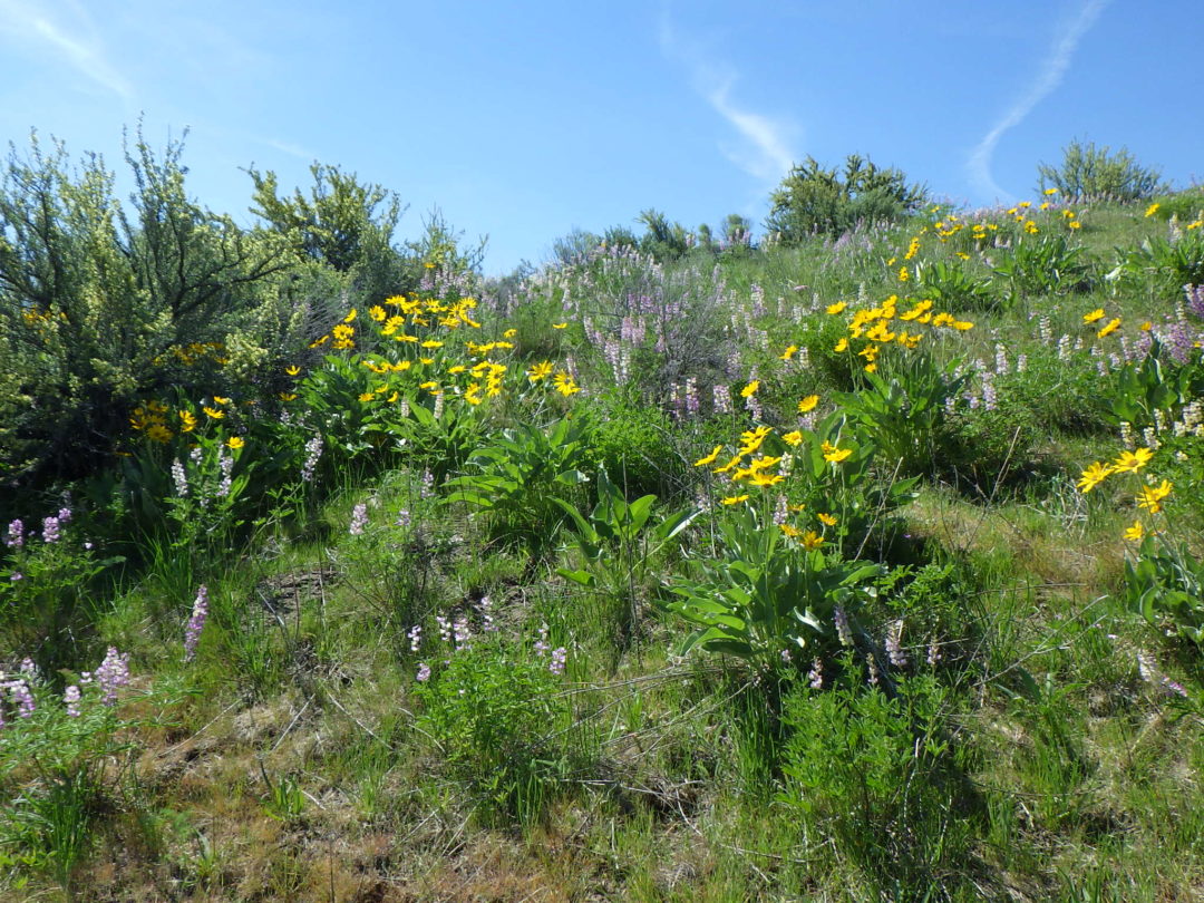
BUCKTAIL/SHANE’S/THREE BEARS LOOP (peak bloom: mid-May to mid-June): Although largely through relatively low-diversity altered pastureland, patches of interesting wildflowers, habitat diversity, and wide views makes this walk a good intermediate-distance loop in one of the less-used parts of Military Reserve. The elongate loop traverses in and out around tributaries of Freestone Creek, well above the stream except where it crosses at the far end. The full loop is nearly 4 miles, with 420 foot elevation gain. Most trails have a relatively high clay content, so are best used when fully dry. The trails are popular with mountain bikers, so be prepared to share.
BONNEVILLE POINT WILDFLOWER WALK (peak bloom: mid May to mid June): This walk provides a very different experience from that of most trails in the Boise Front, exploring a section of the Oregon Trail on the edge of the Mountain Home desert to enjoy serene views, mid-season wildflowers, history, and maybe even a few pronghorn. The self-guided tour and plant list covers 2-3 miles roundtrip from Bonneville Point, with modest elevation loss and gain. The walk is on exposed tableland, so it is best to avoid extremes of either hot temperatures or the threat of thunderstorms.
BOB’S TRAIL WILDFLOWER WALK (peak bloom: June): The lower half-mile of Bob’s Trail (#30), along East Crane Creek, is a delightful walk at most times of the year, harboring a surprising diversity of native wildflowers along its relatively short length. Separate walks are described for June, when the syringa and checkermallow are most likely to be in bloom, and early fall, when an entirely different suite of streamside plants are in bloom. The popular single-track trail is narrow and rocky in places, with three stream crossings that can be challenging at high water. Total distance covered by the plant list is a bit less than a mile (out and back); total elevation gain is 150-200 feet. Longer return loop options exist for those feeling more ambitious.
SWEET CONNIE TRAIL: Recommended for June, when syringa (Philadelphus lewisii) is in bloom; the granite outcrops are spectacular at any time. Hiking poles might be useful for balance when negotiating portions of path through rock outcrops. Sections of the trail can be muddy; avoid when wet. Total distance: 1½ to 2½ miles, with about 300 feet elevation loss.
HULLS GULCH INTERPRETIVE LOOP
(peak bloom: June/early July): As the days heat up, take advantage of somewhat cooler temperatures at higher elevations (1500-2000 feet above the Boise Valley) to explore the upper reaches of Hulls Gulch. In addition to spectacular scenery and fascinating rock outcrops, enjoy a wonderful diversity of mid-elevation wildflowers, including Wilcox’s penstemon, white mariposa-lily, and two different varieties of sulphur-flowered buckwheat. The 2½ mile loop begins on the ridgeline at nearly 4900 feet elevation, descends steeply to creekside at 4370 feet, and returns by a more moderate grade.

MILEPOST 12 / UPPER DRY CREEK WILDFLOWER WALK (peak bloom: mid June through July): Enjoy spectacular mountain flowers and views along the Upper Dry Creek trail system from the Milepost 12 trailhead at the lower edge of the conifer forest, 2500 feet above the Boise Valley heat. This is the quickest driving access to a hike in the conifers for most residents of Boise, with the least carbon footprint. In addition to penstemon and other showy floral treasures, special treats of this wildflower walk include two native (albeit inconspicuous) orchids and several types of parasitic plants. The walk is about 3 miles long, with about 350 foot elevation gain. The trails follow old logging roads, mostly fairly level but eroded in places and with some steep sections.
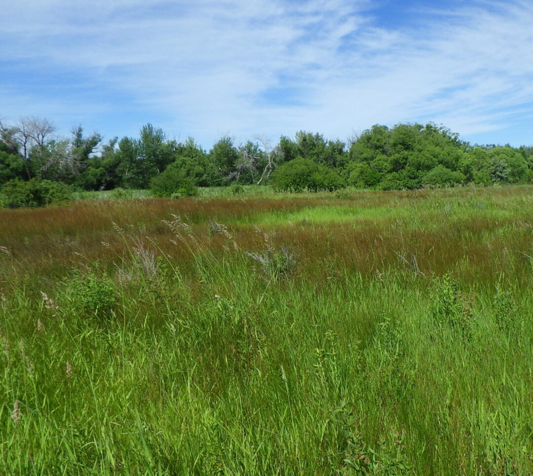
HIGHLIGHTS OF HIDDEN SPRINGS WETLANDS WILDFLOWER WALK (peak bloom: mid June through July): As an alternative to heading to higher elevations during the summer months, check our what’s growing in your local wetlands for a whole new suite of interesting plants, some of which are just hitting their stride. The wildflower walk described here, through the exceptionally rich remnant wetlands at Hidden Springs, is the shortest walk in the series, a half-mile ramble that is a pleasant morning or evening outing even on a hot summer day.
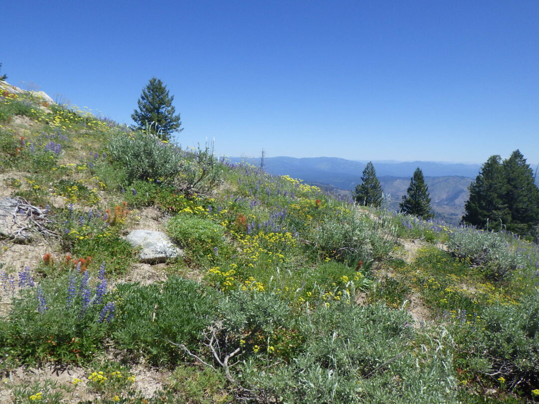 SHAFER BUTTE LOOP WILDFLOWER WALK (peak bloom: summer months): Shafer Butte Loop is one of the premier wildflower walks in the Boise Front, with extraordinary displays of mountain wildflowers throughout the summer, a wide diversity of habitats, and outstanding views in all directions (at least if not blocked by smoke). At elevations mostly above 7000′, the walk also provides a refreshing respite from the summer heat in the valley floor 4000′ lower down. The complete loop is about 4½ miles long, with 620′ elevation gain, starting at Pioneer Lodge.
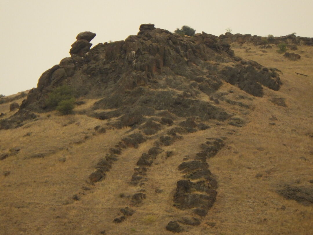
CHIEF EAGLE EYE RESERVE WILDFLOWER WALK
(timing: end of summer): In addition to highlighting its significant Native American importance, a walk around Chief Eagle Eye Reserve (previously Castle Rock Reserve) provides some geological and accompanying botanical diversity that is not represented on other wildflower walks. Although the relatively short loop described here can be a pleasant walk anytime of the year, the wildflower walk is described as an end-of-summer option, when some noteworthy fall-blooming species can be appreciated. The loop is about 1½ miles long, with about 250 feet elevation gain.
MAPS: Interactive maps have been generated by Martha Brabec for some trails in the Ridge to Rivers system, based on the interactive Ridge to Rivers trail map.
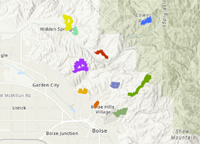
Click here to see an expanded map
| Walk | Time of year | Difficulty |
| Bob’s Trail |
June | Easy |
| Bonneville Point | mid May to mid June | Moderate |
| Bucktail/Shane’s/Three Bears Loop | mid May to mid June | Moderate |
| Buena Vista Trail | mid March to early April | Easy |
| Camelsback |
mid to late May | Moderate |
| Chief Eagle Eye Reserve | end of summer | Moderate |
| Cobb Trail |
mid April to mid May BURNED IN 2024 |
Challenging |
| Currant Creek East | May | Moderate |
| Redtail/Currant Creek | early May | Moderate |
| Hidden Springs Wetlands | mid June to mid July | |
| Interpretive Loop |
June | Moderate |
| Lydle Gulch | mid March to early April | Moderate |
| Lydle Gulch | mid April to mid May | Moderate |
| Milepost 12 | mid June to mid July | Easy |
| Miller Gulch | early May | Easy |
| Oregon Trail |
mid March through April BURNED IN 2024 |
Moderate |
| Polecat Gulch | late March through April | Easy |
| Shafer Butte Loop | July through August | Moderate |
| Sweet Connie | June | Easy |
| Get the Jump on Spring | mid February to late March | Moderate |