SHAFER BUTTE LOOP WILDFLOWER WALK
July through August
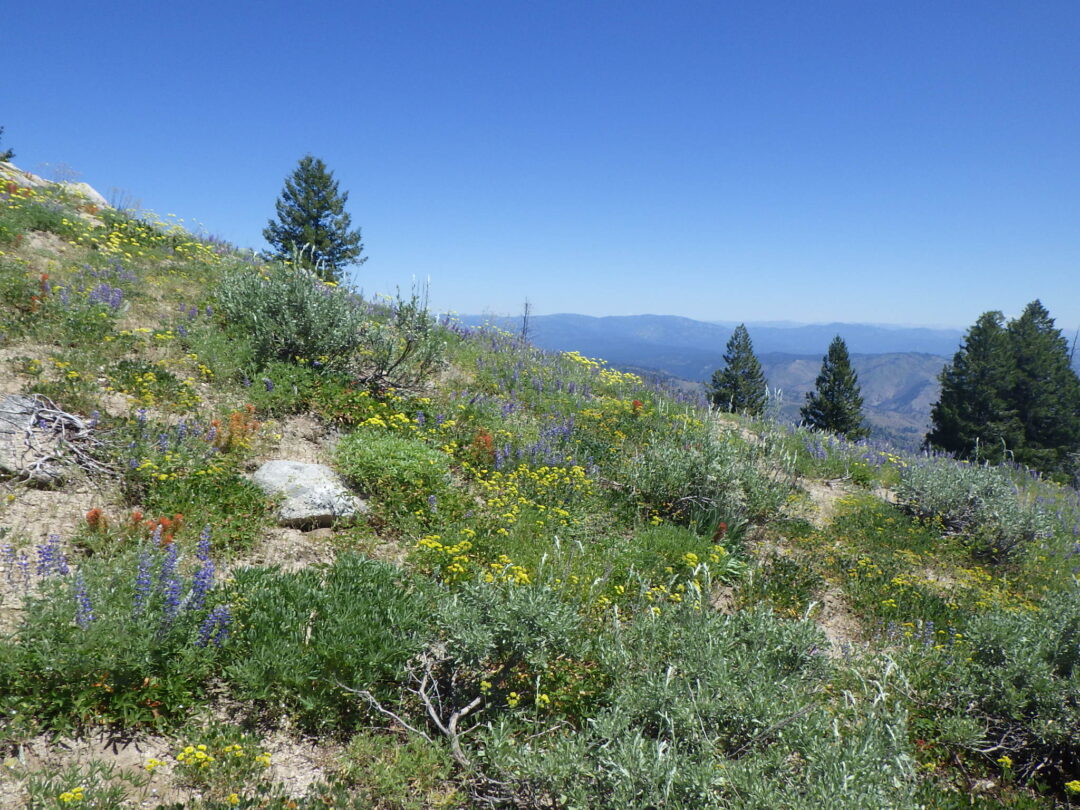
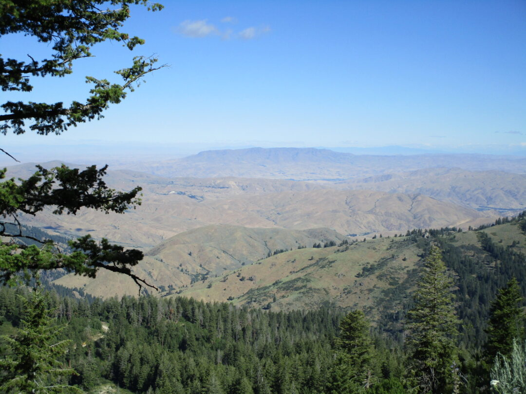
Shafer Butte Loop is one of the premier wildflower walks in the Boise Front, with extraordinary displays of mountain wildflowers throughout the summer, a wide diversity of habitats, and outstanding views in all directions (at least if not blocked by smoke). At elevations mostly above 7000′, the walk also provides a refreshing respite from the summer heat in the valley floor 4000′ lower down. The complete loop is about 4½ miles long, with 620′ elevation gain; give yourself enough time to enjoy the flowers and views, as well as travel time to Pioneer Lodge where the walk begins.
ABOUT SHAFER BUTTE: Shafer Butte (7582′) and nearby Mores Mountain (7237′) are the highest points on the Boise Ridge, essentially functioning as elevational “islands” at the very edge of the northern Rocky Mountains. Although the mid-elevation mixed conifer forest is relatively continuous to the north and east, except where too hot or dry, the Boise Ridge as a whole is separated from the rest of the Idaho Batholith by the Mores Creek/Grimes Creek drainage to the east and the Harris Creek/Granite Creek divide between Horseshoe Bend and Idaho City to the north. With a high point of 5200′ at Harris Creek Summit, these drainages and divides serve as barriers to plants that are restricted to higher elevations, and beyond are additional barriers created by the complex network of drainages that dissect the Boise Mountains. Among the archipelago of other scattered peaks that exceed 7000′ in this part of Idaho, the closest to Shafer Butte are Hawley Mountain (7293′) 15 miles to the north and Thorn Creek Butte (7515′) 17 miles to the east. The closest significantly larger expanse of high elevations is Trinity Mountain (9451′), 35 miles to the east; the crest of the popular Sawtooth Range is 50 miles away.
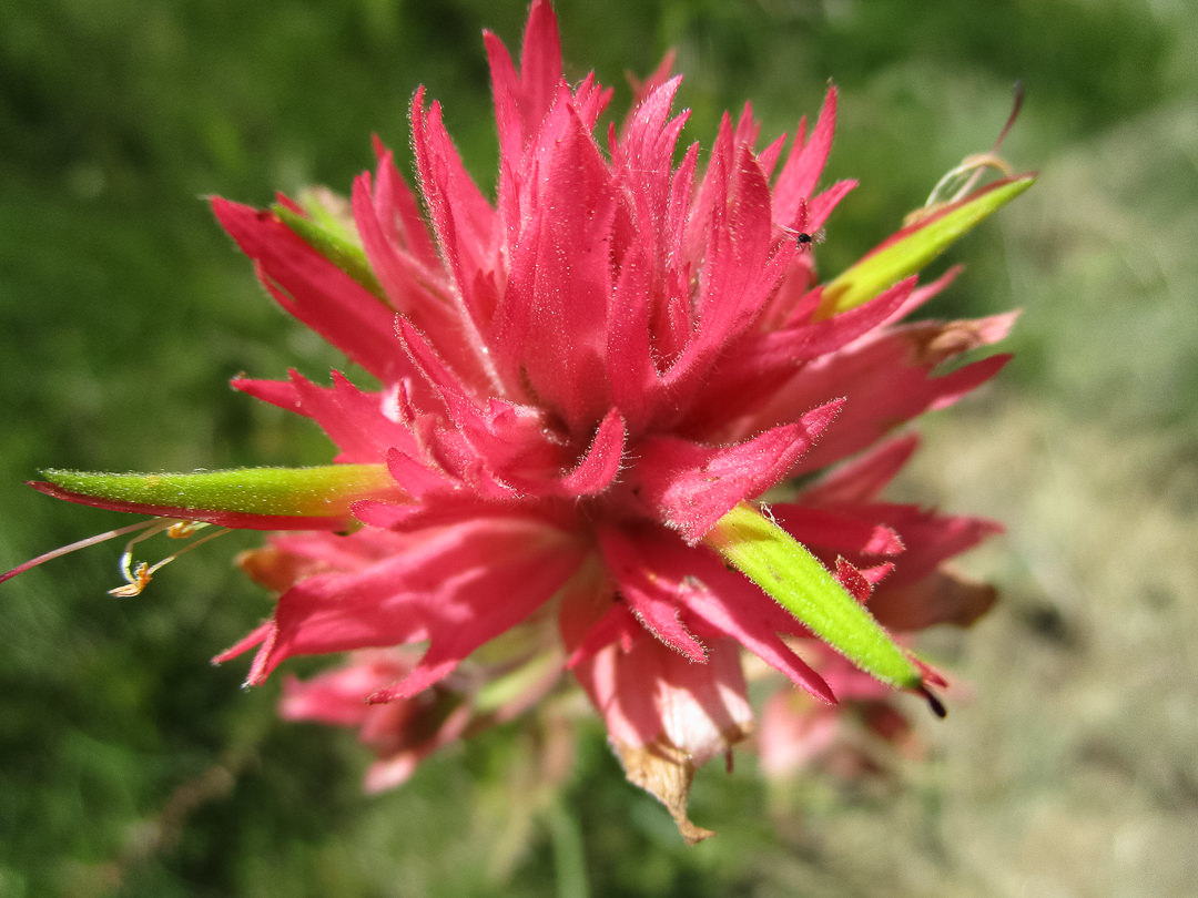
The island nature of Shafer Butte is amplified by its location at the very edge of the Idaho Batholith and Rocky Mountains, an outlier in the archipelago of isolated peaks of comparable elevation to the north and east. Its south and west slopes overlook the western Snake River Plains on the northern edge of the Intermountain Desert, with distant views of the Owyhee Range and uplands to the south and the Blue Mountains to the west. One result is a rich diversity of habitats as the peak is circumnavigated, from dry rocky south-facing slopes to moist meadows and conifer forests on the northeast side, artificially enhanced by wildflower-rich meadows where brush is cleared for ski runs. Another likely result of the island-like isolation is local endemism (i.e., species unique to a geographically restricted area), at least genetically. No plants are currently considered endemic to Shafer Butte, but this might simply indicate that the flora has not previously been given the attention it deserves; the lure of higher mountains in Idaho’s backcountry has disproportionately determined the summer destination of the relatively few local botanists. A prime candidate for overlooked endemism is the common paintbrush on Shafer Butte, which has the morphology of Castilleja miniata but the more crimson (violet-red) coloration of rosy paintbrush (C. rhexifolia), in contrast to the characteristic scarlet (orange-red) color of populations just below the conifer zone. Several other plants growing on this island peak are also slightly different from those found growing elsewhere and deserving of further study.

Even though not flat-topped, Shafer Butte and several other comparable peaks are sometimes called buttes locally, particularly if the summit area is barren of trees. This absence of trees is not an indication of normal timberline, which is several thousand feet higher in central Idaho, but is more likely the result of insufficient soil moisture on the rocky exposed summits to sustain trees through the hot dry summers. These scattered peaks are also prime locations for a variety of uses, historically for fire lookouts and more recently for communication towers; the summit of Shafer Butte is no exception, with a restricted-access road to the top and a plethora of communication and other structures. It is also the upper terminus for two ski-lifts of the non-profit Bogus Basin Mountain Recreation Area: Superior Express and Pine Creek Express. Regular skiers on Bogus Basin will enjoy seeing the different face the mountain puts on in summer.
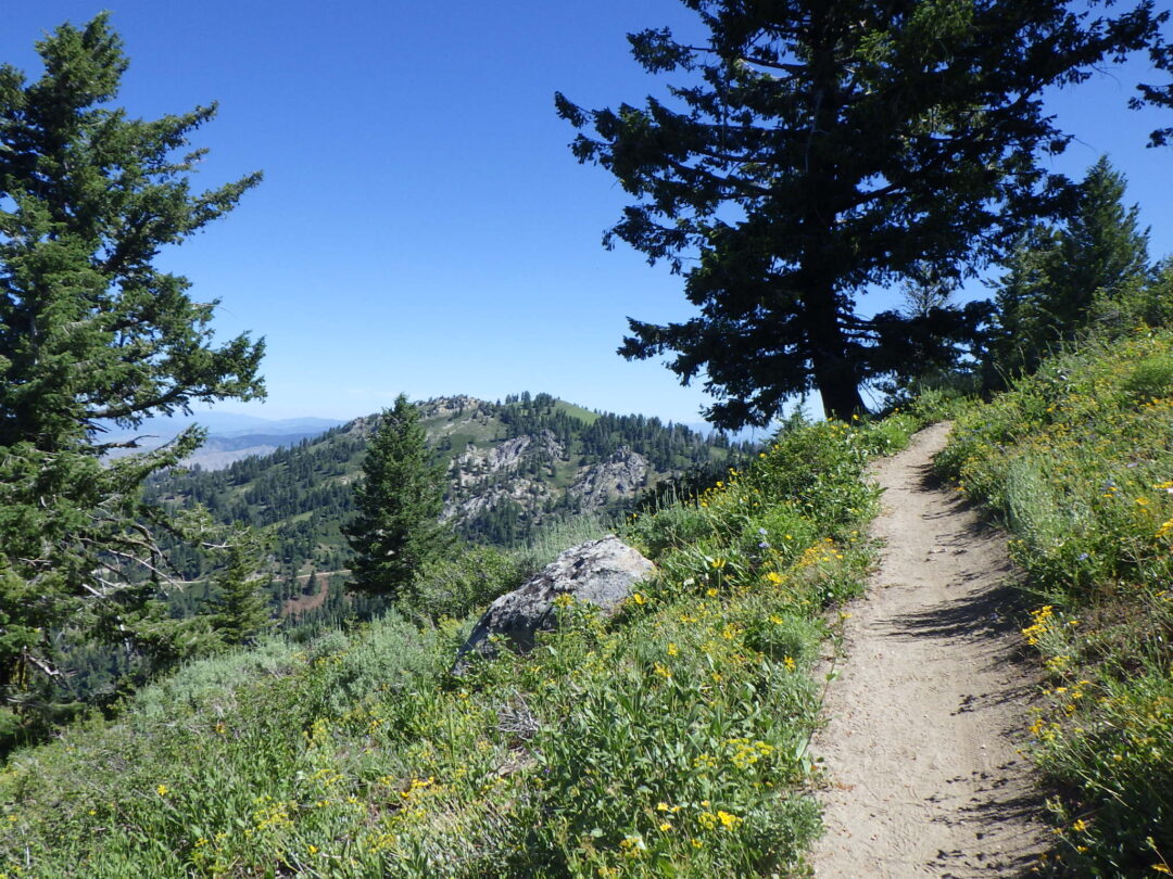
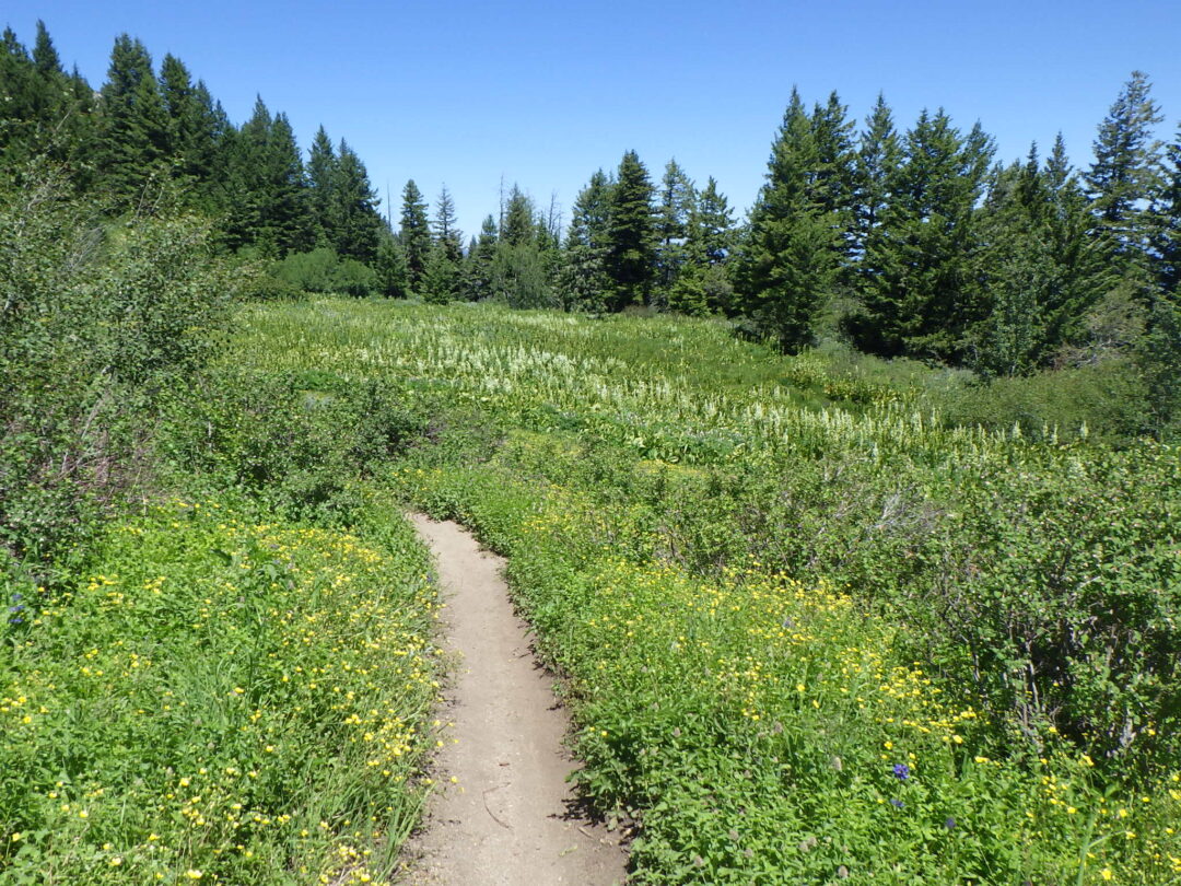
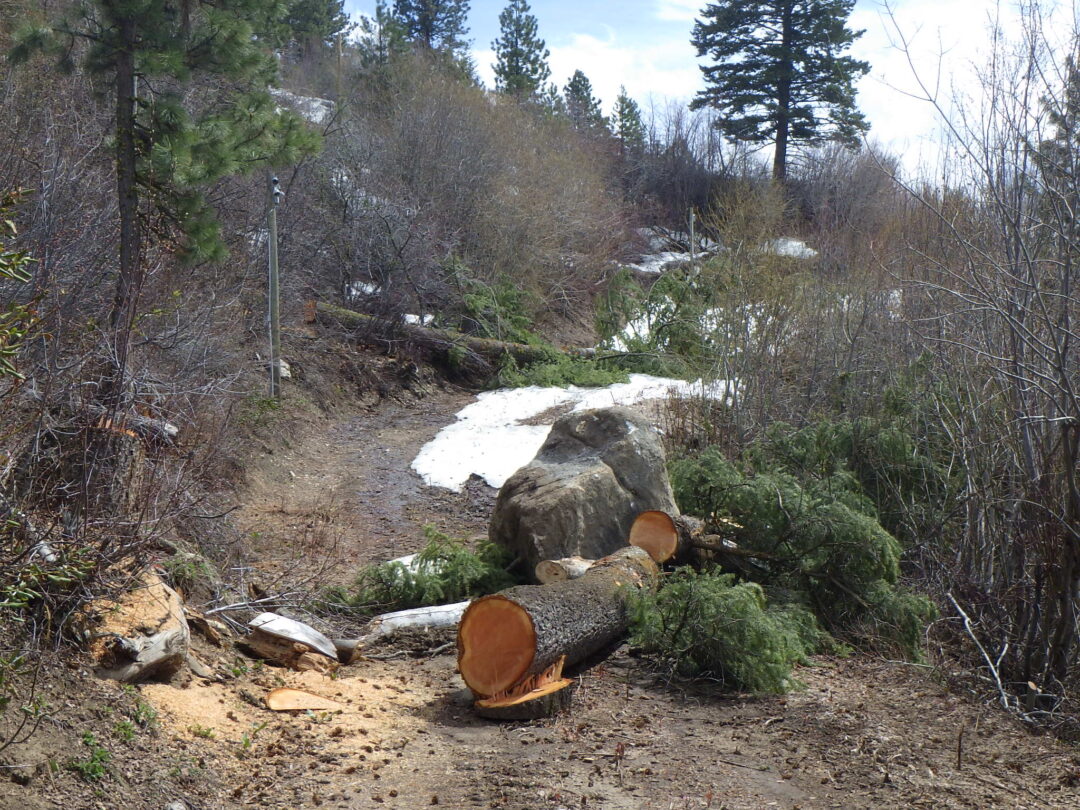
SELF-GUIDED WILDFLOWER WALK: The 4½ mile loop begins and ends at the Pioneer Lodge parking area at 6770 feet and soon climbs to 7390 feet, followed by a circumnavigation and gradual descent around the summit of Shafer Butte. The walk is described counterclockwise with the recommendation of starting no later than mid-morning, so that the exposed south-facing slope can be traversed before midday heat. Be sure to bring sufficient water for several hours, especially on hot days. Although unlikely, be alert for signs of altitude sickness, primarily if recently coming from sea level. Sturdy footwear and a hat are recommended; hiking poles may help with balance, though most trails are well-graded. About two-thirds of the loop consists of single-track trails shared with mountain bikes, so it is often a good idea to avoid peak cyclist times (though the longer Round the Mountain loop at lower elevations is preferred by most mountain bikers).
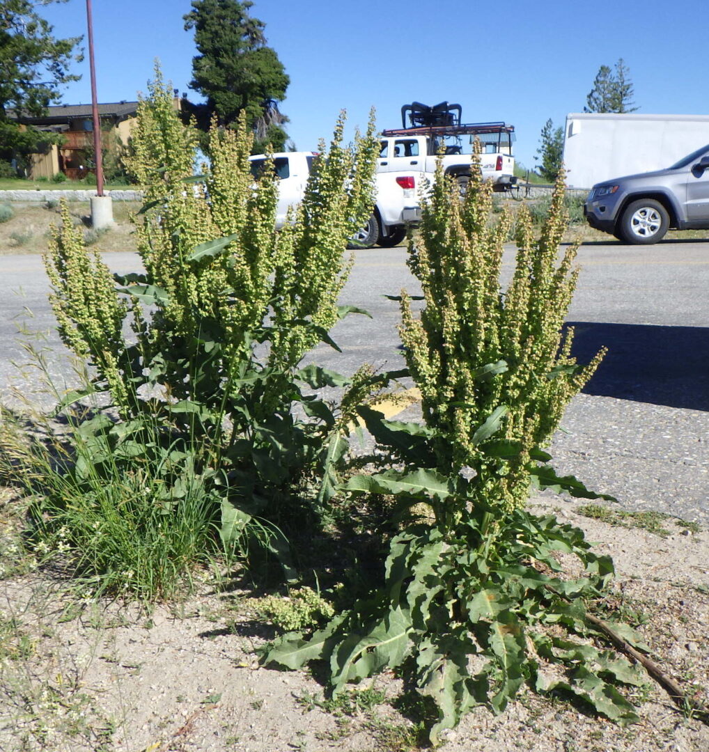
Pioneer Lodge is part of the Bogus Basin Recreation Area, accessible on a paved (except for a short stretch through the lower parking area) but windy road. Park in the public portion of the lot, not that reserved for condominium use. For those wishing to enjoy a scenic ride for a modest fee, the Morning Star chairlift provides an alternate means to reach the starting point from the lower base area parking. One plant to take note of in the parking area itself is patience dock (Rumex patientia), which looks like the common curlydock (Rumex crispus) on steroids. This is recently arrived invasive species that is unfortunately making itself at home at Bogus Basin and a few other sites in the Boise Front. Spotted knapweed (Centaurea stoebe ssp. australis, previously C. maculosa) is another invasive species that is well-established here and elsewhere in Bogus Basin.
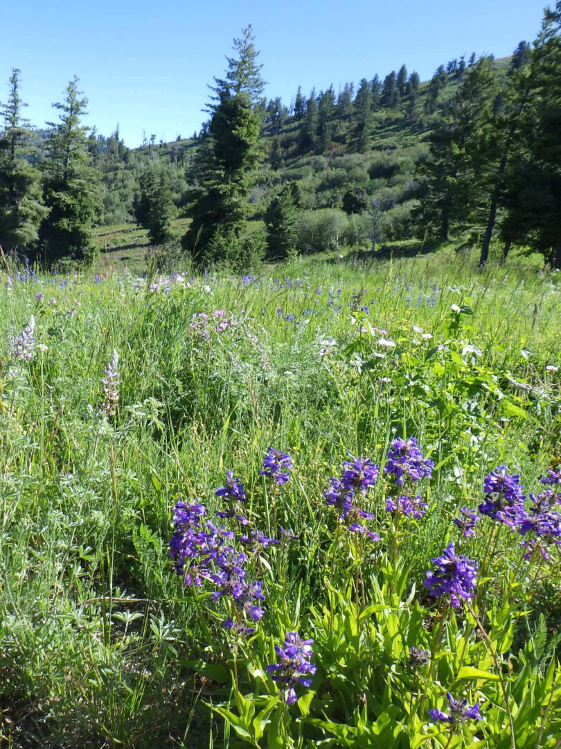
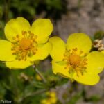
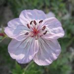
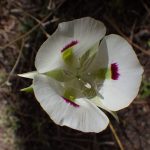
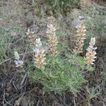
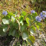
From the parking lot, head uphill behind the lodge, keeping left to skirt the bicycle-only area and chairlift terminus. A good introduction to some of the showy wildflowers that are common on the loop is provided by a meadow on the north side of the designated walking trail. Depending on the season, you can enjoy displays of blue-flowered taperleaf penstemon (Penstemon attenuatus var. militaris), yellow-flowered Idaho woodbeauty (Drymocallis glabrata, previously Potentilla glandulosa var. glabrata), pink-flowered sticky geranium (Geranium viscosissimum), lavender-flowered silky lupine (Lupinus sericeus), white-flowered wing-fruited sego lily (Calochortus eurycarpus), and yellow-flowered sulphur buckwheat (Eriogonum umbellatum, mostly var. stragulum). The grasses are primarily intentionally planted species, most notably smooth brome (Bromus inermis) that is capable of eventually displacing much of the native wildflower diversity.
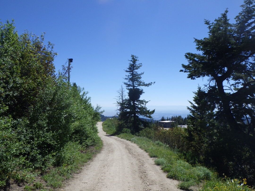
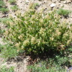
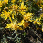
Turn left on LODGE TRAIL/Lodge Cat Road (#140), used as a snowcat track during skiing season. Douglas-fir (Pseudotsuga menziesii) and ponderosa pine (Pinus ponderosa) are the dominant trees throughout the hike, with an occasional quaking aspen (Populus tremuloides) in relatively moist sites. Common shrubs include snowbrush ceanothus (Ceanothus velutinus), bittercherry (Prunus emarginata), Rocky Mountain maple (Acer glabrum), Scouler’s willow (Salix scouleriana), and mountain snowberry (Symphoricarpos rotundifolius var. vaccinioides, previously S. oreophilus), along with an occasional mountain-ash (Sorbus scopulina) and mountain big sagebrush (Artemisia tridentata ssp. vaseyana).
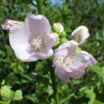
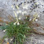
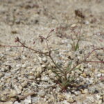
The roadcuts along Lodge Trail provide habitat for a rich diversity of wildflowers; in addition to those already mentioned, look for little sunflower (Helianthella uniflora), horsemint (Agastache urticifolia), scarlet gilia (Ipomopsis aggregata), Oregon sunshine (Eriophyllum lanatum), western columbine (Aquilegia formosa), arrowleaf balsamroot (Balsamorhiza sagitatta), western sweetroot (Osmorhiza occidentalis), ballhead gilia (Ipomopsis congesta), western hawkweed (Hieracium scouleri), spreading groundsmoke (Gayophytum diffusum), and wormleaf stonecrop (Sedum stenopetalum). Keep an eye out in particular for patches of dwarf monkeyflower (Diplacus nanus, previously in Mimulus), tiny plants with startlingly out-sized magenta flowers. Another unusual plant is clustered bird’s-beak (Cordylanthus captatus), a late-season dusty-looking annual that doesn’t appear to be in bloom until you look closely. Several large plants of mountain hollyhock (Illiamna rivularis) might also be in bloom along the roadside, mostly opposite the roadcuts.
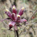
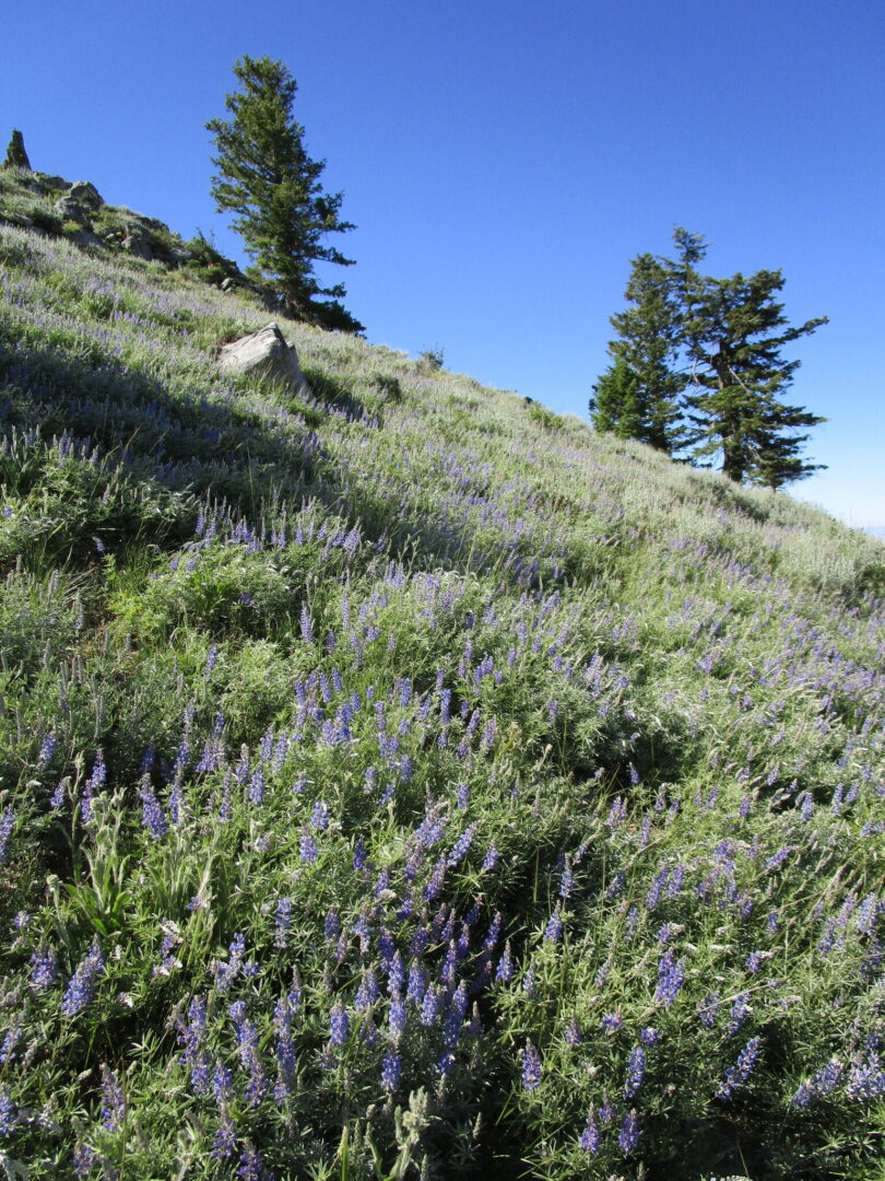
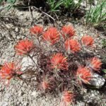
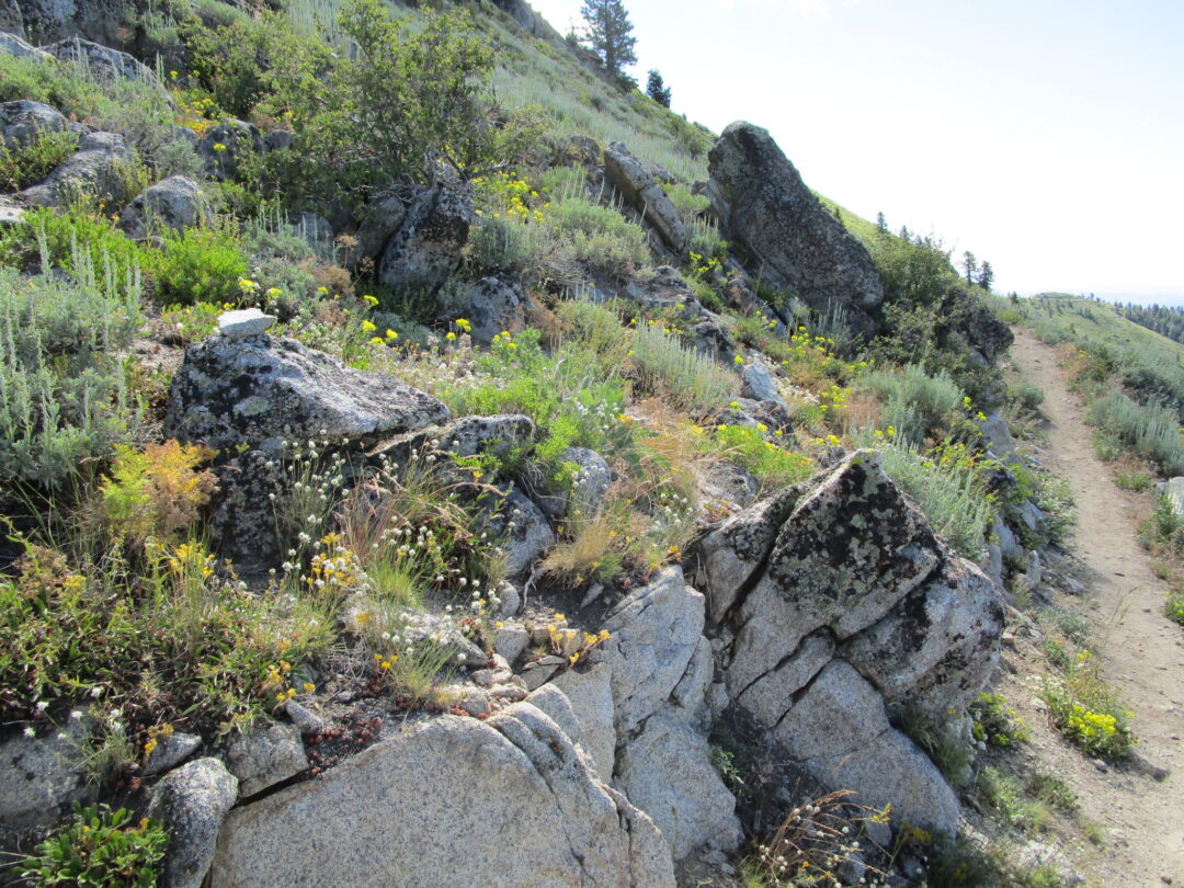
Turn right on TEMPEST TRAIL (#95), about half a mile from Pioneer Lodge. This single-track trail, which zigzags up a northwest-facing slope, is where you will accomplish your primary elevation gain, so take your time to enjoy the wildflowers and views (while also keeping an eye out for cyclists!) Sparse Douglas-fir, some beautifully old and gnarled, are scattered across the slope, which is covered with a high quality high-elevation habitat of perennial wildflowers, bunchgrasses, and low shrubs. Silver lupine (Lupinus argenteus var. heteranthus) forms solid stands in some areas, reflecting the blue of the sky at peak bloom. Other wildflowers that you might not yet have already seen include Coville’s paintbrush (Castilleja covilleana), blue stickseed (Hackelia micrantha), Nuttall’s linanthus (Leptosiphon nuttallii, previously Linanthastrum), gooseberry-leaf alumroot (Heuchera grossulariifolia), prickly sandwort (Eremogone aculeata, previously in Arenaria), western groundsel (Senecio integerrimus), western wallflower (Erysimum capitatum), and fernleaf biscuitroot (Lomatium multifidum). Lewis’s flax (Linum lewisii) is native here, on contrast to its smaller-flowered counterpart that is commonly seeded in the lower foothills. Early-season hikers might even catch mountain kittentails (Synthyris missurica) still in bloom, especially near lingering snowbanks.
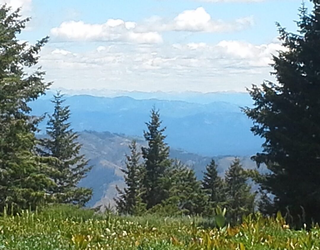
The FACE TRAIL (#93), which heads right at a marked junction on a switchback about half a mile from the Lodge Trail, cuts a mile-long transect across the southwest face of Shafer Butte. Enjoy the view across the Boise Valley and upper Snake River Plains to the distant Owyhee Mountains (curiously sharing the same name, with an alternate spelling, as Hawai’i, in memory of three Hawai’ian members of an 1819 fur-trapping expedition who disappeared after being sent into the area to look for beaver). Closer topographic features include the tower-studded twin summits of Deer and Doe Points to the left, and conical Stack Rock, a popular hiking and cycling destination, on the forested ridge to the right.
New wildflowers that you might see along this more exposed segment of the loop include ballhead sandwort (Eremogone congesta), Payette penstemon (Penstemon payettensis), and dusty maidens (Chaenactis douglasii) as well as a diversity of annuals such as diamond-petal farewell-to-spring (Clarkia rhomboidea), common tarweed (Madia gracilis), largeflower collomia (Collomia grandiflora), and several species of bristly-haired Cryptantha. Large outcrops midway along the trail provide special habitat for other plants; look for Douglas’s catchfly (Silene douglasii), shrubby penstemon (Penstemon fruticosus), and Alberta penstemon (Penstemon albertinus).

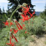
Occasional seepage areas add diversity to the east part of the Face trail, with conspicuous patches of cow-parsnip (Heracleum maximum, previously H. lanatum) intermixed with mountain stinging nettle (Urtica dioica ssp. gracilis). A narowly green-leaved form of Wyeth’s buckwheat (Eriogonum heracleoides), whose cream-colored flowers turn reddish with age, is also common along this stretch of trail, along with little sunflower (Helianthella uniflora), horsemint (Agastache urticifolia), and scarlet gilia (Ipomopsis aggregata). A few curiously white-flowered plants combine characters of widespread sticky geranium (Geranium viscosissimum) and white geranium (Geranium richardsonii), which is not otherwise known from the Boise Front.
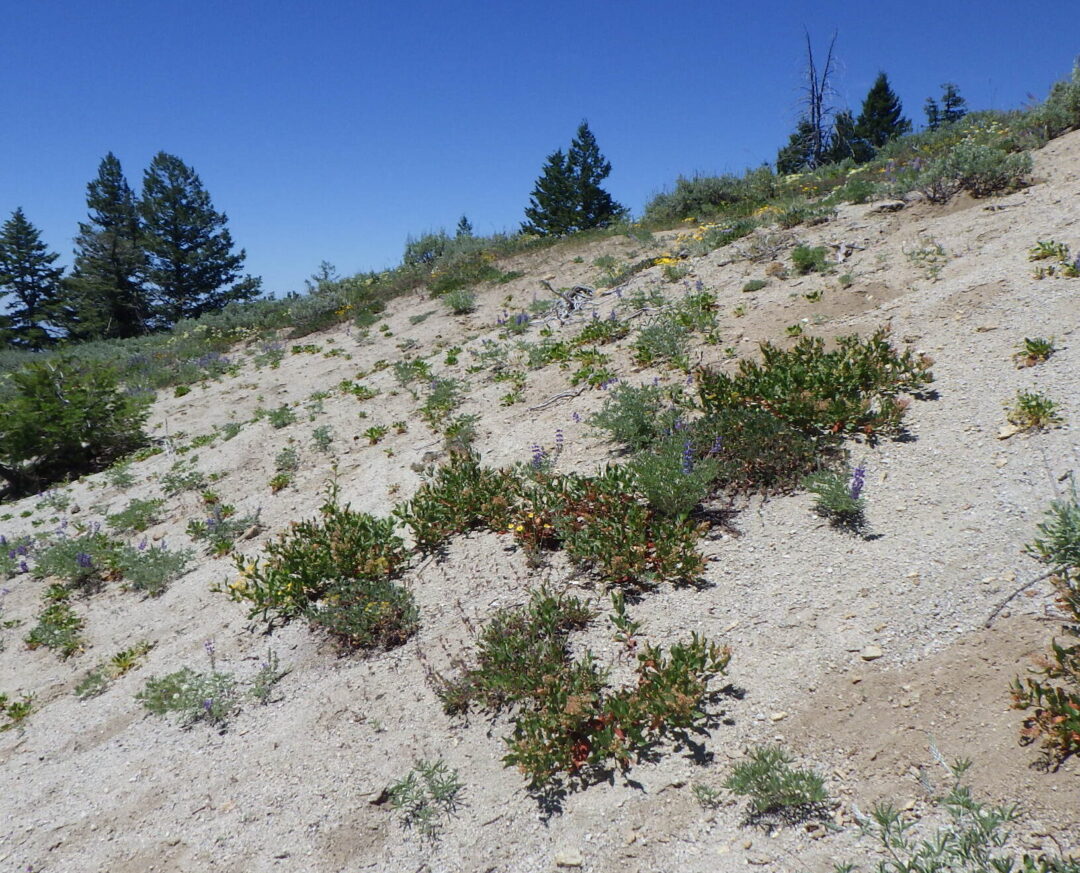
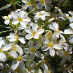
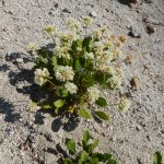
Near the east end of the Face trail is an unusual barren slope of coarse sand, cause unknown, that harbors an interesting suite of plants. The most curious is a prostrate form of fleeceflower (Aconogonon phytolaccifolium, previously in Polygonum). Another noteworthy plant is the alpine buckwheat (Eriogonum pyrolifolium); although two varieties are commonly recognized in this species, based on leaf pubescence, both forms often grow intermixed on Shafer Butte. Other wildflowers on this site include prickly sandwort (Eremogone aculeata), ballhead gilia (Ipomopsis congesta), Oregon sunshine (Eriophyllum lanatum), and a narrow-leaved form of silver lupine (Lupinus argenteus var. heterophyllus).
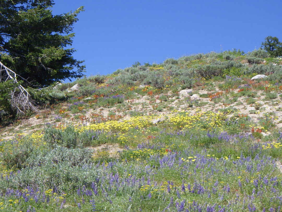
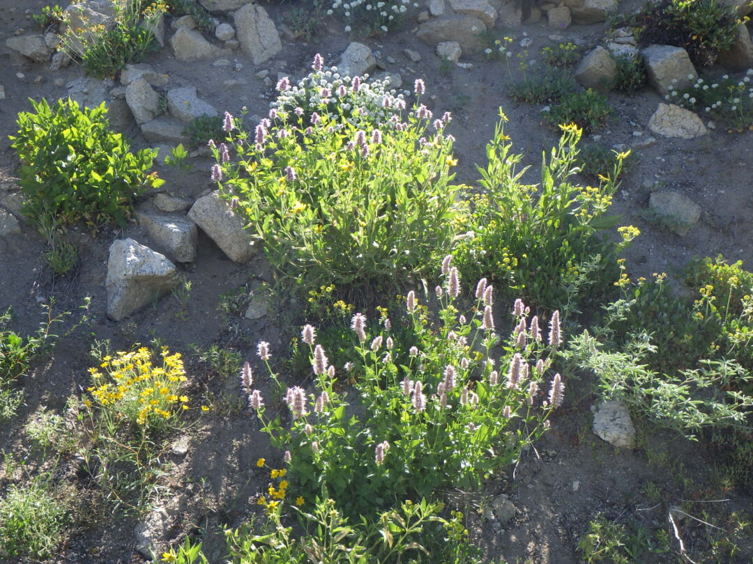
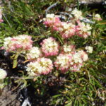
The most spectacular display of wildflowers, especially if you are lucky enough to arrive at the peak season in a good year, is the natural rock garden on the open slopes at the saddle where the loop crosses the Cabin Traverse (# 144, the access road to Shafer Butte summit). The yellow flowers of sulphur buckwheat (Eriogonum umbellatum) and Piper’s buckwheat (E. flavum var. piperi), blue flowers of silver lupine, and red flowers of Coville’s paintbrush (Castilleja covilleana) combine in a colorful mosaic. After admiring the showier wildflowers, look closer for more alpine buckwheat (Eriogonum pyrolifolium) and the diminutive annual spurry buckwheat (Eriogonum spergulinum var. reddingianum), which in a good year can cover the ground with a smoky cast. The display continues along the beginning of Elk Meadows trail, where you can also find some more typically erect fleeceflower (Aconogonon phytolaccifolium) growing at the base of a dramatic rock-face that is more sharply angled than most outcrops of Idaho batholith granite.
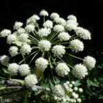
New habitats quickly add to the loop’s diversity as you follow ELK MEADOWS TRAIL (#94) for about a mile around the more forested east side of Shafer Butte. After passing another lupine-covered slope, a lovely wet meadow appears on your right, full of California false hellebore or corn-lily (Veratrum californicum), northern bluebells (Mertensia paniculata var. borealis), Cusick’s corydalis (Corydalis caseana var. cusickii), western coneflower (Rudbeckia occidentalis), and western larkspur (Delphinium occidentale). Shrubs around the margins include mountain-ash (Sorbus scopulina) and black elderberry (Sambucus racemosa var. melanocarpa). The path itself cuts across a drier portion of the flat, brightened mid-season with yellow Idaho wood-beauty (Drymocallis glabrata) and blue taperleaf penstemon (Penstemon attenuatus var. militaris), changing to purple at the end of summer with thickstem aster (Eurybia integrifolia, previously in Aster).
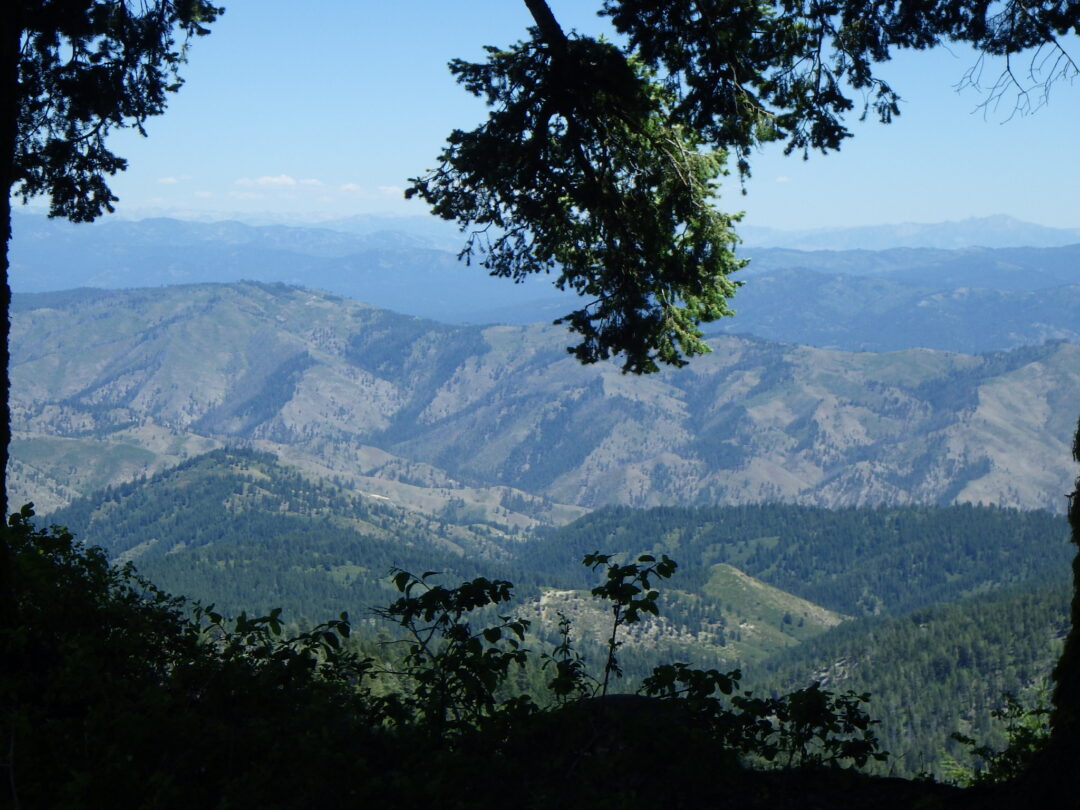
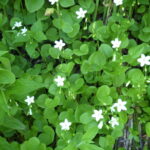
The path jogs to the right as it enters a shaded grove (at least as of 2020; many of the trees are marked for logging with the blue ring of death). Take time to look for western columbine (Aquilegia formosa), western meadowrue (Thalictrum occidentale, which has leaves very similar to those of the columbine), licorice-scented western sweetroot (Osmorhiza occidentalis), and monotypic kelloggia (Kelloggia galioides, named for Albert Kellogg, one of the more eccentric founders of the California Academy of Sciences). Farther along the path crosses an open stretch, kept clear for the Wildcat ski run (Black Diamond). Shortly before the Pine Creek Express lift is a perfect rest spot (if not already occupied), in the cleared ground beneath a dense grove of trees on a small knoll left of the path. Enjoy the view looking across the mountains to the east; try to pick out Trinity Mountain and Soldier Mountains to the right, Smoky Mountains in the distant middle, and the jagged white peaks of the Sawtooth Mountain on the horizon to the left. You can also look for the small white flowers of Menzies’s catchfly (Silene menziesii), tucked at the base of some of the trees.

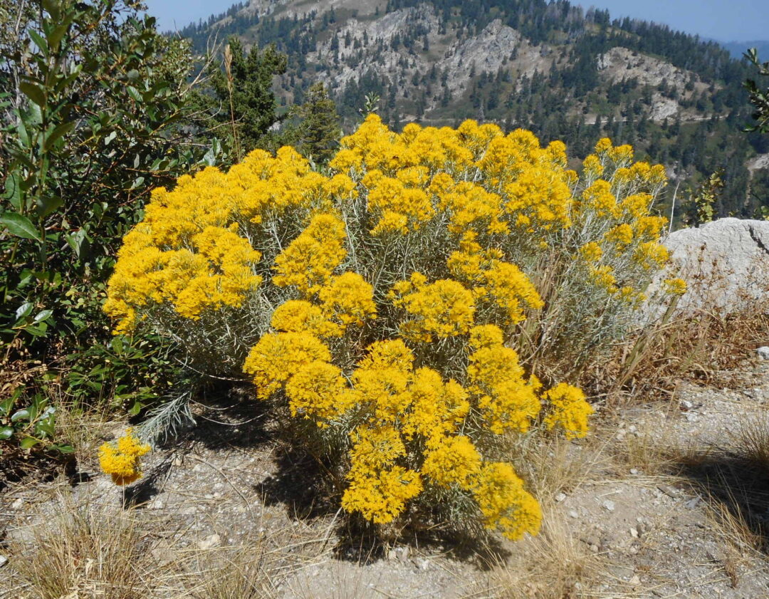
Elk Meadows trail continues through a sequence of more patches of wet meadow with California corn-lily (Veratrum californicum), cow-parsnip (Heracleum maximum), and fireweed (Chamaenerion angustifolium, previously in Epilobium), and cleared ski runs, where the Shafer Butte form of the common paintbrush (Castilleja miniata) is abundant, along with regularly sheared mountain snowberry (Symphoricarpos rotundifolius var. vaccinioides, previously S. oreophilus). An open lupine-covered slope, eroded with runoff from late-lingering snowpack, deserves a closer look. Keep an eye out in particular for pussypaws (Calyptridium umbellatum), growing with its look-alike alpine buckwheat (Eriogonum pyrolifolium). Late-season color is provided by two similar yellow-flowered shrubs: the montane form of rubber rabbitbrush (Ericameria nauseosa, previously in Chrysothamnus) and Greene’s goldenbrush (Ericameria greenei), in addition to vivid fall foliage and the red berries of mountain-ash (Sorbus scopulina).

Mores Mountain comes into view as Elk Meadows trail wraps around to the north side of Shafer Butte; a future wildflower walk is planned for its excellent network of pedestrian-only trails and natural rock-gardens on its craggy outcrops. The single-track trail soon ends and rejoins the road back to Pioneer Lodge (a final mile or so to go!) Keep to the left at the fork where an unmarked road drops down to connect with Mores Mountain, and continue straight on Lodge Road (#140) where the Packing Trail (#149) doubles back to the left and zigzags up to the summit. One noteworthy plant in the along this stretch is the mountain lupine (Lupinus argenteus var. argentatus), a green-leaved relative of the more common silver lupine (Lupinus argenteus var. heteranthus).

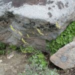
A short distance past the Packing Trail junction is a lovely seepage-covered slope with small springs flowing next to the road that merits a closer look. The conspicuous large plants are California false hellebore (Veratrum californicum), northern bluebells (Mertensia paniculata var. borealis), Cusick’s corydalis (Corydalis caseana var. cusickii), white angelica (Angelica arguta), Lewis’s monkeyflower (Erythranthe lewisii), arrowleaf groundsel (Senecio triangularis), and mountain stinging nettle (Urtica dioica ssp. gracilis). Heartleaf springbeauty (Claytonia cordifolia) grows tucked in the shade along the streamlets, and you might even find a few leaves of heartleaf cardamine (Cardamine cordifolia) which is currently known in the Boise Front only from this site, and not yet found in flower. Unfortunately, invasive reed canarygrass (Phalaris arundinacea) also has a foothold here, and has the potential to displace the rich wildflower diversity.
The road then crosses several more cleared ski runs and passes under the Superior chairlift, completing the loop at the base of Tempest Trail. In addition to keeping an eye out for wildflowers that you overlooked at the beginning of the walk, or which are now open or in better lighting, take time to admire the view to the northwest. The dark ridge in the middle distance is the recently renamed Sehewoki’l Newenee’an Katete (previously Sq*** Butte), an isolated fault block at the southeastern edge of the massive Columbia Basalt flows. The Blue Mountains in Oregon form the horizon in the background, with the often snow-capped Wallowa Mountains to the right, peeking around the Cuddy Mountains.
NOTE ON FIRE CONTROL EFFORTS: A major tree-removal project (aka logging) is currently underway in the area around Shafer Butte, initiated in 2019 to reduce the risk of devastating fires especially given the increasing number of dead and dying Douglas-fir trees. Fires are certainly a real concern, and the evident tree mortality is indisputable, but in my analysis the proposed solution should be understood as fundamentally experimental, with long-term consequences remaining to be determined. There is strong evidence that many forest types depend on regular fires to keep fuels at non-destructive levels, and that fire-suppression efforts during the last century have resulted in overly dense forests and the build-up of fuels (aka living and dead plants) in the understory. Uncertainties include the extent that this applies to all forest types, how equivalent mechanical thinning efforts are to regular fires, the relative importance of other contributing factors such as climate change and highly flammable invasive species, and the likelihood of any follow-up management needed in the long run.
Most media coverage (e.g., “Logging starts at Bogus Basin in major forest health project“) tends to focus on Douglas-fir dwarf-mistletoe (Arceuthobium douglasii) as the primary culprit behind tree mortality. However, this native species is probably analogous to lice; unlikely to lead to death in a healthy individual, but potentially increasingly dramatically and ultimately contributing to mortality in an already stressed tree. The plant itself is an inconspicuous parasite that requires a close look to spot, but the host tree often responds by developing a dense growth called “witch’s broom” (which can also be caused by fungi and other factors). These growths can be conspicuous on many (but not all) dead and dying trees, easily leading to the conclusion that they are the cause of death, but they are also often present (with or without dwarf mistletoe) on otherwise healthy trees.
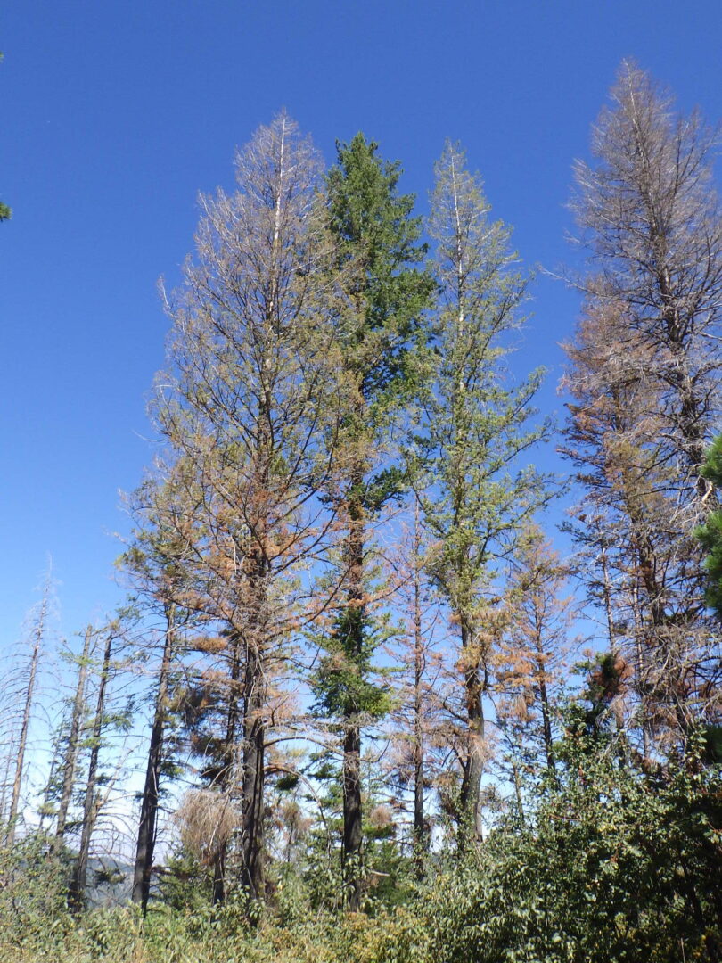
Given all this, what might be stressing the forest around Bogus Basin? The most obvious explanation is a long-term trend towards hotter and drier conditions (aka climate change), especially for trees that are already outliers teetering at the very edge of their climatic envelope for long-term survival. On the one hand, reducing the number of trees might leave more water available for the remaining trees; on the other hand, less shade could easily result in the forest floor drying out faster, thereby increasing the drought stress and fire potential. If the latter dominates, then thinning efforts might actually speed up the demise of the remaining trees, and the drying up of springs and other moist habitats, rather than the intended outcome. Economic factors also often dictate that sufficient marketable trees be included in the cut, independent of what might otherwise be optimum environmentally. Tragically, it is possible that the current natural forest on the Boise Ridge is doomed no matter what measures are taken locally, along with the various ferns, orchids, and other wildflowers that are dependent on the various unique microhabitats within the conifer zone.
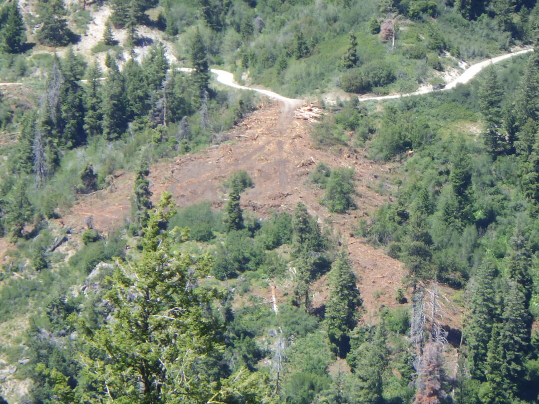
Even in the short term, it remains to be seen how existing diversity responds to the current logging activities, including the wildflower sites profiled above. Soil disturbance can be severe, especially in staging areas; this can benefit certain pioneering species like lupines, but other species will suffer from the disturbance and reduced shade. Invasive non-natives, notably spotted knapweed (Centaurea stoebe ssp. australis) and patience dock (Rumex patientia) locally, can rapidly spread into disturbed sites, and the intentional planting of non-native perennial grasses such as smooth brome (Bromus inermis) could also significantly interfere with the recovery of native wildflowers. Of course, a megafire would be even more devastating, so let us fervently hope that the current experiment is successful, and that all the lovely wildflowers profiled in this wildflower walk will continue to be available for all to enjoy, along with the shade- and moisture-dependent ferns, orchids, and other special wildflowers found elsewhere in the conifer zone.
To learn more about the ski resort’s history, see Rick Just’s “Building Bogus Basin“.