“GET THE JUMP ON SPRING” WILDFLOWER WALK
Mid-February to late March
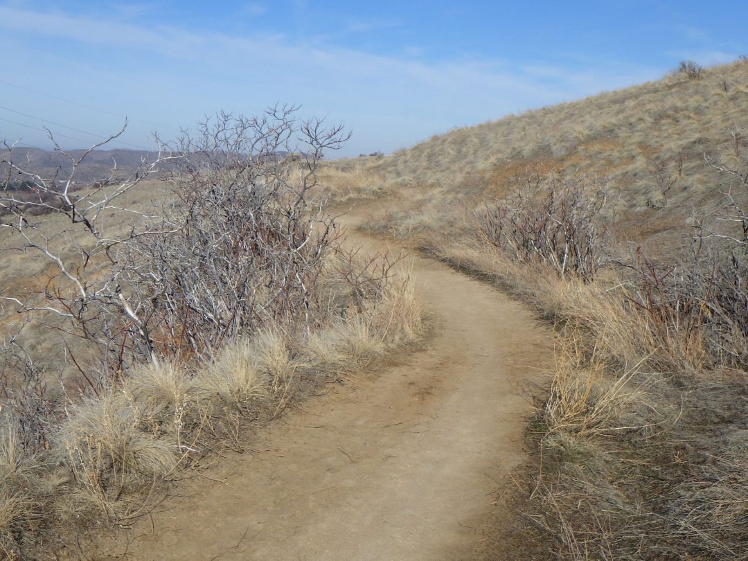
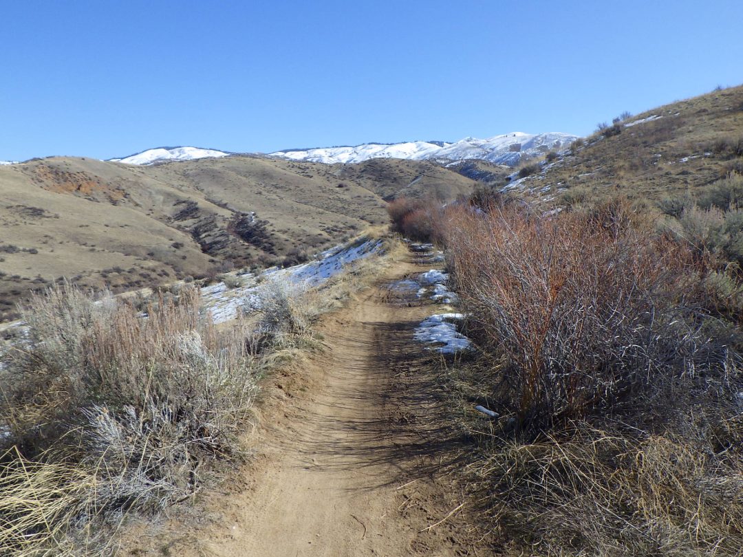
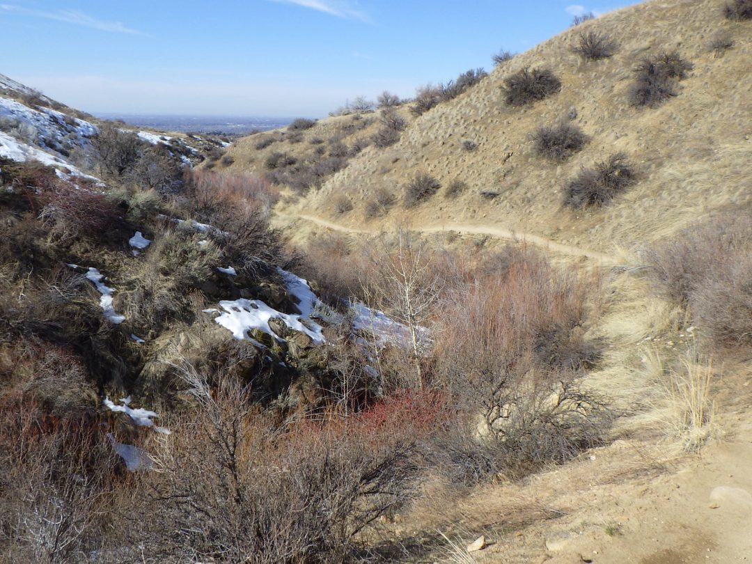
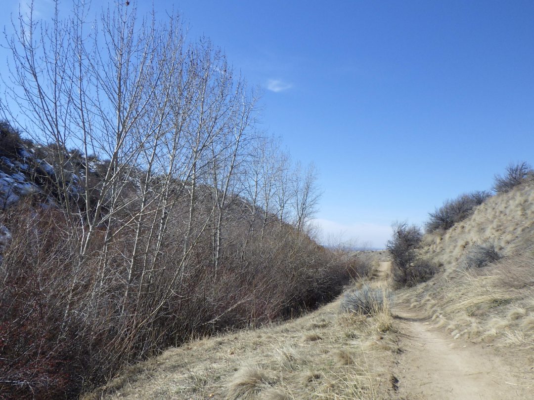
As days start to lengthen, triggering once again the urge to seek out the floristic treasures that the Boise Front has to offer, this walk offers an excellent chance to “get the jump on spring”. With luck, you will be rewarded with at least two of the earliest blooming wildflowers and the spring serenade of meadowlarks, supplemented with a diversity of natural history and cultural tidbits that can be enjoyed throughout the winter months. The loop described here is about 5 miles long, with about 600 feet elevation gain. The full loop is now accessible to hikers only on even-numbered days, with the last leg (Lower Hulls Gulch #29) restricted to downhill cyclists on odd-numbered days (see Ridge to Rivers’ Special Trail Management Strategies). Furthermore, some trail sections tend to be too muddy to use in winter except when frozen; the walk is therefore described in a counterclockwise direction so that the worst trail sections are more likely to still be frozen with an early morning start (e.g., by 9 am on an average winter day). Lower Hulls Gulch is sandy enough to qualify as all-weather, though footwear traction devices (e.g., Yaktrax) are recommended if icy trails are a possibility. Hiking poles can also be helpful, for negotiating both icy and rocky sections of trail.

The closest parking is at a wide spot on Sunset Peak Road (8th Street Extension) about 1/4 mile past the Foothills Learning Center (FLC); you can also park at the Hulls Gulch trailhead adjacent to the FLC (parking often limited, but with a restroom), and walk 0.3 miles north on Lower Hulls Gulch trail (#29) to the junction with Red Cliffs trail (#39).
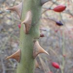
If taking the trail from Sunset Peak Road, take note of the large patch of interior rose (Rosa woodsii ssp. ultramontana), our common native rose, on the right side of the path. In contrast to the several species of non-native rose, which will be encountered later on the hike, interior rose has slender straight prickles and grows as an open thicket. Note also the tall dried stalks of the highly toxic poison-hemlock (Conium maculatum), a concoction of which was used to poison Socrates. You might also spot some leaves of the poison-hemlock, which look somewhat like those of carrots (which are in the same plant family, Apiaceae).

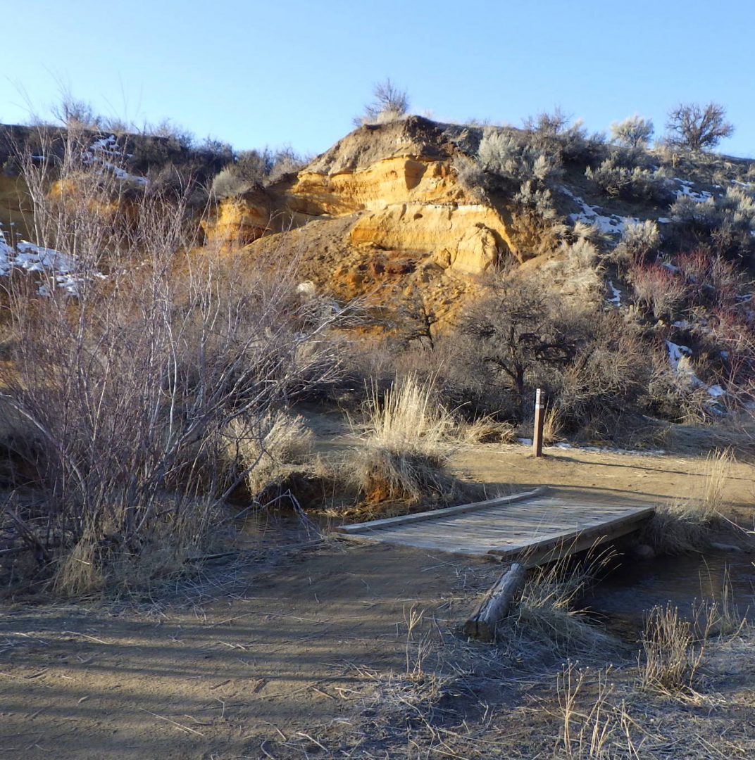
Turn right at the junction with the other branch of Lower Hulls Gulch trail (#29) and cross the bridge over the small creek, which is lined with the numerous slender stems of sandbar willow (Salix exigua var. exigua). Go left up Red Cliffs trail (#39), first taking a moment to admire the colorful cliffs for which the trail is named. Note the lovely red, yellow, black, brown, and white bands of soft sandstone, all representing different chemical and depositional strata in Lake Idaho sediments.
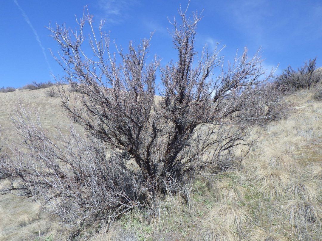
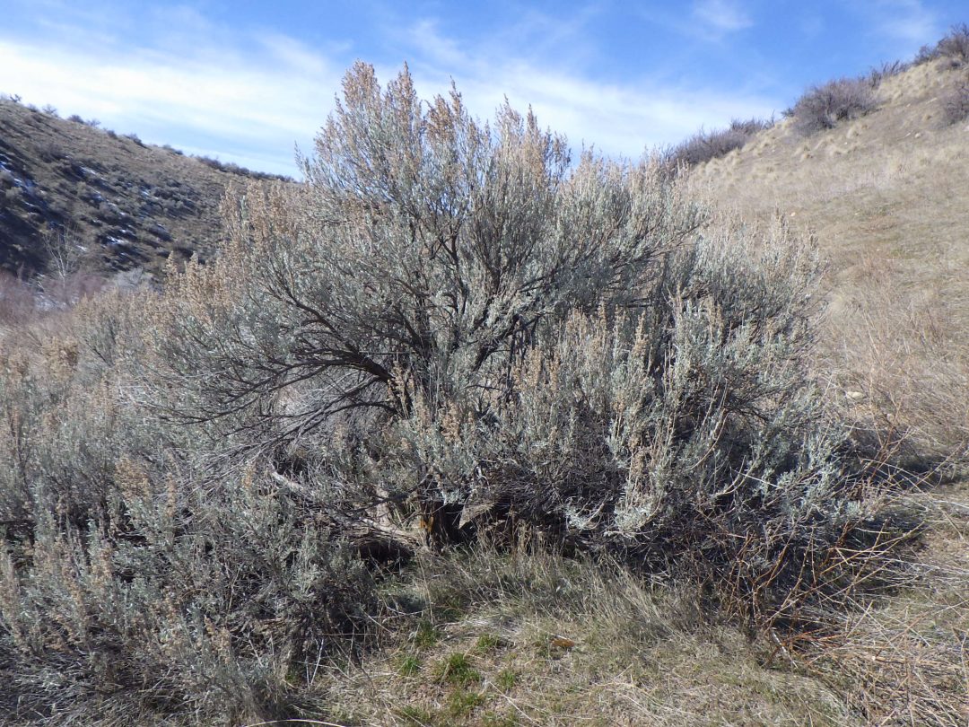
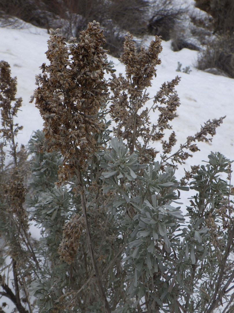
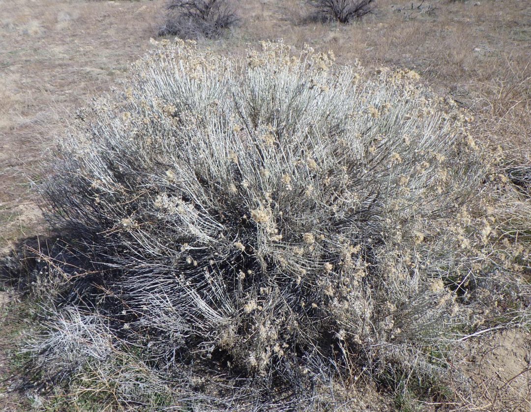
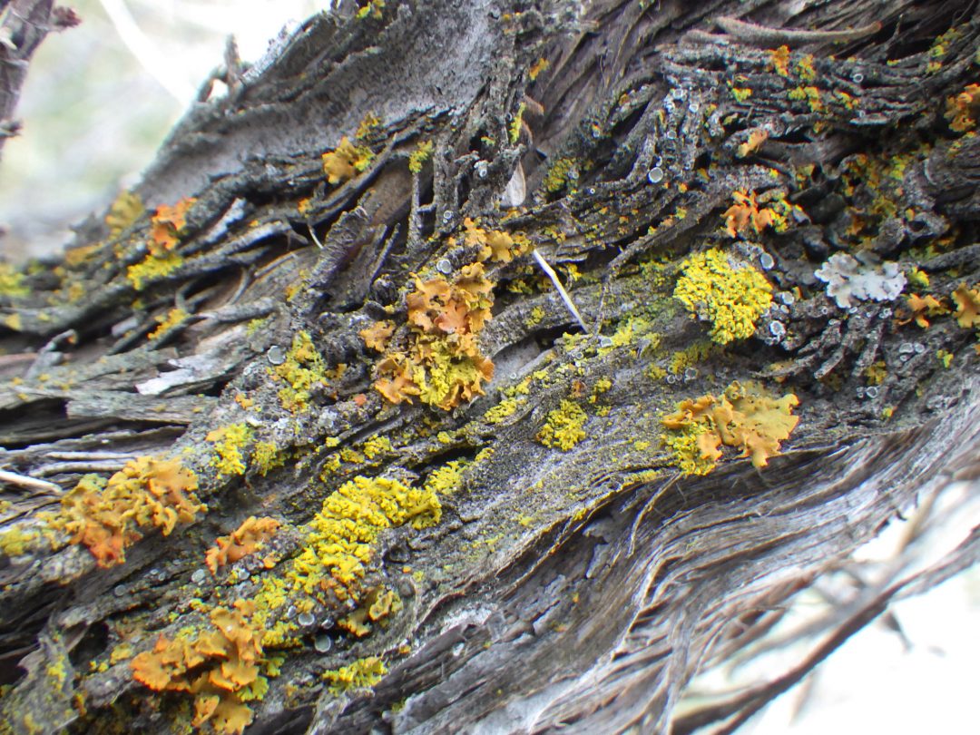
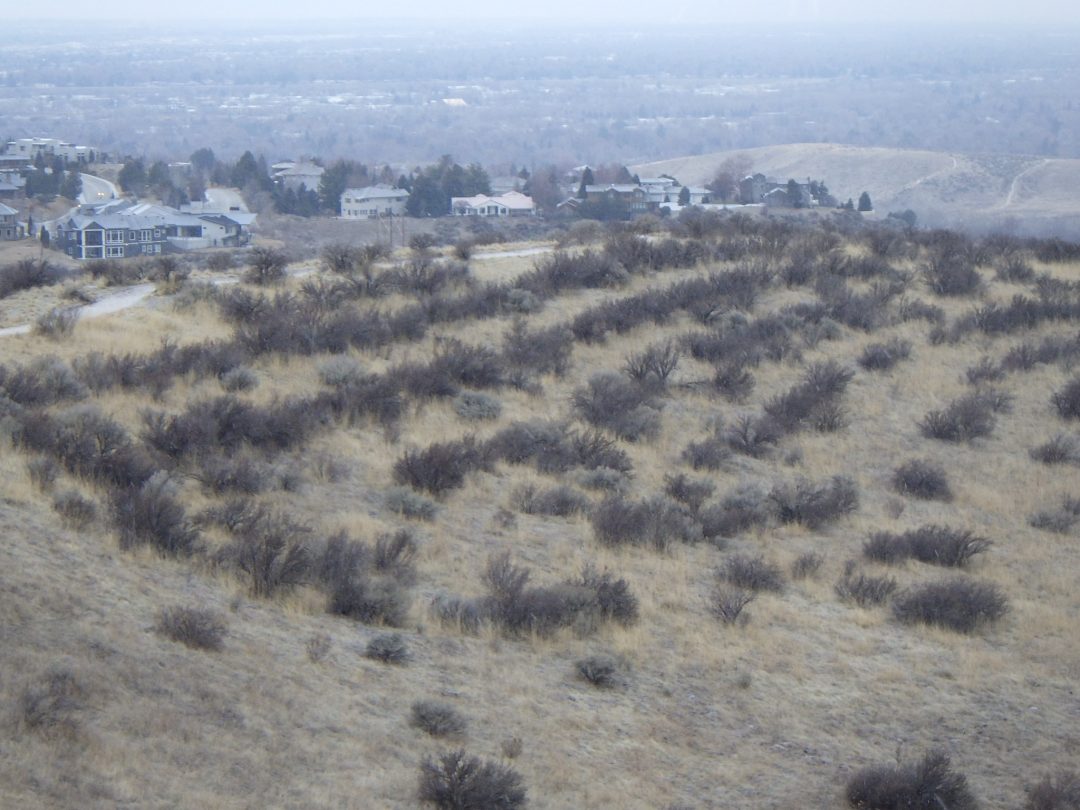
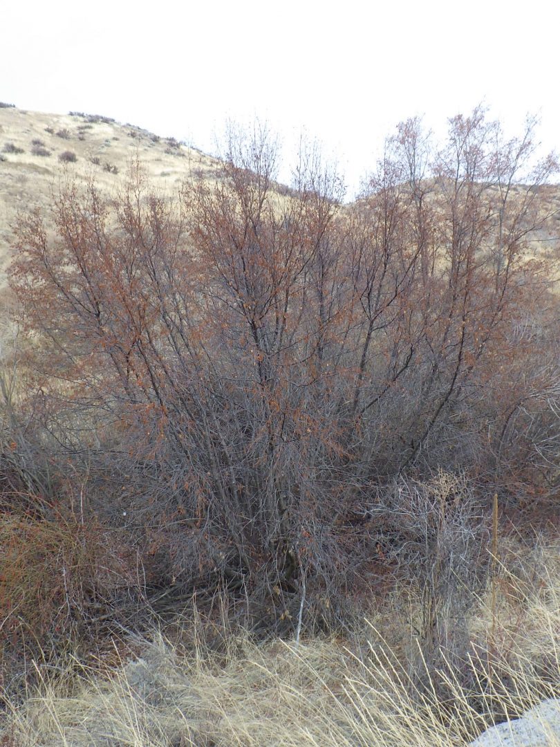
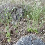
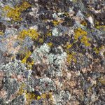
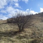
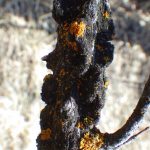
This is also a good starting place to hone your recognition skills for the three primary upland shrubs that are common in the Boise Front: bitterbrush (Purshia tridentata), rubber rabbitbrush (Ericameria nauseosa, previously Chrysothamnus nauseosus), and big sagebrush (Artemisia tridentata). Bitterbrush is a relatively large shrub covered with short stubs, which are nearly leafless in winter or with reduced winter leaves; these same stubs will be covered with fragrant yellow flowers in mid spring. Stems are sometimes heavily browsed, since bitterbrush is one of the most important winter food sources for deer and elk. Rubber rabbitbrush is a smaller grayish shrub, often topped with round clusters of dried flowers; most of the linear leaves fall off in winter. In contrast, the fragrant, grayish, 3-toothed leaves of big sagebrush are present year-round, and the spikes of tiny dried flowers are also distinctive. As you continue your walk, take note of how each of these three shrubs prefer different habitats, in particular associated with soil type and slope aspect. Be sure to also admire the colorful lichens that occur on the stems of large bitterbrush and sagebrush, indicating that these qualify as old-growth shrubs.

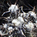
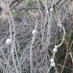
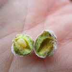
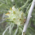
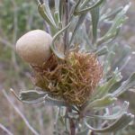
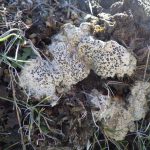
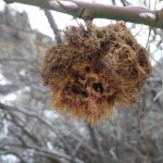
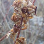
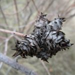
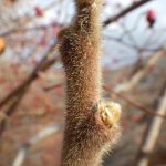
Another fascinating item to keep an eye out for during your walk is the diversity of plant galls that can be found at this time of year, in particular on rabbitbrush, sagebrush, and willows. The most intriguing of these curious structures form when certain insects, most often tiny wasps and flies, lay their eggs on developing plant tissue; somehow, the developing larvae then chemically “hijack” the plant’s growth mechanisms to create a custom-built home specific to that insect, on a specific species of plant. The study of plant galls is still a wide-open field, with a large percentage of gall-forming species still undescribed, including some of the most common ones in the Boise Front. (Note: labels on photos are morphological descriptions rather than standardized common names).
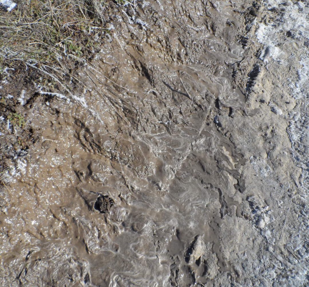
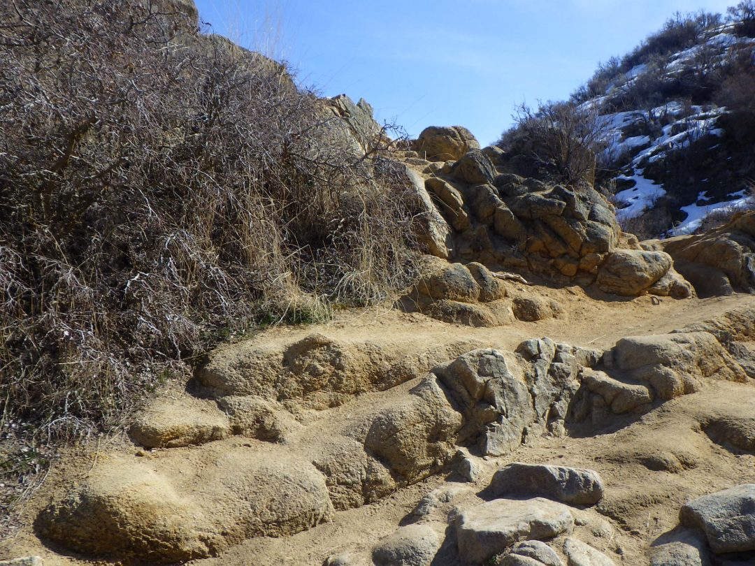
Continuing beyond the cliffs, the trail traverses across a a slope with heavy clay content, which is likely to be exceptionally muddy if neither dry nor frozen. If at all muddy, turn around and come back another day; do not proceed! High-clay soils in the Boise Front are extremely fragile and can be badly damaged by irresponsible use when muddy, resulting in erosion, badly damaged trails, decline of native vegetation, and spread of invasive non-natives, at the expense of the very wildflowers that we are here to look for. The freeze-thaw cycle that is typical of late winter, when saturated ground freezes at night and then warms in the morning sun, creates particularly unfavorable conditions. Water released as the top layers thaw cannot soak into the still-frozen layers underneath, and instead forms a slippery slurry that can actually flow when thawing. Trampling on adjacent vegetation in an attempt to avoid the mud results in destroying this vegetation as well, expanding the damaged mud-prone section of trail wider and wider. Please don’t be misled into thinking that your individual choices have no impact; quite the opposite.
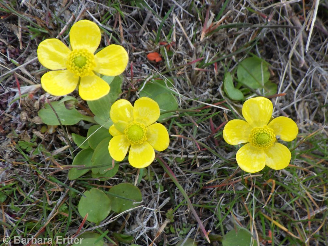
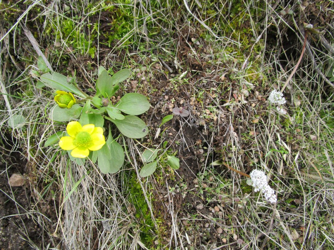
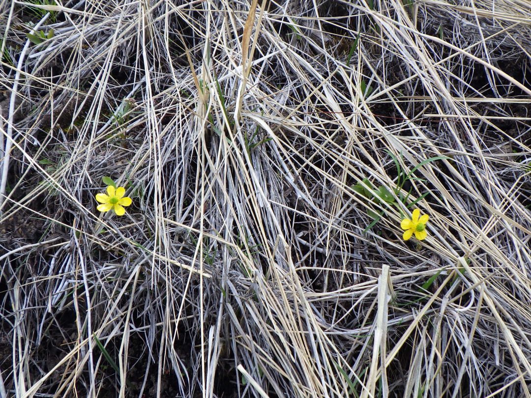
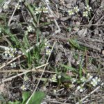
As long as the trail is dry or frozen solid, continue onward, keeping an eye out for the first of our target wildflowers on the upper portion of the slope: sagebrush buttercup (Ranunculus glaberrimus). These charming yellow flowers, which can be found throughout the Boise Front, appear quickly after a spell of weather warm enough to thaw the ground, sometimes by early February, sometimes not until March. If no buttercups are in bloom at this site during your walk, don’t give up; there are other populations on the loop that might be further along. There are also numerous other trails with early displays of sagebrush buttercup, including Polecat Gulch, Peggy’s Trail, Cartwright Ridge, and trails from the Big Springs trailhead.
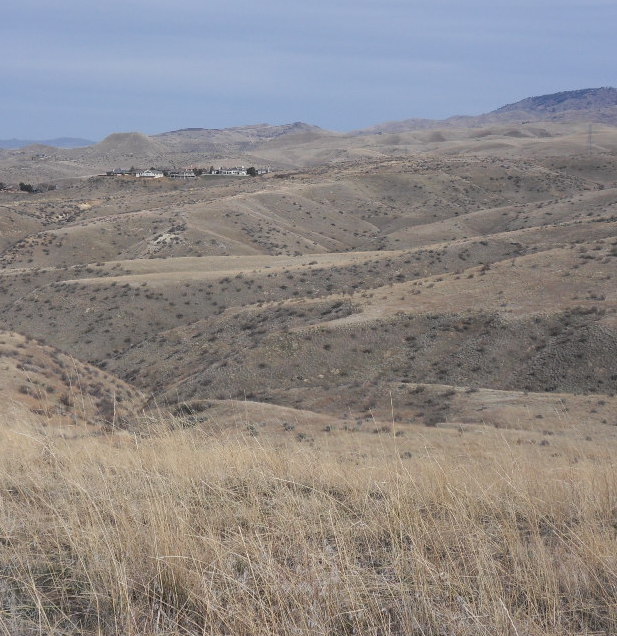
At the top of the slope, the trail levels out onto a flat-topped divide or narrow plateau between side gullies of Hulls Gulch. Particularly looking to the northwest, you can similar plateaus aligned in the same plane, representing the remnants of a former lake bed terrace that has been tilted by the uplift of the Boise Ridge and eroded by numerous drainages. Be forewarned: soils on these plateaus tend to be fine-grained and therefore muddy when wet. The lighter color of these remnant plateaus in winter, which makes them easy to see, results primarily from a dense thatch of dried grasses, mostly intermediate wheatgrass (Thinopyron intermedium) and other non-native perennials.
These non-native perennial grasses, which have been routinely planted for forage and post-fire rehabilitation, can unfortunately crowd out native wildflower diversity. Most of our wildflowers are adapted to the open matrix between the shrubs and bunchgrasses that characterize our local shrub steppe. The background matrix may appear to be bare ground, but it is actually a complex microhabitat that is critical to the reproduction and flourishing of many, perhaps the majority, of our native species. Non-native grasses, both rhizomatous perennials like intermediate wheatgrass and invasive annuals like cheatgrass, eliminate this critical habitat by filling it with their own biomass, which tends to accumulate as dried thatch in the absence of decomposing organisms adapted to non-native species. Throughout your walk, both today and throughout the year elsewhere in the Boise Front, take note of the difference in species diversity between areas of shrub steppe that still have a good open matrix, vs. those that have been filled in by thatch.
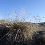
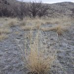
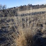
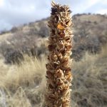
Continuing on the topic of grasses, the majority of our native grasses are perennial bunchgrasses, meaning that they form more or less tight tufts instead of spreading turf or swards. Many of these can be seen on this walk and identified even in the winter; some of the more conspicuous are pictured below. Three-awn grass (Aristida purpurea var. longiseta) is particularly abundant on sandy south-facing slopes; it is easily recognized by the seeds tipped by three long awns, many remaining attached throughout the winter. The awned seeds of squirreltail grass (Elymus elymoides, previously Sitanion hystrix) form a distinctive dense cluster that easily breaks apart once mature, but usually with enough basal portions retained to confirm identification. Another conspicuous bunchgrass that can be common on sandy flats at several sites along this walk, sand dropseed (Sporobolus cryptandrus), has a more subtle combination of diagnostic characters: relatively wide, twisted leaves and narrow, curved inflorescences with tiny seeds. Bluebunch wheatgrass (Pseudoroegneria spicata, previously in Agropyron) is another common but even more challenging grass, in that both native and non-native forms are common in the Boise Front. The native, locally adapted genotype (= genetically unique form) forms rather messy clumps with straight, slender inflorescences, most often on north-facing slopes in reasonably intact shrub-steppe. In contrast, the non-native genotype(s), which are widely used for post-fire rehabilitation, are generally larger and more erect, and can also form more solid stands in a diversity of habitats. Bluebunch wheatgrass is one of the most widely used native grasses propagated for various purposes, with multiple cultivars developed from particularly vigorous sources.
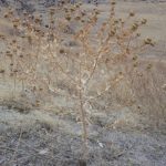
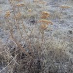
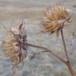
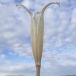
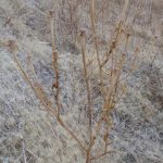
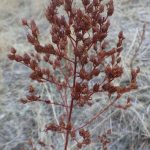
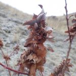
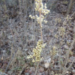
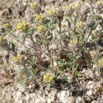
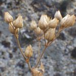
Some dried wildflowers are also identifiable in winter condition, sometimes jokingly referred to as “forensic botany”. Pictured below are some to keep an eye out for on this walk, beginning with the natives:
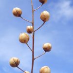
Add some of the more distinctive non-natives:

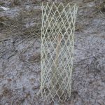
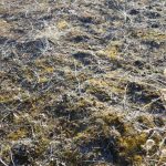
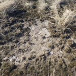
Returning to the walk description itself, Red Cliffs trail continues winding up the small ridge for 1.3 mile, sometimes cutting across north-facing slopes to avoid some steep ascents on the ridgeline proper. The snow-covered Boise Ridge beckons to the northeast, promising a rewarding destination for summer wildflower walks (e.g., Hulls Gulch Interpretive Loop, Milepost 12/Upper Dry Creek, Shafer Butte Loop). On a clear day, the Owyhee Mountains stand out on the southern horizon, easily admired when the trail crests out after doubling back through a stand of bitterbrush. Among the trailside curiosities that might catch your attention are the tubular mesh “cages” (aka Vexar® Seedling Protection Tubes) that are placed to protect seedling sagebrush and other shrubs, which are often planted for restoration and to discourage further trail widening. Golden patches of ground-covering moss, tipped with slender young sporophytes, glow enchantingly when backlit by the low winter sun. A young Russian-olive (Elaeagnus angustifolia) is conspicuous at one spot along the Red Cliffs trail; other representatives of this highly invasive tree are scattered on the ridge above and elsewhere along the loop. Small slickspots, nearly devoid of vegetation, can be noted on some of the flatter stretches; these seemingly degraded sites, formed and maintained by an unknown combination of factors, are in fact one of our most sensitive habitats regionally. Larger expanses elsewhere support the last remaining populations of slickspot peppergrass (Lepidium papilliferum), currently listed as a threatened species under the Endangered Species Act. Perhaps this species can someday be reintroduced into appropriate habitats throughout the foothills, including sites like these along the Red Cliffs trail.
Another noteworthy feature consists of the straight bands of bitterbrush that can be seen from some vistas, in particular looking back from the final ascent of Red Cliffs trail. These are evidence of massive planting efforts in previous decades, probably planted as post-fire rehabilitation. Further along on this walk you can see evidence of earlier experimental plantings of a wide diversity of shrubs from throughout the western US, mostly by the Rocky Mountain Research Station in the 1960’s and 1970’s. The goal at this time was to improve deer winter range, with a focus on growth rates, protein content, winter leafiness, and palatability. Whether or not a species was already growing in the Boise Front was irrelevant; quite the contrary, trying out shrubs far outside of their natural range was part of the experiment. In addition to the current walk, the Cobb Trail wildflower walk also highlights some noteworthy survivors of this planting phase.
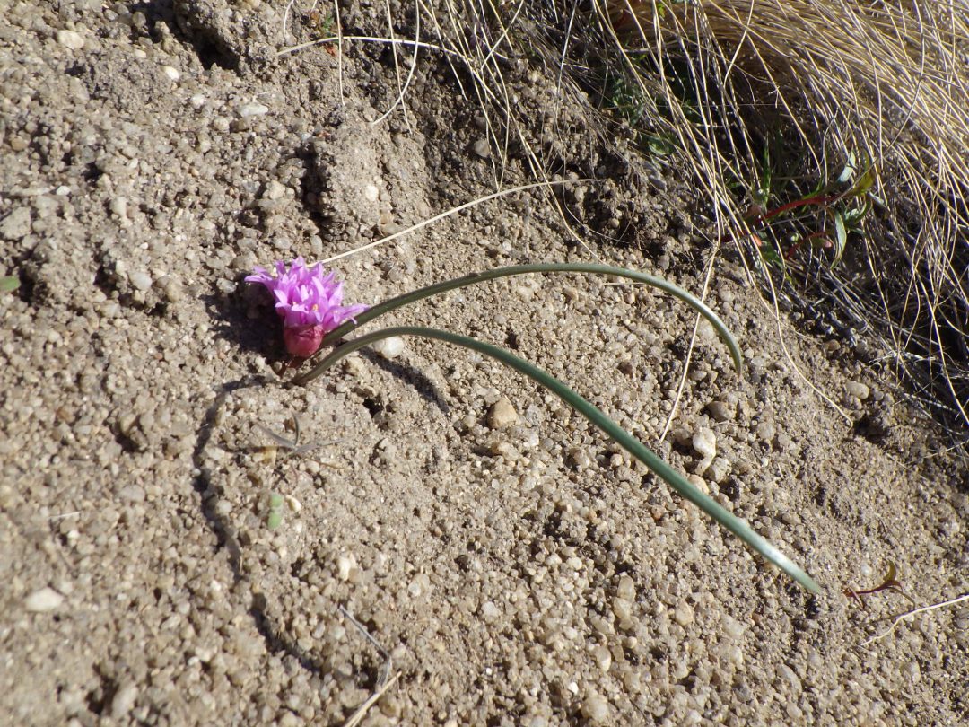
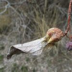
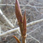
Red Cliffs trail ends at the junction with Crestline trail (#28), which follows the ridge dividing the Hulls Gulch and Freestone/Cottonwood drainages. The full loop described here takes the lefthand fork, continuing uphill, with the righthand fork an alternate option for a shorter and/or odd-numbered day loop option via the Kestral trail. Even if doing the full loop, consider taking a short sidetrip (about 120 yards from the right junction) to see a small population of Aase’s onion (Allium aaseae) growing on the bank where the road cuts through a high spot on the ridge. Plants often begin blooming in early March, but can be recognized even earlier by the curving paired leaves with a reddish bud at the base. Be careful not to disturb these locally rare plants, whose worldwide distribution is limited to sandy areas in the foothills from Boise to Emmett.

Returning to the junction with Red Cliffs trail, the main loop continues northeast (uphill) on the lefthand fork of the Crestline trail (#28). Note that this is marked as an easement through private property, as are other segments of the loop and many other trails in the Boise Front; be respectful and stay on the marked trail, to avoid jeopardizing future access. Several items are worth pondering about on this stretch of trail; for example, how did rounded cobblestones, indicative of a former riverbed, end up on a ridgeline? Or, where exactly is the electricity generated that is flowing through the high voltage power transmission lines high overhead, strung between conspicuous towers marching across the foothills? And where is it heading, as part of the grid that provides the power to our light-switches that we take for granted?
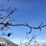
Another noteworthy feature, about 1/3 mile from the Red Cliff trail junction, is a prominent grove of black-locust trees (Robinia pseudoacacia) above a large erosion gully. Black-locust, native to the eastern United States, was one of several trees planted by early Euro-American settlers that thrived in the Boise Front. Trees are easily recognized, even in mid-winter, by the persisting flattened seed-pods, thorny branches, and deeply furrowed bark, which is often covered with colorful lichens. This and other groves are popular nesting sites for magpies, with the thorny branches providing added protection for the large masses of twigs that surround the nest proper.
Black-locust groves in the Boise foothills commonly mark the site of old homesteads, but the presence of this particular grove is a bit of puzzler. There is no adjacent flat site that would indicate a former homestead or abandoned field, nor a currently obvious source of water to have created the associated erosion gully. A plausible but unconfirmed explanation, provided by the realization that Crestline trail from this point makes a nearly level transect to Hulls Gulch creek, is that the trail follows an old abandoned ditch that once diverted water from Hulls Gulch to the Cottonwood/Freestone Creek drainage, perhaps to supplement the water available to Fort Boise and the earliest adjacent settlements. If so, did the ditch fail at this point, creating the current large erosion gully, or was the water was simply allowed to flow freely once across the dividing ridge?

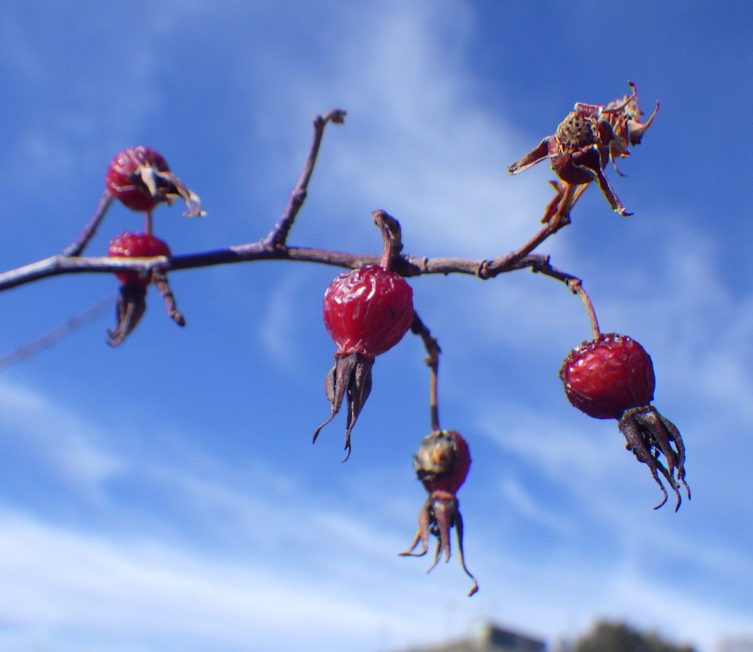
Crestline trail follows the contour line from this point, though the roadside drainage barrow only hints at a former irrigation ditch. Around the bend (which is a good place to look for an odd ground lichen, Diploschistes muscorum, sometimes called “bird-poop lichen”), and past the west junction with Sidewinder Trail (#24), the trail make a sharp dogleg around the head of a brush-lined drainage. The dominant shrub here is one of the non-native wild roses (Rosa) that are established to the point of being invasive in the Boise Front. The several different possible species are difficult to distinguish in winter, but all can be readily distinguished from the native interior rose (Rosa woodsii ssp. ultramontana, noted previously) by their dense growth form, arching branches, large hooked thorns, and conspicuous hips (= fruit) that have dropped their sepals. Conspicuous mossy galls are also much more common on non-native roses. Take note also of the large shrub on the ridgeline, marked by arrow in the accompanying photograph. This is the largest survivor in a small colony of cliff-rose (Purshia stansburiana, previously in Cowania), easily accessible from the Sidewinder Trail. The presence of this lovely shrub in the Boise Front, 200 miles north of its normal range in the Great Basin, suggests that cliff-rose is one of the shrubs persisting from the experimental plantings mentioned previously.
As the trail wraps around to the opposite side of the drainage, take note of the difference in snow persistence between the north- and south-facing slopes, and the associated differences in soil type, vegetation cover, and species composition. This dramatic difference between north- and south-facing slopes, a significant feature of the Boise Front in general, presumably results from different amounts of solar radiation, but exactly how this affects the development of different soil types and associated vegetation remains to be determined. You will also see a small colony of smooth sumac (Rhus glabra), another presumed survivor of earlier experimental plantings. Although the Boise Front is encompassed by the natural range of this wide-ranging species, the fact that it only occurs here as small localized populations, restricted to areas where other non-native shrubs have been intentionally planted or escaped, suggests that smooth sumac is only present locally as a result of experimental plantings. The colony, which consists mostly of dead stems, is barely hanging on, probably dependent on water captured by the ditch remnant. The attractive red stems of non-native curly dock (Rumex crispus) might also catch your attention, growing along the roadside drainage.
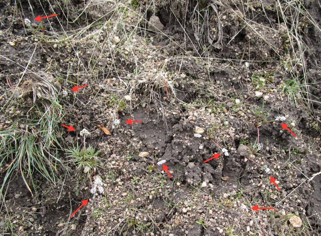
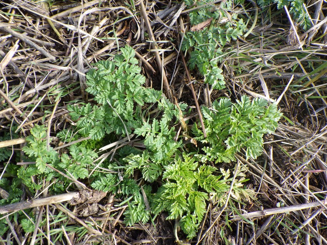
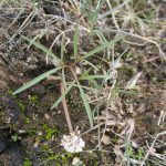
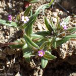
After the trail doubles back again, now traversing the north-facing slope above Hulls Gulch, it is time to start keeping a close eye out for our second target species, known variously as orogenia, turkey-pea, and Indian-potato (Lomatium linearifolium, previously in Orogenia). This cute little plant sometimes blooms even earlier than sagebrush buttercups, but is less common and much less conspicuous. Even at peak bloom, the clusters of tiny salt-and-pepper flowers can be hard to spot, and if there are still patches of snow around the challenge of distinguishing flowers from snow flecks is even greater. Your best bet is to scan areas of bare soil on the road bank, with patches scattered from here to the creek crossing. This particular harbinger of spring is unfortunately in decline in the foothills, as the bare soil it requires is filled with competing non-natives and thatch. Please do not contribute to further decline by digging the bulbs; leave the flowers for others to enjoy!
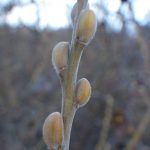
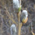
This stretch of trail is also a good place to start looking for more buttercups, as well as paying attention to the shrubby willows (several species of Salix) that line the road in places. Even in winter, willows can be easily recognized (at least to genus!) by their buds, which are covered with a single bud-scale shaped like a curved, blunt cone. With luck, you will see newly emerging inflorescences, commonly called pussy-willows, breaking free of these buds, before expanding into mature male and female inflorescences. Keep an eye out for willow galls as well, with willow leaf galls being particularly conspicuous here. Take a look also at the distant opposite slope, specifically the curious eroded orange cliffs at the top of a drainage with exposed granite outcrops at the base. Our loop will take us to the granite outcrop and the special plants there, but whatever botanical curiosities might occur on the orange cliffs is currently unknown.
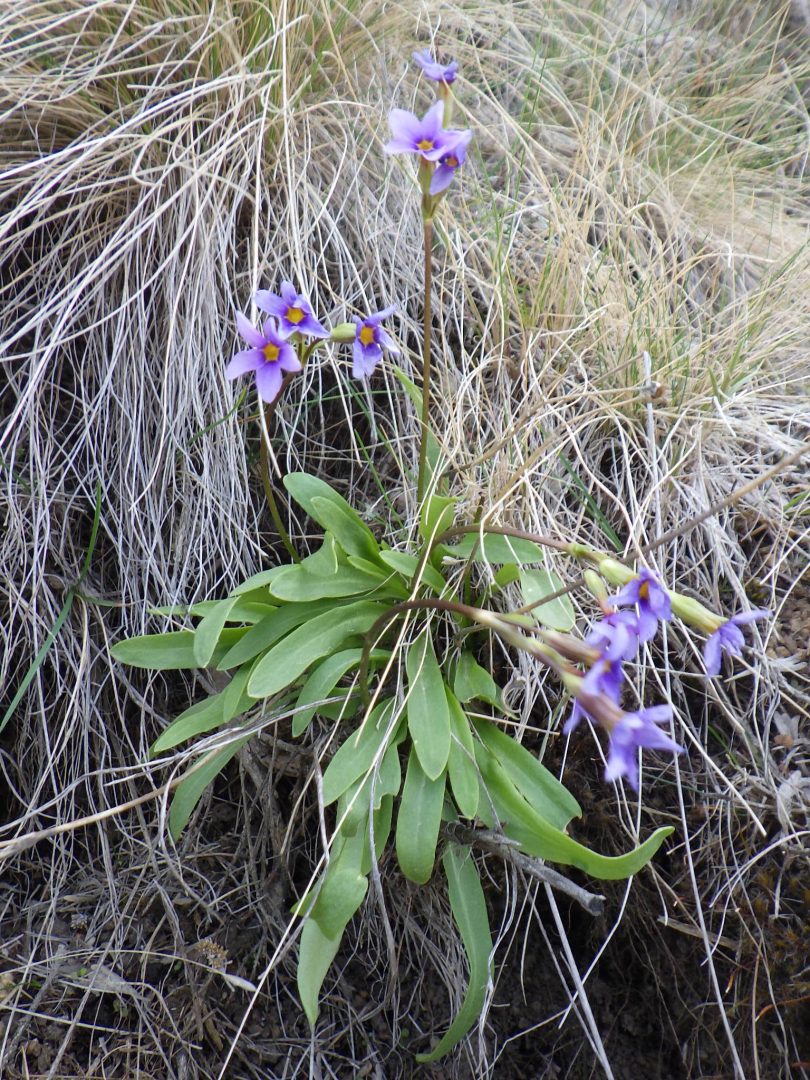
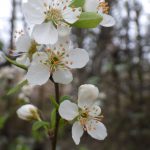
About 1/4 mile before the road reaches the creek, Crestline trail gives way to the 8th Street Motorcycle trail (#4) where the latter doubles back up the slope; be aware that motorcycles might be legally sharing this short stretch of the loop. Especially in mid- to late March, consider taking a short side trip up the right fork, which transects high quality shrub-steppe habitat on a steep north-facing slope. Note the wonderful diversity of wildflowers that flourish in the intact portions of this habitat, which used to be the dominant habitat on north-facing slopes throughout the foothills before being overrun and displaced by invasive annuals, planted grasses, and other non-natives. In particular, look carefully for the lovely Cusick’s primrose (Primula cusickiana), about 1/10 mile from the junction (while also remaining alert for bicycles and motorcycles on a narrow singletrack trail). This is our only native true primrose, faintly violet-scented, which has become increasingly difficult to find as its habitat declines. It also has a fun backstory, in that the first collection from the Boise Front was by made by Captain Timothy E. Wilcox when he was stationed at Fort Boise as Assistant Surgeon. The collection was sent to a botanist in New York, who thought it might be a new species to be named “wilcoxiana”. Although this name was never formally published, it has remained associated with the Boise populations of this lovely spring wildflower.
Returning to the main loop, continue following the contour road (left-hand fork of the 8th Street Motorcycle Trail) to the multi-trail junction at the Hulls Gulch creek crossing. While still keeping an eye out for more buttercups and orogenia, start paying attention to the diversity of shrubs and small trees that line the stream, along with the beautiful birds that enrich this habitat. One of the largest is river birch (Betula occidentalis), whose multiple trunks are covered with smooth dark bark. Our state flower, syringa (Philadelphus lewisii), can be recognized in winter by the distinctive dried capsules; come back in early June to enjoy the fragrant flowers. Large shrubs or small trees with thorns and a few left-over fruit (“haws”) are black hawthorn (Crataegus douglasii), our local native hawthorn. Red-osier dogwood (Cornus sericea, alternately C. stolonifera) gets its common name from the willow-like red stems, which resemble those of interior rose (which has been scattered at multiple locations along our walk) but with opposite branching and no prickles. A variety of willows and roses, both native and non-native, provide additional winter color with their red and yellow stems. Perhaps the most important woody plant to learn how to recognize, however, is the inconspicuous low-growing one with dull gray stems bearing whitish berries. This is our local form of western poison-ivy (Toxicodendron rydbergii); emerging young leaves are particularly rich in dermatitis-causing urushiol, and broken winter stems should also be avoided. Many birds, however, relish the berries as an important winter food source.

Across the bridge on the north side of the creek, a wide spot with large rocks to sit on provides a convenient place to take a break and enjoy a snack. In addition to refreshing yourself with whatever you brought along, this is a particularly good spot to taste-test wild rose hips, specifically those of the non-native dog rose (Rosa canina) that flourishes at this site. The hips are best in late winter, after freezing has softened and sweetened the pulp. Taking care not to get snagged on the prickles, select an oblong fruit that is bright orange-red, slightly soft, and unmarred. Break it off at its base, and either carefully squeeze out some of the pulp, or else nibble a bit off the base of the hip. Be careful to avoid the seeds (pips) and the irritating hairs that surround them. If you succeed in selecting a prime hip, and extracting the edible pulp, you will be rewarded with a burst of intense flavor that is high in vitamin C. Please discard the uneaten portion in the middle of an existing population; otherwise you may be contributing to the spread of this invasive species.
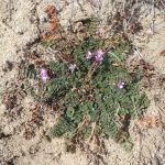
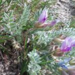
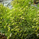
Provided it is an even-numbered calendar date, continue the loop by heading down Lower Hulls Gulch trail (#29). The trail is sandy enough to qualify as all-weather, but icy stretches in winter are best navigated with traction footwear. The first thing to take note of is the extreme contrast between the south-facing slope you are now on, and the north-facing slope on the other side of the creek. Here on the south-facing slope, where warmed by the sun even in winter, soils are sandier, vegetation cover is sparser, and a different suite of species predominate. Tiny spring-blooming annuals, collectively referred to as belly flowers, are common in favorable years, notably spring whitlow-grass (Draba verna) with its split white petals, yellow-flowered desert alyssum (Alyssum desertorum), the white flowers and blue-green foliage of jagged chickweed (Holosteum umbellatum), the delightful pink and white flowers of slender phlox (Microsteris gracilis), and the light green basal rosettes and white flower clusters of cross-seed popcornflower (Plagiobothrys tenellus); regrettably, only the last two are native. Cranes-bill (Erodium cicutarium) is abundant, with its pink flowers arising from rosettes of conspicuous winter-red leaves, and you might even catch the purple pea-flowers of woolly-pod milkvetch (Astragalus purshii var. glareosus) in bloom. Also take time to admire the mosses and colorful lichens on granite boulders along the trail; this time of year is actually their most active growing season.
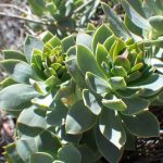
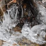
The most impressive features along this stretch of the loop, about half a mile downstream from the junction, are some trailside granite outcrops. (Note: the trail traverses one outcrop with tricky enough footing to make hiking poles appreciated.) These outcrops are the bones of the Idaho Batholith, exposed by the creek cutting away the overlying sediments of Pliocene Lake Idaho. The combination of exposed granite and cold air drainage down the deeply cut creek makes this spot a low-elevation refuge for common woodbeauty (Drymocallis glandulosa var. glandulosa, previously in Potentilla as sticky cinquefoil), and possibly other species more common at high elevations above the Lake Idaho sediments. Even at this time of year, woodbeauty can be recognized by its pinnate basal leaves and dried inflorescence; come back in early summer to look for the flowers with small cream-white petals. Less welcome are the bluish green clusters of myrtle spurge (Euphorbia myrsinites) that are abundant on the opposite site of the creek; although the rosettes of succulent leaves and early-blooming yellow flowers make this a seemingly desirable addition to fire-wise gardens, it is an extremely pernicious non-native whose milky sap can cause blisters, or even blindness. If hiking the loop when temperatures still drop below freezing, be sure to also admire the beautiful, and often bizarre, ice formations that develop along the creek, especially where flowing water cascades over rocks.
The dense tangled groves of netleaf hackberry (Celtis reticulata), particularly noticeable near the outcrops, are common in rocky sites throughout the foothills. Although defying traditional aesthetics in American landscaping norms, this shrub to small tree deserves more horticultural consideration as a drought-tolerant native that supports a large number of insect species, which in turn are critical for songbirds. One of these insects is the cause of the conspicuous petiole gall on dried leaves that persist through the winter, contributing to the hackberry’s apparent “messiness”. The small reddish berries have only a thin layer of dried pulp over the large seed, but the intense sweetness of this layer in mid-winter merits a taste trial.
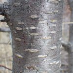
About 1/3 mile farther down the trail, approaching the high-voltage transmission lines passing high overhead, keep an eye out for cone galls on the sandbar willows (Salix exigua). These are most common just before a large stand of black cottonwood (Populus trichocarpa) that flourishes at the mouth of the same drainage that the dogleg on the Crestline trail wrapped around higher up. Black cottonwood, easily recognized by its smooth powdery white bark and large sharply pointed buds, is the largest of our native trees that occur along streams below the conifer zone. The old dangling nests of Bullock’s orioles can often be seen in the high branches. Growing with the cottonwoods is a large tangled thicket of small trees and shrubs, including various willows (Salix spp.), more river birch, Russian-olive, and red-osier dogwood. By late March, you might also see scattered cherry plums (Prunus cerasifera) in flower; this non-native small tree is our most common and early-blooming species of Prunus. Mahaleb cherry (Prunus mahaleb) is also well-established at this site, covered in white flowers in late April and early May. This shrub to small tree was probably originally brought to the Boise area as rootstock for other kinds of Prunus (e.g., cherries and plums), though a spice derived from the seeds has an ancient history. Like most other Prunus and several other genera, both species have smooth dark bark with horizontal streaks called lenticels, which allow the tree to “breathe”. The winter twigs of mahaleb cherry are finely hairy, while those of cherry plum are glabrous.
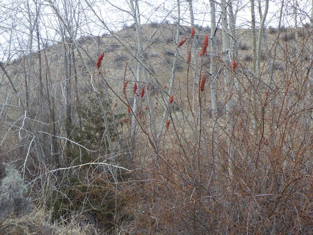
In another 1/3 mile, an unofficial trail to the right follows a deeply eroded gully to Sunset Drive/8th Street Extension, also providing access to East Highland View Drive. The main trail forks a bit later, only to rejoin after a short distance. The right-hand option provides a good opportunity to look for more early blooming annuals on the open south-facing slope, as well as comparing the similar red stems of red-osier dogwood (Cornus sericea; opposite branching) and interior rose (Rosa woodsii ssp. ultramontana; alternate branching) growing side by side. The left-hand option crosses two bridges over the creek, and also passes by a solitary Utah serviceberry (Amelanchier utahensis) on the left, which could be in bloom in late April/early May. Both options allow a good look at several noteworthy non-native trees and shrubs growing intermixed with the other streamside vegetation. The spindly shrub with brick red clusters of fuzzy fruit is staghorn sumac (Rhus typhina), which differs from the smooth sumac seen earlier on the walk in that the twigs are densely hairy (resembling the velvet on deer antlers, giving rise to the common name). The evergreen juniper (Juniperus sp.) is a puzzle; even though several native species of juniper are major ecosystem components south of the Snake River Plains, the distribution and age class of the ones scattered along streams in the Boise Front suggest that these are all sporadic introductions of cultivated junipers, perhaps cultivars of Chinese juniper (Juniperus chinensis), mostly likely spread by birds. If so, this in turn begs the question of why native junipers, which are abundant elsewhere in southern Idaho, are missing from the Boise Front. The third noteworthy non-native is a well-established colony of English elm (Ulmus procera), which dominates the downstream end of the grove. It can be recognized by its dark lichen-spangled bark and twigs that are often corky winged; these features, along with its tendency to form rhizomatous colonies, help distinguish this species from other naturalized elms in the Boise Front.
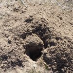
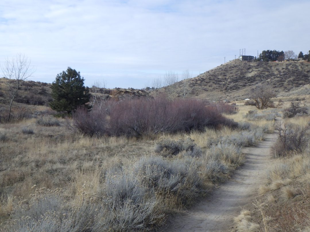
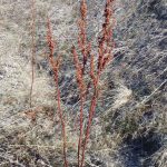
The final 1/3 mile to complete the loop has no shortage of additional curiosities to engage the attention of anyone willing to take note of their surroundings, such as the numerous gopher mounds, leaf rosettes of a variety of native and non-native plants, the dried red stems of broom buckwheat (Eriogonum vimineum), and occasional black beetles scuttling across the path. These, however, are now left to the individual observer to appreciate, and to ponder on. What is the origin, for example, of the lone pine tree on the left at the mouth of the gulch? And why is the large box-elder on the right more dead than alive? Keep your eyes open, and keep nourishing your sense of curiosity, as you continuing enjoying the Boise Front on future walks throughout the year.
Special thanks to Roger Rosentreter, Alma Hanson, and Samuel Degrey for helping with the identifications of lichens, mosses, and galls, and to all my hiking companions that tolerate my wandering rambles.
For more wildflower walks in the Boise Front, see SELF-GUIDED WILDFLOWER WALKS IN THE BOISE FRONT.